Top 50 Apps Similar to Dragon Wars - Robot Game


SailDroid
The Sailing AppApp for sailors, yachts and boats, containinga set of nautical applications:- Magnetic Compass- Speedometer in knots, mph or km/h, Course over Ground- Position- Mark or edit waypoints- Import Waypoints from gpx file- Distance measurement in nautical miles and meters. Also usefulforanchoring.- Course to WaypointAll in large, high contrast characters


Transas iSailor
Transas iSailor is an easy-to-usenavigationalsystem developed for the amateur seafarers. Intendedfor use onboats and yachts, iSailor provides a clear presentationofnavigation information and electronic charts. Transas ownTX-97vector chart format supported by iSailor is recognizedworldwide asone of the most accurate and reliable sources ofnavigationalinformation.Available Chart Folios cover coastal and offshore waters ofNorthAmerica, Latin and South America, Europe, Africa, Middle East,FarEast, Asia, Australia & New Zealand. All chart folios canbeselected, purchased and downloaded via the Transas iSailorappusing its Chart Store section. Purchased chart folios includesaone year Chart Updates subscription service of yourchosencoverage. At the end of one year you can choose to renew yourChartUpdates subscription service or continue to use the chartsyoupreviously purchased and downloaded.• Positioning system:- Internal GPS (if available, through the AndroidLocationProvider)- NMEA GPS over Wi-Fi (TCP/UDP connection)- AIS class B Transponder (TCP/UDP connection)- Bluetooth NMEA GPS through the Android LocationProvide("Bluetooth GPS Provider" app is needed)• Navigation sensors support: GPS, Compass & ROT (TrueorMagnetic Heading), Wind, Echo-Sounder• AIS targets support: AIS Class A, AIS Class B, AIS Receiver,BaseStations, Aids-to-Navigation (AtoN)• Display of Charts and Routes• North Up, COG Up and Route Up chart orientations• Information on any vector chart objects• Free cursor, Point-To-Point and Own Ship referencedERBLfunctionality• Monitoring of navigational data: Position, Course (COG) andSpeedOver Ground (SOG)• Route creation by the graphic methods. “Go To” routes• Alarms & Warnings• Waypoint monitoring: Bearing to WP, Distance to WP, XTD• Schedule information: Time-To-Go and ETA to any selectedwaypointahead• Day and Night chart palettes• Track recording• Import & Export for Tracks and Routes• Multi-UnitsCompatible with Android versions since 4.4.x (API level 19)andhigher!List of supported and tested devices:Tablets:• Google Nexus 7 (2013)• Samsung Galaxy Tab S• Samsung Galaxy Note 8.0• Samsung Galaxy Tab Pro 8.4• Samsung Galaxy Note 3• Sony Xperia Z2 Tablet• Lenovo A3300-HV• Lenovo YOGA Tablet 2 ProSmartphones:• Samsung Galaxy S4• Lenovo S60• Samsung Galaxy A3• HTC Desire 630• Asus ZenFone Z00ADWe cannot guarantee correct operation on non-tested devices.Ourteam will continue to improve the application performance,keepingyou informed about our progress in the upcomingreleases.iSailor web site http://www.isailor.usAny questions? Feel free to contact us at [email protected] Yours,Transas iSailor team


Vaarkaart Friese Meren 2.11
The perfect chart for sailing on theFrisianlakes. This chart is made for boat renters, skippers andcrew ofsail boats, motor boats and barges. Also recommended forcanoes andfishers.AreaFrom Stavoren to Grouw, with the following lakes::Heegermeer,Fluessen, Morra, Oudegaster Brekken, Zwarte and WitteBrekken,Sneekermeer, Koevorden, Tjeukermeer, Langweerderwielen,andPikmeer/Wijde Ee.This is a detailed chart with a scale 1,3m/pixel. This comesdownto about 1 : 5000 on the screen.Depth viewWith clear depth view from the Friese Meren Project in wellcoloreddepth areas on the lakes and depth numbers along the waterways.Developed by Stentec in cooperation with the province Fryslânbasedon the most recent depth measurements.WaypointsThe included database contains 2345 waypoints divided in 13groups.The 145 marinas show phone numbers and websites. Othergroups areamong others bouyage, mooring spots, campings and gasstations.The accurate positioned bouyage contains the socalled‘slobbers’. These mark the protected bird area from 1 Octoberto 1May. Outside this period these are replaced by yellowregattabuoys.Marrekrite 2014 natural mooring places are also included inthechart. You can easily see if camping is allowed (CAMP), ifacontainer is present (CONT) or if you can moor (WAL).The bridges and locks along the water ways are shown withheightand width so you can easily plan your route. The manyaquaducts arealso shown. Most bridges are operated daily from 1 Mayto 1November from 9h-19h. In June, July and August even until20h.

Marinus ColRegs Lite 4.2.7
The Nautical App you've been waitingsincequite a lot, easy, simple and at your fingertips. A must-haveAppeither to navigate or to pass your certificate. All at hand,onyour iPhone or iPod! Learn the 'International RegulationsforPreventing Collisions at Sea'. (IRPCS/ColRegs).Contains the most important parts of InternationalRegulationsfor Preventing Collisions at Sea (IRPCS).International code flags, morse code, maneuvers, lights,Douglassea scale, Beaufort scale, sound signals... All this andmuch morein graphic sections in order to solve your questionsquickly.


DONIA 5.07
DONIA - Enjoy & protect the sea, together!DONIA est une application de cartographie marinecommunautairepour smartphone et tablette. Elle est destinée auxplaisanciers,plongeurs, pécheurs et à tous les amoureux de la merqui souhaitentbénéficier de cartes précises, enrichies de donnéessur la viemarine et d'informations en temps réel sur les activitésensurface.DONIA, c’est avant tout une communauté de passionnésquiéchangent des informations pour rendre leurs sorties en merplusriches en découvertes et qui veulent contribuer àprotégerl'environnement.DONIA œuvre et sensibilise à la préservation del’environnementen fournissant des cartes de la nature des fondsextrêmementprécises qui permettent aux plaisanciers de Méditerranéede jeterl’ancre en dehors des herbiers de posidonie protégés.DONIA c’est aussi plus de sécurité à bord. L’applicationproposede vivre la traditionnelle solidarité maritime en partageantdesinformations sur les dangers aperçus en mer (obstacles,accidents,méduses, etc.).Enfin, les utilisateurs de DONIA peuvent recevoirgratuitementdes informations de la part des gestionnaires de sitesprotégés(parcs, réserves). Pratique pour éviter les démarchesfastidieuseset trouver la réglementation locale facilement.En options payantes, vous pouvez bénéficier:- D'un pack alarmes graphiques (Alarmesanti-dérapage,anti-collision (au mouillage), anti-emmelage dechaînes). Lesalarmes sont transférées sur un autre téléphone parsms en cas debesoin (coût d'un sms).- Vous pouvez aussi acquérir des cartes de bathymétrie trèshauterésolution et en 3D. Ces données, acquises ausondeurmulti-faisceaux par la société spécialisée AndromèdeOcéanologie,sont environ 1000 fois plus précises que les cartesclassiques.Vous voyez la vraie forme des reliefs, les failles,etc.Attention l'utilisation continue du GPS en tâche de fondpeutréduire considérablement la durée de la batterie.DONIA - Enjoy&protect the sea, together!DONIA is a community marine mapping application forsmartphoneand tablet. It is intended for boaters, divers, fishermenand allsea lovers who want accurate maps, enriched data on marinelife andreal time information on surface activity.DONIA, is above all a community of enthusiasts whoexchangeinformation to make their outputs richest offshorediscoveries andwant to help protect the environment.DONIA work and awareness to preserve the environment byprovidingmaps of nature extremely precise funds that allowMediterraneanboaters to anchor outside the protected Posidoniameadows.DONIA is also more safety on board. The application offerslivetraditional maritime solidarity by sharing information aboutthedangers at sea surveys (obstacles, accidents, jellyfish,etc.).Finally, users DONIA can receive free information frommanagersof protected sites (parks, reserves). Convenient to avoidthetedious steps and find local regulations easily.By paying options, you can benefit:- A pack graphics alarms (Alarms anti-skid, anti-collision(atanchor), anti-tangle of strings). The alarms are transferredtoanother phone via SMS in case of need (cost SMS).- You can acquire high resolution bathymetric maps and 3D.Thesedata, acquired multibeam echosounder by the specializedcompanyAndromeda Oceanology, are about 1000 times more accuratethantraditional cards. You see the true form of reliefs,faults,etc.Caution Continued use of GPS running in the backgroundcandramatically decrease battery life.

MX Mariner - Marine Charts
MX Mariner is a basic mobile marine navigator/chart plotter featuring quilted offline raster marinecharts.Offline raster marine charts are are available for the US,NewZealand, Brazil, and UK.US, New Zealand and Brazil chart regions are free to downloadandupdate.UK chart regions are available for the United Kingdom, IrelandandChannel Islands as in-app purchases. Each UK chart regionin-apppurchase gives you 1 year of free chart updates. UK chartregionsin MX Mariner are "derived in part from material obtainedfrom theUK Hydrographic Office".Features:Offline raster marine chartsOnline satellite and road mapsGPS NavigationActiveCaptain interactive cruisingguidebookhttps://activecaptain.com/Waypoints - create, edit, navigateTracks - record, editRoutes - create, edit, navigateGPX import / exportConfigurable units of measure and the World Magnetic ModelPlease see https://mxmariner.com/#/manual for details.


Sight reduction 4.3
Celestial navigation - Astronavigation Sight reduction: -MarcqSaint Hilaire Line of Position, intercept method (p=Ho-Hc, Zn)-Input for observed altitude Ho or instrumental Hs (NauticalAlmanacdata needed for the Sun and the Moon) - Calculator: altitudeHc andazimuth Zn - Running fix - Plots up to 3 Marcq Saint HilaireLinesof Position on Google maps - Local hour angle (LHA) Sightreductionis the process of deriving from a sight the informationneeded forestablishing a line of position. This app is a calculatorto getthe intercept from the assumed position of theobserverAP(latitude, longitude), the geographical position of thecelestialbody observed, GP(Dec, GHA), and its corrected altitudeHo. Manualand examples in the developer's website.Ref:https://en.wikipedia.org/wiki/Sight_reduction User interface:-Zoom buttons +/- - Map types: standard, terrain, and satellite-GPS location. ("Location" App permission must be allowed. Switchonyou GPS, and then automatic location detection is possible)


Ships66 3.5.1
Ships66 is a professional ship location servicesoftware,whichprovides users with ship search, ship screening,global AISshipposition inquiry, historical track inquiry,electronic fencealarmand other functions. It can be widely used inship management,portdispatch management, ship brokerage, cargoAgency,shippingfinance, maritime law, etc. Features 1.View of shipfilesand AISinformation Click any ship on the chart or use the shipnameandMMSI to view the ship file, real-time position,sailingstatus,running track and other information of any ship. 2.ShipscreeningFilter qualified ships by type, length, status,datasource, etc.3. History track query The user can select thetimeperiod to playback the ship's sailing trajectory and reproducetheship's sailingprocess. 4. Fleet management Users can managefleetseasily andquickly by customizing fleets. 5, electronic fenceSetmonitoringarea, the ship will automatically alarm whenapproachingthemonitoring area, and remind the staff to handlethrough WeChatandSMS. 6, label management Superimpose personalizedlabels suchaspoints, lines, and areas on the chart, and synchronizethem totheapplet, app, pc, and shipboard equipment. 7.Equipmentmanagementfunction Provides multi-screen interaction ofterminaldevices andcloud data management functions. Remoteoperation ofship-borneequipment, online upgrade, ship-sidevideosurveillance,situational warning, and tracking ofglobaltrajectories throughsatellite services. 8.One-stop solutionThroughthe ship-to-shipnetwork SaaS platform, lightweightsoftwareservices are providedfor enterprise users, such as: datasharingservices forocean-going fleets, ship energy efficiencymanagementsystems forship-shore integration, and ship intentresearch andjudgmentsystems for ship supervision agencies. Usersonly need toorder thecorresponding cloud services according totheir own needs,and theycan directly conduct business management,without having tospendhigh fees to arrange servers and purchasesoftware.


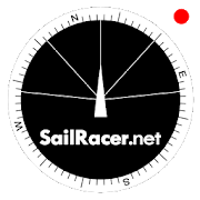
Sail Racer 6.6.4
This is a sail racing app for sailing enthusiastsandprofessionals.Application is used as an additional tool nexttostandard yachtequipment to take tactical sail decisionsfaster.Sail Racer appsuggest the favored end of the start line,monitorsyour position,time and guides the maneuvers that the startlinewas hit at thelast moment with the best possible speed duringyoursail. With thesail app it is easy to navigate in racing area.SailRacer interfaceis designed in a way that course efficiency,thelay lines andshifts could be captured in a splash of asecond.Skipper does notneed to analyze the numbers and canconcentrate onhandling theboat, maximizing performance and playingtacticalgames withcompetitors. Every wind gust and lull affect theboatheading and isvisualized in a “easy to read” shift bar on thetopof compass roseand on the map. Sail Racer is designedanddeveloped by sailors. Ithas everything to sail on the edge. -Timeto burn, Coundown andStarting box distances - Windaveragecalculation for 6minutes andan hour - Course averagecalculation(in case you do not have NMEAdata) - Boat efficiencyaccording topolar data - Mark, Laylinedistance and ETA - Tracker -Nauticalcharts - NMEA 0183 dataconnection, BlueTooth dataconnection,SailTimer wind information -Current indication and manymore -Works on watch (Android wear OS)More informationwww.sailracer.netSailrace.net app is free forlearning (Optimistkids, Lasers andother centerboards) and forevaluation purposes. Wekindly ask allkeel boat racers to purchasePremium license for 35euros / year.Have a good start and evenbetter finish.

Sea Sector – Maritime Courses for Sailors 3.1.2
Sea Sector is an information source for marineprofessionals,sailors and sea enthusiasts with learning solutionsthat build upyour nautical knowledge through maritime courses thatfollow STCWstandards of navigation and requirements set by IMO(InternationalMaritime Organization). Easy distance learning.Remote educationputs seafarers in control of their maritimetraining – especiallysuitable for everyone in the maritime industrysince you, asmariners, often spend time away from home. With ourcoursesseafarers can study when, where and how they choose – evenwithoutaccess to the Internet. Reader-friendly lessons. All ourarticlesare presented to you in a simple, practical andeasy-to-readformat. STCW courses, collision regulations (COLREGs)and marinetraffic rules simply explained and presented to you inanuncomplicated, practical and easy-to-read format. Thismaritimeknowledge application provides quality education to marinestudentsin the most effective and helpful way! Systemizedknowledge. Youcan bookmark articles or mark them as complete andtrack theprogress of courses you are currently taking or those youhavealready completed. Find STCW courses that form a part ofthecompulsory basic safety training for all seafarers as well asotheradditional courses to expand your maritime knowledge – frombasicmaritime English to collision regulations (COLREGs).Relevantmaterial. Heighten your understanding of different typesofmanoeuvres of a vessel and learn how to navigate throughmarinetraffic to become a successful marine professional in notime. Saveyour time and energy with our well-structured andsimplified studymaterials for sailors and become a skilful seamanwith a vastknowledge of personal survivor techniques, firefighting,first aidand personal safety and social responsibility. Essentialmaritimecourses. Find the STCW personal survival techniquescourse,firefighting, elementary first aid, personal safety andsocialresponsibility course, all of which form part of thecompulsorybasic safety training for all seafarers. Alongside withthesemandatory courses for sailors you can find meteorology,maritimenavigation, COLREG maneuvers and basic maritime Englishcourses tofurther expand your marine knowledge and become an expertonnautical terminology and seamen skills. Maritime dictionary.Withall of the most common terms on marine industry. Ourmaritimedictionary contains over 2,000 straightforward definitions.Theseinclude shipping, meteorological, tanker terminologies andmaritimetransport, sailing and sea navigation definitions. Maritimenews.Sea Sector keeps you in the loop about maritime matters andnewsfor the shipping industry, maritime professionals, andenthusiasts.Read new nautical information on various aspects of themarineworld on a daily basis. Join thousands of satisfied marinersandeducate yourself to become a skillful and more competent seaman.Weappreciate your feedback, ideas and thoughts about anythingthatcan improve our app. Please feel free to reach [email protected] with any comments, concerns, or suggestionsyouwish to share.


Boating HD 8.0.1
The world's most popular marine &lakesapp!A favorite among cruisers, sailors, fishermen and divers.Findthesame detailed charts as on the best GPS plotters. Downloadtheapp,then go to Menu>Charts and select your region to get a14day freetrial to the overwhelming value of Navionics+.NAVIONICS+ includes:√ Download of the following chart layers that will resideonyourdevice even after expiration:- NAUTICAL CHART for all essential cartographic referencedetail.Themost accurate and thorough set of information basedonHydrographicOffice data, Notices to Mariners, newpublications,our own surveys,and reports from users. It providesport plans,safety depthcontours, marine services info, tides ¤ts,navigation aidsand more.- SONARCHART™: the award-winning 1 ft/ 0,5 m HD bathymetrymapthatreflects ever-changing conditions. Be part of thecommunityandcontribute by uploading your sonar logs to enhanceit.- COMMUNITY EDITS made by users (rocks, wrecks, etc.) andsharedforall to benefit.√ CHART UPDATES: we deliver more than 2,000 updates everyday!Takeadvantage of our updates as frequently as you like.√ ADVANCED MAP OPTIONS to highlight Shallow Areas, andfilterDepthContours. Includes a Fishing Mode that enables FishingRangefortargeting key fishing areas.√ NAVIGATION MODULE for advanced route planning with ETA,distancetoarrival, heading to WP, fuel consumption and more!√ DOCK-TO-DOCK AUTOROUTING quickly creates detailedrouteseventhrough narrow waterways and channels, based on chartdataandnavigation aids. POIs are automatically shownnearbyyourdestination.√ WEATHER & TIDES provides real-time weather dataandforecasts.Access daily and hourly forecasts for yourfavoritelocations andget wind, weather buoys, Tides &Currentsoverlaid on yourmap.Buoy data is retrieved from NOAA and can include wind speed,gustanddirection as well as air pressure, water temperature,waveheight andother relevant marine data.Note: Download detailed maps by zooming inorfromMenu>Download Map. Check navionics.com for coverage.Navionics+ is a one year subscription. At expiration youcanrenewwith a discount of up to 50%. If you don’t renew, youcanstill usethe charts you previously downloaded, along withseveralfreefeatures:TRACK your journey, view speed, distance, time and COG.Savetoarchive, see stats and playbackROUTES: create and edit, based on speed and fuel consumptionMeasure DISTANCE, add MARKERS, get WIND FORECASTSandsun/mooncyclesMAP OPTIONS: Satellite/Terrain, adjust shorelines toselectedWaterLevel, choose Depth Shading and Easy View tobeginSYNC Tracks, Routes & Markers among your mobile devicesMAGAZINES & GUIDES for location-based articlesfromleadingindustry publishersSONARCHART ™ LIVE - allows you to create new personal 1ft/0.5mHDbathymetry maps that display in real time whilenavigating.Uploadyour sonar logs to build even better local chartsfor yourareaconnecting wirelessly to a compatiblesounder/plotter.PLOTTER SYNC - NEW! Plotter Sync may also provideaccesstoDock-to-dock Autorouting, SonarChart Live and AdvancedMapOptionsfor your GPS plotter. Learnmoreatwww.navionics.com/en/plotter-syncNavionics has certified several Android models where theappisdesigned to load and operate correctly with an OS of 4.0orhigher.Please refer to our Compatibility Guide, whichiscontinuouslyupdatedathttp://www.navionics.com/en/compatibility/mobile.Wecannotguarantee flawless operation or provide supportfornon-certifieddevices. ALL SALES ARE FINAL on Google Play.

