
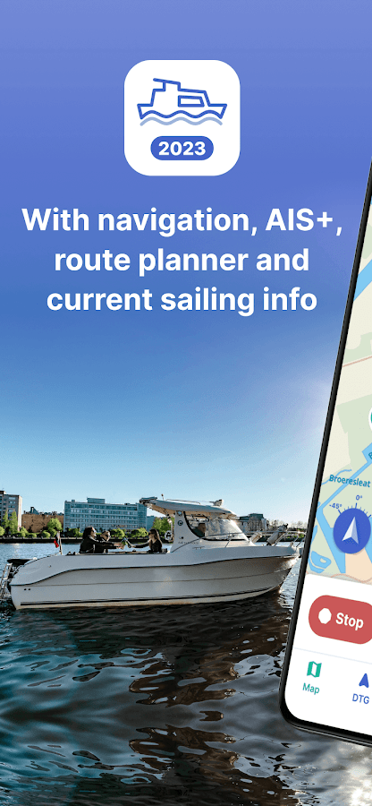


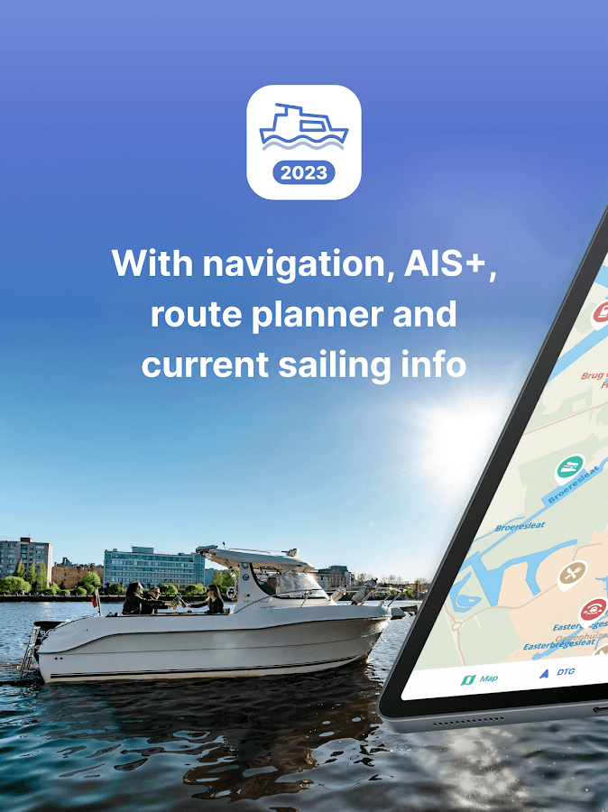
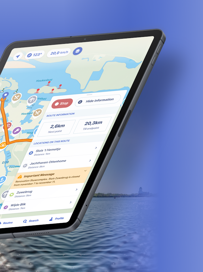

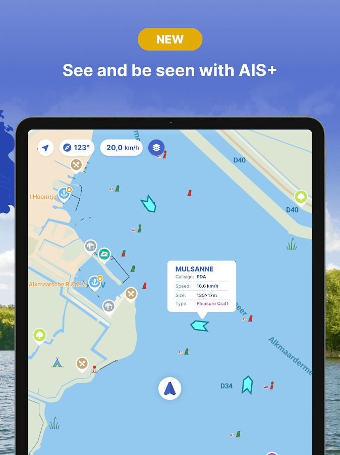
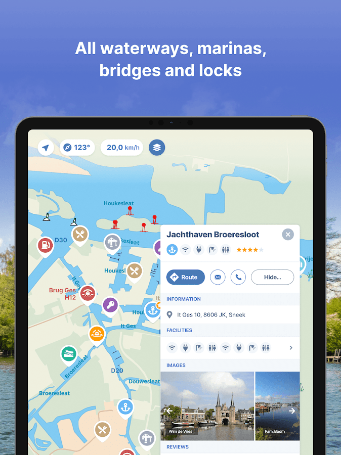

Description
App Information Nautical Maps: Boat Navigation
- App NameNautical Maps: Boat Navigation
- Package Namenl.anwb.android.anwbwaterkaarten
- UpdatedJun 20, 2023
- File SizeUndefined
- Requires AndroidAndroid 8.0
- Version10.0.5
- DeveloperBiggerworks
- Installs100K+
- PriceFree
- Categoryinfo_outline</i></button></div>
- DeveloperDanzigerkade 5 - 2G 1013 AP Arwerwmsterdam The Netherlands
- Google Play Link
Nautical Maps: Boat Navigation Version History
Select Nautical Maps: Boat Navigation Version :-
Nautical Maps: Boat Navigation 3.0.6 APK File
Publish Date: 2016 /9/20Requires Android: Android 4.1+ (Jelly Bean, API: 16)File Size: 43.2 MBTested on: Android 5.1 (Lollipop, API: 22)File Sha1: 20013038c3bffeb0a344df81e66ae554c09e1618 -
Nautical Maps: Boat Navigation 3.0.5 APK File
Publish Date: 2016 /9/7Requires Android: Android 4.1+ (Jelly Bean, API: 16)File Size: 47.5 MBTested on: Android 5.1 (Lollipop, API: 22)File Sha1: e04f8b6669f5c25ba860596d37755b7a4bab3107 -
Nautical Maps: Boat Navigation 3.0.5 OBB Main File
File Size: 498.4 MBData: mainFetch Date: 2016/9/7File Sha1: 29b88265359c20350f77698b478949673a76d7f8 -
Nautical Maps: Boat Navigation 3.0.0 APK File
Publish Date: 2015 /12/24Requires Android: Android 3.0+ (Honeycomb, API: 11)File Size: 33.1 MBTested on: Android 5.0 (Lollipop, API: 21)File Sha1: ec69ebe7518865c7c703f7bd90e7bf646730969d
How to Install the OBB File (APK Expansion File)
- Firstly, Download APK file of the app Nautical Maps: Boat Navigation 10.0.5 for Android.
- Copy the APK file to your Android device's SD card and Install it. (Don't open it after installation)
- Download Obb files and copy the *.obb file named '' into the required location:
/SDCARD/Android/obb/nl.anwb.android.anwbwaterkaarten/ - The full/absolute path of the obb file should look like as the following (Case-sensitive):
If there is no such location, you need to create the path or folder manually on your SD card.

Similar Apps Show More...

Vaarkaart Friese Meren 2.11 APK
The perfect chart for sailing on the Frisianlakes. This chart is made for boat renters, skippers and crew ofsail boats, motor boats and barges. Also recommended for canoes andfishers.AreaFrom Stavoren to Grouw, with the following lakes:: Heegermeer,Fluessen, Morra, Oudegaster Brekken, Zwarte and Witte Brekken,Sneekermeer, Koevorden, Tjeukermeer, Langweerderwielen, andPikmeer/Wijde Ee.This is a detailed chart with a scale 1,3m/pixel. This comesdown to about 1 : 5000 on the screen.Depth viewWith clear depth view from the Friese Meren Project in well coloreddepth areas on the lakes and depth numbers along the water ways.Developed by Stentec in cooperation with the province Fryslân basedon the most recent depth measurements.WaypointsThe included database contains 2345 waypoints divided in 13 groups.The 145 marinas show phone numbers and websites. Other groups areamong others bouyage, mooring spots, campings and gas stations.The accurate positioned bouyage contains the so called‘slobbers’. These mark the protected bird area from 1 October to 1May. Outside this period these are replaced by yellow regattabuoys.Marrekrite 2014 natural mooring places are also included in thechart. You can easily see if camping is allowed (CAMP), if acontainer is present (CONT) or if you can moor (WAL).The bridges and locks along the water ways are shown with heightand width so you can easily plan your route. The many aquaducts arealso shown. Most bridges are operated daily from 1 May to 1November from 9h-19h. In June, July and August even until 20h.


