Top 50 Apps Similar to Altimeter

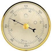
Accurate Altimeter 2.2.32
The most downloaded Altimeter on the PlayStoreis now updated with a new interface and new features!- Altitude estimation with three different methods to be alwayssureto get a reliable measure, even without internetconnection.- Historical charts to see your excursions elevation gain.- Map with your elevation and contour lines.- Pictures with impressed place name and altitude.Altitude can be estimated:- With satellites triangulation. Slow and less accurate but itworkseven with no internet connection.- Taking the ground elevation at your current position fromaninternet web service.- Using the pressure sensor of your device (if available).Itcalibrates itself on pressure from the nearest weather stationtoimprove accuracy.As additional PRO features you can also:- compensate systematic error of pressure sensor- record altitude without opening the App- remove advertising


Altimeter & Altitude Widget 4.57
DS Altimeter is an elevation meter,elevationlogger, and altitude mapper. In addition to showing andoptionallytracking your altitude, the app allows you to search thealtitudefor other locations as well.You can select from the best sources of elevationdata,including:1. Location based altitude from NASA's Shuttle RadarTopographyMission2. Satellite based altitude (GPS altitude) corrected toheightabove mean sea level (AMSL)3. Get actual land survey altitude values for your locationfromthe United States Geologic SurveyDevices equipped with a barometer sensor can also obtainpressurealtitude which is converted to true altitude. For the mostprecisereadings, calibrate the pressure altitude by entering areferencevalue or by selecting one from the app's dynamic list ofnearestairfields.USGS (United States Geologic Survey) altitude results arealsoavailable for customers in the contiguous United States, CanadaandMexico.DS Altimeter also works offline: barometric altitude andGPSaltitude corrected to elevation above sea level do not requireaninternet connection.NEW IN DS ALTIMETER: Record altitude profiles and elevationtracksfor your favorite journeys to the highlands, the lowlandsandeverything in-between!Upgrade the application to pro and gain access to even morefeaturesincluding the Altimeter Widget and variousbarometricaltimeter calibration methods.Going skiing? Record your ski run with DS Altimeter, then viewyourski trail with its elevation points on the included maps.Mininumand maximum altitude points for your run will beclearlyshown.Altitude mapping, altitude search and bathymetry (lake andseadepths) are also included with DS Altimeter. Tap anywhere on amapto get the altitude or water depth at that location.* The perfect altimeter for skiing, hiking, mountain climbingandother outdoor sports, boating, marine navigation and anytimeyouare curious about your elevation!


Altimeter Ler Live Gps Geotracker 2.6
Modern Altimeter GPS+ app is for folks who care for hikingandbikingin mountainous terrain. GPS is getting very accurateinterms ofdistance indication. The choice between unit systemisperhaps animportant thing, just for your convenience the appisbeing equippedwith both of them (Imperial andMetric).Surprisingly strongbarometer measures the weight of theairpressure above a given pointand determines elevation oftwopoints. This app has a creativeand user-friendlystyledesign, simple and comprehensivefunctionalities. Featuresincluded- Imperial and Metric unitsettings. - GPS accuracyindicator. -GPS distance accuracyindicator. - Density of air ,indicator.Search any place and dropsearch pin with place info.Built inlibrary Map integration - GOOGLEmaps - Satellite mapsmode. -Hybrid maps mode. - Standard maps mode.- Terrain maps mode.-Tracking location changes trajectory. Compass- Compass withcamera- Take a pictures with coordinates - Showsdevicereal-timeorientation to magnetic fields. - Ability toswitchbetween trueand magnetic North. - Location coordinates(longitude,latitude). -Course Track information - Time elapsed. -Distance. -Averagespeed. - Max speed. - Altitude. Tracking - Speedtracking inmph orkm/h based on MPH or KM/H mode. - Distancetracking in milesorkilometers based on MPH or KM/H mode. - Timetracking. -Longitude,latitude coordinates. - Save locations drop apinWeather --Temperature information. -- Wind --Visibility--Sunrise,Sunset -- High/Low Temperature. --Abilitytoswitch between Celsius and Fahrenheit.


Altimeter Offline Pro 1.3
Altimeter not need phone signal orinternetconnection to work with high elevation accuracy. Accuracyimprovedgeoid compensation. Ideal for hiking, treking and climbs inmediumand high mountain, where the telephone is often lacking and3ghedge.Improved Altimeter Offline Version. Improvements: more precisely, to write data to yourroutes(maximum height, initial height, climbed, cumulative height,date...), record your historical record of maximum height andadjuststhe refresh rate of the sensor to save battery.Geographical coordinates displayed(longitude and latitude).This application saves your highest elevation automatically.Only need a phone/tablet with GPS sensor.Know your altitude always.Elevation showed in meters and feet. High accuracy inelevationdata.

Metric Conversions 2.0.3
Unit Converter - Free App - Convert Metric to Imperial-CurrencyConverter - Fast - Offline Access Description***NEW***Free UnitConverter App from Metric Conversions Super quickaccessto over30,000 everyday unit conversions in 45 differentlanguagesBroughtto you by the most popular metric conversionswebsite in theworldNeed to convert a unit from metric to imperialor vice versa?Themost popular metric conversions website intheworld,Metric-Conversions.org, has created this quick and easytouse FREEconverter app with a comprehensive range ofconversionssuch asmiles to kilometers, kilograms to pounds, dollarsto eurosandcelsius to fahrenheit. Whether you are in thesupermarket, onatrain or at a restaurant, you can access over30,000calculationsat your fingertips, making everyday conversionssimple,both onlineand offline. FEATURES: Over 30,000 unitconversions inover 45languages Over 160 currencies with liveexchange rates Easyto useinterface Create a conversion favouriteslist for quickaccessAccess unit conversions offline when on-the-goSwitchbetweenconversion units with one click Convert tofractionsObtainconversion results with up to 8 significantdigitsCONVERTERS:Weight Converter (kilograms, pounds, stones,grams,ounces andmore) Temperature Converter (celsius, fahrenheit,kelvin,rankineand more) Currency Converter (over 160 currencieswithliveexchange rates) Length Converter (miles, kilometres,feet,yards,centimetres, inches and more) Area Converter (Squarefeet,squaremetres, hectares, square kilometres and more)VolumeConverter (US& UK Gallons, litres, US pints, UK pints,cubicfeet and more)Speed Converter (miles per hour, kilometers perhour,meters persecond and more) Time Converter (seconds, minutes,hoursand days)Angle Converter (Milliradians, sign, seconds,radians,degrees andmore) Pressure Converter (Pascals, inches ofmercury,bar, inchesof water, torrs and more) Energy & PowerConverter(calories,therms, newton-meters, kilowatt-hours and more)TheMetricConversions Unit Converter App is FREE to use.ABOUTUS:Metric-Conversions.org is the most popularmetricconversionswebsite in the world.* A simple to use onlineconversionwebsitefor a multitude of units including temperature,length,area,volume, weight and currencies in over 45 languages, thesiteiswell equipped to offer this comprehensive, free and easytouseunit converter app. *Source: Alexa


AndMeasure (Area & Distance) 2.0.7
The AndMeasure tool allows you tomeasuredistances and calculate area between points on a map.The tool has virtually unlimited applications. Use itPROFESSIONALLYfor measuring distances and areas in landscaping,lawn care, waterline measuring, paving and fencing. Use it infarming, agricultureand forestry to measure your fields andforests. Realtor's can useit for showing clients distances tocertain landmarks.For RECREATIONAL use, it can be used in measuring off-roadroutes,plotting running courses, water trips, range estimation attheshooting/driving range. Use it in Golf for gettingreal-timedistance to the green.★★★ Featured on AgWeb.com powered by Farm Journal ★★★"This app could be an easy way for farmers to measure newfields."March 2012Features:● Use it as a ruler on a map to calculate the distancebetweenmultiple points● Calculate areas in acres, sq miles, sq feet, m2, km2,Hectare,Ares● Measure the distance to your location from multiple pointsinreal-time using the "continuous mode" feature● Switch between Satellite, Hybrid, Terrain and normalmapmode● Find your current location via GPS or Network● Share measurement and screenshot via email and Google Drive● Add markers to the map either via tap or by dragging from the"addbutton" to get super accuracy● Move markers around to get precise measurementKeywords: map, maps, area, distance, length, ruler, gps, golf,areacalculator, range finder, map measure, area measure,distancemeasure, field area measure, surface measurement, realestate,realtor, GPS measure, solar, landscape, areacalculation,planimeter, efarmer, perimeter, landscaping, garden,fencing,acreage, terrain, geographical, property, geo,agricultural,calculator, forest, farm, field measure, location,roof area,solar, solar panel roof area, outdoor, snow removal,farmlogs, landcalculatorLanguages: English (write an email if you want to help withothertranslations)Get it at:https://play.google.com/store/apps/details?id=com.megelc.andmeasureFacebook:http://www.facebook.com/andmeasurePrivacy Policy:AndMeasure does not store any personal information at all.HoweverGoogle Analytics is used in the app to better understand howtheapp is used and performs.The Google Privacy Policy can be found here:http://www.google.com/intl/en/policies/privacy/
![Peakview [Trial] 6.6](https://cdn.apk-cloud.com/detail/image/com.PeakView-w130.png)


Compass Level & GPS
Take advantage of accurate andintegratedcompass, level and gps tools in one screen.For lovers of D.I.Y. and fans of self-assembling: this makes youanexpert in placing furniture, hanging up a shelf or frame.For tracking, hiking and camping fanatics: now you will never beoffcourse, always having the right position and direction.This tool is handy and very accurate - try it yourself!Advice: for a better accuracy, first calibrate once.✓ Compass Usage• Find and keep track of the right heading• Get information of your current position or atargetposition• Find your parked car through the target position feature.✓ Level Usage• Proper positioning of furniture• Straight installation of a shelf or a frame• Quickly level out your motor home or caravan✓ Features• Automatic horizontal and vertical level display• Choose Sound and/or Vibration when level• Manual compass and level calibration available• 'Hold / Release' button, for easy readout• Screen Capture: no notes, just copy• Sensor sensitivity and update-cycle adaptable• Powerful GPS feature: set target position, and find thedirectionand distance.✓ Remarks (Compass)• Sensor accuracy may differ depending on the device used• For better accuracy, keep away from magnetic fields andelectronicdevices.** Usermanual:http://lemonclip.blogspot.kr/2014/02/compass-level-user-manual.html• If you encounter any problem with this App or incorrectwording,please contact us via:- https://www.facebook.com/CompassLevel- [email protected]


Compass Steel
FEATURES:• Ad-free compass app.• Choose from multiple color themes.• Choose between 2 heading modes - True heading (based onTruenorth) and Magnetic heading (based on Magnetic north).• Sun direction indicator.• Moon direction indicator.• Set and save a target direction.• Tilt-compensated and self-calibrates as you use.• High contrast design improves readability.PERMISSIONS:• Requires access to location coordinates to calculateTrueheading.Any suggestions or feedback are warmly welcomed.


Atfarm 1.18.0
Atfarm helps farmers monitor biomass with satellite imageryanddovariable-rate fertilization, even withoutvariablespreaders.Monitor crop growth Keep track of the biomass ofyourfields withthe N-Sensor and NDVI indices. Planvariableapplications Createnitrogen variable-rate application mapsonAtfarm web application(https://app.at.farm) usingstate-of-the-artsatellite imagery.Fertilise variably with our app!Send theapplication maps from theAtfarm web application to yourphone andspread variably with yourexisting equipment.

Compass Steel 3D
FEATURES:• Choose from multiple color themes• Choose between 2 heading modes - True heading (based onTruenorth) and Magnetic heading (based on Magnetic north).• Sun direction indicator• Moon direction indicator• Sunrise and sunset times• Moonrise and moonset times• Self-calibrates as you use• Marine-style compassPERMISSIONS:• Requires access to location coordinates to calculateTrueheading.

Weather Station with barometric pressure sensor 2.8.7.1
Simple, nice and retro weather station. Our barometer appshowsmaindata: temperature, barometric pressure and humidity.Themes,Graph,Forecast and different Data Providers are also inside.Seepressurewith built-in barometric pressure sensor (not foralldevices)! Thisapp is pleasant and easy to use. It lookslikevintage barometerwith modern technology inside. Onlycorrectweather data withoutanything superfluous (like map, widgetsetc.).Free versionincludes: • Temperature (could measure in °C and°F onthe samescreen) • Wind speed (switch between km/h, mph, mps)•Atmosphericpressure (3 different pressure units of barometer-inHg, hPa, mmHg)• Relative humidity in live time • 7commonlanguages (EN, IT, DE,ES, RU, UK, PL) • barometric pressuresensorYou can also switchbetween classic and forecast viewsPremiumversion: • Forecast for4-7 days (depends on data provider) •Morewind meteo data • Sunriseand sunset data • 3additionalmeteorological live-time datachannels • 3 additionalbackgroundthemes • charts of changingindicators by day or hourlyStayinformed about the weather.Barometer will show you airpressure,hygrometer will show humidityand thermometer – a realtemperature.All local weather informationin your pocket. Rain, snowor evenstorm outside will no longersurprise you. FEATURES: • A lotofrealistic themes to make yourWeather Station unique •Ergonomicdesign: comfortable userinterface in both positions(vertical andhorizontal) • A lot ofdevice configurations forpersonal usage •Compare meteo data fromdifferent providers, sourcesand channels •You can switch betweenanalog style graphic and modernstylegraphics • Celsius andFahrenheit - together on one screenAweather station is a facility,either on land or sea,withinstruments and equipment for measuringatmospheric conditionstoprovide information for weather forecastsand to study theweatherand climate. The measurements taken includetemperature,barometricpressure, humidity, wind speed, winddirection.Atmosphericpressure, sometimes is the pressure exertedby the weightof air inthe atmosphere of Earth. Low-pressure areashave lessatmosphericmass above their location, whereashigh-pressure areashave moreatmospheric mass above their location.Again, we havebuilt-inbarometric pressure sensor support. Itallows to readcurrentatmospheric pressure in realtime. Humidity isthe amount ofwatervapor in the air. Our app shows you relativehumidity, itisexpressed as a percent, measures the currentabsolutehumidityrelative to the maximum (highest point) forthattemperature.Humans are sensitive to humid air because thehumanbody usesevaporative cooling as the primary mechanismtoregulatetemperature. Under humid conditions, the rate atwhichperspirationevaporates on the skin is lower than it would beunderaridconditions. Because humans perceive the rate of heattransferfromthe body rather than temperature itself, we feel warmerwhentherelative humidity is high than when it is low.AnalogWeatherStation always identify exactly where you are. Youhaveopportunityto enable GPS detection or search for your city. Youcansee localweather, alert about rain, snow, strong wind andotherweatherevents. And you can be sure of the accuracy oftheforecast.Updates and more features are coming. Stay tuned forthecurrentweather with vintage Analog Weather Station! Find outwhentheweather will be sunny, cloudy or snowy, there will besevererainor atmospheric pressure will increase in realtime mode!


Wikiloc outdoor navigation GPS 3.25.28
Wikiloc App - Now with offline topomaps!Enjoy free offline maps available worldwide to be used withoutadata connectionCreate your trips and share them with friends on socialnetworks.Track your outdoor activities on a map, take photos alongthe routeand upload all of it directly to Wikiloc right fromyourAndroid.Discover millions of outdoor routes even in the most remoteplaceson Earth. You can choose between running, hiking, cycling,mountainbiking, kayaking and up to 45 different outdooractivitiesavailable.Want more? Transform your phone into a GPS navigator! For asmallfee you can use your mobile phone to guide you through anyroutelike a GPS navigator with heading indicator and audible alertstowarn you if you go off-track.Broadcast your GPS tracked activities on Wikiloc.com and yourfamily& friends you choose can watch how you're doing theentiretime.Join us at wikiloc.com, the community where you can meet millionsofsports enthusiasts, travelers and nature lovers sharingourexperiences through GPS trails.Visit www.wikiloc.com to access even more features.