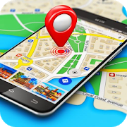
Top 39 Apps Similar to Trailblazer GPS: Offline Maps


Navmii GPS World (Navfree) 3.7.22
Navmii is a free navigation and traffic appfordrivers.Navmii combines FREE voice-guided navigation, livetrafficinformation, local search, points of interest and driverscores.Offline maps stored locally, for use without aninternetconnection. Over 24 million drivers use Navmii and our mapsareavailable for more than 150 countries.• Real voice-guided navigation• Real-time traffic and road information• Works with GPS only – internet not needed• Offline and Online Address search• Driver Scoring• Local Place search (powered by TripAdvisor, FoursquareandWhat3Words)• Fast routing• Automatic rerouting• Search using Postcode/ City/ Street/ Points of interest• Heads-Up Display (HUD) – upgrade• Community map reporting• HD accurate maps• + Much, much moreWe have thousands of 5-STAR REVIEWS:- why buy a satnav when navmii does it all- unbeatable value and functionality- love, love this app!Navmii features on-board OpenStreetMap (OSM) maps, which arestoredon your device and therefore you don’t need no dataconnection(unless of course you use the connected services). UseNavmiiabroad to avoid high roaming costs!We're always eager to hear about your experience of usingNavmii.You can contact us anytime by email, on Twitter or Facebookusingthe details below:- Twitter: @NavmiiSupport- Email: [email protected] Facebook: www.facebook.com/navmiigpsNote: continued use of GPS running in the backgroundcandramatically decrease battery life.


GPS Essentials
The most complete GPS tool available:Navigate,manage waypoints, tracks, routes, build your owndashboard from 45widgets.❧❧❧❧❧ Dashboard ❧❧❧❧❧Shows navigation values such as: Accuracy, Altitude, Speed,Battery,Bearing, Climb, Course, Date, Declination, Distance, ETA,Latitude,Longitude, Max Speed, Min Speed, Actual Speed, TrueSpeed, Sunrise,Sunset, Moonset, Moonrise, Moon Phase, Target,Time, TTG,Turn.❧❧❧❧❧ Compass ❧❧❧❧❧Show the orientation of the earth's magnetic field, showsanarbitrary tracking angle and the current target. Also amarineorienteering compass.❧❧❧❧❧ Tracks ❧❧❧❧❧Record tracks and view them on map. Export KML files and importintoGoogle Maps, Google Earth and others.❧❧❧❧❧ Routes ❧❧❧❧❧Manage routes and view them on map. Import KML files fromGoogleMaps, Google Earth and others. Create turn-by-turninstructionsbetween waypoints.❧❧❧❧❧ Camera ❧❧❧❧❧A camera HUD (heads-up display) view to show your waypoints,takepictures and share them.❧❧❧❧❧ Map ❧❧❧❧❧A map to show your waypoints. Convert mail addresses ofyourcontacts to waypoint so that they can be used within theapp.Supports Google Maps, MapQuest, OpenStreetMap and others.Supports Google Maps v2: Indoor Maps, Traffic, Buildings,Satelliteand Terrain layers and map rotation.❧❧❧❧❧ Waypoints ❧❧❧❧❧A list of all your waypoints with export and import (KML, KMZ,GPXand LOC format).❧❧❧❧❧ Satellites ❧❧❧❧❧A sky view of the current positions that shows satellitesinview.❧❧❧❧❧ Features ❧❧❧❧❧Supported position formats: UTM, MGRS, OSGB,Degree-Minute-Second,Degree-Minute-Fractions, Decimal, Mils.Supports over 230datums.Waypoints, routes and tracks can be exported as KML or GPX filesandsent by email or uploaded to Google Docs or DropBox.Please open the web page below for more info, send me emailsforsupport. I CANNOT HELP IF YOU SIMPLY PLACE A COMMENT HERE.Purchase the "GPS Essentials Donation Plugin" on Android Marketifyou want to support development.The latest beta release is available athttp://www.gpsessentials.comfor download. Try out the latestfeatures and help us improve GPSEssentials!If you are on Facebook, come and join GPS Essentials for thelatestinfo: http://www.gpsessentials.comTHIS APP WILL SHOW ADVERTISING. IF YOU DON'T LIKE THIS,PLEASEREFRAIN FROM INSTALLING/UPDATING.GPS Essentials is not affiliated with any political party norwithany other organization mentioned in the ads, and it hasnoconnection with any economic interests. If you don't like theads,please contact AdMob.WHAT ARE THE PERMISSIONS GOOD FOR?✓ Coarse/Fine location: To access network locations and GPS✓ Full internet access: To read map tiles, send bug reports✓ Modify/delete USB storage contents: To write waypoints, tracksandimages onto the SD card✓ Read phone state and identity: To tag pictures with the deviceID(can be switched off in settings)✓ Take pictures and videos: Camera HUD, take pictures✓ Your accounts: Required to run Google Maps v2


BackCountry Nav Topo Maps GPS
Use your Android as an offroad topo mappingGPSwith the bestselling outdoor navigation app for Android! TrythisDEMO to see if it is right for you, then upgrade to thepaidversion.Use offline topo maps and GPS on hike trails without cellservice!The GPS in your Android phone can get its position fromsatellites,and you don’t have to rely on your data plan to getmaps. Have morefun and safe GPS adventures in thebackcountry.Preload FREE offline topo maps, aerial photos, and road maps onyourstorage memory, so they are ready when you need them.Add custom GPS waypoints in longitude and latitude, UTM or MGRSgridreference. Import GPS waypoints from GPX files. Choose iconsforwaypoints much like in MapSource. (This app uses the WGS84datum,NAD27 is available in settings).Use GPS for hunting a waypoint or geocache, for recording tracksandGPS waypoints on your trip, all the while tracking your questontopographic maps.About topo (topographic) maps: Topo maps show terrain throughcolorand contours, and are useful for navigation offroad. Topo mapsandGPS can be used for hiking, hunting, kayaking, snowshoeing,&backpacker trails.The app has many built in map sources and allows you to createyourown maps with Mobile Atlas Creator. Built in sourcesinclude:OpenStreetMaps and NASA landsat data worldwide.OpenCyle Maps are topo maps that show terrain worldwide.USGS Color Aerial photography.Topographic Maps of Spain and Italy.Outdoor maps of Germany and AustriaTopo maps of New ZealandHere are some of the outdoor GPS activities BackCountryNavigatorhas been used for:Hiking both on hiking trails and off trail.Camping, to find the perfect camping site or the way backtocamp.Hunting trips for hunting wild game in rugged areas, includingreconfor the hunt.Bait fishing or fly fishing with a buddy.Search and Rescue (SAR) with GPS.Kayak and canoe trips on inland lakes and streams or marine,coastalwaters.Backpacker trips: using topo maps of wilderness areas andnationalforests to navigate on trails with the GPS.Snow adventures including snowmobiling, skiing (alpine orcrosscountry) and snowshoeing. Create a memory. Map it out.This a great addition to the outdoor gear you bought atCabelas,REI, or another outdoor store. Your android phone couldsubstitutefor a Garmin or Magellan outdoor handheld GPS! Youstorage hasmemory for maps.Find your own ways to have fun in the outdoors. Be a maverickbyventuring into new territory beyond cell service boundaries.Becomea pro at navigation with GPS.BackCountry Navigator has been previously available on WMdevicesand preloaded on the Trimble Nomad outdoor rugged device.ThisAndroid version is more flexible, featured, and fun.


TrekMe - GPS trekking offline 3.2.6
TrekMe is an Android app to get live position on a map andotheruseful information, without ever needing an internetconnection(except when creating a map). It's ideal for trekking,biking, orany outdoor activity. In this application, you create amap bychosing the area you want to download. Then, your map isavailablefor offline usage (the GPS works even without mobiledata).Download from USGS, OpenStreetMap, SwissTopo, IGN (FranceandSpain) Other topographic map sources will be added. Fluidanddoesn't drain the battery Particular attention was giventoefficency, low battery usage, and smooth experience. SDcardcompatible A large map can be quite heavy and may not fit intoyourinternal memory. If you have an SD card, you can use it.Features •Import, record, and share GPX files • Marker support,with optionalcomments • Real-time visualization of a GPX record, aswell as itsstatistics (distance, elevation, ..) • Orientation,distance, andspeed indicators • Measure a distance along a trackFor instance,all map providers are free, except for France IGN -which requiresan annual subscription. During a GPX recording, theapp collectslocation data even when the app is closed or not inuse. However,your location will never be shared with anyone and gpxfiles arestored locally on your device. General TrekMeguidehttps://github.com/peterLaurence/TrekMe/blob/master/Readme.md