Top 20 Apps Similar to Gps route planner map 2017

路線隨你排 1.2
路線隨你排是一個路線規劃的APP,它能幫助您規劃出遊、送貨或訪客的最佳路線,您也可以自行設定自己想要的路線。主要的重點功能如下:● 地址或地點欄位提供自動完成功能。● 可設定常用的喜愛點。● 可設定單日行程及多日行程。● 已存檔的行程可修改。● 已存檔的行程資料可備份及還原。● 可自行選擇是否將路線最佳化。使用說明:http://leetwo.blogspot.tw/※因為使用Google提供的自動完成功能在輸入台灣地址時會有地址順序顛倒的問題,路線隨你排有針對台灣的地址顯示順序做處理,若您只有需要在台灣使用這套APP請使用路線隨你排,若在國外使用請安裝RoutePlanner。Route as you row isaroute planning APP, it can help you plan your trip, the bestrouteof delivery or visitors, you can also set their own routestheywant.The main focus of the following functions:● Address or Location field providesauto-completefunctionality.● You can set common point favorite.● You can set one-day and multi-day travel itinerary.● archived itinerary can be modified.● archived trip data can be backed up and restored.● You can choose whether to route optimization.Description: http: //leetwo.blogspot.tw/※ Because you use Google's auto-complete feature whenenteringTaiwan Address will address questions in reverse order,with theroute you have a row address for Taiwan to do the orderprocess. Ifyou only need to use this APP in line with Taiwan useYou row, ifused abroad install Route Planner.


GPS MAP Mobile 1.0
GPS MAP Mobile is mobile mappingserviceapplication and technology provided offering satelliteimagery,street maps, and Street View perspectives, as well asfunctionssuch as a route planner for traveling by foot, car,bicycle or withpublic transportation. Live MAPS locator for urbanbusinesses andother organizations in numerous countries around theworld.One of the neat features of Google Maps / Google Earth istheability to get a street view of many urban and suburban areas.Thestreet view is an actual photograph shot with an ImmersiveMediacamera that delivers a 360 degree image of thesurroundings.Street View - Walk Down Your Street With Google MapsWe all love their traffic alerts, but how exactly doesGoogleMapsknow how clogged the highway is on your way out of townthisweekend?Features,• How to Get Latitude From Google Maps• How to Use Coordinates in Live Maps• How to Find Latitudes & Longitudes forMultipleAddresses• How to Convert Google Maps CoordinatesNOTE : This is Contents Application. It gives youinformationregarding GPS MAP Mobile


Travel planner - Explorld 2.4
Explorld features: • Mark locations on the map. • Calculatethedriving time between locations. • Update the timetable by thestaytime and driving time. • Start navigation with Google map.•Provide fuel info (Taiwan region limited). • Protect yourschedulesby passcode lock. ©Boot by Ivan Pletenac from the NounProject©Earth Icon made by https://www.freepik.com fromwww.flaticon.com

All-In-One Offline Maps 3.6c
All-In-One OfflineMaps offers you toaccessa wide range of maps for free.Bored to wait for maps to display? Once displayed, mapsarestored and remain available, quickly, even with nonetworkaccess.• Want more than just roads on your maps? You will findwhatyou need here;• Used to go to places with poor network coverage?Everythingwill stay available;• Used to go abroad? You won't be lost anymore;• Have a data allowance limit? It will reduceyourusage.★★ Maps ★★A lot of maps are available, including classical roadmaps,topographic maps, aerial (satellite) maps and various layersthatcan be added over any maps: OpenStreetMap (Roads, Topo),GoogleMaps, Bing Maps, USGS National Map (Hi-res topo, Aerialimagery),Worldwide Military Soviet topo maps, etc.• All maps can be stacked in layers, with preciseopacitycontrol.• Select and store large areas in few clicks.• Stored space is clear and can be easily deleted.★★ Display, store and retrieve unlimited landmarks ★★You can add various items on the map such as waypoints,icons,routes, areas and tracks.You can easily manage them using the powerful SD-CardLandmarksExplorer.★★ On-map GPS Location & Orientation ★★Your real location and direction are clearly displayed on themap,which can be rotated to match your real orientation (dependsondevice capabilities).Easy turn on/off to save battery.And also:• Metric, imperial and hybrid distance units;• GPS Latitude/Longitude and grid coordinate formats (UTM,MGRS,USNG, OSGB Grid, Irish Grid, Swiss Grid, Lambert Grids, DFCIGrid,QTH Maidenhead Locator System, ...);• Ability to import hundreds of coordinate formatsfromhttp://www.spatialreference.org;• On-map grids display;• Full screen map view;• Multi-touch zoom;• ...★★ Need more? ★★If you are a real adventurer, try AlpineQuest GPS Hiking,thecomplete outdoor solution based on All-In-One OfflineMaps,loadedwith a powerful GPS Location Tracker andmore:http://www.alpinequest.net/google-play

Voice Map Navigation: GPS Directions & Compass 3.1
Get shortest routes and driving directions with VoiceMapNavigation: GPS Directions & Compass. Reachingdesireddestination would never be easy without perfect routeplanner. Withstep-by-step voice commands you can get driving routedirectionsplus estimated time and distance in Km. This voice GPSnavigationapp makes sure you don’t get distracted during drivingwith its mapvoice. Experience real-time GPS driving directions inVoice MapNavigation: GPS Directions & Compass. If you areunaware of thearea, GPS route finder app in your mobile not onlyshow your livelocation but also give a clear view of the nearbyareas on itslatest satellite maps 3d. Let this location finder andtransit mapapp gives you amazing trip memories with its voicedirectionsfeatures. Voice Map Navigation: GPS Directions &Compass mixesedgy maps directions with current location data tofind anyshortest navigation routes by just entering the targetlocationwith simple voice command. Voice Map Navigation: GPSDirections& Compass is a simple map guide that helps travelersto reachdesired location easily with the help of best journeyassistance.Understand your GPS location with map locator and drawroutes toexperience real-time direction GPS with free navigationapp.Explore world with Voice Map Navigation: GPS Directions&Compass. Get travel information no matter where you are intheworld with voice navigation rout map app. This ultimatemapnavigator is a must-have before you decide to set off. It notonlyallows drivers and travelers to get directions by speaking thenameof the target destination but also help them to know theaccurateestimated time and driving distance in Km on GPS maps. Ifyou wantto see the world in its true colors then satellitenavigation mapsare here to help you searching nearby places andplaces of theworld with ease. This location navigator not onlyshows the currentarea but also give a wide view of the areasearched on thedirection map. Enter the name of the destination andshare locationwith your friends and family to let them know whereyou are headingto. Want to know accurate latitude and longitudewith currentlocation info? Then open GPS compass. Free compass willprovideaccurate data regarding location, latitude and longitude.Keep theaccurate locator to know true coordinates. The analoguecompasshelps drivers, bikers, cyclists and hikers to get truedirectionswhile its dark theme make it easy for everyone to getinformationin bright day light or at night. Keep a track on yourvehicle speedwith the best GPS speedometer feature. The freespeedometer managesto show maximum speed, minimum speed and currentspeed in Km/h. Letthis location navigator navigates distances withvoice searches toany destination anytime. Enjoy turn-by-turnnavigation on the go!Download a perfect route assistant – pathfinder that provideseasiest way and live locate to easily get thedirections. Thisdirection guide with live navigation makes sure noone losses itsway even in desolate streets of the world. Voicespeaking addressfeature makes it easy for a driver to speak theaddress instead oftyping the whole address that can divert theattention of thedriver from road.

شاهد منزلك من الأقمار الصناعية 1.0
كيف اشاهد منزلي من الفضاء عبرالاقمارالاصطناعيةمجانا ، هذا هو التساؤل الذي يطرحه الكثير من الناسعبرالعالم،شاهدمنزلك من الأقمار الصناعية .شاهد أي مكان او اي منطقة في العالم بدون اي حظر مع دقةبياناتمتناهيةكما يمكنك رؤية اسماء المدن والعواصم والدول وكذلكالحدودالدولية بدقةمتناهية مع قياس للمسافات، كما يمكنك تكبير صورة أيمكانفي الخريطةبكل سهولة.تجول في انحاء مدينتك ... شوارع ... وكل مايحلو لكمعهذاالبرنامجمشاهدة اي منطقة في العالم سواء مشاهدة منزلك او بيتكمنالفضاء كمايمكنك التجوال في اي دولة و اي منطقة بدون اي حظر معدقةبياناتمتناهية و يمكنك حفظ المنطقة التي تريدها للرجوع لها عندالحاجةكمايظهر لك اسماء الدولة و المدن و العواصم و الحدود الدوليةوحتىالاحداثيات بصورة متناهية الدقة ويمكن قياس المسافات سواءالطويلةاوالقصيرة استمتع و تجسس على العالمبعد قراءة إحداثيات GPS توفر الجهاز المحمول الخاص بك، يمكنكالذهابإلى"خرائط GPS العيش"، تغذية تلك المعلومات في ذلك وعرضالموقعالحاليالخاص بككما يمكنك البحث عن مكان محدد وترك تعليق علي هذا المكانتحديد مكان منزلك علي الخريطه .مشاهده اي مكان مباشره عبر القمر الصناعي .How do I watchmyhousefrom space via satellite for free, this is the questionposedbymany people across the world, watch your homefromthesatellite.View anywhere or any region in the world without anybanwithpinpoint accuracy data as you can see the names ofcitiesandcapitals and countries, as well as the internationalborderwiththe precision measurement of distances, you can alsoenlargeanimage anywhere on the map with ease.Wandering around the streets of your city ... ... and allMaihloyouinstall below program to watch for any region in theworldeitherwatch your house or your house from space as you canroam inanycountry and any region without any ban with pinpointaccuracydata,and you can save the region that you want to returnthem whenneededalso shows you the names of the state and citiesandcapitals andinternational borders and even coordinates aninfiniteaccuracy andcan measure distances, whether long or shortEnjoy andspy on theworldAfter reading the GPS coordinates provide your mobile device,youcango to "live GPS maps," feed that information in it anddisplayyourcurrent locationYou can also search for a specific place and leave a commentonthisplaceLocate your home on the map.Watch any place directly via satellite.

Mawaqi3 - Arabic guide GPS 1.0
Mawaqi3 gives you the ability to listnearbyplaces like mosque, Bank, Cafe,GasStation,Hospitals,School,University , Airport,Parcs ...Mawaqi3 app is using Map api so it can displayallnearbylocations as per search criteria. If you want to navigatetothesearched place then it is advised to enable GPS .Also Mawaqi3 acts as a great navigation tool by which youcanfindyour way in a strange city, discover all the great placesnearyou .Especially it will be easier for you to find yourwantedplace thanksto the direction toolsFeatures :* Nearby roads suggestions for better decision* Easy to use app , just enable gps and 3G/wifi and allisdone* The app provide many location services* compatible with all smartphones* Save favorite places* Ability to adjust search distancemanually

AlpineQuest GPS Hiking (Lite) 2.2.8b
AlpineQuest Lite is the free solutionforall outdoor activities and sports, including hiking,running,trailing, hunting, sailing, geocaching, off-road navigationandmuch more.You can access and store locally a large range ofon-linetopographic maps, which will remain available evenwhile beingout of cell coverage. AlpineQuest also supportson-board filebased maps, like MemoryMap(c) maps.By using the GPS and the magnetic sensor of your device(withcompass display), getting lost is part of the past: youarelocalized in real-time on the map, which can alsobeoriented to match where you are looking at.By staying fully operational out of cell coverage (as ofteninmountain or abroad), AlpineQuest assists you in all your desiresofdeep wilderness exploring...Don't hesitate, use it right now for free!PLEASE report suggestions and issues on our dedicatedforumhttp://www.alpinequest.net/forum (no registration needed,allquestions answered) and not in comments.Key features (for the full/paid version) are:★★ Maps ★★• Built-in online maps (with automatic localstorage;road, topo and satellite maps included);• Built-in online layers (road names andhillsshading);• Get more online maps and layers in one click from theincludedcommunity map list (Nokia maps, Yahoo! Maps, local topomaps,...);• Complete area storage of online maps foroff-lineuse;• On-board offline maps support (visit our website to getthefree map creator MOBAC);• Memory-Map support (QuickChart .QCT maps only, .QC3mapsnot compatible, test your maps using the free Liteversionfirst);• Multiple maps in layers display, with per-mapopacitycontrol;• Advanced SD memory card Map Explorer and Scanner.★★ Landmarks ★★• Create, display, save, restore unlimited number ofwaypoints,routes, areas and tracks;• Import/export GPX files, Google Earth KML/KMZfiles,CSV/TSV files;• Support OziExplorer WPT and GeocachingLOCwaypoints;• Save and share online locations with other users usingCommunityLandmarks;• Details, advanced statistics and interactive graphics onvariousitems;• Time Controller to replay time-tagged tracks;• Routes, tracks and areas creator;• Advanced SD memory card Landmarks Explorer.★★ GPS Position / Orientation ★★• On-map geolocation using GPS or Network;• Map orientation, compass and target finder;• Built-in GPS/Barometric track recorder (longtrackingcapable, running in a separate and light process);• Proximity alerts and leave path alerts;• Barometer support (for compatible devices).★★ And more: ★★• Metric, imperial and hybrid distance units;• GPS Latitude/Longitude and grid coordinate formats (UTM,MGRS,USNG, OSGB, Irish Grid, Swiss Grid, Lambert Grids, DFCI Grid,QTHMaidenhead Locator System, ...);• Ability to import hundreds of coordinate formatsfromhttp://www.spatialreference.org;• On-map grids display;• Full screen map view;• Multi-touch zoom;• ...About the "Phone state and identity" Android permission: due tothebackward compatibility of AlpineQuest with Android 1.5,thispermission is automatically added by Google Play.

Voice GPS Navigation & Map
New features added in version 2:- Route Finder (Navigation)- Near by : get near by school, parks, hospital, restaurant,banks,atm, gas stations, shopping malls, railway stationsetc.- Current location: get your current location in text form andshareit with your friends .App features :- Speak to search between 2 places, route, Map andnavigation.- Search is integrated between current location todestinationlocation by default. You can replace the currentlocation withother location too.- Easy and quick to search.- Use of Google Map Service and navigation- Detailed features of Near By search with real user ratingsandcomments.- Get navigation between 2 destination by setting destinationswithin the app in Route Finder. Get shortest and best route withroutefinder.Just speak out California and you'll instantly get the locationandnavigation from your current location to California.
GPS Route and Maps Navigaton 1.1.2
GPS Route and Maps Navigator is one of thebestapps available on play store for navigation and locationsearch.With this app you can experience the Google Maps differenceandoutsmart the traffic with the world’s best Google mapsandnavigation option.It has offline maps option, get directions and usenavigationwithout an Internet connection.It has comprehensive, accurate maps in 200+ countriesandterritories.All you need to do is just start the service and track locationsonthe map. When you don’t require tracking you can switch offtheservice.Some of the app features:- Live routing with real-time traffic & road map info- Voice guided navigation for easy navigation- Live maps, consistently edited and updated by GoogleLivemaps- Automatic rerouting as conditions change on the road- Find GAS stations and Restaurants for quick stops- Keeps track of your visited locations for easy reference- It’s very simple to use and easy to find locations.
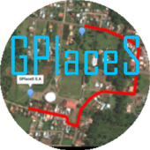
Maps GPS Places 1.8
Registren la empresa donde trabajan:GPlaceS surgió como un proyecto que busca aprovechar al máximolalocalización GPS y Google Map v2. Si eres un empresario osoloalguien que desea registrar una cuenta para una empresa ygestionartodos los servicios que ofrece dicha empresa, ya quetendrás elcontrol de tu cuenta y de los productos o servicios quepublicasserán administrados por el dueño de la cuenta.Pero si eres un usuario que desea calificar o votar porlasempresas que se encuentran registradas, podrás registrar unacuentade usuario la cual te permitirá calificar a lasempresasregistradas desde 1 a 5 estrellas y muy pronta, podrásopinar sobrelas empresas que calificas.GPlaceS se encuentra en fase beta, es por ello que concadapersona que registre su empresa en nuestra base dedatos,lograremos una aplicación estable y con muchos lugaresdondeescoger. por lo que pido a las personas que votan con unaestrella,piensen primero que esta aplicación tiene sus bases dedatosintactas y que entre mas empresarios conozcan esta app,masopciones de búsqueda exitosas tendrán. GPlaces se encuentraendesarrollo y por el momento las cuentas son gratis.Características*Registrar cuenta gratis*Localización GPS de tu empresa en cualquier parte delmundo.(Google Map)*Registro de varias categoría para tu empresa (Hotel,Restaurante,Soda)*Registro de productos o servicios*Estado de empresa open/closed*búsqueda por categoría, distancia, cantidad de resultadoycoordenada.*Calificación a lugares visitados*Información de la empresaMuy pronto se podrán comprar productos y servicios desde lamismaaplicación.Record the companywherethey work:GPlaceS emerged as a project that seeks to maximize theGPSlocation and Google Map v2. If you are a businessman orjustsomeone who wants to register an account for a company andmanageall the services offered by the company, as you will havecontrolof your account and the products or services you post willbeadministered by the account holder.But if you're a user who wishes to qualify or vote forthecompanies that are registered, you can register a useraccountwhich will allow you to qualify from the registered from 1to 5stars and very prompt companies can review the companiesthatqualify.GPlaceS is in beta, which is why each person registeringyourcompany in our database, we will achieve a stable and plentyofplaces to choose application. so I ask people to vote with astar,think first that this application has data bases intact andthatthe more entrepreneurs know this app, more options havesuccessfulsearch. GPlaces is under development and currentlyaccounts arefree.Features* Register Free Account* GPS of your company at any location in the world.(GoogleMap)* Record multiple categories for your business (Hotel,Restaurant,Soda)* Registration of products or services* Company State open / closed* Search by category, distance, number of resultsandcoordinate.* Rated to places visited* Company InfoSoon be able to buy products and services from thesameapplication.

Offline Maps & Navigation
Here we created another great navigationappbased on offline maps.You can enjoy unlimited navigation features, lifetime freemapupdates with no hidden costs. Our real-time traffic helps youtoavoid traffic jams. Features: - Free offline GPS navigation- Offline maps- Lifetime free map updates- Speed limit warnings- 3D buildings - Large POI database- Pedestrian, car, or even bee-line navigation- Night mode based on local sunset time Advanced:- Real-time traffic- Multi-language voice navigation- Speed camera warnings- Lane guidance- Track recording- Navigate to photo- Travelbook- Support Free version includes 90 days Advanced features with voiceguidednavigation. After 90 days use offline maps and trip planningforfree or upgrade to unlimited voice guided premiumnavigation.


Satellite Live Maps 2.0
Satellite Live Maps view opens up newmethodsofstaying in touch, sharing information, locating addressesandnow, itallows you to view specific addresses from satellitemaplive. MajorInternet entities like Google or TerraServer allowyouto enter anaddress live view satellite of earth, sometimesevendown to aspecific home or building. In many cases, thistechnologyis free,requiring only a fast Internet connection.satellite camera live view requires the installationandcorrectaiming of a satellite dish. Aiming the live satellitedishisaccomplished through gradual up/down and left/rightadjustmentstothe dish while mounted. While many people rely on aprofessionaltoprovide this installation, you can install and aimasatelliteyourself and receive live satellite programming onyourtelevisionso long as you have patience and the help ofanotherindividual.Currently, it is not possible to get livesatelliteimages forevery location by looking online. It isrelatively simpleto accesslive images of interesting and importantplaces in theworld,however, as a few sites are dedicated toproviding livesatellitefeed for these particular sites. who havebeen three bigprovidersof live map satellite view and imagery upuntil 2015,will, nodoubt, work to make a live service available forthe restof theglobe. A live satellite feed is video that isrecorded liveat anevent and then broadcast on the Internet. Byaccessing thesitefrom which the feed is broadcast, you can watch itsatellitemaplive as it is transmitted. All you need to do to watchalivesatellite feed is make sure that you know on which websitethefeedwill be broadcast.Each server and free live satellite maps search engine hasitsownspecific set of rules and guidelines, but theaccessprocessfollows a basic formula.