Top 46 Apps Similar to DKW The Netherlands

Vaarkaart Friese Meren 2.11
The perfect chart for sailing on theFrisianlakes. This chart is made for boat renters, skippers andcrew ofsail boats, motor boats and barges. Also recommended forcanoes andfishers.AreaFrom Stavoren to Grouw, with the following lakes::Heegermeer,Fluessen, Morra, Oudegaster Brekken, Zwarte and WitteBrekken,Sneekermeer, Koevorden, Tjeukermeer, Langweerderwielen,andPikmeer/Wijde Ee.This is a detailed chart with a scale 1,3m/pixel. This comesdownto about 1 : 5000 on the screen.Depth viewWith clear depth view from the Friese Meren Project in wellcoloreddepth areas on the lakes and depth numbers along the waterways.Developed by Stentec in cooperation with the province Fryslânbasedon the most recent depth measurements.WaypointsThe included database contains 2345 waypoints divided in 13groups.The 145 marinas show phone numbers and websites. Othergroups areamong others bouyage, mooring spots, campings and gasstations.The accurate positioned bouyage contains the socalled‘slobbers’. These mark the protected bird area from 1 Octoberto 1May. Outside this period these are replaced by yellowregattabuoys.Marrekrite 2014 natural mooring places are also included inthechart. You can easily see if camping is allowed (CAMP), ifacontainer is present (CONT) or if you can moor (WAL).The bridges and locks along the water ways are shown withheightand width so you can easily plan your route. The manyaquaducts arealso shown. Most bridges are operated daily from 1 Mayto 1November from 9h-19h. In June, July and August even until20h.


KNRM Helpt 2.1.5.1
Official app of the Royal NetherlandsSeaRescue Institution (KNRM) - the ‘KNRM Helps’ app allows youtoregister your vessel and plan and track your trip onyoursmartphone.Registering vessel and trip information could not be anyeasier.Follow the registration process to start using the app. Onceyourregistration details have been saved, you can make your choicefromthe menu in the app. You may either plan and file your trip(Sailplan mode) or just activate the tracking function of the app(Trackonly mode).For filing a planned trip choose your vessel, determine theenddestination, calculate the ETA (Estimated Time of Arrival),enterthe number of persons on board and the activity type. Then,usingthe built-in maps, select a starting point, an optionalwaypointand the end destination. Once this is completed simplypress the‘start’ button when you are ready to start your trip. You,youremergency contacts and eventually the SAR authorities willbeautomatically alerted following a time scheme after thejourneyexceeds the ETA in Sail Plan mode.Pressing ‘start’ in Sail plan mode or just pressing the startbuttonin Track only mode will register the trip details withKNRM’s serverand will activate position reporting in the app. Atregularintervals the app will send a position report to theserver.At any stage during the trip you can end your trip, revise theETA,number of people on board or the destination.Use the KNRM Helps app to:- Improve maritime trip planning with Electronic NavigationalChart(ENC) data.- Quickly start recording using the ‘Track only’ mode tobegintracking at a touch of a button. Change the recording intervaltosave on battery consumption when your tracking isinprogress.- Find nearby port information, VHF channels, lifeboat stationandbusy waterways information using the “Explorer” tool.- Access location-based, real-time weather & water datawhenplanning your trip or when your trip is in progress.- Receive maritime safety messages and marine notices throughtheKNRM Helps app and SMS messages.- Check valuable maritime safety information when both onlineandoffline.- Create your own personalised checklist to be included as partofyour Sail Plan before departing.- Activate a distress call or call for assistance while your tripisin progress. (iPhone only, not with iPAD)- Manage your profile, vessel, checklist and emergencycontactinformation within the KNRM Helps app.Continued use of GPS running in the background canconsiderablydecrease battery life while in use.Please note:This application’s functionality and the information it containsarepublished on the understanding that end users are to applytheir ownknowledge and skills in the use of saidapplication.Maritime safety is an extremely serious matter. In an emergencythisapplication’s function and information are not meant to berelied onexclusively. In addition, other reliable information andhelp fromthird parties should be looked for and made use of.This application can provide valuable coordinates of theuser’sposition, as determined by the mobile device used and theGPSsystem. Mobile devices and their supportingtelecommunicationnetworks are, however, not reliable and there is areal chance ofloss of connection between the mobile device and themobile networkand / or the GPS system. Nor is there any guaranteethat theconnection between your mobile device and mobile networkswill beuninterrupted. The user hereby agrees to and accepts allrisksinvolved in the use of this application.


SeaWi Marine 1.08.CI22.449
A full Navigation Tool for Android TabletsandPhones and the best Navigation aid Tool for Sailors.Navigation DataVisualize navigation data on your phone or tablet: position,SOG,COG, speed, heading, apparent wind, true wind, ground wind,VMG,Beaufort force, depth, water temperature, UTC time. (A NMEA2000® ora NMEA 0183 WiFi adaptor is required to receive NMEA data.SeaWidecodes NMEA 2000® and NMEA 0183 data received in TPC, UDPUnicastand Multicast packets).You can also use the built-in GPS of your device toshowposition, SOG, COG and UTC time.AIS TargetsSeaWi decodes AIS information and allows you to visualizeAIStarget information on your phone or tablet: AIS target nameandMMSI, AIS target position, AIS target SOG, AIS target COG,distanceand bearing from your vessel, heading, rate of turn,length, beam,draft, IMO, Callsign. SeaWi shows AIS targets on thechart andtriggers alarms for dangerous AIS targets or AIS targetlost. (AnAIS receiver and a NMEA 2000® or a 38400 baud NMEA 0183WiFiadaptor; or a WiFi AIS receiver is required to receiveAISinfo).You can select your buddies and keep track of them.AlarmsSeaWi allows you to program multiple alarms: anchor alarms,depthalarms (shallow water alarm, deep water alarm), alarm of lostdata(depth data lost, heading data lost, position data lost,apparentwind data lost) and AIS alarms (dangerous AIS target, lostAIStarget).TracksYou can create a track tapping the Create new track buttonfromthe Track View. The tracks are saved and may be visualized atanytime.You may configure the time period or the distance betweentrackpoint creation and the number of viewed points athighresolution.You may continue a saved track whenever you need it.WaypointsYou can create a waypoint tapping and holding on a chartposition.Once the waypoint dialog appears you can modify thewaypointposition and place the waypoint at your vessel’s positionor at aposition of your choosing. You can mark the waypoint withsixdifferent symbols: generic waypoint, anchorage waypoint,divingwaypoint, fishing waypoint, dangerous waypoint and MOBwaypoint.You may add a photo to your preferred waypoints.Man Over Board (MOB)You can create a Man Over Board waypoint with only oneclick(menu MOB). Your vessel's position and UTC time and date willbeautomatically saved. You can manage the MOB mark as a waypointfromwaypoints view.SMS ServiceThe SMS Service allows you to receive SMS messages when analarmis activated. If you are anchored and you are not on board youcanprogram alarms (anchor alarm, depth alarm, dangerous AIStargetalarm or lost data alarm) and receive them on your phone.When noton board you can schedule SMS messages at certain intervalsof timeand receive navigational data from your vessel on yourphone.SeaWi NMEA forwardingYou can forward all navigation and AIS data where you needthem.Forward NMEA data to other tablets and phones on your boat.ForwardNMEA data remotely and use SeaWi app to visualize thesamenavigational and AIS data as if you where aboard.Log Trip and Simulation ModeYou can record navigational data of your trip and recoverthemlater to review your trip in Simulation Mode.ChartsOff-line OpenSeaMaps charts of the entire world areavailable.Currently charts of Europe, North America, MediterraneanSea, BlackSea, Caribbean, Australia, New Zealand, Pacific and NorthAfricaare available. Charts of the rest of the world will beavailablesoon.OpenSeaMap is an open source, worldwide project to create afreenautical chart. In 2009, OpenSeaMap came into life. Thismapincludes beacons, buoys and other navigation aids. OpenSeaMap isasubproject of OpenStreetMap and uses its database.


Kwindoo Tracking 2.1.9
Use KWINDOO to hook up to sailing regattasandstay instantly informed aboutany news or changes in effect regarding your upcoming race.You will get invitations to join races, from organisers whouseKWINDOO.com for their regatta. The race administrator will seeifyou join or decline.You will see the NOR and the sailing instructions and getpushnotifications about any changes. You will also see theactualchange itself.You will receive Active Race information Messages in theARIMsection of your app.These can be instructions or informations. These are providedforthe entire fleet or a class. No individual messaging is possibletoa single boat.Your phone will provide GPS tracking for the race. This can beseenby the organiser and by your fans and family, too.The organiser can pre-set an emergency call number to be used atasingle button press, should that be needed.Use "quit the race" function to inform your race administratorandnot to search and or wait for you in case you gave upastage.Use KWINDOO to hook uptosailing regattas and stay Informed about Instantlyany news or changes in effect Regarding your upcoming race.You will get invitations to join races, from organizersforKWINDOO.com Who Use Their regatta. The race will seeadministratorif you join or decline.You will see the NOR and the sailing instructions and getpushnotifications about any changes. You will also see theactualchange Itself.You will receive the Active Messages in the Arima Raceinformationsection of your app.These instructions can enter or Information. These are providedforthe Entire fleet or class. No Individual messaging is Possibleto asingle boat.Your phone will provide GPS tracking for the race. This Can BeSeenby the organizer and by fans and your family, too.The organizer can pre-set call an emergency number to be Used atasingle button press, hurt Should you needed.Use "Quit the Race" function to inform your administrator andraceand not to search or wait for you in case you gave upthestage.


SailDroid
The Sailing AppApp for sailors, yachts and boats, containinga set of nautical applications:- Magnetic Compass- Speedometer in knots, mph or km/h, Course over Ground- Position- Mark or edit waypoints- Import Waypoints from gpx file- Distance measurement in nautical miles and meters. Also usefulforanchoring.- Course to WaypointAll in large, high contrast characters


Transas iSailor
Transas iSailor is an easy-to-usenavigationalsystem developed for the amateur seafarers. Intendedfor use onboats and yachts, iSailor provides a clear presentationofnavigation information and electronic charts. Transas ownTX-97vector chart format supported by iSailor is recognizedworldwide asone of the most accurate and reliable sources ofnavigationalinformation.Available Chart Folios cover coastal and offshore waters ofNorthAmerica, Latin and South America, Europe, Africa, Middle East,FarEast, Asia, Australia & New Zealand. All chart folios canbeselected, purchased and downloaded via the Transas iSailorappusing its Chart Store section. Purchased chart folios includesaone year Chart Updates subscription service of yourchosencoverage. At the end of one year you can choose to renew yourChartUpdates subscription service or continue to use the chartsyoupreviously purchased and downloaded.• Positioning system:- Internal GPS (if available, through the AndroidLocationProvider)- NMEA GPS over Wi-Fi (TCP/UDP connection)- AIS class B Transponder (TCP/UDP connection)- Bluetooth NMEA GPS through the Android LocationProvide("Bluetooth GPS Provider" app is needed)• Navigation sensors support: GPS, Compass & ROT (TrueorMagnetic Heading), Wind, Echo-Sounder• AIS targets support: AIS Class A, AIS Class B, AIS Receiver,BaseStations, Aids-to-Navigation (AtoN)• Display of Charts and Routes• North Up, COG Up and Route Up chart orientations• Information on any vector chart objects• Free cursor, Point-To-Point and Own Ship referencedERBLfunctionality• Monitoring of navigational data: Position, Course (COG) andSpeedOver Ground (SOG)• Route creation by the graphic methods. “Go To” routes• Alarms & Warnings• Waypoint monitoring: Bearing to WP, Distance to WP, XTD• Schedule information: Time-To-Go and ETA to any selectedwaypointahead• Day and Night chart palettes• Track recording• Import & Export for Tracks and Routes• Multi-UnitsCompatible with Android versions since 4.4.x (API level 19)andhigher!List of supported and tested devices:Tablets:• Google Nexus 7 (2013)• Samsung Galaxy Tab S• Samsung Galaxy Note 8.0• Samsung Galaxy Tab Pro 8.4• Samsung Galaxy Note 3• Sony Xperia Z2 Tablet• Lenovo A3300-HV• Lenovo YOGA Tablet 2 ProSmartphones:• Samsung Galaxy S4• Lenovo S60• Samsung Galaxy A3• HTC Desire 630• Asus ZenFone Z00ADWe cannot guarantee correct operation on non-tested devices.Ourteam will continue to improve the application performance,keepingyou informed about our progress in the upcomingreleases.iSailor web site http://www.isailor.usAny questions? Feel free to contact us at [email protected] Yours,Transas iSailor team


MX Mariner - Marine Charts
MX Mariner is a basic mobile marine navigator/chart plotter featuring quilted offline raster marinecharts.Offline raster marine charts are are available for the US,NewZealand, Brazil, and UK.US, New Zealand and Brazil chart regions are free to downloadandupdate.UK chart regions are available for the United Kingdom, IrelandandChannel Islands as in-app purchases. Each UK chart regionin-apppurchase gives you 1 year of free chart updates. UK chartregionsin MX Mariner are "derived in part from material obtainedfrom theUK Hydrographic Office".Features:Offline raster marine chartsOnline satellite and road mapsGPS NavigationActiveCaptain interactive cruisingguidebookhttps://activecaptain.com/Waypoints - create, edit, navigateTracks - record, editRoutes - create, edit, navigateGPX import / exportConfigurable units of measure and the World Magnetic ModelPlease see https://mxmariner.com/#/manual for details.

WingX Pro7 2.0.4.0
WingX Pro7 requires a $74.95annualsubscription or $199.95 three-year subscription. There is a30-dayFree Period option. The $74.99 Advanced IFR subscriptionenablesshowing your aircraft on an approach chart.● ● ● New - ADS-B Support ● ● ●GPS-Enabled Moving Map● VFR Sectionals, IFR Enroute Low and High, and WACs● Awesome user-defined enroute transparency - this is cool!● Split screen● Track Up● Brightness● Route CDI, ETEs, and ETAs● Knots, MPH, km/h● External Bluetooth GPS support● Display Airport Labels● Display Airport Status including Flight Rules,Visibility,Ceiling, Temperature, Temperature/Dew Point Spread, andDensityAltitude● Select Airports, NavAids and Fixes from Moving Map (NavAidsandFixes are currently limited to those in the route)● Select TFRs and display TFR Information● State BordersADS-B Support● Display GPS, METARs, TAFs, Winds and Temps Aloft, PIREPs,andNOTAM-D● Display ADS-B NEXRAD images on moving map● Display ADS-B TrafficWx Text● Color-coded and decoded METARs, TAFs, winds/temps aloft● Includes Alaska and Hawaii● Calculates METAR Density Altitude and Freezing LevelsRoute Planning● Victor Airways and Jetways● Total and Longer Than Direct distances● Flight Log shows Magnetic Headings, Groundspeed, ETE, FuelBurnusing winds aloftFlight Services - Lockheed Martin● Flight Plans and Weather Briefings use a secure connection● Official and recorded by Lockheed Martin● File on device, view on Lockheed Martin web site(1800wxbrief.com)or vice versa● File, Close, and Cancel flight plans● Route and Area Weather Briefings● Aircraft Manager for auto-fillE6B● TAS● Conversions● Distance-Speed-Time● Pressure/Density Altitude● Winds Aloft● Runway Winds● IFR Climb● Descent RateIntegrated Help System● Built-in mini-manualFollow us on twitter: mobilewingx


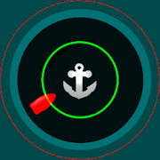
Sailsafe. Anchor alarm. 2.0.4
Sailsafe is an application designed toincreasesafety in the anchoring of small and medium-sizedships.It lets you stablish a safety zone around your anchor andactivatean alarm that will alert you in case your ship leaves thatzone atany given time (very common situation when anchor driftingoccursor the chain breaks). You will be able to see where the boatislocated on the map at any moment, which is very useful if itisdark or visibility is reduced.The safety zone can be set just indicating a radius.In PRO version, you can also specify an aditional exclusion zonetodetect, for example, changes in wind direction that could putourboat at risk if, for example, the coast is positioned itselftoleeward.Sailsafe has been designed to maximize the safety afteranchoring.Therefore, once the alarm is activated, not only theposition ofthe ship is checked, but also the level of the batteryin themobile device or the state of the GPS signal. If any oftheseparameters fails, then the app will produce an audible alarmtoinform about the specific problem. Thus, after setting thealarmyou can relax and trust Sailsafe. It will be watchingforyou.Features:- It runs in the background.- Main screen shows useful information:1. Current position (latitude, longitude and accuracy ofthemeasure).2. Current security radius.3. Current drift.- Set graphically and easily a security zone with anoptionalexclusion zone.- Wind forecast included (48h). You will be warned if the boatisexpected to be out of the security zone due to a windchange.- The ship and the security zone are always shown over a mapwithoptional satellite view.- Once the alarm is set, you can adjust the anchor position incaseit is not correct. Just indicate the actual bearing (read itfromthe compass) and estimated distance between the ship and theanchor(surface distance).- Option to ignore the current volume of the device and set ittothe max when the alarm is triggered.- Option to set a minimum battery level. When reached, the alarmistriggered.- Option to allow automatic alarm re-launch after afalsepositive.- Option to keep the screen on while the alarm is activated.- Option to call a phone number when the alarm is triggered.- Remote commands:1. An incoming call from a defined phone will reset thealarm.2. Send a SMS with the word STATUS to the on board device anditwill respond with another SMS containing useful informationaboutthe location of the ship.- After a set number of seconds without GPS signal, the alarmistriggered.- Option to mute alarm tone after a set number of minutes (toavoidannoying pets in the boat if the alarm is triggered and nobodyison board).- Option to set the measurement unit (feet or meters).- Three modes of operation:1. Normal. GPS readings every 10 seconds. Simple algorithmtodiscard odd positions. (Save battery when the device isnotcharging).2. Fine. GPS readings every 2 seconds. Complex averagingalgorithmbased on accuracy and time of the last 10 GPS readings todiscardodd positions making the whole system smooth and robust.More powerconsumption.3. Continuous. GPS readings every 1 second. Same algorithm asinfine mode. Optimus for adverse weather conditions. Morepowerconsumption.4. Poor GPS signal mode.- When re-enabling alarm, if ship moved less than 150 meters,youcan opt between keeping last anchor position (useful after afalsealarm) or using the actual GPS reading.


Ecofleet Mobile 1.18.1
In order to use this app, you must have a validEcofleetSeeMeaccount. Please don't hesitate to press "Sign up"buttoninapplication login screen to create one. You can createyourownfleet by using android devices instead ofdedicatedGPScontrollers. With this app, tablets and smartphones canbe usedasdedicated portable tracking devices. To do so, pleaseregisteryourdevices by pressing 'Start Tracking' button in thehomescreen.Main features: Surveillance - View vehicle's locationandtrackinghistory on map • Vehicle quicksearch • A selectionofquality maps• Addresses are retrieved on demand • Completelatestvehiclelocation info: address, coordinates, speed, headingTracking- Turnyour handheld device into portable tracker •Adaptivetrackerconfiguration • Auto suspending GPS sensor whenstationaryforoptimal battery consumption Task management - Assigntasksdirectlyfrom web application to field worker's smartphoneortablet. -Create and edit tasks on the fly - Viewandmanagecustomer-specific data - Navigate to destination viaGoogleMobileMaps - Add photos to task - View route to task locationonmap •Mileage calculation and reporting • Signableuser-definedforms •Notifications and messaging • Photos • Traveltimeestimation Assetmanagement - Pick up and drop QR coded assets•Barcode scannerintegration 19 languages are currently supportedFormoreinformation, please visit www.fleetcomplete.ee.


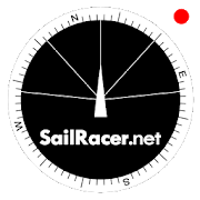
Sail Racer 6.6.4
This is a sail racing app for sailing enthusiastsandprofessionals.Application is used as an additional tool nexttostandard yachtequipment to take tactical sail decisionsfaster.Sail Racer appsuggest the favored end of the start line,monitorsyour position,time and guides the maneuvers that the startlinewas hit at thelast moment with the best possible speed duringyoursail. With thesail app it is easy to navigate in racing area.SailRacer interfaceis designed in a way that course efficiency,thelay lines andshifts could be captured in a splash of asecond.Skipper does notneed to analyze the numbers and canconcentrate onhandling theboat, maximizing performance and playingtacticalgames withcompetitors. Every wind gust and lull affect theboatheading and isvisualized in a “easy to read” shift bar on thetopof compass roseand on the map. Sail Racer is designedanddeveloped by sailors. Ithas everything to sail on the edge. -Timeto burn, Coundown andStarting box distances - Windaveragecalculation for 6minutes andan hour - Course averagecalculation(in case you do not have NMEAdata) - Boat efficiencyaccording topolar data - Mark, Laylinedistance and ETA - Tracker -Nauticalcharts - NMEA 0183 dataconnection, BlueTooth dataconnection,SailTimer wind information -Current indication and manymore -Works on watch (Android wear OS)More informationwww.sailracer.netSailrace.net app is free forlearning (Optimistkids, Lasers andother centerboards) and forevaluation purposes. Wekindly ask allkeel boat racers to purchasePremium license for 35euros / year.Have a good start and evenbetter finish.


EuroAirport
The app shows current arrivals or departuresonlaunch. In addition, individual flights can be added to afavoriteslist, allowing direct access to the current status of theflightwithout a time-consuming search. The detail view of a flightshowsthe check-in counter and departure gate for departingflights, thebaggage belt for arriving flights.For every flight, push notifications can be activated to beinformedabout status changes like delays or boarding times (onlyfor Android4.1 or higher).With the search function, all flights of the current season canbefound using search criteria in any combination (date, airportofdestination or of origin, airline, flight number).The app also includes:• Overview of the parking zones, their current occupancy andtheirtariffs, incl. a tariff calculator (only for Android 4.1orhigher)• Access maps and information on Public transport connections(bus,train)• Information on the airlines serving EuroAirport• Check-In information• Important phone numbers with direct dialling function• "Bag Tracker" - follow the progress of your bags to theplaneafter check-in at EuroAirportThe EuroAirport app is trilingual (English, German, French);thedesired language can be changed in the settings.

