Top 34 Apps Similar to New York Subway & Bus maps


Maps & GPS Navigation OsmAnd+
OsmAnd+ (OSM Automated NavigationDirections)is a map and navigation application with access to thefree,worldwide, and high-quality OpenStreetMap (OSM) data.Enjoy voice and optical navigation, viewing POIs (pointsofinterest), creating and managing GPX tracks, using contourlinesvisualization and altitude info, a choice between driving,cycling,pedestrian modes, OSM editing and much more.OsmAnd+ is the paid application version. By buying it, yousupportthe project, fund the development of new features, andreceive thelatest updates.Some of the main features:Navigation• Works online (fast) or offline (no roaming charges when youareabroad)• Turn-by-turn voice guidance (recorded andsynthesizedvoices)• Optional lane guidance, street name display, and estimated timeofarrival• Supports intermediate points on your itinerary• Automatic re-routing whenever you deviate from the route• Search for places by address, by type (e.g.: restaurant,hotel,gas station, museum), or by geographical coordinatesMap Viewing• Display your position and orientation• Optionally align the picture according to compass oryourdirection of motion• Save your most important places as Favorites• Display POIs (point of interests) around you• Display specialized online tiles, satellite view (fromBing),different overlays like touring/navigation GPX tracksandadditional layers with customizable transparency• Optionally display place names in English, local, orphoneticspellingOnly this week 50% OFFUse OSM and Wikipedia Data• High-quality information from the best collaborative projectsofthe world• OSM data available per country or region• Wikipedia POIs, great for sightseeing• Unlimited free downloads, directly from the app• Compact offline vector maps updated at least once a month• Selection between complete region data and just roadnetwork(Example: All of Japan is 700 MB or 200 MB for the roadnetworkonly)Safety Features• Optional automated day/night view switching• Optional speed limit display, with reminder if you exceedit• Optional speed-dependent zooming• Share your location so that your friends can find youBicycle and Pedestrian Features• Viewing foot, hiking, and bike paths, great foroutdooractivities• Special routing and display modes for bike and pedestrian• Optional public transport stops (bus, tram, train) includinglinenames• Optional trip recording to local GPX file or online service• Optional speed and altitude display• Display of contour lines and hill-shading (viaadditionalplugin)Directly Contribute to OSM• Report data bugs• Upload GPX tracks to OSM directly from the app• Add POIs and directly upload them to OSM (or laterifoffline)• Optional trip recording also in background mode (while deviceisin sleep mode)OsmAnd is open-source and actively being developed. Everyonecancontribute to the application by reporting bugs,improvingtranslations or coding new features. The project is in alivelystate of continuous improvement by all these forms ofdeveloper anduser interaction. The project progress also relies onfinancialcontributions to fund coding and testing ofnewfunctionalities.Approximate map coverage and quality:• Western Europe: ****• Eastern Europe: ***• Russia: ***• North America: ***• South America: **• Asia: **• Japan & Korea: ***• Middle East: **• Africa: **• Antarctica: *Most countries around the globe available as downloads!From Afghanistan to Zimbabwe, from Australia to the USA.Argentina,Brazil, Canada, France, Germany, Mexico, UK, Spain,...

All-In-One Offline Maps +
All-In-One OfflineMaps+ offers you toaccessa wide range of maps.Bored to wait for maps to display? Once displayed, mapsarestored and remain available, quickly, even with nonetworkaccess.• Want more than just roads on your maps? You will findwhatyou need here;• Used to go to places with poor network coverage?Everythingwill stay available;• Used to go abroad? You won't be lost anymore;• Have a data allowance limit? It will reduceyourusage.This Plus version includes all features of the Standardversionwithout ads, and supports import of professional GPS andgeographiclandmarks file formats (waypoints, routes, tracks, areas)like GPX,Google Earth KML/KMZ (map overlays not supported),OziExplorer WPT,CVS/TSV and Geocaching LOC★★ Maps ★★A lot of maps are available, including classical roadmaps,topographic maps, aerial (satellite) maps and various layersthatcan be added over any maps: OpenStreetMap (Roads, Topo),GoogleMaps, Bing Maps, USGS National Map (Hi-res topo, Aerialimagery),Worldwide Military Soviet topo maps, etc.• All maps can be stacked in layers, with preciseopacitycontrol.• Select and store large areas in few clicks.• Stored space is clear and can be easily deleted.★★ Display, store and retrieve unlimited landmarks ★★You can add various items on the map such as waypoints,icons,routes, areas and tracks.You can easily manage them using the powerful SD-CardLandmarksExplorer.★★ On-map GPS Localization & Orientation ★★Your real location and direction are clearly displayed on themap,which can be rotated to match your real orientation (dependsondevice capabilities).Easy turn on/off to save battery.And also:• Metric, imperial and hybrid distance units;• GPS Latitude/Longitude and grid coordinate formats (UTM,MGRS,USNG, OSGB Grid, Irish Grid, Swiss Grid, Lambert Grids, DFCIGrid,QTH Maidenhead Locator System, ...);• Ability to import hundreds of coordinate formatsfromhttp://www.spatialreference.org;• On-map grids display;• Full screen map view;• Multi-touch zoom;• ...★★ Need more? ★★If you are a real adventurer, try AlpineQuest GPS Hiking,thecomplete outdoor solution based on All-In-One OfflineMaps,loadedwith a powerful GPS Location Tracker andmore:http://www.alpinequest.net/google-play


Indian Railway Train Status 10.95
Live running train status, time tables,stationstatus, PNR enquiry, a unique berth & seat calc, andreservationdate calc for Indian Railways.Amaze your co travellers by telling them "Hmmmm.. we arerunningtwenty minutes late", without looking outside!You can also add home screen widgets & quick★marksforultra-quick, one-touch access to train, station & PNRstatusand time tables, and even search trains by voice with with"TrainMic", in app & new widget.Time tables & PNR statuses are cached offline forquickrechecking.Featuring the handy berth & seat calculator: for the timeswhenyou want to quickly know whether its a lower berth or anaisleseat......and the reservation date calculator: to find thereservationopening date for a given date of travel, and also setreminders forit.A convenient link to open the IRCTC mobile app/website based onthetime of day is also featured.Share live status, time tables and trains between two stationwithdynamic links from the app which will show uptodateinformationwhen received.The app has a companion app to make your journeys even better,whichmay be installed by selecting the "More Enquiries"option.Note: 'Launch Map'- launches the default android 'Maps'applicationwhich can show the exact location of the train on GoogleMaps.Please note: this will work only if the 'Maps' applicationandlocation features are available on your device; thesearepre-installed on most android phones and tablets.Train status information shown is from the National TrainEnquirysystem - http://enquiry.indianrail.gov.inPermission required (only in pre-KitKat devices):Photos/Media/Files - This is for accessing the externalstorage,where time tables and PNR statuses are saved offline.Usinginternal storage does not require this permission, but willconsumethe limited space. (Note that the permission is notcalled'External Storage' or 'SD Card', but'Photos/Media/Files'.)

MAPS.ME – Map with Navigation and Directions v14.2.71484-googleRelease
Free, fast, detailed and entirely offlinemapswith turn-by-turn navigation – trusted by over 90milliontravelers worldwide.OFFLINE MAPSSave mobile data, no internet is required.FREE FOREVERAll maps inside and all features are free. Always were andalwayswill be.NAVIGATIONUse driving, walking and cycle navigation anywhere intheworld.INCREDIBLY DETAILEDDirections to points of interest (POI), hiking trails andplacesmissing from other maps.UP-TO-DATEMaps are updated by millions of OpenStreetMap contributorsdaily.OSM is an open-source alternative to Google Maps, MapquestandWaze.FAST AND RELIABLEOffline search, GPS navigation along with optimized mapstoeffectively save memory space.BOOKMARKSSave locations you love and share them with your friends.AVAILABLE WORLDWIDEEssential for home and travel. Paris, France? Check.Amsterdam,Netherlands? Check. Barcelona, Spain? Check. New York,Chicago,Florida, Las Vegas, Nevada, Seattle, San Francisco,California,USA? Check! Rome, Italy? Check. London, UK? Check.TRAFFIC DATANew online city traffic maps. Check out updates on traffic infoandfastest driving routes in 36 countries!AND MORE!– Search through different categories e.g. restaurants,cafes,tourist attractions, hotels, ATMs and public transport(metro,bus…)– Make hotel bookings via Booking.com directly from the app– Share your location via text message or social media– When cycling or walking, the app shows whether the way isuphillor downhillContinued use of GPS running in the background candramaticallydecrease battery life.If you have any questions, visit our HelpCenter:support.maps.me.If you are unable to find the answer to your question, contactusat: [email protected] us on FB: http://www.facebook.com/mapswithme |Twitter:@MAPS_ME

Offline Maps & Navigation
Here we created another great navigationappbased on offline maps.You can enjoy unlimited navigation features, lifetime freemapupdates with no hidden costs. Our real-time traffic helps youtoavoid traffic jams. Features: - Free offline GPS navigation- Offline maps- Lifetime free map updates- Speed limit warnings- 3D buildings - Large POI database- Pedestrian, car, or even bee-line navigation- Night mode based on local sunset time Advanced:- Real-time traffic- Multi-language voice navigation- Speed camera warnings- Lane guidance- Track recording- Navigate to photo- Travelbook- Support Free version includes 90 days Advanced features with voiceguidednavigation. After 90 days use offline maps and trip planningforfree or upgrade to unlimited voice guided premiumnavigation.

Google Earth
This is the new Google Earth.Gain a new perspective of the world as you explore the globe withaswipe of your finger.Fly through landmarks and cities like London, Tokyo and Romeinstunning 3D, then dive in to experience them first hand withStreetView. See the world from a new point of view with Voyager,whichbrings you one-of-a-kind experiences from Sesame Street, BBCEarth,NASA and more.


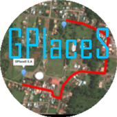
Maps GPS Places 1.8
Registren la empresa donde trabajan:GPlaceS surgió como un proyecto que busca aprovechar al máximolalocalización GPS y Google Map v2. Si eres un empresario osoloalguien que desea registrar una cuenta para una empresa ygestionartodos los servicios que ofrece dicha empresa, ya quetendrás elcontrol de tu cuenta y de los productos o servicios quepublicasserán administrados por el dueño de la cuenta.Pero si eres un usuario que desea calificar o votar porlasempresas que se encuentran registradas, podrás registrar unacuentade usuario la cual te permitirá calificar a lasempresasregistradas desde 1 a 5 estrellas y muy pronta, podrásopinar sobrelas empresas que calificas.GPlaceS se encuentra en fase beta, es por ello que concadapersona que registre su empresa en nuestra base dedatos,lograremos una aplicación estable y con muchos lugaresdondeescoger. por lo que pido a las personas que votan con unaestrella,piensen primero que esta aplicación tiene sus bases dedatosintactas y que entre mas empresarios conozcan esta app,masopciones de búsqueda exitosas tendrán. GPlaces se encuentraendesarrollo y por el momento las cuentas son gratis.Características*Registrar cuenta gratis*Localización GPS de tu empresa en cualquier parte delmundo.(Google Map)*Registro de varias categoría para tu empresa (Hotel,Restaurante,Soda)*Registro de productos o servicios*Estado de empresa open/closed*búsqueda por categoría, distancia, cantidad de resultadoycoordenada.*Calificación a lugares visitados*Información de la empresaMuy pronto se podrán comprar productos y servicios desde lamismaaplicación.Record the companywherethey work:GPlaceS emerged as a project that seeks to maximize theGPSlocation and Google Map v2. If you are a businessman orjustsomeone who wants to register an account for a company andmanageall the services offered by the company, as you will havecontrolof your account and the products or services you post willbeadministered by the account holder.But if you're a user who wishes to qualify or vote forthecompanies that are registered, you can register a useraccountwhich will allow you to qualify from the registered from 1to 5stars and very prompt companies can review the companiesthatqualify.GPlaceS is in beta, which is why each person registeringyourcompany in our database, we will achieve a stable and plentyofplaces to choose application. so I ask people to vote with astar,think first that this application has data bases intact andthatthe more entrepreneurs know this app, more options havesuccessfulsearch. GPlaces is under development and currentlyaccounts arefree.Features* Register Free Account* GPS of your company at any location in the world.(GoogleMap)* Record multiple categories for your business (Hotel,Restaurant,Soda)* Registration of products or services* Company State open / closed* Search by category, distance, number of resultsandcoordinate.* Rated to places visited* Company InfoSoon be able to buy products and services from thesameapplication.

All-In-One Offline Maps 3.6c
All-In-One OfflineMaps offers you toaccessa wide range of maps for free.Bored to wait for maps to display? Once displayed, mapsarestored and remain available, quickly, even with nonetworkaccess.• Want more than just roads on your maps? You will findwhatyou need here;• Used to go to places with poor network coverage?Everythingwill stay available;• Used to go abroad? You won't be lost anymore;• Have a data allowance limit? It will reduceyourusage.★★ Maps ★★A lot of maps are available, including classical roadmaps,topographic maps, aerial (satellite) maps and various layersthatcan be added over any maps: OpenStreetMap (Roads, Topo),GoogleMaps, Bing Maps, USGS National Map (Hi-res topo, Aerialimagery),Worldwide Military Soviet topo maps, etc.• All maps can be stacked in layers, with preciseopacitycontrol.• Select and store large areas in few clicks.• Stored space is clear and can be easily deleted.★★ Display, store and retrieve unlimited landmarks ★★You can add various items on the map such as waypoints,icons,routes, areas and tracks.You can easily manage them using the powerful SD-CardLandmarksExplorer.★★ On-map GPS Location & Orientation ★★Your real location and direction are clearly displayed on themap,which can be rotated to match your real orientation (dependsondevice capabilities).Easy turn on/off to save battery.And also:• Metric, imperial and hybrid distance units;• GPS Latitude/Longitude and grid coordinate formats (UTM,MGRS,USNG, OSGB Grid, Irish Grid, Swiss Grid, Lambert Grids, DFCIGrid,QTH Maidenhead Locator System, ...);• Ability to import hundreds of coordinate formatsfromhttp://www.spatialreference.org;• On-map grids display;• Full screen map view;• Multi-touch zoom;• ...★★ Need more? ★★If you are a real adventurer, try AlpineQuest GPS Hiking,thecomplete outdoor solution based on All-In-One OfflineMaps,loadedwith a powerful GPS Location Tracker andmore:http://www.alpinequest.net/google-play


GPS Map 27.0.7
GPS Map is a free, advertising supported app that allows you todoawesome things with a map powered by Google on Android devices.Fora price, you can get GPS Map Pro which is identical withouttheadvertising banner.Activities are organized into the following categories:* Search - Find new Placemarks by address, or coordinates.* My Location - Center or mark your place quickly, toggleReal/Mocklocation, Search nearby, and Share your location.* Layers - Allows you to toggle the visibility of MyLocation,Placemarks, Satellite, Traffic, Track, and Routelayers.* Placemarks - View list, Center, Change location, use asMocklocation, Navigate to, Route to, Search nearby, Street View,andShare* Routes - View list, Change color, Details, Hide, ShowandShare* Tracks - View list, Start/Stop Recording, Change color,Graph,Tour on Google Earth, View at Human, Land, and Plane speed,andShare* Images - View list, set Default for Marker, Import as aMarker,Import location from Image* Markers - View list, Edit/Delete/Hide/Show groups ofPlacemarks,Markers created for each Import* Compass Mode - All visible layers rotate instead of MyLocationarrow rotating towards north* Copyright - All the legal copyright and disclosure stuff* Data Management - Import/Export/Manage data* Help - A quick introduction, the FAQ, and links to otherhelpfulcontent about GPS Map* Preferences - Adjust update time, long press time, thevisibilityof various items and featuresUse almost any image from your Camera, Gallery, or file browsingappto create a Marker for a Placemark on the map. Imagescontaininglocation information can be imported as Placemarks withtheir imageas the Marker on the map.GPS Map has the following features:* Easy to search for a location by address, placemark name,orlatitude, longitude.* Import/Export your Placemarks - GPSMap GPS, Garmin CSV,GeocodeGEO, Google Earth/Google Maps KML,GPS Exchange GPX filesandTomTomASCII* Imports the location and image from a photograph to createaPlacemark on the map with the Image as the Marker* Able to view Placemarks, Routes and Tracks with GoogleEarth* Able to be taken to Google Street View for a Placemark(ifavailable)* Able to use Placemarks to start a navigation app likeGoogleNavigation* Export to Google Drive Fusion Tables with an activeGmailaccount* Creates Tours for Google Earth based upon your recorded TrackWorks best with:* Google Earth, Google Maps, Google Street View installed.GPS location service enabled.Visit https://sites.google.com/site/wrightkeith/gpsmap/formore information.


GPS Route Finder Maps 1.0.21
Now you don't have to worry about finding awayto any place. GPS Route Finder is the best solution toyourproblems. It's your personal GPS navigation App where youcanSearch and track any place in world.It provides youmultipleresults including Shortest route finder to yourdestination.GPS Route Finder Map is a personnel application through whichyoucan easily track all the locations you have visited. It’s asimpleGPS tracking app that helps you to track your own locationson datewise GPS location tracker takes advantage of GPS &Network toget your position on Earth, and obtains map informationnear yourlocation using Google Map and GPS locator and one can alsorequestthe location of his/her friend.It uses Global PositioningSystemfor GPS tracking. GPS Router provides your distance and timetakento reach your destination.GPS Navigation allows users to navigate to there destinationsviadirections and search maps using a number of differentmethods..Itis also a driving route finder app. Google Maps bestfeatures areintegrated in it to give you accurate result.Ithighlights HighlyTraffic areas on Map and save your time. Try itOut !Features:* GPS Route Finder give you best possible route toyourdestination.* This App uses Global Positioning System to giveaccurateresult.* GPS Route Finder Provide multiple route and give you the optiontochoose.* One can find any place or address through this GPS Locator.* Best Navigator app for searching Online Maps in threedifferentModes.* It give accurate result.(try yourself).* Supports different Online maps & Offline maps types :Normal,Satellite, Terrain maps.* Find GPS Driving Route.* Find GPS Walking Route.* Find GPS bicycle Route.* Added GPS location Alarm .* Offline GPS Route Finder Added.Privacy Policy:Your privacy is important to .Sometimes we need informationtoprovide services that you request; this privacy statementappliesto This App only. We Do Not share your Physical Locationwith ThirdParty.


Map GPS 2.1
Maps GPS app quickly find your position and shows you to thenearestPlaces, for example Banks, Bars, Gas Stations, Hospitals,Hotels,Movie Theatres, Restaurants, Supermarkets, Theatres andTaxi. MapsGPS shows you place with the distance from where youare. For everylisting you can choose to see its location on a Map,view the routefrom where you are, add the information to yourcontact list or evenemail the information to a friend. The Nearbylisting allows you tofind information using Wikipedia about whatis around you. Maps Gpsusing Google Maps ™ and Google Places ™services. Features: -Automatically finds your current location andplots it on a map. -Customize the application to include customsearch terms. - Finddistance of searched locations from yourcurrent position. - Use iton-the-go to search for places ofinterest. Note: Google ™, GoogleMaps ™ and Google Places ™ areregistered trademarks of Google Inc.

CityMaps2Go Plan Trips Travel Guide Offline Maps 12.1.8 (Play)
Your reliable and easy-to-use globaltravelcompanion. Find directions with detailed offline maps,in-depthtravel content, popular attractions and insider tips.Plan and have the perfect trip! Book your hotel or guide andenjoyrestaurant reviews and shared user content.Here is why 15+million travelers love City Maps 2Go:Didn’t you always want to have an easily portable and compacttravelassistant that allows planning your trips to foreigncountries andcities upfront? So turn your smartphone or tabletinto a digitalguide and planner leading you through YOUR choicesof restaurants,hotels and which attractions to visit. Enjoyrecommendations andreviews of other enthusiastic travelers andtourists. Always keepyour orientation and find the direction tothe next place;completely without roaming and offline.With City Maps 2Go you enjoy a wide variety of advantages:FREESimply download and try CityMaps2Go for free. There is absolutelynorisk, and we’re sure you’ll love it!WORLDWIDE MAP COVERAGEThousands of destinations available worldwide, coveringvirtuallythe entire globe. Paris, France; London, UK; Rome, Italy;New York,USA and all other major and many not so major destinationsinEurope, Asia, the Americas, Africa and Oceania. Majortouristdestination regions such as Hawaii, Mallorca, the Canaries,theGreek islands, the French Riviera, Thailand, the Tuscany ortheCaribbean can be covered by downloading a few maps.DETAILED MAPSNever get lost and keep your orientation. See your location onthemap, even without an internet connection. Findstreets,attractions, restaurants, hotels, local nightlife and otherPOIs –and get guided in the walking direction of places you wanttosee.IN-DEPTH TRAVEL CONTENTHave all the information offline and freely portable. Foreachdestination, access comprehensive and up-to-date guideinformationcovering thousands of places, attractions, points ofinterest andmany hotel booking options.SEARCH AND DISCOVERFind the best restaurants, shops, attractions, hotels, bars,etc.Search by name, browse by category or discover nearby placesusingyour device’s GPS – even offline and without dataroaming.GET TIPS AND RECOMMENDATIONSFind tips and recommendations from locals and tourists. Browseforthe most popular attractions, restaurants, shops, hotels,nightlifeplaces, etc.PLAN TRIPS AND CUSTOMIZE MAPSSave places you want to visit, pin existing places, like yourhotelor a recommended restaurant, to the map. Add your own pins tothemap. Find and book hotels from within CityMaps2Go in allmajorregions from Hawaii to the French Riviera, from ScandinaviatoMallorca, from the Caribbean to the Tuscany and for allcountrieslike Thailand, France, Germany, Italy or Spain.OFFLINE ACCESSMaps and guide content are fully downloaded and stored onyourdevice. All features, such as address searches and yourGPSlocation also work offline and without data roaming (aninternetconnection is of course required for initial downloading ofdata orbooking hotels).DATA QUALITY:Map data and POI are provided by OpenStreetMap and areregularlyupdated by us. To check the level of detail, gotowww.openstreetmap.org. The same applies to Wikipediatravelarticles.Use this offline map app and you will never have to carry aroundapaper city map or guide book. No matter whether you travel totopdestinations in the USA, Europe or Asia. Have reliable,interactiveoffline maps always available in your pocket, on yoursmartphone ortablet.Enjoy your travels. Your Ulmon team! :-)If you have any questions, feel free to reach [email protected]

Maps of Republic of Serbia 1.0.0.2
Maps of Republic of Serbia and itstownsfromOpenStreetMaps, Google Maps and satellite.To view the maps you must have a working internet connection.Once maps are loaded, you can use them later withoutaninternetconnection established.Return to the start menu by pressing Back.Close application by pressing Home.The application does not have support for GPS, but it may beofuseto someone.If the cached maps take too much space, application cachecanbeemptied via "Settings - Applications -ManageApplications".The application does not collect any personal informationabouttheuser and does not send any information about its use totheauthorof the application.


Singapore Map
Hello Everyone,Streetdirectory App comes Offline maps & real-timebustimingExciting Feature★ The most up-to-date Singapore maps★ Bus arrival time★ 2016 Singapore Maps★ 2016 Johor Maps★ latest Bus-stops and train stations with real-time data.★ Free Offline Maps, once you download the offline map, you canusethe map without internet connection.★ Directions by Car, Taxi, Bus & MRT★ Traffic, Bus timing & ERP pricing information★ Complete 2016 Business directory data for SG businessesandretailers.


Google Trips - Travel Planner
Google Trips makes exploring the worldeasierby organizing your essential info in one place and makingitavailable even offline. Get activity suggestions based onwhat’snearby, customizeable day plans, and your travel reservationsfromGmail.AUTOMATIC TRIP ORGANIZATIONYour travel reservations are automatically gathered from Gmailandorganized into individual trips. Each trip contains dayplans,things to do, food and drink suggestions, and more.BUNDLED RESERVATIONSSee your flight, hotel, rental car, and restaurant bookings inoneplace without having to search for them individually.DAY PLANSFor several hundred of the world’s top places, find populardayplans organized on a map that you can customize based onyourinterests and available time.NEARBY ATTRACTIONSFind out when you’re near popular attractions (and whetherthey’reopen) as well as reviews and ratings from othertravelers.THINGS TO DOEvery trip contains ideas for things to do automaticallyorganizedinto useful categories like Top Spots and Indoors orOutdoors. Formany of the world’s top places, you’ll get curatedlocalsuggestions and travel tips.OFFLINE ACCESSNo Internet? No problem. Google Trips is available offline,soyou’ll always have access to your info.

Navitel Navigator GPS & Maps v11.11.917
Navitel Navigator is a precise offlineGPSnavigation with free geosocial services and detailed maps of64countries. Try popular navigation for 7 day free!______________________________* 20M DOWNLOADS WORLDWIDE ** TOP 5 NAVIGATION IN 12 COUNTRIES!*ADVANTAGES• Offline navigation. No Internet connection required for the useofthe program and maps: No additional expenses on roamingordependency on mobile connection.• Access to maps at any time: Maps are downloaded to theinternalmemory of a device or an SD-card.• Map subscription: Map purchase for a limited period (1 year)withprices starting at 10.99$.SPECIAL FEATURES• 3 alternative routes with display of time and distance for eachofthem.• Navitel.Traffic. Information on all traffic jams in thecoveredarea, available in real time.• Navitel.Friends/Cloud. Messaging with friends, trackingtheirlocation and routing towards them. Program settings andwaypointsare stored in the NAVITEL cloud storage. Log intoNavitel.Friends/Cloud service using your social networkprofile(Facebook, Twitter, VKontakte)• Navitel.Weather. Weather forecast information for the nextthreedays anywhere in the world.• Dynamic POI. Fuel prices, movie showtimes and otherusefulinformation.• Navitel.Events. Road accidents, road works, speed cams andotherevents marked on the map by users.• Navitel.SMS. Message exchange with friends whilenavigating.• SpeedCam warnings. Information on radars, video recordingcamerasand speed bumps.• 3D Mapping. Three-dimensional maps with texture and numberoffloors support.• 3D Road interchanges. Displaying multilevel road interchangesin3D mode.• Line Assist. Route calculations taking multilane trafficintoaccount and visual prompts while following the route.• Multilanguage support. Support of the interface and voicepromptsin multiple languages.• Turn-by-turn voice guidance. Voice guidance while moving alongtheroute, warnings on battery charge and connection tothesatellites.• Dashboard. More than 100 different gauges: time, speed,weatherand other parameters.• Fast route calculation. Instant calculation and routing ofanylength and complexity.• Unlimited number of waypoints for routing. Easy routingwithunlimited number of waypoints.• Customizable user interface. Ability to adapt theprograminterface and map display mode for your own needs.• Multitouch support. Quick access to map scaling androtationfunctions via the multitouch input.• Purchase through the program menu.• GPS / GLONASS.OFFLINE NAVIGATION MAPS FOR PURCHASEAlbania, Andorra, Armenia, Austria, Azerbaijan, Cilumbia,Belarus,Belgium, Bosnia and Herzegovina, Brazil, Bulgaria, Croatia,Cyprus,Czech Republic, Denmark, Estonia, Finland, France,Georgia,Germany, Gibraltar, Greece, Hungary, Iran, Iceland, Isle ofMan,Italy, Kazakhstan, Kyrgyzstan, Latvia, Liechtenstein,Lithuania,Luxembourg, Macedonia, Maldives, Malta, Mexico, Moldova,Monaco,Montenegro, Netherlands, Norway, Peru, Poland,Portugal,Philippines, Romania, Russia, San Marino, Serbia,Slovakia,Slovenia, Spain, Sweden, Switzerland, Tajikistan, Turkey,Ukraine,United Kingdom, Uzbekistan, Vatican.If you have any questions contact us: [email protected]. We willbehappy to help you.CONNECT WITH USFacebook: http://www.facebook.com/NavitelWorldTwitter: https://twitter.com/NavitelNInstagram: http://instagram.com/navitel_en