Top 50 Games Similar to Altimeter Ler Live Gps Geotracker
Altimeter Offline Pro 1.3
Altimeter not need phone signal orinternetconnection to work with high elevation accuracy. Accuracyimprovedgeoid compensation. Ideal for hiking, treking and climbs inmediumand high mountain, where the telephone is often lacking and3ghedge.Improved Altimeter Offline Version. Improvements: more precisely, to write data to yourroutes(maximum height, initial height, climbed, cumulative height,date...), record your historical record of maximum height andadjuststhe refresh rate of the sensor to save battery.Geographical coordinates displayed(longitude and latitude).This application saves your highest elevation automatically.Only need a phone/tablet with GPS sensor.Know your altitude always.Elevation showed in meters and feet. High accuracy inelevationdata.
GPS Essentials
The most complete GPS tool available:Navigate,manage waypoints, tracks, routes, build your owndashboard from 45widgets.❧❧❧❧❧ Dashboard ❧❧❧❧❧Shows navigation values such as: Accuracy, Altitude, Speed,Battery,Bearing, Climb, Course, Date, Declination, Distance, ETA,Latitude,Longitude, Max Speed, Min Speed, Actual Speed, TrueSpeed, Sunrise,Sunset, Moonset, Moonrise, Moon Phase, Target,Time, TTG,Turn.❧❧❧❧❧ Compass ❧❧❧❧❧Show the orientation of the earth's magnetic field, showsanarbitrary tracking angle and the current target. Also amarineorienteering compass.❧❧❧❧❧ Tracks ❧❧❧❧❧Record tracks and view them on map. Export KML files and importintoGoogle Maps, Google Earth and others.❧❧❧❧❧ Routes ❧❧❧❧❧Manage routes and view them on map. Import KML files fromGoogleMaps, Google Earth and others. Create turn-by-turninstructionsbetween waypoints.❧❧❧❧❧ Camera ❧❧❧❧❧A camera HUD (heads-up display) view to show your waypoints,takepictures and share them.❧❧❧❧❧ Map ❧❧❧❧❧A map to show your waypoints. Convert mail addresses ofyourcontacts to waypoint so that they can be used within theapp.Supports Google Maps, MapQuest, OpenStreetMap and others.Supports Google Maps v2: Indoor Maps, Traffic, Buildings,Satelliteand Terrain layers and map rotation.❧❧❧❧❧ Waypoints ❧❧❧❧❧A list of all your waypoints with export and import (KML, KMZ,GPXand LOC format).❧❧❧❧❧ Satellites ❧❧❧❧❧A sky view of the current positions that shows satellitesinview.❧❧❧❧❧ Features ❧❧❧❧❧Supported position formats: UTM, MGRS, OSGB,Degree-Minute-Second,Degree-Minute-Fractions, Decimal, Mils.Supports over 230datums.Waypoints, routes and tracks can be exported as KML or GPX filesandsent by email or uploaded to Google Docs or DropBox.Please open the web page below for more info, send me emailsforsupport. I CANNOT HELP IF YOU SIMPLY PLACE A COMMENT HERE.Purchase the "GPS Essentials Donation Plugin" on Android Marketifyou want to support development.The latest beta release is available athttp://www.gpsessentials.comfor download. Try out the latestfeatures and help us improve GPSEssentials!If you are on Facebook, come and join GPS Essentials for thelatestinfo: http://www.gpsessentials.comTHIS APP WILL SHOW ADVERTISING. IF YOU DON'T LIKE THIS,PLEASEREFRAIN FROM INSTALLING/UPDATING.GPS Essentials is not affiliated with any political party norwithany other organization mentioned in the ads, and it hasnoconnection with any economic interests. If you don't like theads,please contact AdMob.WHAT ARE THE PERMISSIONS GOOD FOR?✓ Coarse/Fine location: To access network locations and GPS✓ Full internet access: To read map tiles, send bug reports✓ Modify/delete USB storage contents: To write waypoints, tracksandimages onto the SD card✓ Read phone state and identity: To tag pictures with the deviceID(can be switched off in settings)✓ Take pictures and videos: Camera HUD, take pictures✓ Your accounts: Required to run Google Maps v2
Accurate Altimeter 2.2.32
The most downloaded Altimeter on the PlayStoreis now updated with a new interface and new features!- Altitude estimation with three different methods to be alwayssureto get a reliable measure, even without internetconnection.- Historical charts to see your excursions elevation gain.- Map with your elevation and contour lines.- Pictures with impressed place name and altitude.Altitude can be estimated:- With satellites triangulation. Slow and less accurate but itworkseven with no internet connection.- Taking the ground elevation at your current position fromaninternet web service.- Using the pressure sensor of your device (if available).Itcalibrates itself on pressure from the nearest weather stationtoimprove accuracy.As additional PRO features you can also:- compensate systematic error of pressure sensor- record altitude without opening the App- remove advertising
Altimeter & Altitude Widget 4.57
DS Altimeter is an elevation meter,elevationlogger, and altitude mapper. In addition to showing andoptionallytracking your altitude, the app allows you to search thealtitudefor other locations as well.You can select from the best sources of elevationdata,including:1. Location based altitude from NASA's Shuttle RadarTopographyMission2. Satellite based altitude (GPS altitude) corrected toheightabove mean sea level (AMSL)3. Get actual land survey altitude values for your locationfromthe United States Geologic SurveyDevices equipped with a barometer sensor can also obtainpressurealtitude which is converted to true altitude. For the mostprecisereadings, calibrate the pressure altitude by entering areferencevalue or by selecting one from the app's dynamic list ofnearestairfields.USGS (United States Geologic Survey) altitude results arealsoavailable for customers in the contiguous United States, CanadaandMexico.DS Altimeter also works offline: barometric altitude andGPSaltitude corrected to elevation above sea level do not requireaninternet connection.NEW IN DS ALTIMETER: Record altitude profiles and elevationtracksfor your favorite journeys to the highlands, the lowlandsandeverything in-between!Upgrade the application to pro and gain access to even morefeaturesincluding the Altimeter Widget and variousbarometricaltimeter calibration methods.Going skiing? Record your ski run with DS Altimeter, then viewyourski trail with its elevation points on the included maps.Mininumand maximum altitude points for your run will beclearlyshown.Altitude mapping, altitude search and bathymetry (lake andseadepths) are also included with DS Altimeter. Tap anywhere on amapto get the altitude or water depth at that location.* The perfect altimeter for skiing, hiking, mountain climbingandother outdoor sports, boating, marine navigation and anytimeyouare curious about your elevation!
BackCountry Nav Topo Maps GPS
Use your Android as an offroad topo mappingGPSwith the bestselling outdoor navigation app for Android! TrythisDEMO to see if it is right for you, then upgrade to thepaidversion.Use offline topo maps and GPS on hike trails without cellservice!The GPS in your Android phone can get its position fromsatellites,and you don’t have to rely on your data plan to getmaps. Have morefun and safe GPS adventures in thebackcountry.Preload FREE offline topo maps, aerial photos, and road maps onyourstorage memory, so they are ready when you need them.Add custom GPS waypoints in longitude and latitude, UTM or MGRSgridreference. Import GPS waypoints from GPX files. Choose iconsforwaypoints much like in MapSource. (This app uses the WGS84datum,NAD27 is available in settings).Use GPS for hunting a waypoint or geocache, for recording tracksandGPS waypoints on your trip, all the while tracking your questontopographic maps.About topo (topographic) maps: Topo maps show terrain throughcolorand contours, and are useful for navigation offroad. Topo mapsandGPS can be used for hiking, hunting, kayaking, snowshoeing,&backpacker trails.The app has many built in map sources and allows you to createyourown maps with Mobile Atlas Creator. Built in sourcesinclude:OpenStreetMaps and NASA landsat data worldwide.OpenCyle Maps are topo maps that show terrain worldwide.USGS Color Aerial photography.Topographic Maps of Spain and Italy.Outdoor maps of Germany and AustriaTopo maps of New ZealandHere are some of the outdoor GPS activities BackCountryNavigatorhas been used for:Hiking both on hiking trails and off trail.Camping, to find the perfect camping site or the way backtocamp.Hunting trips for hunting wild game in rugged areas, includingreconfor the hunt.Bait fishing or fly fishing with a buddy.Search and Rescue (SAR) with GPS.Kayak and canoe trips on inland lakes and streams or marine,coastalwaters.Backpacker trips: using topo maps of wilderness areas andnationalforests to navigate on trails with the GPS.Snow adventures including snowmobiling, skiing (alpine orcrosscountry) and snowshoeing. Create a memory. Map it out.This a great addition to the outdoor gear you bought atCabelas,REI, or another outdoor store. Your android phone couldsubstitutefor a Garmin or Magellan outdoor handheld GPS! Youstorage hasmemory for maps.Find your own ways to have fun in the outdoors. Be a maverickbyventuring into new territory beyond cell service boundaries.Becomea pro at navigation with GPS.BackCountry Navigator has been previously available on WMdevicesand preloaded on the Trimble Nomad outdoor rugged device.ThisAndroid version is more flexible, featured, and fun.
Topography APP 1.0.11
The Topography APP is an excellent application for georeferencingorland surveying, design of electrical networks, avenues,streets,subdivisions and studies in general.Export your surveys to DXF (Autocad), KML (Google Earth), CSV(MSExcel) without the slightest difficulty and the possibilityoftransmission by email of their withdrawals directly from thefieldto the office.In the Professional version you can mark up to 5000 pointsforsurveys.
TrekMe - GPS trekking offline 3.2.6
TrekMe is an Android app to get live position on a map andotheruseful information, without ever needing an internetconnection(except when creating a map). It's ideal for trekking,biking, orany outdoor activity. In this application, you create amap bychosing the area you want to download. Then, your map isavailablefor offline usage (the GPS works even without mobiledata).Download from USGS, OpenStreetMap, SwissTopo, IGN (FranceandSpain) Other topographic map sources will be added. Fluidanddoesn't drain the battery Particular attention was giventoefficency, low battery usage, and smooth experience. SDcardcompatible A large map can be quite heavy and may not fit intoyourinternal memory. If you have an SD card, you can use it.Features •Import, record, and share GPX files • Marker support,with optionalcomments • Real-time visualization of a GPX record, aswell as itsstatistics (distance, elevation, ..) • Orientation,distance, andspeed indicators • Measure a distance along a trackFor instance,all map providers are free, except for France IGN -which requiresan annual subscription. During a GPX recording, theapp collectslocation data even when the app is closed or not inuse. However,your location will never be shared with anyone and gpxfiles arestored locally on your device. General TrekMeguidehttps://github.com/peterLaurence/TrekMe/blob/master/Readme.md
AlpineQuest GPS Hiking (Lite) 2.2.8b
AlpineQuest Lite is the free solutionforall outdoor activities and sports, including hiking,running,trailing, hunting, sailing, geocaching, off-road navigationandmuch more.You can access and store locally a large range ofon-linetopographic maps, which will remain available evenwhile beingout of cell coverage. AlpineQuest also supportson-board filebased maps, like MemoryMap(c) maps.By using the GPS and the magnetic sensor of your device(withcompass display), getting lost is part of the past: youarelocalized in real-time on the map, which can alsobeoriented to match where you are looking at.By staying fully operational out of cell coverage (as ofteninmountain or abroad), AlpineQuest assists you in all your desiresofdeep wilderness exploring...Don't hesitate, use it right now for free!PLEASE report suggestions and issues on our dedicatedforumhttp://www.alpinequest.net/forum (no registration needed,allquestions answered) and not in comments.Key features (for the full/paid version) are:★★ Maps ★★• Built-in online maps (with automatic localstorage;road, topo and satellite maps included);• Built-in online layers (road names andhillsshading);• Get more online maps and layers in one click from theincludedcommunity map list (Nokia maps, Yahoo! Maps, local topomaps,...);• Complete area storage of online maps foroff-lineuse;• On-board offline maps support (visit our website to getthefree map creator MOBAC);• Memory-Map support (QuickChart .QCT maps only, .QC3mapsnot compatible, test your maps using the free Liteversionfirst);• Multiple maps in layers display, with per-mapopacitycontrol;• Advanced SD memory card Map Explorer and Scanner.★★ Landmarks ★★• Create, display, save, restore unlimited number ofwaypoints,routes, areas and tracks;• Import/export GPX files, Google Earth KML/KMZfiles,CSV/TSV files;• Support OziExplorer WPT and GeocachingLOCwaypoints;• Save and share online locations with other users usingCommunityLandmarks;• Details, advanced statistics and interactive graphics onvariousitems;• Time Controller to replay time-tagged tracks;• Routes, tracks and areas creator;• Advanced SD memory card Landmarks Explorer.★★ GPS Position / Orientation ★★• On-map geolocation using GPS or Network;• Map orientation, compass and target finder;• Built-in GPS/Barometric track recorder (longtrackingcapable, running in a separate and light process);• Proximity alerts and leave path alerts;• Barometer support (for compatible devices).★★ And more: ★★• Metric, imperial and hybrid distance units;• GPS Latitude/Longitude and grid coordinate formats (UTM,MGRS,USNG, OSGB, Irish Grid, Swiss Grid, Lambert Grids, DFCI Grid,QTHMaidenhead Locator System, ...);• Ability to import hundreds of coordinate formatsfromhttp://www.spatialreference.org;• On-map grids display;• Full screen map view;• Multi-touch zoom;• ...About the "Phone state and identity" Android permission: due tothebackward compatibility of AlpineQuest with Android 1.5,thispermission is automatically added by Google Play.
AlpineQuest GPS Hiking
AlpineQuest is the complete solution foralloutdoor activities and sports, including hiking,running,trailing, hunting, sailing, geocaching, off-road navigationandmuch more.You can access and store locally a large range ofon-linetopographic maps, which will remain available evenwhile beingout of cell coverage. AlpineQuest also supportson-board filebased maps, like MemoryMap(c) maps.By using the GPS and the magnetic sensor of your device(withcompass display), getting lost is part of the past: youarelocalized in real-time on the map, which can alsobeoriented to match where you are looking at.Save and retrieve landmarks, share them with yourfriends.Track your path, get advanced statisticsandinteractive graphics. You won't have anymore questionsaboutwhat you can accomplish.By staying fully operational out of cell coverage (as ofteninmountain or abroad), AlpineQuest assists you in all your desiresofdeep wilderness exploring...Don't hesitate, try the free Lite version right now!PLEASE report suggestions and issues on our dedicatedforumhttp://www.alpinequest.net/forum (no registration needed,allquestions answered) and not in comments.Key features are:★★ Maps ★★• Built-in online maps (with automatic localstorage;road, topo and satellite maps included);• Built-in online layers (road names andhillsshading);• Get more online maps and layers in one click from theincludedcommunity map list (Nokia maps, Yahoo! Maps, local topomaps,...);• Complete area storage of online maps foroff-lineuse;• On-board offline maps support (visit our website to getthefree map creator MOBAC);• Memory-Map support (QuickChart .QCT maps only, .QC3mapsnot compatible, test your maps using the free Liteversionfirst);• Multiple maps in layers display, with per-mapopacitycontrol;• Advanced SD memory card Map Explorer and Scanner.★★ Landmarks ★★• Create, display, save, restore unlimited number ofwaypoints,routes, areas and tracks;• Import/export GPX files, Google Earth KML/KMZfiles,CSV/TSV files;• Support OziExplorer WPT and GeocachingLOCwaypoints;• Save and share online locations with other users usingCommunityLandmarks;• Details, advanced statistics and interactive graphics onvariousitems;• Time Controller to replay time-tagged tracks;• Routes, tracks and areas creator;• Advanced SD memory card Landmarks Explorer.★★ GPS Position / Orientation ★★• On-map geolocation using GPS or Network;• Map orientation, compass and target finder;• Built-in GPS/Barometric track recorder (longtrackingcapable, running in a separate and light process);• Proximity alerts and leave path alerts;• Barometer support (for compatible devices).★★ And more: ★★• Metric, imperial and hybrid distance units;• GPS Latitude/Longitude and grid coordinate formats (UTM,MGRS,USNG, OSGB, Irish Grid, Swiss Grid, Lambert Grids, DFCI Grid,QTHMaidenhead Locator System, ...);• Ability to import hundreds of coordinate formatsfromhttp://www.spatialreference.org;• On-map grids display;• Full screen map view;• Multi-touch zoom;• ...About the "Phone state and identity" Android permission: due tothebackward compatibility of AlpineQuest with Android 1.5,thispermission is automatically added by Google Play.
Compass Pro - with camera view 2.0
A very accurate compass withmanyfunctions:Spirit level, magnetic field, geo data (location).With the camera function you can 'look through' your device,focuson a point and get the exact cardinal point.No ads!Features:* Choose individual layout colors* Portrait and landscape mode (optimized for tablets)* Location (GPS or network)* Spirit level: acoustic and visiual feedback, decimalplaces,calibration, x and y values can be swapped* The rotation in horizontal position can be measured withthecompass* Strength of the magnetic field is displayed* App can be moved to sd-card* ...ONLY IN PRO VERSION:* No ads!* Set visual and acoustic indicator with a tolerance* Location can be displayed in decimal format* ...INFO:- You can't take pictures with this compass. If you want totakepictures as well, get the 'Level Camera' app in thePlayStore.- The precision of the compass depends on your sensor. Magnetsandelectric fields have a magnetic field and thus have an influenceonthe compass.PERMISSIONS:'Location': only used to display your location.'Camera': camera view can be set as background.
Weather Station with barometric pressure sensor 2.8.7.1
Simple, nice and retro weather station. Our barometer appshowsmaindata: temperature, barometric pressure and humidity.Themes,Graph,Forecast and different Data Providers are also inside.Seepressurewith built-in barometric pressure sensor (not foralldevices)! Thisapp is pleasant and easy to use. It lookslikevintage barometerwith modern technology inside. Onlycorrectweather data withoutanything superfluous (like map, widgetsetc.).Free versionincludes: • Temperature (could measure in °C and°F onthe samescreen) • Wind speed (switch between km/h, mph, mps)•Atmosphericpressure (3 different pressure units of barometer-inHg, hPa, mmHg)• Relative humidity in live time • 7commonlanguages (EN, IT, DE,ES, RU, UK, PL) • barometric pressuresensorYou can also switchbetween classic and forecast viewsPremiumversion: • Forecast for4-7 days (depends on data provider) •Morewind meteo data • Sunriseand sunset data • 3additionalmeteorological live-time datachannels • 3 additionalbackgroundthemes • charts of changingindicators by day or hourlyStayinformed about the weather.Barometer will show you airpressure,hygrometer will show humidityand thermometer – a realtemperature.All local weather informationin your pocket. Rain, snowor evenstorm outside will no longersurprise you. FEATURES: • A lotofrealistic themes to make yourWeather Station unique •Ergonomicdesign: comfortable userinterface in both positions(vertical andhorizontal) • A lot ofdevice configurations forpersonal usage •Compare meteo data fromdifferent providers, sourcesand channels •You can switch betweenanalog style graphic and modernstylegraphics • Celsius andFahrenheit - together on one screenAweather station is a facility,either on land or sea,withinstruments and equipment for measuringatmospheric conditionstoprovide information for weather forecastsand to study theweatherand climate. The measurements taken includetemperature,barometricpressure, humidity, wind speed, winddirection.Atmosphericpressure, sometimes is the pressure exertedby the weightof air inthe atmosphere of Earth. Low-pressure areashave lessatmosphericmass above their location, whereashigh-pressure areashave moreatmospheric mass above their location.Again, we havebuilt-inbarometric pressure sensor support. Itallows to readcurrentatmospheric pressure in realtime. Humidity isthe amount ofwatervapor in the air. Our app shows you relativehumidity, itisexpressed as a percent, measures the currentabsolutehumidityrelative to the maximum (highest point) forthattemperature.Humans are sensitive to humid air because thehumanbody usesevaporative cooling as the primary mechanismtoregulatetemperature. Under humid conditions, the rate atwhichperspirationevaporates on the skin is lower than it would beunderaridconditions. Because humans perceive the rate of heattransferfromthe body rather than temperature itself, we feel warmerwhentherelative humidity is high than when it is low.AnalogWeatherStation always identify exactly where you are. Youhaveopportunityto enable GPS detection or search for your city. Youcansee localweather, alert about rain, snow, strong wind andotherweatherevents. And you can be sure of the accuracy oftheforecast.Updates and more features are coming. Stay tuned forthecurrentweather with vintage Analog Weather Station! Find outwhentheweather will be sunny, cloudy or snowy, there will besevererainor atmospheric pressure will increase in realtime mode!
Dioptra™ Lite - a free camera tool 1.0.10
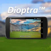
Dioptra™ Lite - a camera position and angle measurementtoolfornavigation, surveying, positioning, and measurement - -withover35,000 users! Stay tuned for an enhanced Dioptra app in2020withmore features, better sharing integration, andsupportingmorephones and devices! Instructions: Press the on-screencamerabuttonto save an image. View saved images in your device'sgalleryapp.[⊹] Dioptra™ Lite provides the following informationlikeatheodolite optical instrument - • yaw indicator (compass)•pitchindicator (tilt degrees) • roll indicator (tilt degrees)alongwith- • GPS position • azimuth and bearing to photo subjectTheancientgreek "dioptra" was a classical astronomicalandsurveyinginstrument, dating from the 3rd century BCE. Thedioptrawas asighting tube or, alternatively, a rod with a sight atbothends,attached to a stand. If fitted with protractors, it couldbeusedto measure angles. [⊹]
ViewRanger - Explore Rides & Hiking Trails
Discover thousands of inspiring trailguides,download offline topo maps, and navigate with confidence onyournext hike, bike ride, backpacking trip, or outdoor adventure.Goanywhere: ViewRanger works offline without mobile anddatasignals.** 2017 Best Outdoor App -Elevation Outdoors **** Best New Outdoor Tech in 2017 –Backpacker magazine**** Trusted by 300 Search & Rescue teams **>> BEST-IN-CLASS MAPSFree Worldwide Maps: street maps, aerial and satellite images,andterrain maps.Upgrade to access four premium map types: USA Topo, USGS Topo,USALand Cover, and USA Slopes. USA topographic maps are 1:24Kscalewith 20- to 40-foot contours in most places. Plusadditionalpremium topographic maps for Europe, USA, Canada andNewZealand.>> SKYLINE: AUGMENTED REALITY FOR THE OUTDOORSLaunch our Skyline feature and pan the landscape usingyourAndroid’s camera. Skyline identifies over 9 million peaks,places,lakes in the world. Bonus: When following a route, seedirectionarrows and navigate to points on the real landscape.(Note: NoSkyline coverage in Alaska.)>> ANDROID WEAR™• Navigate trails and view track stats on your wrist withAndroidWear™ enabled smartwatches.• Record a new track and pause or stop an existingtrackrecording.• View heading, bearing, lat/long and altitude data.• ViewRanger is also optimized for the Casio PRO TREKsmartwatch.>> TRAIL GUIDESSee 180,000 routes posted by top publishing brands and findtrailsin national parks, state parks, and national forests. Checkoutevery mile of Appalachian and Pacific Crest Trails too.More Online: Plan your next hiking project, draw routes, printmaps,and import GPX files on our website too. Then send and followthemon your Android device. Bonus: Import GPS files fromoutdoorwebsites and handheld GPS units.>> GPS NAVIGATION & STATS• See your GPS location on a map.• Record tracks and follow routes• Plot and go to point of interests• See live trip and navigation stats: time, speed,distance,navigation arrows, compass bearing, sunrise andsunset.• Privately share your real-time GPS location with friendsandfamily with BuddyBeacon™. Data connection required.• Share routes and tracks with friends and social networks.-------------------------------Any questions or feedback?Visit: www.viewranger.com/en-us/supportOr, send us an email: [email protected] Global maps © OpenStreetMap contributors.Some features, such as viewing online maps, browsingroutes,downloading maps and routes and sharing your locationusingBuddyBeacon require an internet connection.


