Top 50 Apps Similar to Wheel It Off
AndMeasure (Area & Distance) 2.0.7
The AndMeasure tool allows you tomeasuredistances and calculate area between points on a map.The tool has virtually unlimited applications. Use itPROFESSIONALLYfor measuring distances and areas in landscaping,lawn care, waterline measuring, paving and fencing. Use it infarming, agricultureand forestry to measure your fields andforests. Realtor's can useit for showing clients distances tocertain landmarks.For RECREATIONAL use, it can be used in measuring off-roadroutes,plotting running courses, water trips, range estimation attheshooting/driving range. Use it in Golf for gettingreal-timedistance to the green.★★★ Featured on AgWeb.com powered by Farm Journal ★★★"This app could be an easy way for farmers to measure newfields."March 2012Features:● Use it as a ruler on a map to calculate the distancebetweenmultiple points● Calculate areas in acres, sq miles, sq feet, m2, km2,Hectare,Ares● Measure the distance to your location from multiple pointsinreal-time using the "continuous mode" feature● Switch between Satellite, Hybrid, Terrain and normalmapmode● Find your current location via GPS or Network● Share measurement and screenshot via email and Google Drive● Add markers to the map either via tap or by dragging from the"addbutton" to get super accuracy● Move markers around to get precise measurementKeywords: map, maps, area, distance, length, ruler, gps, golf,areacalculator, range finder, map measure, area measure,distancemeasure, field area measure, surface measurement, realestate,realtor, GPS measure, solar, landscape, areacalculation,planimeter, efarmer, perimeter, landscaping, garden,fencing,acreage, terrain, geographical, property, geo,agricultural,calculator, forest, farm, field measure, location,roof area,solar, solar panel roof area, outdoor, snow removal,farmlogs, landcalculatorLanguages: English (write an email if you want to help withothertranslations)Get it at:https://play.google.com/store/apps/details?id=com.megelc.andmeasureFacebook:http://www.facebook.com/andmeasurePrivacy Policy:AndMeasure does not store any personal information at all.HoweverGoogle Analytics is used in the app to better understand howtheapp is used and performs.The Google Privacy Policy can be found here:http://www.google.com/intl/en/policies/privacy/
Locus GIS - offline geodata collecting, SHP edits 1.10.1
Professional GIS application for offline fieldwork with geodata.Itprovides data collection, viewing, and updating. All itsfeaturesare available above a wide selection of online, offline,and WMSmaps. Fieldwork • offline collecting and updating of fielddata •saving points with current or arbitrary position • creatinglinesand polygons by motion recording • settings of attributes •photos,video/audio or drawings as attachments • guidance topointsImport/Export • importing and editing ESRI SHP files •exportingdata to ESRI SHP or CSV files • exporting whole projectsto QGISMaps • wide range of maps both for online use and fordownload •support of WMS sources • support of offline maps inMBTiles,SQLite, MapsForge, TAR, GEMF, RMAP formats, andcustomOpenStreetMap data or map themes Tools and features •measuringdistances and areas • searching and filtering of data intheattribute table • style editing and text labels • organizingdatainto layers and projects Locus GIS is successfully used in awiderange of industries: • collection of environmental data(ecologicalscanning, tree surveys ...) • forestry management andplanning, •agriculture and soil management • gas and energydistribution •planning and construction of wind farms • explorationof miningfields and location of wells • survey and management ofurbanfacilities • road constructions and maintenance
Maps Ruler
Maps Ruler is helping you to calculatedistancebetween selected points.Find shortest way and save energy or use it as a golfdistance(yard)calculator.Now: Area calculation mode (Beta)-Path save/load-Multiple points,-Conversions: meter, km , mile, feet, fathom etc-continuous path calculation like drawing.-name paths
Topography APP 1.0.11
The Topography APP is an excellent application for georeferencingorland surveying, design of electrical networks, avenues,streets,subdivisions and studies in general.Export your surveys to DXF (Autocad), KML (Google Earth), CSV(MSExcel) without the slightest difficulty and the possibilityoftransmission by email of their withdrawals directly from thefieldto the office.In the Professional version you can mark up to 5000 pointsforsurveys.
Route Planner - GetWay 0.0.43
The GetWay app plans a daily route with multiple stops and morethan100 stops, so your itinerary is as fast and short as possible.Usingthe GetWay app to plan your daily itinerary saves you atleast 20%of the time on the roads during the day and returns youhome faster.How to plan a route on GetWay? Give GetWay a start andend point,add the list of stops you need to make and GetWayhandles everythingelse. It will decide on the shortest travelorder considering theexpected stay times at all your stops,considering scheduledappointments or planned stops for specifichours and of coursetraffic and road data so you finish your dailyroute significantlyearlier. Is GetWay useful during the day oftravel? Using GetWayduring the day will help you complete yourwork day faster. Onceyou've designed your route, easily access anyaddress and additionalinformation you need to complete the taskquickly and with a singleclick. Does GetWay also organizeeverything during the day? GetWay'smulti-stop route planningprovides approximate arrival times for allstops along yourscheduled route. If you do not meet the schedule,recalculate therest of your itinerary to update your agenda screenquickly andefficiently, and to reach a point within the scheduledtime window.Does GetWay replace Google Maps Or Waze? GateWay workswith them tocreate a perfect solution for you. After planning theroute, youcan travel from point to point in your favoritenavigation app inorder to get from destination to destination.GetWay integrateswith your preferred navigation app and does notreplace it. HowMuch Do You Get from Route Planning on GetWay? Userstravelingalong delivery routes save themselves several hours eachday bygetting a short and efficient way to all the stops on theirroute.How much does it cost? Much less than the expected profitfromusing the app; in any case, you will get a free trial. Onceyourfree trial ends, you can choose from one of our subscriptionplans.You can uninstall at any point during the free trial periodand youwill not be charged.
QField for QGIS - EXPERIMENTAL 1.9.3
QField focuses on efficiently getting GISfieldwork done.The mobile GIS app from OPENGIS.ch combines a minimal designwithsophisticated technology to get data from the field to theofficein a comfortable and easy way.QField unleashes the full power of the QGIS styling engine tobringyour customized maps to the field, collect attributes forfeatureswith configured edit widgets like value lists, checkboxes,freetext or pictures taken with the device camera.QField is an open source project, the documentation, muchmoreinformation, the source code and possibilities to to supporttheproject can be found at qfield.org (preferred) or by buyingtheQField for QGIS Karma editionapp(http://qfield.opengis.ch/karma).QField is built from ground up to be touch oriented and easy touseoutside.It is based on a few paradigms● GPS centric● QGIS desktop compatible● Fully working when offline● Synchronization capabilities● Project preparation on desktop● Few and large buttons● Mode based work (Display, Digitizing,Measuring,Inspection,...)QField is built using Qt5, QtQuick 2 (both are supportedandsuggested by Qt) and OpenGL so it is future proof and itspearheadsQGIS towards Qt5.OPENGIS.ch is happy to help you with the implementation ofmissingfeatures. Contact us at http://www.opengis.ch/contact/For bug reports please file an issueathttps://github.com/opengisch/QField/issues
REVER - Motorcycle GPS, Route Planner & Discover 5.1.6
The journey is about so much more than the destination. Theworld'slargest motorcycle, snowmobile and offroad GPS app andcommunity isall about helping you enjoy the ride, relive the route,and shareit with your friends. From planning to navigating tosharing, REVERaims to enhance the entire experience, making it morefun &memorable, while offering convenience and technology toevery ride.If you rev, REVER IT! Plan. Track. Share. Builtspecifically forroute discovery & navigation, REVER turns yourmobile phoneinto a fully functioning GPS device for yourmotorcycle, atv,snowmobile, or 4x4 vehicle. Create your dream rideexperience withthousands of scenic roads, trails and best areas toexplore andride, in-app planning for custom routes, turn-by-turnGPSnavigation, offline maps, 3D playback & more! FREEPOWERSPORTSAND OFFROAD APP FEATURES Record distance, duration,elevation andspeed on all your rides. Keep them public or mark asprivate. Webplanner for scouting at homem to create and auto syncplannedroutes to your mobile device. Website www.rever.co Satelliteandtopographic maps with route line navigation Stay motivatedbycompeting in challenges Discover thousands of miles ofhand-curatedroutes and places to explore from around the globe.Input vehiclesinto your garage Add your riding gear into the appImport GPX filesinto your REVER profile through www.rever.coCONNECT AND SHARE Yourrecorded rides display in your REVER feed sofriends and followerscan like and comment Join brands, events,rallies and friends in aREVER community Share your route and sharephotos of your adventureon social media PRO MEMBERSHIP: Unlockaccess to the most robustnavigation tools and features. Promembership gives you access to:Custom turn-by-turn directions withvoice navigation Weather radarand alerts See adventures in 3DFlyover and Explore LiveRIDE SafetyFeatures and automated safetySMS alerts Mobile-route planning Planroutes in 3D Save Offline mapsand rides In app GPX import DownloadGPX files Butler Mapshighlighted road recommendationsPoint-of-interest with campgrounds,gas stations, restaurants,& hotels Create communities PremiumMap Styles Ad-freeexperience OFFLINE GPS Turns your phone into thebest GPS, usingthe built-in GPS to navigate you through your route.No cellularnetwork needed. You can even record rides in airplanemode.Download offline rides and maps for off-the-grid adventuresNOTJUST FOR TWO WHEELS Track a whole range of powersports andoff-roadactivities including; side-by-side (SxS), ATV, UTV,snowmobile,trikes, Spyder, scooter, personal watercraft, Sea-Doo,Slingshots,Ford Raptor, Jeeps, 4x4s, and more. MANAGESUBSCRIPTIONSubscription automatically renews unless auto-renew isturned offat least 24-hours before the end of the current period.Your cardwill be charged for renewal within 24-hours prior to theend of thecurrent period, and identify the cost of the renewal.Payment willbe charged through Google Play at confirmation ofpurchase. Visitthe following URL for full terms ofuse:https://www.rever.co/privacy-policy Your subscription canbemanaged with Google Play:https://play.google.com/store/accountFEEDBACK: We are riders justlike you. If you have a problem,suggestion, or just want to requestnew features, please contact usat [email protected] Note: Continueduse of GPS running in thebackground can dramatically decreasebattery life. *If you areexperiencing issues with tracking, adjustyour Power Save settingsto Performance.
BackCountry Nav Topo Maps GPS
Use your Android as an offroad topo mappingGPSwith the bestselling outdoor navigation app for Android! TrythisDEMO to see if it is right for you, then upgrade to thepaidversion.Use offline topo maps and GPS on hike trails without cellservice!The GPS in your Android phone can get its position fromsatellites,and you don’t have to rely on your data plan to getmaps. Have morefun and safe GPS adventures in thebackcountry.Preload FREE offline topo maps, aerial photos, and road maps onyourstorage memory, so they are ready when you need them.Add custom GPS waypoints in longitude and latitude, UTM or MGRSgridreference. Import GPS waypoints from GPX files. Choose iconsforwaypoints much like in MapSource. (This app uses the WGS84datum,NAD27 is available in settings).Use GPS for hunting a waypoint or geocache, for recording tracksandGPS waypoints on your trip, all the while tracking your questontopographic maps.About topo (topographic) maps: Topo maps show terrain throughcolorand contours, and are useful for navigation offroad. Topo mapsandGPS can be used for hiking, hunting, kayaking, snowshoeing,&backpacker trails.The app has many built in map sources and allows you to createyourown maps with Mobile Atlas Creator. Built in sourcesinclude:OpenStreetMaps and NASA landsat data worldwide.OpenCyle Maps are topo maps that show terrain worldwide.USGS Color Aerial photography.Topographic Maps of Spain and Italy.Outdoor maps of Germany and AustriaTopo maps of New ZealandHere are some of the outdoor GPS activities BackCountryNavigatorhas been used for:Hiking both on hiking trails and off trail.Camping, to find the perfect camping site or the way backtocamp.Hunting trips for hunting wild game in rugged areas, includingreconfor the hunt.Bait fishing or fly fishing with a buddy.Search and Rescue (SAR) with GPS.Kayak and canoe trips on inland lakes and streams or marine,coastalwaters.Backpacker trips: using topo maps of wilderness areas andnationalforests to navigate on trails with the GPS.Snow adventures including snowmobiling, skiing (alpine orcrosscountry) and snowshoeing. Create a memory. Map it out.This a great addition to the outdoor gear you bought atCabelas,REI, or another outdoor store. Your android phone couldsubstitutefor a Garmin or Magellan outdoor handheld GPS! Youstorage hasmemory for maps.Find your own ways to have fun in the outdoors. Be a maverickbyventuring into new territory beyond cell service boundaries.Becomea pro at navigation with GPS.BackCountry Navigator has been previously available on WMdevicesand preloaded on the Trimble Nomad outdoor rugged device.ThisAndroid version is more flexible, featured, and fun.
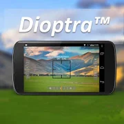
Dioptra™ Lite - a free camera tool 1.0.10
Dioptra™ Lite - a camera position and angle measurementtoolfornavigation, surveying, positioning, and measurement - -withover35,000 users! Stay tuned for an enhanced Dioptra app in2020withmore features, better sharing integration, andsupportingmorephones and devices! Instructions: Press the on-screencamerabuttonto save an image. View saved images in your device'sgalleryapp.[⊹] Dioptra™ Lite provides the following informationlikeatheodolite optical instrument - • yaw indicator (compass)•pitchindicator (tilt degrees) • roll indicator (tilt degrees)alongwith- • GPS position • azimuth and bearing to photo subjectTheancientgreek "dioptra" was a classical astronomicalandsurveyinginstrument, dating from the 3rd century BCE. Thedioptrawas asighting tube or, alternatively, a rod with a sight atbothends,attached to a stand. If fitted with protractors, it couldbeusedto measure angles. [⊹]


