Top 48 Apps Similar to GPS Map Route Planner

Route Planner - GetWay 0.0.43
The GetWay app plans a daily route with multiple stops and morethan100 stops, so your itinerary is as fast and short as possible.Usingthe GetWay app to plan your daily itinerary saves you atleast 20%of the time on the roads during the day and returns youhome faster.How to plan a route on GetWay? Give GetWay a start andend point,add the list of stops you need to make and GetWayhandles everythingelse. It will decide on the shortest travelorder considering theexpected stay times at all your stops,considering scheduledappointments or planned stops for specifichours and of coursetraffic and road data so you finish your dailyroute significantlyearlier. Is GetWay useful during the day oftravel? Using GetWayduring the day will help you complete yourwork day faster. Onceyou've designed your route, easily access anyaddress and additionalinformation you need to complete the taskquickly and with a singleclick. Does GetWay also organizeeverything during the day? GetWay'smulti-stop route planningprovides approximate arrival times for allstops along yourscheduled route. If you do not meet the schedule,recalculate therest of your itinerary to update your agenda screenquickly andefficiently, and to reach a point within the scheduledtime window.Does GetWay replace Google Maps Or Waze? GateWay workswith them tocreate a perfect solution for you. After planning theroute, youcan travel from point to point in your favoritenavigation app inorder to get from destination to destination.GetWay integrateswith your preferred navigation app and does notreplace it. HowMuch Do You Get from Route Planning on GetWay? Userstravelingalong delivery routes save themselves several hours eachday bygetting a short and efficient way to all the stops on theirroute.How much does it cost? Much less than the expected profitfromusing the app; in any case, you will get a free trial. Onceyourfree trial ends, you can choose from one of our subscriptionplans.You can uninstall at any point during the free trial periodand youwill not be charged.


GPS Navigation & Maps - Directions, Route Finder 1.3
GPS Navigation & Maps - Directions, Route FinderopenspopularGPS, Navigation & Maps for you. Maps andNavigationsearchRoutes, Direction Guide, Traffic and Transit.Install uniqueGPSapp to find route with navigation, earth map andLive &gpsdriver location. Get real-time traffic and directions,findplaceswith GPS, smart maps, Navigate & Explore, Traffic&AreaExploring Android Application. GPS Navigation &Maps,usewhat3words free map locator to plan your trips withRoutePlannerand navigator offered by Satellite World Maps.GPSnavigation appgps gives point to point pin location navigatoronlivemapslocationwith its roadmap directions. Live GPS RouteFinderdriving showshortest GPS route, live earth map, Live StreetView& Mapswith GPS Driving Directions. GPS Navigon & Maps-Directions,Route Finder driving shows worldwide navigationwithoff-line maps,GPS driving directions and travel guides. Savetimeon every drivewith Offline Navigation and Direction guidewithdriver locationnavigator. Satellite World Maps tells youabouttraffic, crashes& what3words with Live Navigation. It’stheworld’s mostdownloaded GPS navigation system app. GPS Map appisfree placefinder, perfect route planner & MapsDrivingDirections 2020.Maps and navigation app gprs has satelliteroadmapsfor drivingdirections. Navigate & Explore DrivingDirections,Traffic, andLocal Places on Live Maps. Go from here toanywhere viacarnavigation here wego. Use GPS Map for DrivingDirection andGPSDriving Directions. Offline GPS Maps and Directionsoffers youtoaccess a huge range of maps me round the globe!DownloadOfflineMap, find Driving Directions, GPS Navigation in anyregion.GPSNavigation and Driving Directions route preview helpsyoutonavigate all your nearby location map navigator withmaplocator.Free GPS apps helps in mapas & navigationwithdirection guidemap on Live GPS Maps, driving app.VoiceGpsnavigation and GPSDriving Route Planner Free withdriverlocation навигатор. GPSvoice Navigation, GPS Map RouteTrafficSatellite livemapslocationNavigation is the live route mapapp2020. Live Traffic Alerts& Offline Maps and Directions bandowith wazr Route Finder bySatellite World apps. GPS Live StreetMapand Travel Navigation isfree magellan GPS Navigation system appinGoogle Play. Live GPSRoot Finder is an App with Maps,Navigation,Share Address &Street View Map Transit and TruckNavigationfind my house. Easycal Map Driving Direction &Perfect RoutePlanner with streetview map & navigation. GPSNavigation System& Maps, LiveNavigation, Driving Direction withRoute Finder& GPS satellitemap Transit. Explore whole worldwith 3D liveStreet ViewerPanorama & Live GPS Maps Navigationroute finderdriving in gpsoffline. GPS Navigation offline apps gpsprovideswies GPS CarNavigation, directions, map guide & perfectroutemap finder2020. With GPS Driving Directions, gpsnavigation&Explorefeatures of Navigation along with earth mapquest. FreeGPSMaps appwith real-time map navigation, traffic, transit&direction andgps driver location. Top Features: DrivingRoutesAddress finderSatellite navigation Route PlannerDistancecalculator Offline MapsTraffic Alerts Street view SharelocationShare your address MoreApps Coming Soon AR and VoiceNavigationwill be available shortlyfor our valued users. Stay tunedand keepusing GPS Navigation& Maps - Directions, Route FinderbySatellite World Maps.


POI MAP-Private GPS Tracker - bookmark your places 2.68.12
Do not forget the places you have been: Yourprivatelocationdatabase in your pocket - Geodatabase securelystored onyourphone/tablet. Mark the places of interest,restaurants,parkbenches with a view, ... whatever you want, ...andautomaticallycreate a GPS map of your places. No serverconnection,no spywareand no public tracker. Try it for free! Save alocationOnly inseconds,... 1.) POIs around: Use one of the publicknown POIaroundyou (good to save a restaurant, church, shop,trainstation,...)2.) List fo POI: Search in the list of publicknownPOIs worldwide(especially if you want to bookmark a placeinadvance or longerafter your visit) 3.)Finger on the map: Useourintegrated map todefine a point by your finger somewhere on themap(we use the GPScoordinates of your placed pin) 4.)Currentlocation: The GPScoordinates of your location can be useddirectly.Store yourcurrent place independent of a street, city,...(good forhiking,geocaching, ...) 5.) Take a pictures: we use theGPSinformation ofa taken picture to define a POI 6.) Android map:Finda place inthe Android map and share it with POI MAP to store itasa personalplace. The use of POI MAP POI MAP - is a privatelocaldatabase foryour personal places around the world or just inyoursurrounding(POIbase). Based on the GPS location of your phoneortablet, youcan mark and store highly efficient a Personal PointofInterest byPOI MAP. Within seconds you can add and bookmark aplaceyou'vebeen or you want to visit in your private database. Addyourplacesindependent what it is,... restaurant, bar,hotel,church,viewpoints, geocache, etc.). Know your places you'vebeenand findthem in a list of sights, show it on a personal mapview.We knowthe POI around you. You can use them and enrich it witharanking,notes, categories, tags,... Find in your databaseSearchwithin thedatabase and find your private place by name,position inthe map,etc. in your local database. In addition you cansearchbyindividual categories, tags,... Navigate Directnavigationisintegrated in POI MAP. Use the entries in privatedatabase toreachyour personal points of interest by the shortestway or book arideby UBER or Lyft. Share it Share places you've beenwith friendsandfamily or where you want to meet next time. Weintegratedthefunction to share cross platform (iOS and Android).PrivacyfirstPrivacy is all for us! Every information is storedlocally onyourdevice. We do not know your data. No centralisedserverisconnected to POI MAP. The POI Pin includes - Address /positionofthe location - your pictures - Description - 5-starranking-Opening hours - Phone number - Web site - Timestamp(showingtheactuality of the information) - Category and tags (canbe usedforindividual structuring) Additional in Pro Version:-Directnavigation by Google maps - One-Click-Booking a ride byUBER/ Lyft- bookmark a POI directly by map-APP / pictures -Backupyourentire database Make it your own database We definedthemostimportant fields for a POI based on our experience.Usecategoryand tags to structure your places. Define yourownpersonalcategories (restaurants, churches,campsites,bookshops,geocaches,...) and/or tag the POI in additionbased onyourindividual need. Why POI MAP?/b> We travel a lot andmeetmanypeople. We always wanted to store the places of interest inafastand efficient way, to remember the places we've been, wherewehada good dinner, met a colleague, saw a nice building,... Nowwearesure... it has never been easier to mark interestingPOI'swhereyou've been. Find the places around you where you'vebeenbeforeand show them on the map. Use navigation or sendyourpersonallocation to friends.


Geo Tracker - GPS tracker 5.1.5.2972
You can find answers to most commonquestionsin the FAQ section of mywebsite:https://geo-tracker.org/faq/?lang=enIf you're looking for an excellent gps tracker, if you're a fanofaction sports and long distance travel - this app is foryou!Record tracks of your trips and share them with your friends!Geo Tracker can help:• making the reverse journey in an unfamiliar area withoutgettinglost
• tell your friends how to repeat your route
• use someone else's route that is stored in GPX or KML• mark important or interesting points of your trip.The application is able to record, even when switched off. Verylongtracks could be recorded without problems - you are limitedbystorage memory only. Recorded tracks are saved in GPX orKMLformat, so they can be used in certain applications such asOziExplorer or Google Earth.When showing track on the map, the application keepsdevicebacklight, which simplifies track navigation usage.Geo Tracker is based on public API of Yandex.Maps, so in tripsoverRussia and CIS countries you'll have the most detailed map ofthearea.Application can calculate track statistics - boldly show offyourachievements to your friends :)Geo Tracker calculates:• Max & average speed on the track;• Time and average speed moving;• Max & min altitude, altitude difference;• Vertical distance, ascent & speed;• Min, max & average slope;There are also some fine charts of speed & elevation;If you have a proposal how to enchance the application or facedsomeproblem - please feel free to contactme:[email protected]. Thanks!Useful tips & tricks to solve common GPS issues withyoursmartphone:• If you start the tracking please wait with recording youractivityuntil the GPS signal is found.• Restart your smartphone and make sure that you have "clearview"of the sky before you start (no disturbing objects likehighbuildings, forest, etc.).• The reception conditions are permanently changing because theygotinfluenced by the following factors: weather, season,positioning ofsatellites, areas with bad GPS coverage, highbuildings, forest,etc.).• Go to phone settings, choose "Location" and activate it.• Go to phone settings, choose "Date & time" and activatethefollowing options: "Automatic date & time" and "Automatictimezone". It may occur that it takes longer until the GPS signalisfound if your smartphone is set to the wrong time zone.• Deactivate the airplane mode in your phone settings.If none of these tips & tricks helped to solve yourissues,deinstall the app and reinstall it again.Be aware that Google uses in their Google Maps app not only theGPSdata but also additional data of the current locationfromsurrounding WLAN networks and/or mobile networks.


BackCountry Nav Topo Maps GPS
Use your Android as an offroad topo mappingGPSwith the bestselling outdoor navigation app for Android! TrythisDEMO to see if it is right for you, then upgrade to thepaidversion.Use offline topo maps and GPS on hike trails without cellservice!The GPS in your Android phone can get its position fromsatellites,and you don’t have to rely on your data plan to getmaps. Have morefun and safe GPS adventures in thebackcountry.Preload FREE offline topo maps, aerial photos, and road maps onyourstorage memory, so they are ready when you need them.Add custom GPS waypoints in longitude and latitude, UTM or MGRSgridreference. Import GPS waypoints from GPX files. Choose iconsforwaypoints much like in MapSource. (This app uses the WGS84datum,NAD27 is available in settings).Use GPS for hunting a waypoint or geocache, for recording tracksandGPS waypoints on your trip, all the while tracking your questontopographic maps.About topo (topographic) maps: Topo maps show terrain throughcolorand contours, and are useful for navigation offroad. Topo mapsandGPS can be used for hiking, hunting, kayaking, snowshoeing,&backpacker trails.The app has many built in map sources and allows you to createyourown maps with Mobile Atlas Creator. Built in sourcesinclude:OpenStreetMaps and NASA landsat data worldwide.OpenCyle Maps are topo maps that show terrain worldwide.USGS Color Aerial photography.Topographic Maps of Spain and Italy.Outdoor maps of Germany and AustriaTopo maps of New ZealandHere are some of the outdoor GPS activities BackCountryNavigatorhas been used for:Hiking both on hiking trails and off trail.Camping, to find the perfect camping site or the way backtocamp.Hunting trips for hunting wild game in rugged areas, includingreconfor the hunt.Bait fishing or fly fishing with a buddy.Search and Rescue (SAR) with GPS.Kayak and canoe trips on inland lakes and streams or marine,coastalwaters.Backpacker trips: using topo maps of wilderness areas andnationalforests to navigate on trails with the GPS.Snow adventures including snowmobiling, skiing (alpine orcrosscountry) and snowshoeing. Create a memory. Map it out.This a great addition to the outdoor gear you bought atCabelas,REI, or another outdoor store. Your android phone couldsubstitutefor a Garmin or Magellan outdoor handheld GPS! Youstorage hasmemory for maps.Find your own ways to have fun in the outdoors. Be a maverickbyventuring into new territory beyond cell service boundaries.Becomea pro at navigation with GPS.BackCountry Navigator has been previously available on WMdevicesand preloaded on the Trimble Nomad outdoor rugged device.ThisAndroid version is more flexible, featured, and fun.


Glob - GPS, Traffic and radar
► Glob is all about contributing toandbenefiting from the common good, but not only ! Glob is asleekcombination of the latest car navigation technologyandworld-class real-time traffic information. You willalwayschoose the best route available based on accurate,real-timetraffic information that gets you to yourdestination faster,every day. Enjoy relaxed driving with accurateand timely alertsfor all types of speed cameras andtraffic jams. Youwill always choose the best route availablebased on accurate,real-time traffic information that getsyou to yourdestination faster, every day. Just by driving with Globopen,you're already contributing tons of real-timetrafficinformation to your local community. You can alsoactively reportaccidents, police traps and other hazards you see onthe road. Getroad alerts along your route.Plus, you can addfriends, sendlocations or keep others posted on your arrival time.Downloadnow for free and join the community of more than 3milliondrivers!► Glob is the most accurate and easiest to use GPS basedapp,which lets you:• Get real-time traffic information: See current trafficconditionsand how to avoid traffic jams• Get alerts for safety cameras: Avoid speeding fines withaccurateand timely speed warnings• Live routing based on community driven, real-time traffic androadinfo• Community reported alerts including accidents, police traps,roadclosures, hazards and more• Drive more safely thanks to acoustic and visual warning• Get the real-time alerts of mobile radar traps andfixedspeed cameras location• Automatic rerouting as conditions change on the road• Benefit from biker Mode or colorblind Mode• Report new traps, police radar, mobile camera with asingletap• Live routing based on community driven, real-time traffic androadinfo• Community reported alerts including accidents, police traps,roadclosures, and more• The world’s largest online speed cam database frompremiumproviders• 300 000+ real-time alerts of mobile speedcamerasand police traps each monthNote: Continued use of GPS running in the backgroundcandramatically decrease battery life. Glob will automaticallyshutdown if you run it in the background and haven't driven forawhile.


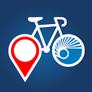
Bicycle Route Navigator 3.2
The Bicycle Route Navigator app features nearly 47,000 milesofawe-inspiring, well-established bicycle routes and 100+ mapstochoose from. You can purchase the route sections you needfromwithin the app. No subscriptions or complex file conversionsarenecessary — just download the app, purchase a route section,andstart riding with confidence. PLAN YOUR PERFECT BICYCLEADVENTUREIf you are craving a long distance 4,200-milecross-country bicycleroute like the TransAmerica Bicycle Trail or ashorter 256-mileoff-road adventure along a portion of the GreatDivide MountainBike Route, this is the app for you. Travelconfidently withat-your-fingertips cycling-specific info likeelevation profiles,distance, riding conditions, location of bikeshops, sources forfood and water, and listings of overnightaccommodations includingcamping facilities, small hotels, andcyclists-only lodging.REAL-TIME WIND AND WEATHER The app includeswind and weather dataalong the routes and severe weather warningsthat includethunderstorm, flood, and fire information. GPSNAVIGATION Followthe highlighted path on the map to yourdestination. The map movesas you ride so you always know where youare and where you'regoing. PLAN YOUR OWN UNIQUE AND AUTHENTICADVENTURE Detailed routedescriptions and service layers reveal allthe beauty you’llencounter along the way. You can plan each day toinclude variousexcursions and scenic stops such as waterfalls, hotsprings, lakes,or local art museums. TAP TO CALL One tap to callahead for acampsite, check lodging availability or connect with anearby bikeshop. Use embedded OpenStreetMap search for even moreservices. NOCELL COVERAGE? NO PROBLEM Download the basemap to yourdevice soit’s available offline without a cell signal. BEST LONGANDSHORT-DISTANCE BICYCLE ROUTES AVAILABLE Adventure Cyclingdevelopsthe best cross-country, loop, coastal, and inland cyclingroutesavailable. This app serves as an excellent companion to ourpapermaps. The Adventure Cycling Route Network features ruralandlow-traffic established bicycling routes through some of themostscenic and historically significant terrain in NorthAmerica.Adventure Cycling’s Routes & Mapping department isconstantlyworking on research and development of new routes as wellas themaintenance of the 47,000 miles of existing routes.

Navmii GPS World (Navfree) 3.7.22
Navmii is a free navigation and traffic appfordrivers.Navmii combines FREE voice-guided navigation, livetrafficinformation, local search, points of interest and driverscores.Offline maps stored locally, for use without aninternetconnection. Over 24 million drivers use Navmii and our mapsareavailable for more than 150 countries.• Real voice-guided navigation• Real-time traffic and road information• Works with GPS only – internet not needed• Offline and Online Address search• Driver Scoring• Local Place search (powered by TripAdvisor, FoursquareandWhat3Words)• Fast routing• Automatic rerouting• Search using Postcode/ City/ Street/ Points of interest• Heads-Up Display (HUD) – upgrade• Community map reporting• HD accurate maps• + Much, much moreWe have thousands of 5-STAR REVIEWS:- why buy a satnav when navmii does it all- unbeatable value and functionality- love, love this app!Navmii features on-board OpenStreetMap (OSM) maps, which arestoredon your device and therefore you don’t need no dataconnection(unless of course you use the connected services). UseNavmiiabroad to avoid high roaming costs!We're always eager to hear about your experience of usingNavmii.You can contact us anytime by email, on Twitter or Facebookusingthe details below:- Twitter: @NavmiiSupport- Email: [email protected] Facebook: www.facebook.com/navmiigpsNote: continued use of GPS running in the backgroundcandramatically decrease battery life.


