Top 50 Apps Similar to Radar Plotting

ITF Seafarers 4.0.6
This latest development combines the two previous applications(Lookup a Ship and Find an Inspector/Union) into one great appthatprovides a one stop shop for seafarers in search ofvesselinformation, contact details for ITF inspectors/affiliatesand theITF Helpline. The information displayed is derived directlyfromthe ITF’s centralised system and is therefore as up to dateaspossible. Aside from merging the two previous applications wehavealso introduced; •Colour coded system on vessels to easilyidentifywhich are covered, uncovered, National flag etc. Thecolours being;o Green – Covered vessel o Yellow – Vessel undernegotiation(Prospect agreement) o Red – Uncovered FOC vessel oOrange –National flagged vessel o Blue – Cruise vessel •Hotlinkstoaffiliate contact information by touching the Signatory Unionnameon covered vessel details • Ability to contact the ITFHelplinedirectly from the app via telephone or email • Links totheITFglobal and ITFSeafarers websites • Greater information ontheITF and FOC campaign Please note that response times willvarydepending on the device connection (Wifi, 3G etc.) and theamountof information you are searching for. If you havepreviouslydownloaded the Look up a Ship and Find an Inspector/Unionapps Iwould advise you to remove them as they will shortly bedeletedfrom the respective app stores. We look forward to anyfeedback youfeel appropriate and suggestions for improving theapplication.


Sight reduction 4.3
Celestial navigation - Astronavigation Sight reduction: -MarcqSaint Hilaire Line of Position, intercept method (p=Ho-Hc, Zn)-Input for observed altitude Ho or instrumental Hs (NauticalAlmanacdata needed for the Sun and the Moon) - Calculator: altitudeHc andazimuth Zn - Running fix - Plots up to 3 Marcq Saint HilaireLinesof Position on Google maps - Local hour angle (LHA) Sightreductionis the process of deriving from a sight the informationneeded forestablishing a line of position. This app is a calculatorto getthe intercept from the assumed position of theobserverAP(latitude, longitude), the geographical position of thecelestialbody observed, GP(Dec, GHA), and its corrected altitudeHo. Manualand examples in the developer's website.Ref:https://en.wikipedia.org/wiki/Sight_reduction User interface:-Zoom buttons +/- - Map types: standard, terrain, and satellite-GPS location. ("Location" App permission must be allowed. Switchonyou GPS, and then automatic location detection is possible)


SailDroid
The Sailing AppApp for sailors, yachts and boats, containinga set of nautical applications:- Magnetic Compass- Speedometer in knots, mph or km/h, Course over Ground- Position- Mark or edit waypoints- Import Waypoints from gpx file- Distance measurement in nautical miles and meters. Also usefulforanchoring.- Course to WaypointAll in large, high contrast characters


VesselFinder Pro 4.1.4
VesselFinder is the most popular vessel tracking app,providingreal-time data on the positions and movements of vessels,utilisinga large network of satellites and terrestrial AISreceivers.VesselFinder features include: - Real-time tracking ofover 200,000ships every day - Ship search by Name, IMO number orMMSI number -Ship movement history - follow the track of eachvessel for thepast 7 days - Ship details - name, flag, type, IMO,MMSI,destination, ETA, draught, course, speed, gross tonnage, yearofbuilt, size and more - Port search by Name or LOCODE - PortCallsper ship – time of arrival and stay in ports - Port Calls perport– detailed list of all vessels Expected, Arrivals, Departuresandcurrently In Port - My Fleet - add your favourite vessels to"MyFleet" list and even split them in groups. It is syncedwithVesselFinder.com, so any change of vessels in My Fleet listwillreflect on either the mobile App or the website. - My Views -savefavourite views of the map, so you can easily navigate to them-Ship photos contributed by VesselFinder users Coverage -near-shorecoverage, same as the website VesselFinder.com and theFree versionof VesselFinder availableathttps://play.google.com/store/apps/details?id=com.astrapaging.vffIMPORTANT:If you experience any problem with the App, please fillthis form tocontact us http://www.vesselfinder.com/contact insteadof writing areview here. We will do our best to solve it. Thanks!Visibility ofvessels in the App depends on AIS signalavailability. If aparticular vessel is out of our AIS coveragezone, VesselFinderdisplays her last reported position and updatesit as soon as thevessel comes into range. Completeness andaccuracy of theinformation provided cannot be guaranteed. Connectwith VesselFinder- on Facebook:http://www.facebook.com/vesselfinder - onTwitterhttp://www.twitter.com/vesselfinder


Ships66 3.5.1
Ships66 is a professional ship location servicesoftware,whichprovides users with ship search, ship screening,global AISshipposition inquiry, historical track inquiry,electronic fencealarmand other functions. It can be widely used inship management,portdispatch management, ship brokerage, cargoAgency,shippingfinance, maritime law, etc. Features 1.View of shipfilesand AISinformation Click any ship on the chart or use the shipnameandMMSI to view the ship file, real-time position,sailingstatus,running track and other information of any ship. 2.ShipscreeningFilter qualified ships by type, length, status,datasource, etc.3. History track query The user can select thetimeperiod to playback the ship's sailing trajectory and reproducetheship's sailingprocess. 4. Fleet management Users can managefleetseasily andquickly by customizing fleets. 5, electronic fenceSetmonitoringarea, the ship will automatically alarm whenapproachingthemonitoring area, and remind the staff to handlethrough WeChatandSMS. 6, label management Superimpose personalizedlabels suchaspoints, lines, and areas on the chart, and synchronizethem totheapplet, app, pc, and shipboard equipment. 7.Equipmentmanagementfunction Provides multi-screen interaction ofterminaldevices andcloud data management functions. Remoteoperation ofship-borneequipment, online upgrade, ship-sidevideosurveillance,situational warning, and tracking ofglobaltrajectories throughsatellite services. 8.One-stop solutionThroughthe ship-to-shipnetwork SaaS platform, lightweightsoftwareservices are providedfor enterprise users, such as: datasharingservices forocean-going fleets, ship energy efficiencymanagementsystems forship-shore integration, and ship intentresearch andjudgmentsystems for ship supervision agencies. Usersonly need toorder thecorresponding cloud services according totheir own needs,and theycan directly conduct business management,without having tospendhigh fees to arrange servers and purchasesoftware.


Marinus ColRegs Lite 4.2.7
The Nautical App you've been waitingsincequite a lot, easy, simple and at your fingertips. A must-haveAppeither to navigate or to pass your certificate. All at hand,onyour iPhone or iPod! Learn the 'International RegulationsforPreventing Collisions at Sea'. (IRPCS/ColRegs).Contains the most important parts of InternationalRegulationsfor Preventing Collisions at Sea (IRPCS).International code flags, morse code, maneuvers, lights,Douglassea scale, Beaufort scale, sound signals... All this andmuch morein graphic sections in order to solve your questionsquickly.

Marinus - Boating rules 4.2.7
Marinus ColRegs is not one more app ofthenavigation rules… is the APP of the navigation rules!Designed by and for the maritime and nautical people, thatresolveyour doubts in any moment and anywhere. Is the appindispensableonboard of your sail or power boat!Include the next sections:• Flags: with every letter and significant.• Meteo: Beaufort and Douglas scale, and clouds.• Sonuds• Lights: with a detail view of every vessel in every angle.• Day shapes• Maneuvers• Morse• Buoys IALA• Radio• ColRegs: all the International Regulation for PreventingCollsionsat Sea (IRPCS, Rules of the road, Collision rules) intext.• Quiz• MapDownload the app that miles of people use very day intheiriPhone. No matter if you are an experienced sailor or anovice,this is your app!Any question feel you free to ask to [email protected]

Vaarkaart Friese Meren 2.11
The perfect chart for sailing on theFrisianlakes. This chart is made for boat renters, skippers andcrew ofsail boats, motor boats and barges. Also recommended forcanoes andfishers.AreaFrom Stavoren to Grouw, with the following lakes::Heegermeer,Fluessen, Morra, Oudegaster Brekken, Zwarte and WitteBrekken,Sneekermeer, Koevorden, Tjeukermeer, Langweerderwielen,andPikmeer/Wijde Ee.This is a detailed chart with a scale 1,3m/pixel. This comesdownto about 1 : 5000 on the screen.Depth viewWith clear depth view from the Friese Meren Project in wellcoloreddepth areas on the lakes and depth numbers along the waterways.Developed by Stentec in cooperation with the province Fryslânbasedon the most recent depth measurements.WaypointsThe included database contains 2345 waypoints divided in 13groups.The 145 marinas show phone numbers and websites. Othergroups areamong others bouyage, mooring spots, campings and gasstations.The accurate positioned bouyage contains the socalled‘slobbers’. These mark the protected bird area from 1 Octoberto 1May. Outside this period these are replaced by yellowregattabuoys.Marrekrite 2014 natural mooring places are also included inthechart. You can easily see if camping is allowed (CAMP), ifacontainer is present (CONT) or if you can moor (WAL).The bridges and locks along the water ways are shown withheightand width so you can easily plan your route. The manyaquaducts arealso shown. Most bridges are operated daily from 1 Mayto 1November from 9h-19h. In June, July and August even until20h.


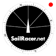
Sail Racer 6.6.4
This is a sail racing app for sailing enthusiastsandprofessionals.Application is used as an additional tool nexttostandard yachtequipment to take tactical sail decisionsfaster.Sail Racer appsuggest the favored end of the start line,monitorsyour position,time and guides the maneuvers that the startlinewas hit at thelast moment with the best possible speed duringyoursail. With thesail app it is easy to navigate in racing area.SailRacer interfaceis designed in a way that course efficiency,thelay lines andshifts could be captured in a splash of asecond.Skipper does notneed to analyze the numbers and canconcentrate onhandling theboat, maximizing performance and playingtacticalgames withcompetitors. Every wind gust and lull affect theboatheading and isvisualized in a “easy to read” shift bar on thetopof compass roseand on the map. Sail Racer is designedanddeveloped by sailors. Ithas everything to sail on the edge. -Timeto burn, Coundown andStarting box distances - Windaveragecalculation for 6minutes andan hour - Course averagecalculation(in case you do not have NMEAdata) - Boat efficiencyaccording topolar data - Mark, Laylinedistance and ETA - Tracker -Nauticalcharts - NMEA 0183 dataconnection, BlueTooth dataconnection,SailTimer wind information -Current indication and manymore -Works on watch (Android wear OS)More informationwww.sailracer.netSailrace.net app is free forlearning (Optimistkids, Lasers andother centerboards) and forevaluation purposes. Wekindly ask allkeel boat racers to purchasePremium license for 35euros / year.Have a good start and evenbetter finish.


ISS Transit Prediction Pro 2.2.2
This application generates InternationalSpaceStation (ISS) Transit Predictions for the Sun, MoonandPlanets.The user specifies a location, which includes latitude,longitudeand elevation. The application downloads the latestorbitalinformation (Two Line Elements or TLEs). The applicationgeneratesa transit prediction map which contains prediction pathsfor eachtransit within a specified alert radius.*** Please try the ad-supported ISS Transit Prediction Freebeforepurchasing to make sure you like the app ***USER INTERFACEThe main screen provides 4 buttons:•Location - Press this button to add or select thepredictiongeneration location•Two Line Elements (TLE) - Press this button to download TLEs•Generate Prediction - Press this button to start thepredictiongeneration•View Prediction - Press this button to view the prediction maportext fileThe options menu provides the following:•Locations - Press to add, select, edit or deletesavedlocations•Predictions - Press to view, share or delete savedpredictionmaps•Settings - Press to set user preferences•DEM Files - Press to list or delete the downloaded DEM Data•Help - Press to display this help page•About - Press to display application version, creditsandlinksLOCATIONSAdd a named observing location by clicking the "Add Location"buttonaccessible from the locations screen.The location coordinates can be entered in any ofthreemethods:•Manually - Enter latitude, longitude and elevation in thetextboxes. Positive values represent North and East, negativevaluesSouth and West. Elevation can be entered in meters or feetabovesea level depending on the current prediction units setting.As thecoordinates are typed, the map pans to the location. Pressthesearch button to search for a location.•Map Input - Use the map to zoom and pan to a location. PressingtheSet button sets the location name, coordinates and elevation inthetext boxes. The elevation of the current coordinates isretrievedusing the specified elevation data source setting. Switchbetweenmap and satellite modes by toggling the Map/Satbutton.•GPS - By pressing the GPS button, the application uses GPStoobtain location coordinates and elevation.Use the locations page accessible from the options menu to editanddelete saved locations.GENERATING PREDICTIONSOnce a location has been entered and TLE have been downloaded,pressthe "Generate Prediction" button to begin predictiongeneration. Theprogress bar gives an indication of how long itwill take tocomplete the process. Depending on your CPU speed, itcan take a fewminutes to generate the predictions. Pressing thecancel button willcancel the prediction.VIEWING PREDICTIONSOnce the prediction generation is complete, the prediction maportext file can be viewed. Pressing the View Prediction buttonbringsup the previously generated prediction map. The text buttonwithinthe map view displays the prediction text. The Map/Satbuttonswitches between Map mode and Satellite mode.Within the map view press the Google Earth button to view the mapinGoogle Earth. Press the save button to save the prediction forlaterviewing.Within the transit information window, press the add tocalendarbutton to create a calendar event (Android 4.0 orbetter).Use the predictions page accessible from the options menu toview,share and delete previously saved prediction maps.PERMISSIONSStorage: To store/delete elevation data needed forpredictiongeneration, saved predictions & locations asrequested byuserSystem Tools: To prevent device from sleeping duringpredictiongenerationNetwork Communications: To download ISS orbital elements fromtheinternetYour Location: Fine (GPS) location. To obtain your currentlocationif requested by userYour Accounts: Read Google service configuration. Todisplaypredictions using Google Maps (Required by Google)

Transas iSailor
Transas iSailor is an easy-to-usenavigationalsystem developed for the amateur seafarers. Intendedfor use onboats and yachts, iSailor provides a clear presentationofnavigation information and electronic charts. Transas ownTX-97vector chart format supported by iSailor is recognizedworldwide asone of the most accurate and reliable sources ofnavigationalinformation.Available Chart Folios cover coastal and offshore waters ofNorthAmerica, Latin and South America, Europe, Africa, Middle East,FarEast, Asia, Australia & New Zealand. All chart folios canbeselected, purchased and downloaded via the Transas iSailorappusing its Chart Store section. Purchased chart folios includesaone year Chart Updates subscription service of yourchosencoverage. At the end of one year you can choose to renew yourChartUpdates subscription service or continue to use the chartsyoupreviously purchased and downloaded.• Positioning system:- Internal GPS (if available, through the AndroidLocationProvider)- NMEA GPS over Wi-Fi (TCP/UDP connection)- AIS class B Transponder (TCP/UDP connection)- Bluetooth NMEA GPS through the Android LocationProvide("Bluetooth GPS Provider" app is needed)• Navigation sensors support: GPS, Compass & ROT (TrueorMagnetic Heading), Wind, Echo-Sounder• AIS targets support: AIS Class A, AIS Class B, AIS Receiver,BaseStations, Aids-to-Navigation (AtoN)• Display of Charts and Routes• North Up, COG Up and Route Up chart orientations• Information on any vector chart objects• Free cursor, Point-To-Point and Own Ship referencedERBLfunctionality• Monitoring of navigational data: Position, Course (COG) andSpeedOver Ground (SOG)• Route creation by the graphic methods. “Go To” routes• Alarms & Warnings• Waypoint monitoring: Bearing to WP, Distance to WP, XTD• Schedule information: Time-To-Go and ETA to any selectedwaypointahead• Day and Night chart palettes• Track recording• Import & Export for Tracks and Routes• Multi-UnitsCompatible with Android versions since 4.4.x (API level 19)andhigher!List of supported and tested devices:Tablets:• Google Nexus 7 (2013)• Samsung Galaxy Tab S• Samsung Galaxy Note 8.0• Samsung Galaxy Tab Pro 8.4• Samsung Galaxy Note 3• Sony Xperia Z2 Tablet• Lenovo A3300-HV• Lenovo YOGA Tablet 2 ProSmartphones:• Samsung Galaxy S4• Lenovo S60• Samsung Galaxy A3• HTC Desire 630• Asus ZenFone Z00ADWe cannot guarantee correct operation on non-tested devices.Ourteam will continue to improve the application performance,keepingyou informed about our progress in the upcomingreleases.iSailor web site http://www.isailor.usAny questions? Feel free to contact us at [email protected] Yours,Transas iSailor team


Kwindoo Tracking 2.1.9
Use KWINDOO to hook up to sailing regattasandstay instantly informed aboutany news or changes in effect regarding your upcoming race.You will get invitations to join races, from organisers whouseKWINDOO.com for their regatta. The race administrator will seeifyou join or decline.You will see the NOR and the sailing instructions and getpushnotifications about any changes. You will also see theactualchange itself.You will receive Active Race information Messages in theARIMsection of your app.These can be instructions or informations. These are providedforthe entire fleet or a class. No individual messaging is possibletoa single boat.Your phone will provide GPS tracking for the race. This can beseenby the organiser and by your fans and family, too.The organiser can pre-set an emergency call number to be used atasingle button press, should that be needed.Use "quit the race" function to inform your race administratorandnot to search and or wait for you in case you gave upastage.Use KWINDOO to hook uptosailing regattas and stay Informed about Instantlyany news or changes in effect Regarding your upcoming race.You will get invitations to join races, from organizersforKWINDOO.com Who Use Their regatta. The race will seeadministratorif you join or decline.You will see the NOR and the sailing instructions and getpushnotifications about any changes. You will also see theactualchange Itself.You will receive the Active Messages in the Arima Raceinformationsection of your app.These instructions can enter or Information. These are providedforthe Entire fleet or class. No Individual messaging is Possibleto asingle boat.Your phone will provide GPS tracking for the race. This Can BeSeenby the organizer and by fans and your family, too.The organizer can pre-set call an emergency number to be Used atasingle button press, hurt Should you needed.Use "Quit the Race" function to inform your administrator andraceand not to search or wait for you in case you gave upthestage.


NV Charts GPS Navigation AIS 2.709.182
A clearly structured navigation app with intuitive andcomprehensivetools for navigation on board. All boating charts ormaps from NVVerlag / NV Charts can be easily downloaded and usedfor offlinenavigation with the NV Charts App. All NV Verlag / NVChartsnautical boating charts or inland charts including | NorthSea |Baltic Sea | Netherlands | Wadden Sea | IJsselmeer | Sweden|Denmark | Germany | Norway | France | USA | Caribbean |Bahamasareas are compatible with NV Charts App. One way to havegreatnautical charts both on paper and on our phone or tablet is touseour popular combination pack of paper and digital nauticalcharts,which includes both charts in clever atlas format anddigitalnautical marine boating charts/maps for use in the NV Chartsapp,including a one-year update service. But you can alsopurchasedigital boating charts as a subscription directly in the NVChartsApp. The subscription duration is one year and isautomaticallyextended. The advantage: your boating charts arealways up to datein the app. If it is not yet clear where thejourney is going totake you, free online charts can be displayedfor all NV Chartsnautical chart areas in the app. The latestinformation isessential for safe navigation on the water. With thenew version ofthe NV Charts App 2020 you have the possibility tobecome part ofthe chart community. You can now add marinas,anchorages andnavigation warnings to the digital chart and also addand shareinteresting places beyond navigation, such as restaurantsor pointsof interest with pictures. Others can respond directlywithcomments. The continuously edited content can bedownloadeddirectly to be available offline. In order to make allinformationeasily accessible, we have improved the search function:You canexplore the surroundings and search directly for place namesaswell as anchorages, harbours, ramps, waypoints, cranes,petrolstations, or tide stations. In addition, an auto-routingfunctionhas been integrated, which allows you to navigate directlyto yourdestination. Together navigation on board is even more fun!You cannow share your tracks with friends or use the data outsidethe appand export it as GPX file. You can share your favoriteharbors andanchorages from the app simply by clicking on a link andcoordinateyour trip planning even better with everyone. With theAIS functionin the NV Charts App you can keep an eye on AIS signalsinreal-time. You can connect a Wlan AIS receiver to the NV Chartsandthe app display AIS Class A and B signals and navigationaids(ATON), as well as MOB AIS SART transponder distresstransmitters,directly in the digital chart in real-time and thetrafficsituation can be assessed better. The NV Charts App canbeinstalled and synchronized on multiple devices. NV Charts App-Features: ✔ Search function ✔ Autorouting (NL, DE, DK +otherregions to follow soon) ✔ Community Layer / Points ofInterest(POI)✔ Free online boating charts preview for planning ✔ InAppPurchases of digital offline charts ✔ Community Layer / PointsofInterest(POI) ✔ Reads sea charts of all NV chart areas ✔Easydownload of the maps ✔ Always the latest data ✔ Seamless zoomandpanning functions ✔ Tide Forecast ✔ Online weather ✔ AISWifiSupport ✔ AIS Sart Beacon ✔ AIS CPA function ✔ Night mode ✔Anchoralarm ✔ Position with GPS ✔ Intuitive route planning ✔Coursemarkings, markings, bearing ruler ✔ Port information ✔Display ofinstruments ✔ Synchronizing devices ✔ Live PositionSharing ✔Social sharing of routes, tracks, positions ## Androidversion 7.0or higher required. (Use the NV Charts Classic versionon olderdevices) Note: Continued use of GPS in the backgroundcansignificantly reduce battery life.


