Top 50 Apps Similar to Altimeter

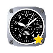
Accurate Altimeter 2.2.32
The most downloaded Altimeter on the PlayStoreis now updated with a new interface and new features!- Altitude estimation with three different methods to be alwayssureto get a reliable measure, even without internetconnection.- Historical charts to see your excursions elevation gain.- Map with your elevation and contour lines.- Pictures with impressed place name and altitude.Altitude can be estimated:- With satellites triangulation. Slow and less accurate but itworkseven with no internet connection.- Taking the ground elevation at your current position fromaninternet web service.- Using the pressure sensor of your device (if available).Itcalibrates itself on pressure from the nearest weather stationtoimprove accuracy.As additional PRO features you can also:- compensate systematic error of pressure sensor- record altitude without opening the App- remove advertising


Altimeter & Altitude Widget 4.57
DS Altimeter is an elevation meter,elevationlogger, and altitude mapper. In addition to showing andoptionallytracking your altitude, the app allows you to search thealtitudefor other locations as well.You can select from the best sources of elevationdata,including:1. Location based altitude from NASA's Shuttle RadarTopographyMission2. Satellite based altitude (GPS altitude) corrected toheightabove mean sea level (AMSL)3. Get actual land survey altitude values for your locationfromthe United States Geologic SurveyDevices equipped with a barometer sensor can also obtainpressurealtitude which is converted to true altitude. For the mostprecisereadings, calibrate the pressure altitude by entering areferencevalue or by selecting one from the app's dynamic list ofnearestairfields.USGS (United States Geologic Survey) altitude results arealsoavailable for customers in the contiguous United States, CanadaandMexico.DS Altimeter also works offline: barometric altitude andGPSaltitude corrected to elevation above sea level do not requireaninternet connection.NEW IN DS ALTIMETER: Record altitude profiles and elevationtracksfor your favorite journeys to the highlands, the lowlandsandeverything in-between!Upgrade the application to pro and gain access to even morefeaturesincluding the Altimeter Widget and variousbarometricaltimeter calibration methods.Going skiing? Record your ski run with DS Altimeter, then viewyourski trail with its elevation points on the included maps.Mininumand maximum altitude points for your run will beclearlyshown.Altitude mapping, altitude search and bathymetry (lake andseadepths) are also included with DS Altimeter. Tap anywhere on amapto get the altitude or water depth at that location.* The perfect altimeter for skiing, hiking, mountain climbingandother outdoor sports, boating, marine navigation and anytimeyouare curious about your elevation!


AndMeasure (Area & Distance) 2.0.7
The AndMeasure tool allows you tomeasuredistances and calculate area between points on a map.The tool has virtually unlimited applications. Use itPROFESSIONALLYfor measuring distances and areas in landscaping,lawn care, waterline measuring, paving and fencing. Use it infarming, agricultureand forestry to measure your fields andforests. Realtor's can useit for showing clients distances tocertain landmarks.For RECREATIONAL use, it can be used in measuring off-roadroutes,plotting running courses, water trips, range estimation attheshooting/driving range. Use it in Golf for gettingreal-timedistance to the green.★★★ Featured on AgWeb.com powered by Farm Journal ★★★"This app could be an easy way for farmers to measure newfields."March 2012Features:● Use it as a ruler on a map to calculate the distancebetweenmultiple points● Calculate areas in acres, sq miles, sq feet, m2, km2,Hectare,Ares● Measure the distance to your location from multiple pointsinreal-time using the "continuous mode" feature● Switch between Satellite, Hybrid, Terrain and normalmapmode● Find your current location via GPS or Network● Share measurement and screenshot via email and Google Drive● Add markers to the map either via tap or by dragging from the"addbutton" to get super accuracy● Move markers around to get precise measurementKeywords: map, maps, area, distance, length, ruler, gps, golf,areacalculator, range finder, map measure, area measure,distancemeasure, field area measure, surface measurement, realestate,realtor, GPS measure, solar, landscape, areacalculation,planimeter, efarmer, perimeter, landscaping, garden,fencing,acreage, terrain, geographical, property, geo,agricultural,calculator, forest, farm, field measure, location,roof area,solar, solar panel roof area, outdoor, snow removal,farmlogs, landcalculatorLanguages: English (write an email if you want to help withothertranslations)Get it at:https://play.google.com/store/apps/details?id=com.megelc.andmeasureFacebook:http://www.facebook.com/andmeasurePrivacy Policy:AndMeasure does not store any personal information at all.HoweverGoogle Analytics is used in the app to better understand howtheapp is used and performs.The Google Privacy Policy can be found here:http://www.google.com/intl/en/policies/privacy/


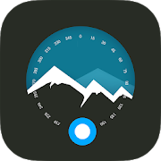
Altimeter Ler Live Gps Geotracker 2.6
Modern Altimeter GPS+ app is for folks who care for hikingandbikingin mountainous terrain. GPS is getting very accurateinterms ofdistance indication. The choice between unit systemisperhaps animportant thing, just for your convenience the appisbeing equippedwith both of them (Imperial andMetric).Surprisingly strongbarometer measures the weight of theairpressure above a given pointand determines elevation oftwopoints. This app has a creativeand user-friendlystyledesign, simple and comprehensivefunctionalities. Featuresincluded- Imperial and Metric unitsettings. - GPS accuracyindicator. -GPS distance accuracyindicator. - Density of air ,indicator.Search any place and dropsearch pin with place info.Built inlibrary Map integration - GOOGLEmaps - Satellite mapsmode. -Hybrid maps mode. - Standard maps mode.- Terrain maps mode.-Tracking location changes trajectory. Compass- Compass withcamera- Take a pictures with coordinates - Showsdevicereal-timeorientation to magnetic fields. - Ability toswitchbetween trueand magnetic North. - Location coordinates(longitude,latitude). -Course Track information - Time elapsed. -Distance. -Averagespeed. - Max speed. - Altitude. Tracking - Speedtracking inmph orkm/h based on MPH or KM/H mode. - Distancetracking in milesorkilometers based on MPH or KM/H mode. - Timetracking. -Longitude,latitude coordinates. - Save locations drop apinWeather --Temperature information. -- Wind --Visibility--Sunrise,Sunset -- High/Low Temperature. --Abilitytoswitch between Celsius and Fahrenheit.


Weather Station with barometric pressure sensor 2.8.7.1
Simple, nice and retro weather station. Our barometer appshowsmaindata: temperature, barometric pressure and humidity.Themes,Graph,Forecast and different Data Providers are also inside.Seepressurewith built-in barometric pressure sensor (not foralldevices)! Thisapp is pleasant and easy to use. It lookslikevintage barometerwith modern technology inside. Onlycorrectweather data withoutanything superfluous (like map, widgetsetc.).Free versionincludes: • Temperature (could measure in °C and°F onthe samescreen) • Wind speed (switch between km/h, mph, mps)•Atmosphericpressure (3 different pressure units of barometer-inHg, hPa, mmHg)• Relative humidity in live time • 7commonlanguages (EN, IT, DE,ES, RU, UK, PL) • barometric pressuresensorYou can also switchbetween classic and forecast viewsPremiumversion: • Forecast for4-7 days (depends on data provider) •Morewind meteo data • Sunriseand sunset data • 3additionalmeteorological live-time datachannels • 3 additionalbackgroundthemes • charts of changingindicators by day or hourlyStayinformed about the weather.Barometer will show you airpressure,hygrometer will show humidityand thermometer – a realtemperature.All local weather informationin your pocket. Rain, snowor evenstorm outside will no longersurprise you. FEATURES: • A lotofrealistic themes to make yourWeather Station unique •Ergonomicdesign: comfortable userinterface in both positions(vertical andhorizontal) • A lot ofdevice configurations forpersonal usage •Compare meteo data fromdifferent providers, sourcesand channels •You can switch betweenanalog style graphic and modernstylegraphics • Celsius andFahrenheit - together on one screenAweather station is a facility,either on land or sea,withinstruments and equipment for measuringatmospheric conditionstoprovide information for weather forecastsand to study theweatherand climate. The measurements taken includetemperature,barometricpressure, humidity, wind speed, winddirection.Atmosphericpressure, sometimes is the pressure exertedby the weightof air inthe atmosphere of Earth. Low-pressure areashave lessatmosphericmass above their location, whereashigh-pressure areashave moreatmospheric mass above their location.Again, we havebuilt-inbarometric pressure sensor support. Itallows to readcurrentatmospheric pressure in realtime. Humidity isthe amount ofwatervapor in the air. Our app shows you relativehumidity, itisexpressed as a percent, measures the currentabsolutehumidityrelative to the maximum (highest point) forthattemperature.Humans are sensitive to humid air because thehumanbody usesevaporative cooling as the primary mechanismtoregulatetemperature. Under humid conditions, the rate atwhichperspirationevaporates on the skin is lower than it would beunderaridconditions. Because humans perceive the rate of heattransferfromthe body rather than temperature itself, we feel warmerwhentherelative humidity is high than when it is low.AnalogWeatherStation always identify exactly where you are. Youhaveopportunityto enable GPS detection or search for your city. Youcansee localweather, alert about rain, snow, strong wind andotherweatherevents. And you can be sure of the accuracy oftheforecast.Updates and more features are coming. Stay tuned forthecurrentweather with vintage Analog Weather Station! Find outwhentheweather will be sunny, cloudy or snowy, there will besevererainor atmospheric pressure will increase in realtime mode!


Sensors Toolbox 1.6.03
Sensors toolbox is the absolute all-in-one diagnostic tool thatletsyou know virtually everything about your mobile device status.Getfull information about all sensors supported by yourtablet,smartphone or wearable device. View in comfortable layoutall datafrom your mobile device sensors in real time, make asensors tests.Check data on chart (graphic view) and text outputavailable foreach sensor and check a detailed description of eachdetectors andparameters. All multi tools and sensors device youneed in one app:altimeter, metal detector, NFC reader, compass,thermometer, stepcounter, sport tracker and much more. This sensorstool box appgives you access to data from: - accelerometer readings(linearacceleration and gravity sensors) - gyroscope (calibratedanduncalibrated) - device 3D orientation - proximity sensor -stepdetector and counter, kinetics sensors - significant motion-rotation vector sensors - other motion and position sensors -lightsensor (lux, lx) - magnetometer, ambient magnetic fieldvaluesstrength (micro Tesla, µT) - barometer, pressure sensor -relativehumidity sensor - temperature sensor - location,accuracy,altitude, maps, speed and GPS NMEA data (latitude,longitude,provider, satelites) - battery status, voltage,temperature, healthand technology - sound level meter andmicrophone meter (decibel) -heart rate sensor - NFC sensor andreader - device front and backcamera resolution - samrtphonedisplay size, resolution andtechnology - device, phone memory, RAMand CPU parameters - IMEInumber - multitouch info and otherssensors available in yourmobile device. With this sensors multitoolapp you can check whatkind of sensors contain your device and testall of this. Itsupports all the sensors an android device and youcan check a lotof data from sensors supported by your hardware. Ifyou have anyproblems with this app or ideas to develop, please sendus messageto [email protected] Have a fun at work with thisultimate tool!


Maps Ruler
Maps Ruler is helping you to calculatedistancebetween selected points.Find shortest way and save energy or use it as a golfdistance(yard)calculator.Now: Area calculation mode (Beta)-Path save/load-Multiple points,-Conversions: meter, km , mile, feet, fathom etc-continuous path calculation like drawing.-name paths


ImageMeter - photo measure 3.5.27
ImageMeter lets you measure dimensions,anglesand areas in your photos with ease. No more need to draw asketchof your apartment or furniture. Simply take a photo andannotate itwith the dimensions on your phone or pad.ImageMeter has the broadest support for Bluetooth laserdistancemeasurement devices. Most devices from Leica, Bosch, CEM,Hilti,and TruPulse are supported (see below for full listofdevices).What is also special about ImageMeter is that it enables youtomeasure within the image long after you took the picture. Itoftenhappens that after taking the photo, being back at home or intheoffice, one realizes that some important distances have notbeenmeasured. This is no problem anymore with ImageMeter, becauseitenables you to measure the missing data directly from thephotos,afterwards. Additionally, with this feature, you can alsoeasilymeasure the dimensions for places which are too difficult toreach.This works whenever the objects you want to measure arewithin aplane (even if it is only virtual) and if you can provideareference rectangle for ImageMeter. ImageMeter will take careofall perspective foreshortening and still compute themeasurementscorrectly. You can also have as many measurement planesin oneimage as you like.Features:- measurements of lengths, angles, circles, and arbitrarilyshapedareas based on a single reference measure- export to PDF, JPEG and PNG- sort your images into subfolders and export complete foldersasZIP archives- Bluetooth connectivity to laser distance meters formeasuringlengths, areas, and angles.- metric and imperial units (even formats like 1' 2 3/4"aresupported)- value input with autocompletion- text annotation with user definable preset texts andautomatictext formattingSupported bluetooth laser distance meters:- Leica Disto D110, D810, D510, S910, D2 (Android 4.3 withBluetoothLE required),- Leica Disto D3a-BT, D8, A6, D330i,- Bosch PLR30c, PLR40c, PLR50c, GLM50c, GLM100c,- Stanley TLM99s,- Hilti PD-38 (this is the only app that supportsthisdevice),- CEM iLDM-150, Toolcraft LDM-70BT,- TruPulse 200 and 360,- Suaoki D5T,- Mileseey P7,- eTape16.This is the free evaluation copy with watermarks in exportedimages,some limitations on the number of measures per photo andlimitedBluetooth measurement distance. For the full version,either installthe pro version or upgrade within the free app. Bothways give youthe full set of features.----------------------------------------------------ImageMeter is a winner of the "Mopria Tap to Print contest2017":most creative Android apps with mobile printcapabilities.*** This Old House TOP 100 Best New Home Products: "a superpowerforanyone shopping for furnishings to fit a space" ***----------------------------------------------------Support email: [email protected] free to contact me if you observe any problems,or just want to give feedback. I will answer to youremails and help you resolve problems.----------------------------------------------------At this place, I'd like to thank all users for all thepositivefeedback I get. Many of your proposals have alreadybeenimplemented and improved the app a lot, and many ideas arewaitingto be included in the next versions. Let me assure you thatall ofyour proposals are considered, as my goal is to make this appasgood as possible to improve your productivity.Thank you for providing translations: Hakan D. (French), MarcoD.(Italian), Victor R. (Russian), Ning Zhao (Chinese),Maxberg(Czech)