Top 29 Apps Similar to GPS Compass Navigator


Compass Steel 3D
FEATURES:• Choose from multiple color themes• Choose between 2 heading modes - True heading (based onTruenorth) and Magnetic heading (based on Magnetic north).• Sun direction indicator• Moon direction indicator• Sunrise and sunset times• Moonrise and moonset times• Self-calibrates as you use• Marine-style compassPERMISSIONS:• Requires access to location coordinates to calculateTrueheading.


Compass 360 Pro Free 3.3.134
A Compass can be used for most of your outdoor activitiessuchastravel, picnics, camping, hiking or boating. There aremanycompassapps on the market but most of them work accurately onlyinAmericabut less accurate in Australia and Asia. Our Compassappscan workaccurately all over the world. Because of The compassappdependson the performance of your device exactly. If itisinaccurate,please check that you aren't being affected byamagnetic field.Your 5-star ratings will encourage us to createanddevelop morefree apps Best Features: **************** - Simpletouse, use itlike a real compass - Professional design - Thedampenedcompasscard, which swings naturally, orientates you withjust oneglance.- A decimal bearing provides detailed direction. -Acardinalbearing gives you a quick way of expressinggeneraldirection toothers. - Magnetic and true north are available,theappautomatically takes care of variation. -Incrediblysmoothmovements - No internet connection required. -Supportmanylanguage - It’s FREE ****IMPORTANT: To use, holdyourAndroiddevice flat, use just like a real compass. Your devicemusthaveMAGNETIC SENSOR inside to read earth magnetic field. Ifyourdevicedoes not have magnetic sensor Smart Compass Pro oranyothercompass app will not work. PLEASE DON’T WRITE BADCOMMENTS,IT’SNOT OUR FAULT!****

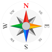
Compass Level & GPS
Take advantage of accurate andintegratedcompass, level and gps tools in one screen.For lovers of D.I.Y. and fans of self-assembling: this makes youanexpert in placing furniture, hanging up a shelf or frame.For tracking, hiking and camping fanatics: now you will never beoffcourse, always having the right position and direction.This tool is handy and very accurate - try it yourself!Advice: for a better accuracy, first calibrate once.✓ Compass Usage• Find and keep track of the right heading• Get information of your current position or atargetposition• Find your parked car through the target position feature.✓ Level Usage• Proper positioning of furniture• Straight installation of a shelf or a frame• Quickly level out your motor home or caravan✓ Features• Automatic horizontal and vertical level display• Choose Sound and/or Vibration when level• Manual compass and level calibration available• 'Hold / Release' button, for easy readout• Screen Capture: no notes, just copy• Sensor sensitivity and update-cycle adaptable• Powerful GPS feature: set target position, and find thedirectionand distance.✓ Remarks (Compass)• Sensor accuracy may differ depending on the device used• For better accuracy, keep away from magnetic fields andelectronicdevices.** Usermanual:http://lemonclip.blogspot.kr/2014/02/compass-level-user-manual.html• If you encounter any problem with this App or incorrectwording,please contact us via:- https://www.facebook.com/CompassLevel- [email protected]

Yandex.Navigator 14.2.0
Yandex.Navigator helps drivers plot theoptimalroute to their destination. The app takes traffic jams,accidents,road works, and other road events into account whenplotting yourroute. Yandex.Navigator will present you with up tothree variantsof your journey, starting with the fastest. If yourselected journeytakes you over toll roads, the app will warn youabout this inadvance.Yandex. Navigator uses voice prompts to guide you along yourway,and displays your route on your device’s screen. Additionally,youcan always see how many minutes and kilometers you havetogo.You can use your voice to interact with Yandex.Navigator so thatyoudon't have to take your hands off the wheel. Just say "Hey,Yandex"and the app will start listening for your commands. Forexample,"Hey, Yandex, let's go to 1 Lesnaya Street" or "Hey,Yandex, take meto Domodedovo Airport". You can also let Navigatorknow about roadevents you encounter (such as "Hey, Yandex, thereis an accident inthe right lane") or search for locations on themap (by simplysaying "Hey, Yandex, Red Square").Save time by choosing recent destinations from your history.Lookthrough your recent destinations and favorites from any ofyourdevices—they are saved in the cloud and available when andwhereyou need them.Yandex.Navigator will guide you to your destinations inRussia,Belarus, Kazakhstan, Ukraine, and Turkey.The app suggests enabling the Yandex search widget forthenotification panel.


Compass S8 (GPS Camera) 4.0.5
Compass with a photo camera is an interesting new appthatdetermines geographic direction and takes a photo in a waythatnever has been done before. With its light and easy set up youcanchoose a direction, direct to needed position save, share themandkeep in built in library. Besides standard map types you cantryother types such as Dark, Night Retro etc...

Compass 1.11
Compass is one of the most if not themostessential app every Android should have installed. Compass isthemost precise compass app on Google Play. Compass app is compassinyour pocket. Use it on camping trips, to navigate inunknownterritory or when you get lost. You never know when it mightcomehandy. It might even save your life one day!Compass is easy to use; just use it like a real compass. Compassappis more than just showing degrees and north, south, east andwest. Ihave designed Compass with user experience in mind, largenumbersand easy to read design. Compass also allows you to setyourdirections by rotating the bezel for easier andprofessionalnavigation.How to use?First we’ll need to cover a little bit of compass jargon first.Thepart of Compass that moves and always points north is calledthecard (with N,S,E, and W indicated, and a beveled edge with aseriesof numbers on it). There is a movable ring around the edge ofthecompass, called the bezel. A red double line across the top ofthecompass is called the lubber line, and finally, there is alittlewindow above the compass which is often named as side-window(as itis on the side of a real compass).Side-window navigation couldn’t be simpler. You point thelubberline on top of your compass at where you want to go. Now aslong asyou hold your compass flat in front of you with the lubberlinepointing in the direction you’re going, you should always seethesame number in your window as long as you’re going the rightway.If you see a different number, turn until you see thesamenumber.The downside of the side window method is that you need torememberyour number.Navigating with bezel works essentially the same as using thesidewindow, but your bezel remembers your number for you. All youdois, point the lubber line on top of your compass at where youwantto go, and then wait until the card settles down and stopsmoving.Then turn your bezel until the double triangle on the edgeof thebezel (the notch right by the number zero on the bezel)isbracketing the north arrow on the card. Now as long as youholdyour compass flat in front of you with the lubber line pointinginthe direction you’re going, you should always see the northarrowinside the notch, as long as you’re going the right way. Ifnot,turn until you see the north arrow inside the notch.Notice that if you’ve adjusted the bezel correctly, the numberinthe side window is also the number directly across from you atthefront end of the lubber line. In other words, if you turnedthebezel counterclockwise until the notch bracketed the northarrow,the 120 on the bezel would be at the far end of the lubberline.Notice that on the card, the number showing in the side windowis120. If you were holding this compass and going in the directionofthe lubber line, you’d be on a heading of 120.Now you should have learned how to go to desired direction. Buthowdo you get back? Easy! If you’re thinking in terms of thebezel,simply turn until the north arrow faces not to the notch, buttothe single triangle that’s exactly across from the notch.Nowyou’re pointed back where you came.The really tricky part of using your compass isn’t learning whatthenumbers mean and how to adjust the bezel. The most commonmistakesare not holding your compass flat, and not actually goingin thedirection your lubber line is pointing.Large iron and steel objects can influence the magnetic sensorinyour Android device, causing it to point in the wrongdirection.This is called deviation. If you suspect this ishappening, simplymove away from the object several feet and theproblem shouldcorrect itself.► Like us on Facebook: https://www.facebook.com/gammaplay/► Follow us on Twitter: https://twitter.com/GammaPlay


Latitude Longitude Location 3.2.3
Simple application to store GPS coordinates (Latitudeandlongitude),wherever you are. Automatic map rotation will guideyouin a veryintuitive way. If you have data connection will alsohavegoogle mapsto better situate. For proper operation musthaveconnected the GPS,and should be on the outside. Thisapplicationallows you to: - Saveyour location - Save GPScoordinates - Savelatitude and longitude ofa point on google maps- Edit the GPS(latitude and longitude)coordinates previouslystored - Skip toany point gps google mapspreviously saved -Guiarte via googlemaps - Mark coordinates(Latitude Longitude)location on googlemaps before you go to yourdestination - Getlocation (latitude andlongitude) - Choose theunits you prefer -Share your location -Approximation to point gpsUse it to findpoints in the city or inthe mountains, to go point topoint.Examples of use: - Save GPScoordinates for your hotel. - Findwhereyou parked the car throughgoogle maps - Save GPS coordinatesyourfavorite fishing spots -Save the GPS coordinates of yourfavoritehunting spots - Findmushrooms and save your coordinates. -Planlocations (LatitudeLongitude) of interest that you want tovisitbefore you leavehome. - Saves GPS (Latitude Longitude)coordinatesof your currentposition. - Save your location anywhere -Share yourGPScoordinates (Latitude and Longitude) - Send theGPS(LatitudeLongitude) coordinates to google maps - Shareyourlocation withyour friends Get the most out of your GPS.Configuretheapplication to your liking. Change the defaultlevelofapproximation of the maps, select the format of theGPScoordinatesand states that want to use the metric system.


Compass for Android - App Free 1.7.1
** No. 1 app in Travel & Local category in American**Compassfor Android - Smart Compass App Free for Android Tousethisapplication, your device must have a compass sensor How touse:-Keep your phone parallel to the ground and turned towardtheredarrow that you want to define - Compass willdisplayon-screendirections and degrees. *** Keep the device awayfrommetalobjects, machinery and where high magnetic field toavoidfalseresults Applications compass, digital compass to helpyoudeterminethe direction quickly and accurately. * note: Yourmobiledevicemust have a compass sensor can use this application. Nisnorth Sis the South E is east W is the West NE is North-East SEistheSoutheast SW is southwest NW is northwest. Vote and commentforAppcompass :) Update: - ver 1.2.1: Update Choose Theme DarkorThemeLight - ver 1.2.2 : Fix error when rotate screen - Ver1.3:+Compass run smoother. + Use the compass s fault does notworkonsome models of China, + Tester with digital compass sensor ornot+Change the look and better logo + Optional interfaceslight,dark,arrows * Best support devices : Compass forsamsung,galaxy,xiaomi, redmi, huawei, motorola, nokia, sony, vivo,oppo,oneplus,asus, blackberry, mi....

Speedometer GPS 4.070
Speedometer GPS can trackyourspeed,distance,time,location and also can get starttime,timeelapsed,avg speed,max speed,altitude...Features included- Save your track info.- Switch between car speedometer and bicycle odometer.- mph,km/h,knot.- Display satellites status.- Speed chart.- Map integration,get your location.……Facebook:https://www.facebook.com/SpeedometerGPSIf you have a translation suggestions, please contact me![email protected]

GPS Essentials
The most complete GPS tool available:Navigate,manage waypoints, tracks, routes, build your owndashboard from 45widgets.❧❧❧❧❧ Dashboard ❧❧❧❧❧Shows navigation values such as: Accuracy, Altitude, Speed,Battery,Bearing, Climb, Course, Date, Declination, Distance, ETA,Latitude,Longitude, Max Speed, Min Speed, Actual Speed, TrueSpeed, Sunrise,Sunset, Moonset, Moonrise, Moon Phase, Target,Time, TTG,Turn.❧❧❧❧❧ Compass ❧❧❧❧❧Show the orientation of the earth's magnetic field, showsanarbitrary tracking angle and the current target. Also amarineorienteering compass.❧❧❧❧❧ Tracks ❧❧❧❧❧Record tracks and view them on map. Export KML files and importintoGoogle Maps, Google Earth and others.❧❧❧❧❧ Routes ❧❧❧❧❧Manage routes and view them on map. Import KML files fromGoogleMaps, Google Earth and others. Create turn-by-turninstructionsbetween waypoints.❧❧❧❧❧ Camera ❧❧❧❧❧A camera HUD (heads-up display) view to show your waypoints,takepictures and share them.❧❧❧❧❧ Map ❧❧❧❧❧A map to show your waypoints. Convert mail addresses ofyourcontacts to waypoint so that they can be used within theapp.Supports Google Maps, MapQuest, OpenStreetMap and others.Supports Google Maps v2: Indoor Maps, Traffic, Buildings,Satelliteand Terrain layers and map rotation.❧❧❧❧❧ Waypoints ❧❧❧❧❧A list of all your waypoints with export and import (KML, KMZ,GPXand LOC format).❧❧❧❧❧ Satellites ❧❧❧❧❧A sky view of the current positions that shows satellitesinview.❧❧❧❧❧ Features ❧❧❧❧❧Supported position formats: UTM, MGRS, OSGB,Degree-Minute-Second,Degree-Minute-Fractions, Decimal, Mils.Supports over 230datums.Waypoints, routes and tracks can be exported as KML or GPX filesandsent by email or uploaded to Google Docs or DropBox.Please open the web page below for more info, send me emailsforsupport. I CANNOT HELP IF YOU SIMPLY PLACE A COMMENT HERE.Purchase the "GPS Essentials Donation Plugin" on Android Marketifyou want to support development.The latest beta release is available athttp://www.gpsessentials.comfor download. Try out the latestfeatures and help us improve GPSEssentials!If you are on Facebook, come and join GPS Essentials for thelatestinfo: http://www.gpsessentials.comTHIS APP WILL SHOW ADVERTISING. IF YOU DON'T LIKE THIS,PLEASEREFRAIN FROM INSTALLING/UPDATING.GPS Essentials is not affiliated with any political party norwithany other organization mentioned in the ads, and it hasnoconnection with any economic interests. If you don't like theads,please contact AdMob.WHAT ARE THE PERMISSIONS GOOD FOR?✓ Coarse/Fine location: To access network locations and GPS✓ Full internet access: To read map tiles, send bug reports✓ Modify/delete USB storage contents: To write waypoints, tracksandimages onto the SD card✓ Read phone state and identity: To tag pictures with the deviceID(can be switched off in settings)✓ Take pictures and videos: Camera HUD, take pictures✓ Your accounts: Required to run Google Maps v2

AlpineQuest GPS Hiking (Lite) 2.2.8b
AlpineQuest Lite is the free solutionforall outdoor activities and sports, including hiking,running,trailing, hunting, sailing, geocaching, off-road navigationandmuch more.You can access and store locally a large range ofon-linetopographic maps, which will remain available evenwhile beingout of cell coverage. AlpineQuest also supportson-board filebased maps, like MemoryMap(c) maps.By using the GPS and the magnetic sensor of your device(withcompass display), getting lost is part of the past: youarelocalized in real-time on the map, which can alsobeoriented to match where you are looking at.By staying fully operational out of cell coverage (as ofteninmountain or abroad), AlpineQuest assists you in all your desiresofdeep wilderness exploring...Don't hesitate, use it right now for free!PLEASE report suggestions and issues on our dedicatedforumhttp://www.alpinequest.net/forum (no registration needed,allquestions answered) and not in comments.Key features (for the full/paid version) are:★★ Maps ★★• Built-in online maps (with automatic localstorage;road, topo and satellite maps included);• Built-in online layers (road names andhillsshading);• Get more online maps and layers in one click from theincludedcommunity map list (Nokia maps, Yahoo! Maps, local topomaps,...);• Complete area storage of online maps foroff-lineuse;• On-board offline maps support (visit our website to getthefree map creator MOBAC);• Memory-Map support (QuickChart .QCT maps only, .QC3mapsnot compatible, test your maps using the free Liteversionfirst);• Multiple maps in layers display, with per-mapopacitycontrol;• Advanced SD memory card Map Explorer and Scanner.★★ Landmarks ★★• Create, display, save, restore unlimited number ofwaypoints,routes, areas and tracks;• Import/export GPX files, Google Earth KML/KMZfiles,CSV/TSV files;• Support OziExplorer WPT and GeocachingLOCwaypoints;• Save and share online locations with other users usingCommunityLandmarks;• Details, advanced statistics and interactive graphics onvariousitems;• Time Controller to replay time-tagged tracks;• Routes, tracks and areas creator;• Advanced SD memory card Landmarks Explorer.★★ GPS Position / Orientation ★★• On-map geolocation using GPS or Network;• Map orientation, compass and target finder;• Built-in GPS/Barometric track recorder (longtrackingcapable, running in a separate and light process);• Proximity alerts and leave path alerts;• Barometer support (for compatible devices).★★ And more: ★★• Metric, imperial and hybrid distance units;• GPS Latitude/Longitude and grid coordinate formats (UTM,MGRS,USNG, OSGB, Irish Grid, Swiss Grid, Lambert Grids, DFCI Grid,QTHMaidenhead Locator System, ...);• Ability to import hundreds of coordinate formatsfromhttp://www.spatialreference.org;• On-map grids display;• Full screen map view;• Multi-touch zoom;• ...About the "Phone state and identity" Android permission: due tothebackward compatibility of AlpineQuest with Android 1.5,thispermission is automatically added by Google Play.


All-In-One Offline Maps 3.6c
All-In-One OfflineMaps offers you toaccessa wide range of maps for free.Bored to wait for maps to display? Once displayed, mapsarestored and remain available, quickly, even with nonetworkaccess.• Want more than just roads on your maps? You will findwhatyou need here;• Used to go to places with poor network coverage?Everythingwill stay available;• Used to go abroad? You won't be lost anymore;• Have a data allowance limit? It will reduceyourusage.★★ Maps ★★A lot of maps are available, including classical roadmaps,topographic maps, aerial (satellite) maps and various layersthatcan be added over any maps: OpenStreetMap (Roads, Topo),GoogleMaps, Bing Maps, USGS National Map (Hi-res topo, Aerialimagery),Worldwide Military Soviet topo maps, etc.• All maps can be stacked in layers, with preciseopacitycontrol.• Select and store large areas in few clicks.• Stored space is clear and can be easily deleted.★★ Display, store and retrieve unlimited landmarks ★★You can add various items on the map such as waypoints,icons,routes, areas and tracks.You can easily manage them using the powerful SD-CardLandmarksExplorer.★★ On-map GPS Location & Orientation ★★Your real location and direction are clearly displayed on themap,which can be rotated to match your real orientation (dependsondevice capabilities).Easy turn on/off to save battery.And also:• Metric, imperial and hybrid distance units;• GPS Latitude/Longitude and grid coordinate formats (UTM,MGRS,USNG, OSGB Grid, Irish Grid, Swiss Grid, Lambert Grids, DFCIGrid,QTH Maidenhead Locator System, ...);• Ability to import hundreds of coordinate formatsfromhttp://www.spatialreference.org;• On-map grids display;• Full screen map view;• Multi-touch zoom;• ...★★ Need more? ★★If you are a real adventurer, try AlpineQuest GPS Hiking,thecomplete outdoor solution based on All-In-One OfflineMaps,loadedwith a powerful GPS Location Tracker andmore:http://www.alpinequest.net/google-play


Ulysse Speedometer 1.9.101
ULYSSE SPEEDOMETER—the ultimate advancedGPS*tool that is not only a high-precision GPS* Speedometer,displayingnot only the current speed (analog or digital) but alsopacking inmany other exciting features.As a part of our Ulysse community, you’ll find itsfunctionalityindispensable. To discover further what’s packed intoour tool,visit:www.binary-toys.chwww.facebook.com/UlysseGpsSpeedometerAt binarytoys Lab, we listen to our users and areconstantlyintegrating your feature requests—Ulysse is not onlybuilt by us,but also by you, our Ulyssers!How about:★ Overlays—display important speed/direction/time info overyourother installed apps★ Trip Computer—record the current, yesterday’s, today’s,week’s,month’s journeys★ Track recorder—trace your journey and export to SD and/oremail**as GPX or Google Earth KML format★ Multiple profiles: for every car, bike, velo,walking,skiing★ Music Controller**—control your installed musicplayerdirectly★ HUD—a Head-Up Display for your windshield★ GPS Altimeter★ GPS Compass★ Latitude/longitude display**★ Settings km/h, mph, knots; miles/feet, kilometers,nauticalmiles★ Maximum displayed speeds: 1900 km/h / 1160 mph / 1000knots!★ Racing meter—measure acceleration times: 0-100 km/h, 0-60 mphandfor 1/4 mile.★ Average speed indicator★ Switchboard – menu system providing easy setting changesoffunctions – simply tap the main speedometer dialforactivation★ Three shortcut pages—Application, Communication, Navigation; foratotal 36 user-defined application shortcuts★ Speed limits’ warnings (‘Speed Edge’) – define audio andvisualspeed alarms★ App quickstart—assign other installed apps and called in justtwotaps★ Customizable UI colors—are 16 million colors enough?★ Current battery status info—charge, temperature★ Car dock support—application automatically starts and exitsondocking and undocking★ Run the speedometer in background mode—show speed discretelyinthe status bar and even gives visual notification forspeedlimits***★ Binarytoys’ Customer support second-to-none… take a look atourreviews!But don’t limit Ulysse to just your automobile!Imagine accessing all the features mentioned via virtually anymeansof transport.Whether traveling by van, truck, bus, motorbike, bike,horse,unicycle, Segway, plane, helicopter, foot, camel, taxi,rickshaw,skateboard, train, boat, hang-gliding or paragliding(etc.)—youwill find a useful use for Ulysse!We Love our Ulyssers – And They Love Ulysse!We are fully dedicated to our user base – with its millions ofloyalworldwide users, we are constantly building on this successtoguarantee that Ulysse remains on pole position now and inthefuture.You don’t have to take our word for it, read what some of thetopnames in the business are saying:"Poetry in motion"—AndroidPit.com"Most advanced Speedometer App"—AppEggs.com"this virtual dashboard has been aprovenlifesaver"—complex.com"...enter Ulysse Speedometer to save me"—RichardDevine,AndroidCentral"Accurate, visually appealing and informativespeedometerapplication"—Crackberry.comHave we forgotten something? Visit our homepage and send usacomment.Would you like to see Ulysse translated into your ownlanguage?Contact us today at [email protected] to find out howor join uson http://crowdin.net/project/ulysse-speedometerPLEASE NOTE: The app contains Ads – but an Ad-free paid(Pro)version is available.*Dependent on phone hardware** Pro version***In the case of system overloading, a small lag is possibleKnown limitation - trip distance may have 2-3% deviation fromcar'sodometer dataLook to ulysse.ibolt.co for a new car-dock for your phone!

GPS Speedometer - Trip Meter, Speed Tracker On Map 1.1.7
GPS Speedometer is an advanced speedometer application that usesthephone's built-in GPS system to show your current and maximumspeed.Suitable for car driving and biking. The speed is display inbothanalog and a digital value. It acts as a normal digital andanalogSpeedometer, which you may find in any car that showing thevelocityof the vehicle in kph and mph. Its best application forbrokenSpeedometer of car or not working then download this app andenjoyyour speedometer . We tries best to make all readings asaccurate aspossible, but the accuracy also depends on yourdevice's GPS sensorand should only be treated as approximations.You can use this appas GPS Odometer with bike Smartphone holderand anything else,especially HUD (Head Up Display) with your car.You can track yourspeed with our GPS Speedometer App. Features: 1Easy to UseSpeedometer GPS. 2 Simple interface and smoothfunctionalitiesodometer. 3 Precise speed and attractive display. 4No internetaccess necessary 5 Digital and Analog speedometer. 6Simple andquick in action Speedometer 7 The speed can be displayedin one ofthree different units: (km/h), (mph) or knot 8 Speed isdisplayedboth with an analog gauge and as a digital value 9 Youcan changethis scale any time on the move.