Top 50 Apps Similar to GPS Status & Toolbox

GPS status 1.2.4
This application is a set of several tools that we collectedforyouin one complete application where through it you can: 1-Knowthelocation of satellites in space compared to your location,thislocation are Illustrated on a compass in different forms(gpsinacircle form,glonass in the form of a triangle and otherformsforthe other satellites......) this forms are coloredaccordingtosignal strength.You can also display and hide what youwant.2-Graphic columns which present the signal strength ofsatellites.3-Know the location of the sun and the moon in the skycomparedtoyour location . 4- Sunrise and sunset and disappearing.5-Compass6- The location *Your location in theformofcoordinates(Longitude, latitude and altitude). *Yourlocationinthe form of address (city, country). *You can displayyourlocationon Google Maps *You can share your location *You cansendthe trackto you 7- AGPS service that Accelerates The process ofGPSreformand detects location. 8- Calculation of speed 9- Knowallthedirections according to the magnetic North which is obtainedbythesensors of your device. 10- Know all the directionsaccordingtothe true north which is calculated by the internetnetwork ortheGPS(GLOBAL POSITIONING SYSTEM). 11- Know all thedirectionswiththe GPS compass via the GPS world localizationsystem. 12- Knowthepower of the magnetic field to know if there areoverlaps ornot.Permissions needed: *The location: We need this toshowyourlocation or re-determine location *Internet: used to getAGPSdata


GPS Essentials
The most complete GPS tool available:Navigate,manage waypoints, tracks, routes, build your owndashboard from 45widgets.❧❧❧❧❧ Dashboard ❧❧❧❧❧Shows navigation values such as: Accuracy, Altitude, Speed,Battery,Bearing, Climb, Course, Date, Declination, Distance, ETA,Latitude,Longitude, Max Speed, Min Speed, Actual Speed, TrueSpeed, Sunrise,Sunset, Moonset, Moonrise, Moon Phase, Target,Time, TTG,Turn.❧❧❧❧❧ Compass ❧❧❧❧❧Show the orientation of the earth's magnetic field, showsanarbitrary tracking angle and the current target. Also amarineorienteering compass.❧❧❧❧❧ Tracks ❧❧❧❧❧Record tracks and view them on map. Export KML files and importintoGoogle Maps, Google Earth and others.❧❧❧❧❧ Routes ❧❧❧❧❧Manage routes and view them on map. Import KML files fromGoogleMaps, Google Earth and others. Create turn-by-turninstructionsbetween waypoints.❧❧❧❧❧ Camera ❧❧❧❧❧A camera HUD (heads-up display) view to show your waypoints,takepictures and share them.❧❧❧❧❧ Map ❧❧❧❧❧A map to show your waypoints. Convert mail addresses ofyourcontacts to waypoint so that they can be used within theapp.Supports Google Maps, MapQuest, OpenStreetMap and others.Supports Google Maps v2: Indoor Maps, Traffic, Buildings,Satelliteand Terrain layers and map rotation.❧❧❧❧❧ Waypoints ❧❧❧❧❧A list of all your waypoints with export and import (KML, KMZ,GPXand LOC format).❧❧❧❧❧ Satellites ❧❧❧❧❧A sky view of the current positions that shows satellitesinview.❧❧❧❧❧ Features ❧❧❧❧❧Supported position formats: UTM, MGRS, OSGB,Degree-Minute-Second,Degree-Minute-Fractions, Decimal, Mils.Supports over 230datums.Waypoints, routes and tracks can be exported as KML or GPX filesandsent by email or uploaded to Google Docs or DropBox.Please open the web page below for more info, send me emailsforsupport. I CANNOT HELP IF YOU SIMPLY PLACE A COMMENT HERE.Purchase the "GPS Essentials Donation Plugin" on Android Marketifyou want to support development.The latest beta release is available athttp://www.gpsessentials.comfor download. Try out the latestfeatures and help us improve GPSEssentials!If you are on Facebook, come and join GPS Essentials for thelatestinfo: http://www.gpsessentials.comTHIS APP WILL SHOW ADVERTISING. IF YOU DON'T LIKE THIS,PLEASEREFRAIN FROM INSTALLING/UPDATING.GPS Essentials is not affiliated with any political party norwithany other organization mentioned in the ads, and it hasnoconnection with any economic interests. If you don't like theads,please contact AdMob.WHAT ARE THE PERMISSIONS GOOD FOR?✓ Coarse/Fine location: To access network locations and GPS✓ Full internet access: To read map tiles, send bug reports✓ Modify/delete USB storage contents: To write waypoints, tracksandimages onto the SD card✓ Read phone state and identity: To tag pictures with the deviceID(can be switched off in settings)✓ Take pictures and videos: Camera HUD, take pictures✓ Your accounts: Required to run Google Maps v2


GPSTest
GPS Test displays real-time informationforsatellites in view of your device. A vital open-source testtoolfor platform engineers, developers, and power users, GPS Testcanalso assist users in understanding why their GPS/GNSS is orisn'tworking.Start/stop monitoring via the on/off switch. After a latitudeandlongitude has been acquired, you can share your location usingtheShare button.Supports:• GPS (USA Navstar)• GLONASS (Russia)• QZSS (Japan)• BeiDou/COMPASS (China)• Galileo (European Union)GLONASS satellites are shown as squares on the Sky view,U.S.NAVSTAR satellites are shown as circles, Galileo andQZSSsatellites are shown as triangles, and BeiDou satellites areshownas pentagons.Menu options:• Inject Time - Injects Time assistance data for GPS intotheplatform, using information from a Network Time Protocol(NTP)server• Inject XTRA Data - Injects XTRA assistance data for GPS intotheplatform, using information from a XTRA server(seehttp://goo.gl/3RjWX for details on gpsOneXTRA)• Clear Aiding Data - Clears all assistance data used forGPS,including NTP and XTRA data (Note: if you select this option tofixbroken GPS on your device, for GPS to work again you may needto‘Inject Time’ and ‘Inject XTRA’ data)• Settings - Change map tile type, auto-start GPS onstartup,minimum time and distance between GPS updates, keepscreenon.Beta versions:https://play.google.com/apps/testing/com.android.gpstestOpen-source on Github:https://github.com/barbeau/gpstest/wikiFAQ:https://github.com/barbeau/gpstest/wiki/Frequently-Asked-Questions-(FAQ)GPSTest discussion forum:https://groups.google.com/forum/#!forum/gpstest_androidNostalgic for old releases? Don't have Google Play Services onyourdevice? Download old versions here:https://github.com/barbeau/gpstest/wiki/Release-NotesIf you want to see the map on the Map tab, you'll need toinstallGoogle Play Services.-----------------------------------Want to measure the *true* accuracy of your GPS?Check out GPS Benchmark:https://play.google.com/store/apps/details?id=com.gpsbenchmark.android

Ultra GPS Logger Lite 3.182b
This lite version of Ultra GPS Loggerallowsyou to test core functionality for up to one week.If you want to continue using the app after one week or if youwantto unlock all features youneed to purchase the full version. The following options are only available in the full version:Online Services Publish via UOS/WebPublish via FTPPublish to Dropbox, OneDrive, GoogleDriveMerge logsAutomatically send/publish logsProcess multiple log formats at onceUltra GPS Logger is a GPS Tracker which allows you to generateNMEA,KML and/or GPX logs with your GPS or GLONASS enabled Androiddevice.It is able to keep GPS on during standby, which enableslogging of along period of time without the need of interactionwith thedevice.Ultra GPS Logger logs raw NMEA sentences! This is much moreaccuratethan other products which just log every minute... It alsosupportsintelligent KML/GPX output, which logs only real movement.Ultra GPSLogger also lets your device vibrate and flash its led incase theGPS fix is lost. Furthermore it represents your track onGoogle Mapor Open Street Map!User feedback is highly appreciated. Ultra GPS Logger is used foravariety of activities, like hiking, sailing, car / motorcycle/yacht racing or geotagging. Let me know what you use UltraGPSLogger for :-))Features:- formats: NMEA, KML, GPX, CSV- log raw, by distance or time- log during standby- AutoLog, AutoStart- Send log / track by email- Publish to FTP- Compress log: Zip, KMZ- Google Maps, Open Street Map- POIs, etc- Online Services- Dropbox, OneDrive, Google Drive- Barometer / pressure sensor- use of internal GPS- use of external GPS via Bluetooth- allow other apps to use external GPS via Mock provider- act as GPS mouseQuick Start Guide: http://ugl.flashlight.de/QuickStartUser Guide (PDF): http://ugl.flashlight.de/UserGuide


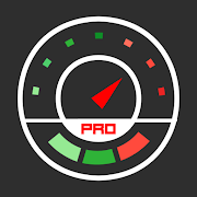
Speedometer GPS Pro 4.070
This is Speedometer GPS Pro version. You can try this freeversion:https://play.google.com/store/apps/details?id=luo.speedometergpsThisapp can track your speed,distance,time,location and also cangetstart time,time elapsed,avg speed,max speed,altitude...Featuresincluded - Save your track info. - Switch between carspeedometerand bike cyclometer. - mph,knot and km/h mode. -Display satellitesstatus. - Speed chart. - Map integration,getyour location. ……Facebook:https://www.facebook.com/SpeedometerGPSIf you have atranslation suggestions, please contactme![email protected]


Speed View GPS Pro 2.040
Speed View GPS can track your speed,distance,time,location andalsocan get start time,time elapsed,avg speed,maxspeed,altitude...Features included - Save your track info. - Switchbetween carspeedometer and bike cyclometer. - mph,knot and km/hmode. - Mapintegration,get your location. - 16 color styles.……Facebook:https://www.facebook.com/SpeedometerGPS If you haveatranslation suggestions, please contactme![email protected]

Navmii GPS World (Navfree) 3.7.22
Navmii is a free navigation and traffic appfordrivers.Navmii combines FREE voice-guided navigation, livetrafficinformation, local search, points of interest and driverscores.Offline maps stored locally, for use without aninternetconnection. Over 24 million drivers use Navmii and our mapsareavailable for more than 150 countries.• Real voice-guided navigation• Real-time traffic and road information• Works with GPS only – internet not needed• Offline and Online Address search• Driver Scoring• Local Place search (powered by TripAdvisor, FoursquareandWhat3Words)• Fast routing• Automatic rerouting• Search using Postcode/ City/ Street/ Points of interest• Heads-Up Display (HUD) – upgrade• Community map reporting• HD accurate maps• + Much, much moreWe have thousands of 5-STAR REVIEWS:- why buy a satnav when navmii does it all- unbeatable value and functionality- love, love this app!Navmii features on-board OpenStreetMap (OSM) maps, which arestoredon your device and therefore you don’t need no dataconnection(unless of course you use the connected services). UseNavmiiabroad to avoid high roaming costs!We're always eager to hear about your experience of usingNavmii.You can contact us anytime by email, on Twitter or Facebookusingthe details below:- Twitter: @NavmiiSupport- Email: [email protected] Facebook: www.facebook.com/navmiigpsNote: continued use of GPS running in the backgroundcandramatically decrease battery life.


Digital Dashboard GPS Pro 4.033
This is Digital Dashboard GPS Pro version. You can try thisdemoversion:https://play.google.com/store/apps/details?id=luo.digitaldashboardgpsFeaturesincluded - Save your track info,Record gpx file(it will besaved in"sdcard/DigitalDashboardGPSPro/gpx/"). - Switch betweencarspeedometer and bike cyclometer. - Switch between mph or km/hmode.- Display satellites status. - Map integration,get yourlocation. ……Facebook:https://www.facebook.com/SpeedometerGPS


Maps & GPS Navigation OsmAnd+
OsmAnd+ (OSM Automated NavigationDirections)is a map and navigation application with access to thefree,worldwide, and high-quality OpenStreetMap (OSM) data.Enjoy voice and optical navigation, viewing POIs (pointsofinterest), creating and managing GPX tracks, using contourlinesvisualization and altitude info, a choice between driving,cycling,pedestrian modes, OSM editing and much more.OsmAnd+ is the paid application version. By buying it, yousupportthe project, fund the development of new features, andreceive thelatest updates.Some of the main features:Navigation• Works online (fast) or offline (no roaming charges when youareabroad)• Turn-by-turn voice guidance (recorded andsynthesizedvoices)• Optional lane guidance, street name display, and estimated timeofarrival• Supports intermediate points on your itinerary• Automatic re-routing whenever you deviate from the route• Search for places by address, by type (e.g.: restaurant,hotel,gas station, museum), or by geographical coordinatesMap Viewing• Display your position and orientation• Optionally align the picture according to compass oryourdirection of motion• Save your most important places as Favorites• Display POIs (point of interests) around you• Display specialized online tiles, satellite view (fromBing),different overlays like touring/navigation GPX tracksandadditional layers with customizable transparency• Optionally display place names in English, local, orphoneticspellingOnly this week 50% OFFUse OSM and Wikipedia Data• High-quality information from the best collaborative projectsofthe world• OSM data available per country or region• Wikipedia POIs, great for sightseeing• Unlimited free downloads, directly from the app• Compact offline vector maps updated at least once a month• Selection between complete region data and just roadnetwork(Example: All of Japan is 700 MB or 200 MB for the roadnetworkonly)Safety Features• Optional automated day/night view switching• Optional speed limit display, with reminder if you exceedit• Optional speed-dependent zooming• Share your location so that your friends can find youBicycle and Pedestrian Features• Viewing foot, hiking, and bike paths, great foroutdooractivities• Special routing and display modes for bike and pedestrian• Optional public transport stops (bus, tram, train) includinglinenames• Optional trip recording to local GPX file or online service• Optional speed and altitude display• Display of contour lines and hill-shading (viaadditionalplugin)Directly Contribute to OSM• Report data bugs• Upload GPX tracks to OSM directly from the app• Add POIs and directly upload them to OSM (or laterifoffline)• Optional trip recording also in background mode (while deviceisin sleep mode)OsmAnd is open-source and actively being developed. Everyonecancontribute to the application by reporting bugs,improvingtranslations or coding new features. The project is in alivelystate of continuous improvement by all these forms ofdeveloper anduser interaction. The project progress also relies onfinancialcontributions to fund coding and testing ofnewfunctionalities.Approximate map coverage and quality:• Western Europe: ****• Eastern Europe: ***• Russia: ***• North America: ***• South America: **• Asia: **• Japan & Korea: ***• Middle East: **• Africa: **• Antarctica: *Most countries around the globe available as downloads!From Afghanistan to Zimbabwe, from Australia to the USA.Argentina,Brazil, Canada, France, Germany, Mexico, UK, Spain,...


Altimeter Ler Live Gps Geotracker 2.6
Modern Altimeter GPS+ app is for folks who care for hikingandbikingin mountainous terrain. GPS is getting very accurateinterms ofdistance indication. The choice between unit systemisperhaps animportant thing, just for your convenience the appisbeing equippedwith both of them (Imperial andMetric).Surprisingly strongbarometer measures the weight of theairpressure above a given pointand determines elevation oftwopoints. This app has a creativeand user-friendlystyledesign, simple and comprehensivefunctionalities. Featuresincluded- Imperial and Metric unitsettings. - GPS accuracyindicator. -GPS distance accuracyindicator. - Density of air ,indicator.Search any place and dropsearch pin with place info.Built inlibrary Map integration - GOOGLEmaps - Satellite mapsmode. -Hybrid maps mode. - Standard maps mode.- Terrain maps mode.-Tracking location changes trajectory. Compass- Compass withcamera- Take a pictures with coordinates - Showsdevicereal-timeorientation to magnetic fields. - Ability toswitchbetween trueand magnetic North. - Location coordinates(longitude,latitude). -Course Track information - Time elapsed. -Distance. -Averagespeed. - Max speed. - Altitude. Tracking - Speedtracking inmph orkm/h based on MPH or KM/H mode. - Distancetracking in milesorkilometers based on MPH or KM/H mode. - Timetracking. -Longitude,latitude coordinates. - Save locations drop apinWeather --Temperature information. -- Wind --Visibility--Sunrise,Sunset -- High/Low Temperature. --Abilitytoswitch between Celsius and Fahrenheit.

X-GPS Monitor 2.10.4
View your assets connected to GPS tracking platformusingyousmartphone or tablet: * Real time assets location on themap *Showtracks and events on the map for any period in the past *Findyourlocation in relation to your tracking assets *Notificationsaboutgeo-related events you defined * Map view change:streetsandsatellite view * Current account balance IMPORTANTNOTICE:Tolaunch the App you will need your personal account inpreferredGPStracking service. The App works with many services.Pleaseobtainan account from your GPS tracking service provider.

BackCountry Nav Topo Maps GPS
Use your Android as an offroad topo mappingGPSwith the bestselling outdoor navigation app for Android! TrythisDEMO to see if it is right for you, then upgrade to thepaidversion.Use offline topo maps and GPS on hike trails without cellservice!The GPS in your Android phone can get its position fromsatellites,and you don’t have to rely on your data plan to getmaps. Have morefun and safe GPS adventures in thebackcountry.Preload FREE offline topo maps, aerial photos, and road maps onyourstorage memory, so they are ready when you need them.Add custom GPS waypoints in longitude and latitude, UTM or MGRSgridreference. Import GPS waypoints from GPX files. Choose iconsforwaypoints much like in MapSource. (This app uses the WGS84datum,NAD27 is available in settings).Use GPS for hunting a waypoint or geocache, for recording tracksandGPS waypoints on your trip, all the while tracking your questontopographic maps.About topo (topographic) maps: Topo maps show terrain throughcolorand contours, and are useful for navigation offroad. Topo mapsandGPS can be used for hiking, hunting, kayaking, snowshoeing,&backpacker trails.The app has many built in map sources and allows you to createyourown maps with Mobile Atlas Creator. Built in sourcesinclude:OpenStreetMaps and NASA landsat data worldwide.OpenCyle Maps are topo maps that show terrain worldwide.USGS Color Aerial photography.Topographic Maps of Spain and Italy.Outdoor maps of Germany and AustriaTopo maps of New ZealandHere are some of the outdoor GPS activities BackCountryNavigatorhas been used for:Hiking both on hiking trails and off trail.Camping, to find the perfect camping site or the way backtocamp.Hunting trips for hunting wild game in rugged areas, includingreconfor the hunt.Bait fishing or fly fishing with a buddy.Search and Rescue (SAR) with GPS.Kayak and canoe trips on inland lakes and streams or marine,coastalwaters.Backpacker trips: using topo maps of wilderness areas andnationalforests to navigate on trails with the GPS.Snow adventures including snowmobiling, skiing (alpine orcrosscountry) and snowshoeing. Create a memory. Map it out.This a great addition to the outdoor gear you bought atCabelas,REI, or another outdoor store. Your android phone couldsubstitutefor a Garmin or Magellan outdoor handheld GPS! Youstorage hasmemory for maps.Find your own ways to have fun in the outdoors. Be a maverickbyventuring into new territory beyond cell service boundaries.Becomea pro at navigation with GPS.BackCountry Navigator has been previously available on WMdevicesand preloaded on the Trimble Nomad outdoor rugged device.ThisAndroid version is more flexible, featured, and fun.


GPS Speed Pro 4.033
This is GPS Speed Pro version. You can try this demoversion:https://play.google.com/store/apps/details?id=luo.gpsspeedLanguagesupport:English\简体中文\繁體中文\Deutsch\Français\Pусский\Português\Nederlands\Italiano\Magyar\Polskie\العربيةGPSSpeed can track your speed,distance,time,location and also cangetstart time,time elapsed,avg speed,max speed,altitude...Featuresincluded - Save your track info. - Switch between analogand digitalspeedometer - Switch between mph or km/h mode. -Display satellitesstatus. - Speed chart. - Map integration,getyour location. ……Facebook:https://www.facebook.com/SpeedometerGPS

Thunder GPS Speedometer 2.4.10
Thunder Speedometer provides several stylish super carthemedspeedometers using GPS speed, showing data in a tidycleanclustered designs. Suitable for all kinds of vehicles. •Rotateyour device to switch Thunder Speedometer to landscape orportraitwithout any settings. • Swipe to change the dashboardtheme. •Multiple free themes. • Odometer for tracking milage. •Embeddedcompass for navigation. • HUD (Heads Up Display)speedometer. •Speed trip efficiency, based on a 90kph/55mph caroptimum speed.All that with no ads, as we value your safety morethan revenue.
