Top 50 Apps Similar to Sunrise Sunset Watch Face

BackCountry Nav Topo Maps GPS
Use your Android as an offroad topo mappingGPSwith the bestselling outdoor navigation app for Android! TrythisDEMO to see if it is right for you, then upgrade to thepaidversion.Use offline topo maps and GPS on hike trails without cellservice!The GPS in your Android phone can get its position fromsatellites,and you don’t have to rely on your data plan to getmaps. Have morefun and safe GPS adventures in thebackcountry.Preload FREE offline topo maps, aerial photos, and road maps onyourstorage memory, so they are ready when you need them.Add custom GPS waypoints in longitude and latitude, UTM or MGRSgridreference. Import GPS waypoints from GPX files. Choose iconsforwaypoints much like in MapSource. (This app uses the WGS84datum,NAD27 is available in settings).Use GPS for hunting a waypoint or geocache, for recording tracksandGPS waypoints on your trip, all the while tracking your questontopographic maps.About topo (topographic) maps: Topo maps show terrain throughcolorand contours, and are useful for navigation offroad. Topo mapsandGPS can be used for hiking, hunting, kayaking, snowshoeing,&backpacker trails.The app has many built in map sources and allows you to createyourown maps with Mobile Atlas Creator. Built in sourcesinclude:OpenStreetMaps and NASA landsat data worldwide.OpenCyle Maps are topo maps that show terrain worldwide.USGS Color Aerial photography.Topographic Maps of Spain and Italy.Outdoor maps of Germany and AustriaTopo maps of New ZealandHere are some of the outdoor GPS activities BackCountryNavigatorhas been used for:Hiking both on hiking trails and off trail.Camping, to find the perfect camping site or the way backtocamp.Hunting trips for hunting wild game in rugged areas, includingreconfor the hunt.Bait fishing or fly fishing with a buddy.Search and Rescue (SAR) with GPS.Kayak and canoe trips on inland lakes and streams or marine,coastalwaters.Backpacker trips: using topo maps of wilderness areas andnationalforests to navigate on trails with the GPS.Snow adventures including snowmobiling, skiing (alpine orcrosscountry) and snowshoeing. Create a memory. Map it out.This a great addition to the outdoor gear you bought atCabelas,REI, or another outdoor store. Your android phone couldsubstitutefor a Garmin or Magellan outdoor handheld GPS! Youstorage hasmemory for maps.Find your own ways to have fun in the outdoors. Be a maverickbyventuring into new territory beyond cell service boundaries.Becomea pro at navigation with GPS.BackCountry Navigator has been previously available on WMdevicesand preloaded on the Trimble Nomad outdoor rugged device.ThisAndroid version is more flexible, featured, and fun.


Sunrise Sunset 5.4.1
Sunrise and Sunset timings for any place intheworld and for any date.• Location Selection is automatic. Manual option to choose fromoverthousands of cities over the world.• 3D Visualization showing and explaining the path of the sunandthe duration of the day.• Two widgets to keep track of daily timings.• Keep track of the planets rise and set times.• Civil, Astronomical and Nautical Sunrise Sunset times.• Shows Transit time, Length of day,Julian Day, Right Ascension(RA)and Declination of Sun.• Useful for Photographers. It will be helpful in keeping trackofthe golden hours and plan photo shoots.• Useful in Astronomy for planning out Solar Observations.[Tip] : Keep pressing on the [<] or [>] Button to seetheduration of day and night changing as the season changes!


Sun Position
Sun Position shows you sunrise andsunsettimes, as well as the solar and lunar path on an augmentedrealitycamera view for any day of the year at your currentlocation. Itshandy data screen also gives you other usefulinformation includingmoon rise/set times, golden hour and twilighttimes, and moon phaseinformation.The app has a map view which plots the daily sun and moonpathrelative to your current location. It also contains a widgetforyour home screen showing sunrise/set times for the current dayandyour current location.This is the full version of Sun Position. You can also downloadafree demo version which is limited to showing data for thecurrentday (click on more apps by Stonekick to find this).- Plan a photography shoot - know in advance exactly whenandwhere sunrise and sunset will be- Viewing a potential new home? Use this app to find out whenyou'llget sun in your kitchen.- Planning a new garden? Find out which areas will be themostsunny, and which areas are likely to be in shade throughouttheday- Getting solar panels? Check whether nearby obstructions will beaproblem.For more information on the data included in Sun Position seeourblog post:http://stonekick.com/blog/the-golden-hour-twilight-and-the-position-of-the-sun/


BackCountry Navigator TOPO GPS
Download topo maps for an offlineoutdoornavigator! Use your phone or tablet as an offroad topomappinghandheld GPS with the bestselling outdoor navigation appforAndroid! Explore beyond cell coverage for hiking andotherrecreation.Download topo maps for the US and many other countries inadvance,so you won't need cell coverage for navigation. Use storagememoryfor maps.New: Android Wear support to see navigation at a glanceonwristUse GPS waypoints from GPX or KML files, or enter yourowncoordinates using longitude/latitude, UTM, MGRS, or gridreference.Using GOTO makes a waypoint a locus for navigation.This uses many publicly available map sources as freedownloads.Some additional content available as an in apppurchase:-Accuterra Topo Map Source for $19.99/year. This can bepurchasedand used with or in instead of the free sources.- Boundary maps for 12 western states from the Bureau ofLandManagement(BLM) Overlay for topo maps valued by hunters.-GMU boundaries in some states-Lake Contours in several states.-Content from US TrailMaps including:-ATV, Whitewater, and Equestrian Trail MapsSee the menu under More-> "Purchasing AddOns". They can beshownon top of topo maps.You may try the DEMO version to make sure you like the maps inyourcountry.About topo (topographic) maps: Topo maps show terrain throughcolorand contours, and are useful for navigation offroad. Topo mapsandGPS can be used for hiking, hunting, kayaking, snowshoeing,&backpacker trails.You can create your own maps with Mobile Atlas Creator, or specifyacustom tile server. Built in sources include:OpenStreetMaps from MapQuestOpenCycleMaps showing terrain worldwideUS Topo Maps from Caltopo and the USGSUSTopo: Aerial Photography with markup.Canada Topo Maps from ToporamaMarine maps: NOAA RNC Nautical Charts (coastal)USGS Color Aerial photographyTopographic Maps of Spain and ItalyTopo maps of New ZealandJapan GSI maps.Many of the above sources are generally free to use.Use offline topo maps and GPS on hiking trails without cellservice.The GPS in your Android phone can get its position fromGPSsatellites, and you don’t have to rely on your data plan togetmaps. Have more fun and safe GPS navigation inthebackcountry.Use as a geocaching navigator by getting a pocket queryasGPX.Besides geocaching, use GPS for recording tracks and GPSwaypointson your trip, all the while tracking your GPS quest ontopographicmaps. It may replace your Garmin handheld GPS.Here are some of the outdoor GPS activities BackCountryNavigatorhas been used for:As a hiking GPS both on hiking trails and off trail.Camping trips to find that perfect camping site or the way backtocamp with GPS.Hunting trips for hunting wild game in rugged areas.Doing recon for a hunt or as your hunting GPSFishing: make it your fishing GPS.Search and Rescue (SAR).Trekking the Pacific Crest trail or other long term hiking.Kayak and canoe treks on inland lakes and streams or marine,coastalwaters.Backpacker trips: using topo maps of wilderness areas andnationalforests for navigation on trails with the GPS in yourrucksack orbackpack.Find your own ways to have fun in the outdoors. Be a maverickbyventuring beyond cell service boundaries with your GPS. Becomeapro at navigation with GPS for the outdoors.BackCountry Navigator has been on WM devices and preloaded ontheTrimble Nomad outdoor rugged device. This Android version ismoreflexible, featured, and fun. Create a memory with maps.For a one time fee, this a great addition to the outdoor gearyoubought at Cabelas, REI, or another outdoor store. Many havefoundthe Android GPS in a phone or tablet to substitute for aGarmin GPSor Magellan GPS, such as the Garmin GPS units Montana,Etrex, orOregon. Android can be your handheld GPS.


Sun Surveyor (Sun & Moon)
Sun Surveyor takes the mystery out ofthesunrise, sunset, and moon phases, allowing photographersandfilmmakers to scout the best locations, plan effectively, andgetthe perfect shot.The Live Camera View, Interactive Map (with Street View),3DCompass, and detailed Ephemeris provide a wealth ofinformationabout the largest natural light source in the galaxy, aswell asthe moon, and milky way:- View augmented reality projections of the sun and moonpaths,pinpoint the time the sun or moon will be at a particularlocationin the sky- Predict and plan for the golden hour, blue hour and everysunrise,sunset, moonrise and moonset- Prepare night photography shots with the Milky Way &startrail featuresSolar Industry (PV) Professionals, architects, real estateagents,and gardeners will also find a wealth of empoweringinteractivefeatures:- Show clients the quality and quantity of seasonal sunlight atagiven location- Understand potential shade of surroundings and discoveranyobstructions- Create images of the summer and winter Solstice &Equinoxpaths for a siteAdditional features:- Photo Opportunities (new!) - an interactive listing ofcriticaltimes to help inspire and generate shot ideas; includingthe fullmoon looming low in the sky during magic hour, totaldarkness forstargazing, and more- Position Search (new!) - an extremely powerful tool to searchforsun, moon and milky way center positions withinvariousconstraints, for the perfectionist planner- Visual time machine - take a quick glance at the light for aday,or dial in desired compositions easily- Moon distance, age, apogee, perigee, super moon predictions- Sun shadow information - calculate the length of shadows castbyobjects- Share details and locations with clients and colleagues- Offline usage (excludes Map View, Street View) -entercoordinates, save & load locations with no data connectionorGPS available- Measure distance, and difference between elevations, andverticalangle differentials with the Map view- Import and export Google Earth .kmz/.kml locations- Magnetic declination compensation- Widgets - 9 varieties of sun and moon widgets foryourhomescreen** NOTE: the Live View and 3D Compass portions of this app makeuseof your device's compass. Some devices may not haveacompass.


RadSat HD 1.0.13
RadSat HD is a weather app that allows the integration ofaweatherradar mosaic with GOES-16 satellite imagery,lightning,forecastsmaps and other products. You can view current orfutureweatherradar imagery from the United States, Europe,Australia,Argentina,Brazil and other countries. In addition,satelliteimagery, globallightning (requires subscription) and GFSproductscan be added.With a forecast, we can know the probabilityof rainorthunderstorms for a given day or hour, but with a weatherradarorsatellite, we can know the exact moment that will rain ineachareaand what risks can be expected (heavy lightning,hail,tornadoes,flash flooding). When lightning occurs near yourdevice'slocation,the app will notify you to seek shelter. Formoreinformation or tosuggest improvements, visittheExtendedForecast.net website or ourFacebookpage:/extendedforecast.


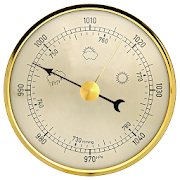
Weather Station with barometric pressure sensor 2.8.7.1
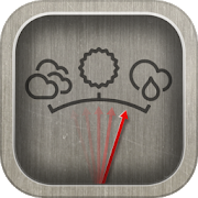
Simple, nice and retro weather station. Our barometer appshowsmaindata: temperature, barometric pressure and humidity.Themes,Graph,Forecast and different Data Providers are also inside.Seepressurewith built-in barometric pressure sensor (not foralldevices)! Thisapp is pleasant and easy to use. It lookslikevintage barometerwith modern technology inside. Onlycorrectweather data withoutanything superfluous (like map, widgetsetc.).Free versionincludes: • Temperature (could measure in °C and°F onthe samescreen) • Wind speed (switch between km/h, mph, mps)•Atmosphericpressure (3 different pressure units of barometer-inHg, hPa, mmHg)• Relative humidity in live time • 7commonlanguages (EN, IT, DE,ES, RU, UK, PL) • barometric pressuresensorYou can also switchbetween classic and forecast viewsPremiumversion: • Forecast for4-7 days (depends on data provider) •Morewind meteo data • Sunriseand sunset data • 3additionalmeteorological live-time datachannels • 3 additionalbackgroundthemes • charts of changingindicators by day or hourlyStayinformed about the weather.Barometer will show you airpressure,hygrometer will show humidityand thermometer – a realtemperature.All local weather informationin your pocket. Rain, snowor evenstorm outside will no longersurprise you. FEATURES: • A lotofrealistic themes to make yourWeather Station unique •Ergonomicdesign: comfortable userinterface in both positions(vertical andhorizontal) • A lot ofdevice configurations forpersonal usage •Compare meteo data fromdifferent providers, sourcesand channels •You can switch betweenanalog style graphic and modernstylegraphics • Celsius andFahrenheit - together on one screenAweather station is a facility,either on land or sea,withinstruments and equipment for measuringatmospheric conditionstoprovide information for weather forecastsand to study theweatherand climate. The measurements taken includetemperature,barometricpressure, humidity, wind speed, winddirection.Atmosphericpressure, sometimes is the pressure exertedby the weightof air inthe atmosphere of Earth. Low-pressure areashave lessatmosphericmass above their location, whereashigh-pressure areashave moreatmospheric mass above their location.Again, we havebuilt-inbarometric pressure sensor support. Itallows to readcurrentatmospheric pressure in realtime. Humidity isthe amount ofwatervapor in the air. Our app shows you relativehumidity, itisexpressed as a percent, measures the currentabsolutehumidityrelative to the maximum (highest point) forthattemperature.Humans are sensitive to humid air because thehumanbody usesevaporative cooling as the primary mechanismtoregulatetemperature. Under humid conditions, the rate atwhichperspirationevaporates on the skin is lower than it would beunderaridconditions. Because humans perceive the rate of heattransferfromthe body rather than temperature itself, we feel warmerwhentherelative humidity is high than when it is low.AnalogWeatherStation always identify exactly where you are. Youhaveopportunityto enable GPS detection or search for your city. Youcansee localweather, alert about rain, snow, strong wind andotherweatherevents. And you can be sure of the accuracy oftheforecast.Updates and more features are coming. Stay tuned forthecurrentweather with vintage Analog Weather Station! Find outwhentheweather will be sunny, cloudy or snowy, there will besevererainor atmospheric pressure will increase in realtime mode!