Top 39 Apps Similar to Surveying


Land Records 0.0.2
Do you know the area that you are planning to buy may begovernmentproperty? Know the location as defined in Revenuedepartment fullyintegrated with Google maps. Get the details of thesurvey number,area under the survey number, place name, villagename, districtname of the property. Single place access to propertydetails, suchas location, survey number, area under the surveynumber, placename, village name, district name and the guidancevalue of theproperty. You can also bookmark a property location forease ofuse. Property location integrated with Google maps iscurrentlysupported for Bangalore region only.


Land Surveying Tool 1.0
We are glad to announce the launch of thisfreeapp. We hope it we will be useful to professional surveyors aswellas individuals that would like to do basic landsurveyingtasks.There is a link to the WCCS website to get current verticalcontrolsin the state of WA. The app can also compute basic landsurveyingcalculations. In the future we intend to add much morefunctionalitywhenever we can. The app is tested against somedevices forbugs.Please report any bugs you may encounter to the developer ofthisapp directly by visiting thewebsitewww.asmarainnovations.comWe hope people would find this app useful. Thank you fordownloadingthis app and we hope you will continue to use our otherapps thatare going to be in the market soon.Please enter angles in decimal degrees.Feature graphic image by Norio. All rights of involvedpartiesreserved.


Survey-It 1.1.1
Survey-It helps you measure distanceandmeasure land area in places you may visit or own. You canuseSurvey-It to get measurements of distances traveled, tobread-crumbyour location (so you won't get lost), or measure afield or yard.Survey-It allows for simple land measurement and areameasuring.Please keep in mind that the accuracy of this tool isonly good asthe GPS on your device.With the pricing calculation feature, make a quick costestimatefor quoting jobs.Use user-provided offline maps when not in mobileinternetrange.Survey-It is perfect for estimating landscaping jobs andoutdoorconstruction jobs like fencing. Great for private mowers andfencebuilders.With added KML and CSV exports, you can use yourmeasurementswith other apps (Google Earth, Sketchup, etc...).With the enhanced version 2 of Google maps, you can tiltandrotate your maps while working.Features:- Export to CSV and KML (DXF coming soon).- Measure Land by walking off the location, or plotting onthemap.- Press to locate on the map- Remember/Overlay previous measurements- Save your maps as images- Save your overlays for later- Send and share your maps with friends- Supports multiple units for calculation and conversion(pleaseemail us if we missed one you need)Feel free to email us with questions or feature requests.


Land Survey Tools 1.0
An surveying applicationforperformingtopographic calculations, developed by experts inthefield ofsurveying engineering.The target audience forthissoftwareconsists mainly of surveying engineers, but alsoincludesengineersof other disciplines as well as cartographers.Theapplicationenables calculation of point coordinates with knowngridbearingand distance, calculation of grid bearing anddistancebetween twopoints with known coordinates. Also solves theproblemof resectionand intersection with the capability ofinserting angleor distancemeasurements. Lastly, it calculates themeasuringelements ofstakeout points such as horizontal clockwiseangle andhorizontalground distance.Earth curvature correction and scale factor is usedincalculations.Settings for units, scale factor etc, aresavedautomatically.Supported units for distances, coordinates, etc:• Angle units: Grad, Degree, DegreesMmSs.• Distance units: Meter, US Survey Foot, Foot International.


Survey Compass AR
Survey Compass can be used as a simplecompassin your pocket or use the augmented reality view todetermine thebearing and elevation of objects in thedistance.Great for map readers as it allows you to view the compassdirectlyon top of a map through the phone’s camera.Survey Compass AR has three modes:- "Ruler mode" shows North, South, East, and West, as wellasorientation markings directly on the camera view- "Grid mode" shows a grid overlaid on the camera viewwithorientation and elevation markings- "Classic mode" shows a 3D classic compassNote that this app relies on the magnetometer of your mobiledeviceso accuracy may vary. Also, please check that your deviceisn’tbeing affected by a magnetic field. There is advice oncalibratingyour device within the app.This app is supported by adverts, which is why it requiresthe“INTERNET” and “ACCESS NETWORK STATE” permissions.


Fake GPS location
Teleport your phone to any place in theworldwith two clicks! This app sets up fake GPS location so everyotherapp in your phone belives you are there!Has Tasker support and can be started/stopped from command line(SeeFAQ for details)+++IMPORTANT+++Be aware that after using FakeGPS you may find your locationLOCKEDTO THE LAST MOCKED LOCATION EVENT AFTER UNINSTALLFakeGPS!It's not a bug and your GPS sensor isn't broken. There are twowaysto fix this issue:1. Install "GPS Status" from the Play, launch and get a freshGPSfix. You may need to repeat it several times with 30mininterval.2. Start FakeGPS, set your real location and leave it so forseveralhours.You may combine these steps. The issue will disappear in one ortwodays - be patient.For ROOTED devices you can mock locations without enabling"Allowmock locations" option. To do so please use Root Explorer orothersimilar app and move /data/app/ru.lexa.fakegps~1.apkto/system/priv-app or to /system/app (for Android 4.3 andolder).Then change apk permissions to rw-r-r and reboot yourdevice. Ifyou find apk in /syste/priv-app disappears after rebootit meansthat your devices has S-ON mode enabled and so restores/systemfolder aftear each reboot. Please google how to switch yourdeviceto S-OFF mode.If you can't find ru.lexa.fakegps.apk in /data/app you may finditat /mnt/asec/ru.lexa.fakegps/1.apk. In this case you shouldcopyand rename it to /system/priv-app/ru.lexa.fakegps.apk.END USER LICENSE AGREEMENTThis app is provided "as is" and we can not be held responsibleforany usage by the end users of our app. This app is freewithlimited functionality and is for testing purposes only.

GoFinder 1.0
* PERINGATAN * PERINGATAN *Use With Your Own RiskFungsi standar app ini adalah:- Mencari lokasi Driver terdekat- Mencari lokasi Restoran terdekatAplikasi ini tidak menjamin apapun, gunakan bila andasiapdengansegala konsekuensi dan resiko yang mungkin bisamuncul.* WARNING *WARNING*Use With Your Own RiskStandard functions of this app are:- Locating the nearest Driver- Locating the nearest restaurantThis application does not guarantee anything, use when youarereadywith all the consequences and risks that might arise.

Network Signal Booster
Are you getting tired of weak cellularsignal?Do you have hard time finding signal reception andnetwork connection? Download Network Signal Booster for FREE andgetbetter signal strength andbetter network reception in instant! Network Signal Booster isasignal booster utility app which helpsyou improve your cellular signal and network connection. Oursignalbooster app employs advancedconfigurations that will improve your signal strengthreception.Simply tap on our network booster appand feel the difference!Improve your mobile phone performance with Network SignalBooster!There are many apps that needreliable connection to the internet or cellular signal to workandsome of them are vital in your day today live. Imagine if you can’t access Maps, call a taxi, ormakeEmergency calls. We create this networkbooster app to help you overcome your cellular signal andnetworkproblems for FREE so you will alwaysbe connected to the network.-- -- -- -- -- -- -- - NETWORK SIGNAL BOOSTER TOP FEATURES: -- ------ -- -- -- - FREE to use. Download our signal boost app and start utilizingournetwork booster now! Effective process. Feel the difference in your signalstrengthafter you have refreshed yourconnection with our phone booster. Easy to use. Simply open our signal booster app and taptoactivate our phone booster. 24/7 support. If our network booster app doesn’t work, pleasefeelfree to contact us via email,Facebook, or Twitter.How does our network booster work? Our Signal Booster worksbyrefreshing your current network. Thisphone boosters app switch off your network temporarily and switchitback on again to signal improveyour cellular signal strength. Our simple process has showntodramatically improve signal strength andnetwork speed for most Android mobile phones.Please feel free to contact us if you have any problem usingNetworkSignal Booster. We will help you inany way we can.


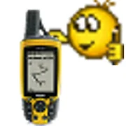
GPS Site Survey 1.0
This app lets you "tag" locations usingyourGPS, then plots them on a map or tells you the distancebetween. Itwas created to help me position antennas during anoutdoor wifiinstallation but I'm sure you can think of moreTwitter: @gpssurvey(Remember when surveying that your accuracy is only as goodasyour GPS chip)


CDSViewer Surveying & Setout 1.10
For help menu gotohttp://www.foresoft.com/onlinehelp/cdsviewer/index.htm ALiteSurvey App to give Surveyor's/Civil Engineers the appropriatetoolswhich can be practically ran in the field on mobile phoneortablet. It contains a number of sections. Allows user to takeaSDR33 file from there Total Station and store on Androiddevice.From there convert it into a human readable form which isdisplayedin a tabular format. User can check all appropriatemeasurementshave been taken. From there you can create a viewablefile whichshows the layout of the points picked up in Plan View.Second partallows user to view Subdivision, Contouring and RoadDesign jobs inthe field created by desktop program CDS. If you haveothersoftware such as CivilCad, 12D, Civil3D etc please note thatCDS ondesktop includes input routines that will convert your datato ausable form. CDS on windows desktop is available in 60 dayfreetrial so that you can create your appropriate designs intheoffice. Once in the field this App lets you do joins/invertsandalso allows setouts using in-device GPS. Please note thattheAndroid GPS is not survey grade but is helpful in that it canhelpyou locate predefined features etc.


Level Book 1.01
Essential tool for any engineer surveying or construction.Anapplication for recording and calculating technical leveling.Fromnow create logs leveling in your smartphone. The main featuresofthe application include: -Create logs leveling -Adding,deleting,editing readings -calculating logs -eksport leveling tocsv filesAfter completing the log, we can export it to a csv fileand sendmail. Readings and enter the amount of benchmarks suchasmillimeter