Top 21 Games Similar to Satellite Director Pro


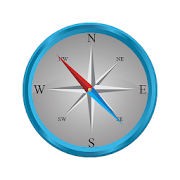
Compass Pro 2.1.2
Compass Pro is the most precise compassappavailable. It supports magnetic and true north calculatedusingnetwork location or GPS coordinates. Furthermore thiscompassdisplays the location coordinates and the strength of themagneticfield to see if it interferes with the compass sensor. Itsupportshigh definition displays and can be installed on theSDCard.Download the best available compass!PERMISSIONSGPS and network location:Needed to calculate true north.Internet Access:Needed for completely anonymous usage statistics. Usagestatisticscan be disabled in the settings of Compass.

Intelligent Compass 1.1
Intelligent Compass*******************The Compass application is free !!!Application Compass can be used for your outdoor activities.AUTHORIZATION*********************Internet access:------------------------Needed by the compass to download ads.Turn off standby mode:---------------------------------Needed by the compass to keep the display whileusingthecompass.


GPS Track Recorder (GPS移動記録) 1.6.2
GPS測位を使って移動記録を記録する(トラッキングする)アプリケーションです。一般的にこのようなアプリをGPSロガー( GPS Logger )と言います。※推奨しませんが、Wi-Fi位置情報(不正確)も利用できます。<特徴>・GPSとWi-Fi位置情報を使って移動記録を取ります。Wi-Fi位置情報は簡単にON/OFFできます。・オフライン(ネットと接続していない)でもGPSで移動記録を取れます。・オンラインのときだけ地図が表示できます。地図はAndroid Maps API v2 (ベクタマップ)を使用しています。・バックグラウンド動作が可能です(Android OSのサービス機能使用)。他のアプリと切り替えても終了しません。・GPXファイル(標準的なGPS記録ファイル)出力可能(エクスポート)。MyTracksなどに読み込ませることができます。・他のアプリ(MyTracks, 山旅ロガーなど)で出力したGPXファイルを読み込むこともできます(インポート)。・測定中に捕捉衛星数、経過時間、移動距離、速度、高度を表示します。・測定していないときでも現在地周辺の地図を見ることができます。・表示する地図の種類を通常、航空写真、ラベル付き航空写真、地形図の4つから選択できます。・設定された距離(最大距離)の間、GPSの信号が取れないと、その区間の線の色を変えて表示します。・位置情報を記録する間隔(更新距離)を設定できます。・高度は地球楕円体を基準にして高度を出します。ジオイド補正なしです。つまり、東京都だと35m程度高度が過大に出ます。<操作>操作は簡単です。アプリを起動して左上のボタンを押すだけで記録が開始されます。測定中の間、地図が表示され、地図上に現在地と移動した軌跡も表示されます。現在地の移動に伴って地図も移動します。地図の移動に伴って、GPS衛星数、経過時間、移動距離、速度、高度の表示も変化します。もう一度、そのボタンを押すとそれまでの記録が保存されます。<用途>特に用途を限定していませんので、徒歩、自転車、電車などでご利用いただけます。ただし、ジェット飛行機では正常に動作しない可能性があります。<動作確認>動作確認は ASUS 新Nexus7(2013) 32GB Wi-Fi版、そして Sony EricssonSO-03D(白ロム)で行なっています。<詳細>詳細は下にある「デベロッパーのウェブサイトにアクセス」をクリックして下さい。<変更履歴>version 1.6.2・新しいSDK(r24.1.2 windows)でビルドした。・いくつかの安定化対策を追加。・住所を取得していない状態でWi-Fiに接続したとき、再取得を試みるようにした。version 1.6.1・1.6.0の速度表示が不自然なので修正した。version 1.6.0・パラメータ表示のON/OFFが可能になった。地図表示を広げることが可能。・表示パラメータに最大速度と平均速度を追加。・しきい値速度の設定を廃止した。・加速度の上限を2Gから0.5Gへ変更。・GPXファイル読み込み画面でインポートが終わったファイルのチェックを消去するようにした。・位置情報精度の初期値を200mから50mへ変更(過去のバージョンを使われている場合、過去の設定がそのまま使われます)version 1.5.4・新Nexus7(2013)+Android4.4における安定性向上・破損した経路ファイルを読み込んだときに強制終了する問題を修正version 1.5.3・2Gよりも大きい加速度を持つ位置情報を無視するようにした。version 1.5.2・「保存した経路の一覧」の初期表示位置を最後尾にした。・「保存した経路の一覧」に最上位と最後尾に行くためのボタンを追加して、レイアウトの色を修正。・「保存した経路の一覧」において経路の合計数を表示するようにした。version 1.5.1・画面レイアウトを調整しました。経路表示画面の地図が少し広く表示されます。・Wi-Fi位置情報をONにしたとき、警告を出すように修正しました。version 1.5.0・地図の種別を切替える機能を追加。航空写真の表示が可能になりました。・複数の<trk>タグを含んだGPXファイル(1ファイルに複数の経路を含むファイル)に対応・それにともなって、GPXファイルの<metadata>の<name><desc>よりも<trk>の<name><desc>を優先するように変更※現時点、複数の<trk>タグを含んだGPXファイルを見かけることは珍しいと思われます。version 1.4.1・SDカードあるいは擬似SDカード領域に本アプリ用のディレクトリが作成されていないとき、 データベース作成に失敗して誤動作することがあるので修正した。 ただし、ファイルブラウザなどで本アプリ用のディレクトリを操作したときの 誤動作については保証しない。version 1.4.0・設定した最大距離を越えると、経路を複数のセグメント(経路の一部分)に分割するようになりました。 分割された部分は青い線が引かれます。・GPXファイルの複数セグメント(<trkseg>タグが複数)に対応しました。version 1.3.2・ルートラボで配布されているメタデータのないGPXファイルをインポートしても異常終了しないように修正。version 1.3.1・見づらい設定画面を多少改善version 1.3.0・タブレットのみに対応していた画面レイアウトを大画面スマートフォンにも合わせた。・捕捉衛星数の計算方法を変更した。version 1.2.2・測定中にアプリが何らかの理由で強制終了されたとき、アプリを再起動すると途中まで記録した経路を救済する機能を追加。・設定画面で空の文字列を入力すると、設定画面が異常終了するバグを修正。・サービスの終了処理に不具合があったので修正。version 1.2.1・測定をやめるかどうかのダイアログでダイアログの外をタッチすると、ボタン表示がおかしくなるバグを修正。・GPXファイル出力時のファイル名を経路の名前と同一にした。・ストレージの空き容量が16MByte未満になれば、位置情報の記録を行わなくなる安全対策を追加。version 1.2.0編集機能を追加、メニュー階層構造を変更。version 1.1.0Android Google Maps API v2 に対応。version 1.0.0Android Google Maps API v1 に対応したが、v1の新規鍵取得が終了していたので、リリースできなかった。Using the GPSpositioningto record the movement record (tracking) is anapplication.I generally refers to such application and GPS logger(GPSLogger).※ I do not recommend, Wi-Fi location information (incorrect) isalsoavailable.• You take the movement recorded using GPS and Wi-Filocationinformation. Wi-Fi location information can be easily ON/OFF.Offline to take the movement recorded by GPS even (not connectedtothe net).• Only when the online map I can display. Map uses Android MapsAPIv2 (the vector map).Background behavior is possible (service function use ofAndroidOS). It does not end even if you switch to other apps.· GPX files (standard GPS recording file) can be output (export).Itis possible to be read as to MyTracks.· Other apps (MyTracks, such as Yamatabi logger) You can alsoimporta GPX file that was output in (import).• The number of captured satellite during the measurement,theelapsed time, distance traveled, speed, I will showthealtitude.• You can see the map of the area around the current positionevenwhen measured and not.And display normally the type of map, aerial photo, aerialphotowith label, I can choose from four of topographic maps.Between-set distance (maximum distance), when the GPS signal isnottaken, you can display by changing the color of the line ofthesection.• Position You can set the interval at which the record(updateddistance) information.-Altitude issues advanced on the basis of the Earth ellipsoid. Isnogeoid correction. In other words, about 35m altitude I gettoexcessive it's Tokyo.Operation is easy.Start the app will start by simply record button at the upperleftof.Between being measured, map is displayed, also appearstrajectorythat has moved with the current location on themap.Map in accordance with the movement of the location tobemoved.With the movement of the map, GPS satellites number, elapsedtime,distance traveled, speed, also changes altitude display.Once again, it until the record is saved by pressing thebutton.Since it does not particularly limited applications, availablewalk,bicycle, train, etc..However, there is a possibility that does not work properly in ajetairplane.Confirm the operation I have done in ASUS new Nexus7 (2013)32GBWi-Fi version, and Sony Ericsson SO-03D (White ROM).Please click on the "access to the developers web site of" belowformore information.version 1.6.2I was build in-new SDK (r24.1.2 windows).· Add some stabilization measures.- When connected to a Wi-Fi is a state that does not get theaddressand to attempt to reacquire.version 1.6.1 · 1.6.0 speed display of I has been modified sounnatural.version 1.6.0 Parameters display of ON / OFF is made possible. Possibletoexpand the map display. Add the average speed and maximum speed anddisplayparameters. • The setting of the threshold speed I was abolished. · Changed the upper limit from 2G to 0.5G acceleration. · GPX file I was made to clear the check of the fileimporthas finished in the loading screen. Change, the initial value of the position informationaccuracyfrom 200m to 50m (If you have used the past versions, pastsettingsare used as is)version 1.5.4 • The stability improvement in the new Nexus7 (2013)+Android4.4 Kill to Fixed the damage pathways file read whenversion 1.5.3 · 2G I was to ignore the position information withgreateracceleration than.version 1.5.2 · I was the initial display position of the "List ofsavedroute" to the tail. · Add a button to go to the top and the tail end to the"listof saved route", Fixed the color of the layout. · I was made to display the total number of routes inthe"List of saved route".version 1.5.1 -Screen I have to adjust the layout. Map of the routedisplayscreen will appear a little wide. • When you have a Wi-Fi location information to ON,wasmodified to issue a warning.version 1.5.0 · Added the ability to switch the type of map. Displayofaerial photographs is now possible. - Multiple & lt; trk & gt; corresponding to a GPXfilecontaining a tag (file containing a plurality of paths inonefile) - It is accompanied, & lt of GPX file; modifiedtoprioritize; metadata & gt; Roh & lt; name & gt;< desc & gt; than & lt; trk & gt; Roh & lt;name& gt; & lt; desc & gt ※ Currently, more than one & lt; it seems that it israreto see a GPX file that contains the tag; trk & gt.version 1.4.1 • When the directory for this application has not beencreatedon the SD card or pseudo SD card area, Was modified because it may be malfunctioning or failstocreate the database. However, when you operate a directory for this app, such asafile browser It does not guarantee the malfunction.version 1.4.0 • When exceeds the maximum distance that has been set, itisnow split the route into a plurality of segments (part oftheroute). Divided parts are drawn blue line. Multiple segments of · GPX file (& lt; trkseg >tag s) now supports.version 1.3.2 • The import modified to also not abnormal termination withnoGPX file of metadata that are distributed in Rutorabo.version 1.3.1 • The ugly setting screen some improvementversion 1.3.0 · Only the screen layout is compatible with the tabletwasadjusted to a large screen smartphone. -Capture satellite number of calculation method I havechangedthe.version 1.2.2 When the app is killed for any reason during andmeasurement,and adds the ability to rescue the recorded route up tothe middlewhen you restart the app. Settings If you enter an empty string in the screen · Fixedabug where setting screen is abnormally terminated. -End processing modification because there was a problemwiththe service.version 1.2.1 If you touch if outside of the dialog in the dialog orquitand measurement, Fixed a bug that button displaybecomesfunny. · GPX file file name at the time of output I was the sameasthe name of the route. · If free space of storage is accustomed to less than16MByte,additional safety measures to be without a record of thelocationinformation.version 1.2.0 Add the edit function, change the menu hierarchy.version 1.1.0 Supports Android Google Maps API v2.version 1.0.0 Although corresponding to Android Google Maps API v1,sincenew key acquisition of v1 has been completed, it could notbereleased.


Simple Compass 1.0.3
The compass is a very useful gadgetfornavigation and orientation that shows direction based onbuild-inmagnetic sensor.Beautiful and simple interface make all information at a glance.Itis not just a simple north direction indicator but isintended to be used as a real orientation tool forhikingactivities.Prerequisite: Your device must have an integrated compass sensortofunction properly.Features:- Beautiful and simple user interface- Display true heading- Display magnetic field strength- Display latitude and longitude- Display current location- Display air pressure and altitude- Display horizontal level- Call the map you have in your device- Copy and share the message displayed- Support many language- Although you may turn your phone into portrait or landscapemode,the heading is fixed.- Camera view is used for reality.- Metal Detector is included to verify magnetic sensor.- GPS and Maps are supported.- It’s FREEIMPORTANTPlease keep your device away from magnetic fields, becausetheyinterfere with the compass sensor.If magnetic filed turns into the red inverse exclamation mark,youbetter calibrate compass instantly.Waving your device several times in a figure of 8motioncorrectly.If you can not solve it in this way,rotate your device along 3-axis many a time. When usingthiscompass, hold your device flat to the groundwith the display facing the sky like you would hold amechanicalcompass.A level is usually used in construction, carpentry andphotographyto determine if objects on which you'reworking on are level. Used properly, a level can help youcreateflawlessly leveled pieces of furniture,help you when hanging paintings or other items on the wall andsoon.Thank you for your using our app!


GPS Navigation
FREE GPS navigation & offline mapsFREE map updatesFREE trip planning & POI searchGPS Navigation is a free offline gps navigation based onPremiumMaps, with multiple map updates per year. Free versionincludes 7days Premium with voice guided navigation. After 7 daysuse offlinemaps and trip planning for free or upgrade to unlimitedvoiceguided Premium navigation.Free features:~ car & pedestrian navigation~ speed limit warnings~ 3D mapsPremium:~ multi language voice guided navigation~ lane guidance~ HUD~ travelbook~ support~ speed camera warnings~ navigate to photoAvailable maps:AfricaAlgeria, Angola, Benin, Botswana, Burkina Faso, Burundi,Cameroon,Capeverde, Central African Republic, Chad, Comoros,DemocraticRepublic of Congo, Congo, Djibouti, Egypt, EquatorialGuinea,Eritrea, Ethiopia, Gabon, Gambia, Ghana, Guinea,Guinea-Bissau,Kenya, Lesotho, Liberia, Libya, Madagascar, Malawi,Mali,Mauritania, Mauritius, Mayotte, Morocco, Mozambique,Namibia,Niger, Nigeria, Reunion, Rwanda, Saint Helena, SaotomeandPrincipe, Senegal, Seychelles, Sierra Leone, Somalia, SouthAfrica,South Sudan, Sudan, Swaziland, United Republic of Tanzania,Togo,Tunisia, Uganda, Western Sahara, Zambia, ZimbabweAsiaAfghanistan, Armenia, Azerbaijan, Bangladesh, Bhutan, BritishIndianOcean Territory, Brunei Darussalam, Burma, Cambodia, China,EastTimor, Georgia, Hong Kong, India, Indonesia, Japan,Kazakhstan,Kyrgyzstan, Laos, Macau, Malaysia, Maldives, Mongolia,Nepal, NorthKorea, Northern Mariana Islands, Philippines,Singapore, SouthKorea, Sri Lanka, Taiwan, Tajikistan, Thailand,Turkmenistan,Uzbekistan, VietnamEuropeAlbania, Andorra, Austria, Belarus, Belgium, Bosnia andHerzegovina,Bulgaria, Croatia, Cyprus, Czech Republic, Denmark,Estonia, FaroeIslands, Finland, France, Germany, Gibraltar,Greece, Guernsey,Hungary, Iceland, Ireland, Italy, Jersey, Latvia,Liechtenstein,Lithuania, Luxembourg, Macedonia, The FormerYugoslav Republic of,Malta, Moldova, Republic of, Monaco,Montenegro, Netherlands,Norway, Poland, Portugal, Romania, RussianFederation, San Marino,Serbia, Slovakia, Slovenia, Spain, Sweden,Switzerland, Turkey,Ukraine, United Kingdom, Vatican, KosovoMiddle EastBahrain, Iran (Islamic Republic of), Iraq, Israel, Jordan,Kuwait,Lebanon, Oman, Pakistan, Palestine, Qatar, Saudi Arabia,Syria,United Arab Emirates, YemenNorth AmericaAnguilla, Antigua and Barbuda, Bahamas, Barbados, AmericanSaoma,Belize, Bermuda, British Virgin Islands, Canada, CaymanIslands,Costarica, Cuba, Dominica, Dominican Republic, ElSalvador,Greenland, Grenada, Guatemala, Haiti, Honduras, Jamaica,Mexico,Montserrat, Nicaragua, Panama, Puerto Rico, Saint Kitts andNevis,Saint Luca, Saint Pierre and Miquelon, Saint Vincent,Trinidad andTobago, Turks and Caicos Islands, Virgin IslandsUnited StatesAlabama, Alaska, Arizona, Arkansas, California,Colorado,Connecticut, Delaware, District of Columbia, Florida,Georgia,Hawaii, Idaho, Illinois, Indiana, Iowa, Kansas,Kentucky,Louisiana, Maine, Maryland, Massachusetts, Michigan,Minnesota,Mississippi, Missouri, Montana, Nebraska, Nevada, NewHampshire,New Jersey, New Mexico, New York, North Carolina, NorthDakota,Ohio, Oklahoma, Oregon, Pennsylvania, Puerto Rico, RhodeIsland,South Carolina, South Dakota, Tennessee, Texas, Utah,Vermont,Virgin Islands (U.S.), Virginia, Washington, WestVirginia,Wisconsin, WyomingOceaniaAustralia, Cook Islands, Fiji, French Polynesia, Kiribati,MarshallIslands, Micronesia, Nauru, New Caledonia, New Zealand,Niue,Palau, Papua New Guinea, Pitcairn, Samoa, Solomon Islands,Tokelau,Tonga, Tuvalu, Vanuatu, Wallis and Futuna, Cocos islands,ChristmasislandsSouth AmericaArgentina, Bolivia, Brazil, Chile, Colombia, Ecuador,FalklandIslands, French Guiana, Guadeloupe, Guyana, Martinique,Paraguay,Peru, Saint Barthelemy, Saint Martin, Suriname,Uruguay,Venezuela


Smart Compass 1.2
Smart Compass is afullyfunctionalmagnetic compass.Do you do like going Camping, Hiking or Fishing? Adetailedtopomap and a compass are still the primary tools fornavigation inthewilderness. A compass helps you orient the map,identifylandfeatures and locate your positionWe all love to be connected with the Nature, go tolittlerivers,cascades, etc. but Taking a wrong turn can take someof thefun.Then a compass suddenly becomes one of the mostimportanttools!It's the perfect companion on your adventure trails.Let go off your clumsy old compass. Use the smart oneinyourpocket!Launcher Icon & Main Screen Compass Image Credits:DesignedbyPaomedia.https://www.iconfinder.com/icons/299042/compas_icon#size=512

Magic Earth Pro Navigation 7.1.17.23.850E41D.0D5E129
MAPS– Professional TomTom maps– 3D maps– Satellite maps– Wikipedia– Weather– Add points-of-interestNAVIGATION– Car Navigation- Lane Guidance- Multiple Stops- Road Signs- Speed Cameras- Speed WarningsHD TRAFFIC– Alternative routes– Avoid traffic– Updated every minuteOFFLINE MAPS– No mobile internet costs– Navigate without internet– Country maps– Regional mapsNOTES:* Upgrading from ROUTE 66 Navigate is entirely free andyourexisting licenses in ROUTE 66 Navigate will automatically workinMagic Earth Pro.* Navigation, Speed cameras and HD Traffic are premiumservicesavailable as in-app purchases.* Some features not available in all countries.* Some features require internet connection.


GPS Fields Area Measure 1.0
GPS Fields Area Measure takes intoaccounttheWorld's geodesic structure and serves highly accurateareaanddistance measurement information. GPS Field Area Measureusefulasmap measurement tool for outdoor activities, sports,rangefinderapplications, bike tour planning, or run tourplanning,exploregolf area, land survey, golf distance meter, fieldpastureareameasure, garden and farm work and planning,arearecords,construction, agricultural fencing, solarpanelinstallation - roofarea estimation, trip planning.This gps area measurement app is mostly useful formeasurementofagricultural areas, building areas. Using GPS FieldsAreaMeasureFarmers who using tractors or harvesters like JohnDeere,Claas, NewHolland, Case, Fendt, Valtra, Massey Ferguson orfarmequipment likeHorsch, Hardy, Amazone, Vaderstad, Lemken,Rau,Kuhn, Kverneland,Simba and other farm equipment are usingGPSFields Area Measure PROin everyday.Features :- GPS Fields Area Measure is Fast area/distance Mapping.- GPS Fields Area Measure is a Smart Marker Mode forsuperaccuratepin placement.- GPS Fields Area Measure to measurement saving and editing.- GPS Fields Area Measure measurement Unit Changing Facility.- GPS Fields Area Measure apply on Map, Satellite, TerrainandHybridmodes.- GPS Fields Area Measure gives you area search facility.- All the Saved Measure display at one place.- Setting give you option of Distance Units, Area Units.- GPS Fields Area Measure is an easy process to calculateareaanddistance of land.GPS Fields Area Measure is useful to calculate GPS areaorGPSdistance with great accuracy. There two way to measure anyGPSareaor distance