Top 50 Apps Similar to Barometer pro - free


Weather Station with barometric pressure sensor 2.8.7.1
Simple, nice and retro weather station. Our barometer appshowsmaindata: temperature, barometric pressure and humidity.Themes,Graph,Forecast and different Data Providers are also inside.Seepressurewith built-in barometric pressure sensor (not foralldevices)! Thisapp is pleasant and easy to use. It lookslikevintage barometerwith modern technology inside. Onlycorrectweather data withoutanything superfluous (like map, widgetsetc.).Free versionincludes: • Temperature (could measure in °C and°F onthe samescreen) • Wind speed (switch between km/h, mph, mps)•Atmosphericpressure (3 different pressure units of barometer-inHg, hPa, mmHg)• Relative humidity in live time • 7commonlanguages (EN, IT, DE,ES, RU, UK, PL) • barometric pressuresensorYou can also switchbetween classic and forecast viewsPremiumversion: • Forecast for4-7 days (depends on data provider) •Morewind meteo data • Sunriseand sunset data • 3additionalmeteorological live-time datachannels • 3 additionalbackgroundthemes • charts of changingindicators by day or hourlyStayinformed about the weather.Barometer will show you airpressure,hygrometer will show humidityand thermometer – a realtemperature.All local weather informationin your pocket. Rain, snowor evenstorm outside will no longersurprise you. FEATURES: • A lotofrealistic themes to make yourWeather Station unique •Ergonomicdesign: comfortable userinterface in both positions(vertical andhorizontal) • A lot ofdevice configurations forpersonal usage •Compare meteo data fromdifferent providers, sourcesand channels •You can switch betweenanalog style graphic and modernstylegraphics • Celsius andFahrenheit - together on one screenAweather station is a facility,either on land or sea,withinstruments and equipment for measuringatmospheric conditionstoprovide information for weather forecastsand to study theweatherand climate. The measurements taken includetemperature,barometricpressure, humidity, wind speed, winddirection.Atmosphericpressure, sometimes is the pressure exertedby the weightof air inthe atmosphere of Earth. Low-pressure areashave lessatmosphericmass above their location, whereashigh-pressure areashave moreatmospheric mass above their location.Again, we havebuilt-inbarometric pressure sensor support. Itallows to readcurrentatmospheric pressure in realtime. Humidity isthe amount ofwatervapor in the air. Our app shows you relativehumidity, itisexpressed as a percent, measures the currentabsolutehumidityrelative to the maximum (highest point) forthattemperature.Humans are sensitive to humid air because thehumanbody usesevaporative cooling as the primary mechanismtoregulatetemperature. Under humid conditions, the rate atwhichperspirationevaporates on the skin is lower than it would beunderaridconditions. Because humans perceive the rate of heattransferfromthe body rather than temperature itself, we feel warmerwhentherelative humidity is high than when it is low.AnalogWeatherStation always identify exactly where you are. Youhaveopportunityto enable GPS detection or search for your city. Youcansee localweather, alert about rain, snow, strong wind andotherweatherevents. And you can be sure of the accuracy oftheforecast.Updates and more features are coming. Stay tuned forthecurrentweather with vintage Analog Weather Station! Find outwhentheweather will be sunny, cloudy or snowy, there will besevererainor atmospheric pressure will increase in realtime mode!


Altimeter & Altitude Widget 4.57
DS Altimeter is an elevation meter,elevationlogger, and altitude mapper. In addition to showing andoptionallytracking your altitude, the app allows you to search thealtitudefor other locations as well.You can select from the best sources of elevationdata,including:1. Location based altitude from NASA's Shuttle RadarTopographyMission2. Satellite based altitude (GPS altitude) corrected toheightabove mean sea level (AMSL)3. Get actual land survey altitude values for your locationfromthe United States Geologic SurveyDevices equipped with a barometer sensor can also obtainpressurealtitude which is converted to true altitude. For the mostprecisereadings, calibrate the pressure altitude by entering areferencevalue or by selecting one from the app's dynamic list ofnearestairfields.USGS (United States Geologic Survey) altitude results arealsoavailable for customers in the contiguous United States, CanadaandMexico.DS Altimeter also works offline: barometric altitude andGPSaltitude corrected to elevation above sea level do not requireaninternet connection.NEW IN DS ALTIMETER: Record altitude profiles and elevationtracksfor your favorite journeys to the highlands, the lowlandsandeverything in-between!Upgrade the application to pro and gain access to even morefeaturesincluding the Altimeter Widget and variousbarometricaltimeter calibration methods.Going skiing? Record your ski run with DS Altimeter, then viewyourski trail with its elevation points on the included maps.Mininumand maximum altitude points for your run will beclearlyshown.Altitude mapping, altitude search and bathymetry (lake andseadepths) are also included with DS Altimeter. Tap anywhere on amapto get the altitude or water depth at that location.* The perfect altimeter for skiing, hiking, mountain climbingandother outdoor sports, boating, marine navigation and anytimeyouare curious about your elevation!


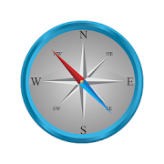
Accurate Compass Pro
An accurate and useful compass in yourpocket!Accurate Compass has a great 3D view along with an intuitiveuserinterface. This tool works exactly like a normal compass andiseasy to use for:-checking (magnetic) North, South, East, and West,-navigating unfamiliar places,-finding out the bearing of objects in the distance,-or just checking which way your garden faces!The compass also shows the bearing (in degrees) in a side windowandits 3D view will work even when your device is not heldparallel tothe ground.This app is the same as Accurate Compass, but withouttheadverts!Note that this app relies on the magnetometer of your mobiledeviceso accuracy may vary. Also, please check that your deviceisn’tbeing affected by a magnetic field. There is advice oncalibratingyour device within the app.


Clock Tuner
A TimegrapherThis app is to measure the BPH(Beats per hour) ofmechanicalwatches.It will display time error per day as well.The app uses microphone to measure BPH.** Recommend to plug a microphone into phone and attachthemicrophone to the back of your watch.** Basic version display wave graph and pulseintervalhistogram.** Frequency display requires 'Premium' upgrade.** Please test the app with your watch before you purchase'Premium'upgrade. The app will work as Premium during 30min.Not for digital clocks.Not working in noisy environment.Set microphone direction toward a clock.- Review from Mr. Kojimahttp://www.thewatchsite.com/index.php/topic,42142.0.html- Preset exampleRolex or mechanical watch: Target frequency: 4 or 5Hz,Sampleduration: 2Sec, Sensitivity: manual 50Most pendulum clock: Target frequency: 1 or 2 Hz, Sample duration:5or 10 Sec, Sensitivity: mediumFAQ.1) in the settings there is a sensitivity option with ahigh,medium, low and 3 manual settings, can you explain how thischangesthe resultsIt determines sound amplitude threshold for detecting clocksound.If your clock sound is loud you may reduce sensitivity. Thiswillallow more environmental noises.If you increase the sensitive, you may measure hand watches.Butsmall noise may measurement errors.2) why does the detected frequency change between light grey,blackand redRed means smaller drift during the measurement interval whilegreymeans that measurement may have an error.3) the average frequency does not always calculate, it staysatNaNThe 'detected frequency' should be red continuously.4) how do you calculate the pulse drift %abs(max detected frequency - min detected frequency) /detectedfrequency during 1 detection cycle.5) what are the 2 graphs showing and what data are you using forthecalculationsThe size of bars in the upper graph should be almost thesame.The bottom shows amplitude of sound wave recorded frommicrophone.6) are newer versions of the app being developed** You may provide sound sample by sending wav or mp3 [email protected]


Bubble Level - Spirit Level
Bubble level also known as spirit level is a free,handy,accurate,simple to use and incredibly useful tool for yourAndroiddevice. Aspirit level or bubble level is an instrumentdesigned toindicatewhether a surface is horizontal (level) orvertical(plumb). Vialson modern level meter have a slightly curvedglasstube which isincompletely filled with a liquid, usually acoloredspirit oralcohol, leaving a bubble in the tube. Atslightinclinations thebubble travels away from the center position,whichis usuallymarked. Bubble Level app tries to mimic the reallevelmeter anddisplays the data as real level meter would. Anextensionof thespirit level is the bull's eye level: acircular,flat-bottomeddevice with the liquid under a slightlyconvex glassface with acircle at the center. It serves to level asurfaceacross a plane,while the tubular level only does so inthedirection of the tube.Bubble Level app tries to mimic therealbull's eye level anddisplays the data as real bull's eyelevelwould. Where any why useBubble Level? A bubble level is adeviceused in construction,carpentry and photography thatdetermines ifobjects on whichyou're working are level. Usedproperly, a bubblelevel can helpyou create flawlessly level piecesof furniture,staircases andhomes. A bubble level is also helpfulwhen setting upa tripod forphotographs or when hanging paintings orother items onthe wall.

Accurate Altimeter 2.2.32
The most downloaded Altimeter on the PlayStoreis now updated with a new interface and new features!- Altitude estimation with three different methods to be alwayssureto get a reliable measure, even without internetconnection.- Historical charts to see your excursions elevation gain.- Map with your elevation and contour lines.- Pictures with impressed place name and altitude.Altitude can be estimated:- With satellites triangulation. Slow and less accurate but itworkseven with no internet connection.- Taking the ground elevation at your current position fromaninternet web service.- Using the pressure sensor of your device (if available).Itcalibrates itself on pressure from the nearest weather stationtoimprove accuracy.As additional PRO features you can also:- compensate systematic error of pressure sensor- record altitude without opening the App- remove advertising


EcoDrive Free Speedometer 1.0.12.2
EcoDrive Speedometer is a unique GPS speedometer allowing youtosaveyour fuel, time and also enhancing safety. Besides, ithelpsyou toavoid penalties and reach the destination first! ●Themotionefficiency indicator on the base of velocity, speedupandelevationsanalysis, permits you to correct your driving styleandreduce fuelconsumption in real time. ● Personalized audiowarningshelp you tokeep maximum speed allowed and not exceed it,at thesame timekeeping an eye on the road and saving your time.EcoDriveSpeedometeris a powerful and handy instrument. ● Allusefulindicators are onthe main screen, thus allowing you tocontrol theelapsed distance,time, acceleration, height, maximumand averagespeed. You can switchbetween indicators of maximum andaveragespeed, haul and time ofvarious periods with a single touch.● Allthe speedometer functionsare available in a background modetoo,even when the screen is off,while the speedometer window showsthespeed above other applications(i.e. navigation software) andcanbe in every point of the screen*.● EcoDrive Speedometerissupported all types of overland, aerial andnaval transportandalso all sports, where speed, distance, time andaccelerationareimportant. Walking, bicycling or mountain skiing -anytimeandanywhere you want to know speed or altitude/distancesyouovercome,how long your workout lasted, you cannot dowithoutEcoDriveSpeedometer. The main unique features: • Versatilescaleofanalogue speedometer → Customizable manual or automatic1-1000ml/h(km/h) scale limit → Customizable indicator type (anarrow orabar) • Digital speed indicator • System of unitsoptions•Indicator of instant and average fuel (energy)efficiencyforvarious time frames • Audio warning ofoverspeed(threecustomizable parameters) • Floating (overlay)speedometerwindowover all other applications • Background mode •Extendedstatisticsfor various time frames* and user's counter →Mileage →Overalltime → Running time → Stop time → Maximum speed →Averagespeed →Average efficiency → Maximum acceleration and braking(ml/hper secor km/h per sec) → The highest and lowest points ofthetrack(above sea level) Good luck on the roads! * Infreeversion,"floating window" option is available for 7 trial days.*In freeversion, the statistics for some periods is not available.


Vaarkaart Friese Meren 2.11
The perfect chart for sailing on theFrisianlakes. This chart is made for boat renters, skippers andcrew ofsail boats, motor boats and barges. Also recommended forcanoes andfishers.AreaFrom Stavoren to Grouw, with the following lakes::Heegermeer,Fluessen, Morra, Oudegaster Brekken, Zwarte and WitteBrekken,Sneekermeer, Koevorden, Tjeukermeer, Langweerderwielen,andPikmeer/Wijde Ee.This is a detailed chart with a scale 1,3m/pixel. This comesdownto about 1 : 5000 on the screen.Depth viewWith clear depth view from the Friese Meren Project in wellcoloreddepth areas on the lakes and depth numbers along the waterways.Developed by Stentec in cooperation with the province Fryslânbasedon the most recent depth measurements.WaypointsThe included database contains 2345 waypoints divided in 13groups.The 145 marinas show phone numbers and websites. Othergroups areamong others bouyage, mooring spots, campings and gasstations.The accurate positioned bouyage contains the socalled‘slobbers’. These mark the protected bird area from 1 Octoberto 1May. Outside this period these are replaced by yellowregattabuoys.Marrekrite 2014 natural mooring places are also included inthechart. You can easily see if camping is allowed (CAMP), ifacontainer is present (CONT) or if you can moor (WAL).The bridges and locks along the water ways are shown withheightand width so you can easily plan your route. The manyaquaducts arealso shown. Most bridges are operated daily from 1 Mayto 1November from 9h-19h. In June, July and August even until20h.

Altimeter Offline Pro 1.3
Altimeter not need phone signal orinternetconnection to work with high elevation accuracy. Accuracyimprovedgeoid compensation. Ideal for hiking, treking and climbs inmediumand high mountain, where the telephone is often lacking and3ghedge.Improved Altimeter Offline Version. Improvements: more precisely, to write data to yourroutes(maximum height, initial height, climbed, cumulative height,date...), record your historical record of maximum height andadjuststhe refresh rate of the sensor to save battery.Geographical coordinates displayed(longitude and latitude).This application saves your highest elevation automatically.Only need a phone/tablet with GPS sensor.Know your altitude always.Elevation showed in meters and feet. High accuracy inelevationdata.