Top 24 Apps Similar to Street Panorama View 3D, Live Street Map 3D

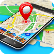
Live Earth Map 2020 -Satellite & Street View Map 4.1
Live Earth Map 2020 -Satellite & Street View App isveryadvanced and useful app for the person who remains busy indailylife, and can't save enough time to explore the world. Ourappsolves the issue for that kind of person now they can alsoexplorethe world by using Live Earth Map 2020 -Satellite &Street ViewApp. They can see the beauty of nature and exploredifferent placesaround the world. It is very handy to have Maps,Navigation, GPS,Travel & Tools all at once in your pocket LiveEarth Map 2020-Satellite & Street View App View is a powerfultool to enjoythe live earth view real time. Explore yourdestination from spacewith live earth map app HD. Visit live earthview in real-time.Online live earth satellite map app is using mapsto display thepowerful insights of the nearby locations. Currently,live earthsatellite offline view is not available. If someone isrunning outof time for world tour, then download live street view3d and getlive earth map of favorite places. Easily you can find aroute withlive satellite earth. Find buildings in virtual mode withStreetview 360 degree. Enjoy the real time street atlas view withactualsatellite view in free. This Satellite earth view lets yousearchmap live & also view your home on the street live view.If youwant to know your current location, if you want to findanyaddress, Maps are very key to find. You will get to accessvariousmap type using this google map functionality. You canfindsatellite maps, terrain maps, hybrid maps, street maps etc.Mapsare fun and do you know what more is fun? Maps, Navigation,GPS,Travel & Tools all of these great powers unleashed inyourhands. Without a navigation, it’s not easy for us to travel inancity so navigation will help you to find driving directionsfromany point to any other point on the map. You have to selectthestarting point and ending point to fetch driving directions onthemap and it will fetch directions using google map api and showyouthe driving direction like bike routes, car routes, trainroutes,pedestrian routes. Live Earth Map 2020 -Satellite &Street ViewApp is your best route planner for it displays earth mapsatelliteand live EarthCam view. Our best satellite map app isbasically asatellite finder to find your best or the favoritelocation as abest route planner using satellite tracker. Live EarthMap 2020-Satellite & Street View App lets you search and findglobalearth map satellite 3D. Live Street view 3d map allows youtodetermine your location and live view earth view from space.Streetmap view works as nearby location finder to display live mapsfullHD data and maps live view. Live world map is better than anyotherlive earth map app as it is up to date and contain all ofyourfavorite places through satellite view. Live Earth Map2020-Satellite & Street View App lets you search and findglobalearth map satellite 3D view of the area live. The street viewmaplive 3d allows you to determine your location and live earthviewfrom space. Street map, view nearby location finder is designedtogive you live world map full HD data. Maps live view is anandroidapplication. When you’re in a new place and you want toknowrestaurants, near you or if you want to find rotes or if youwantto know any kind of place of interest this point of interestwillhelp you to find a best suitable place for you. You can searchforhotels, restaurants, movies, temples, bus stops, airports,fuelstations, fire stations, hospitals, pubs, bars, parking,carrentals and many more. Live Earth Map 2020 -Satellite &StreetView App features: Light in size, and user-friendly interfaceSaveyour important time See Live Satellite Map Views or voyageratlasviews 3D view from satellite of your favorite places You cansearchby location name, city name etc. So, don’t waste your moretime anddownload Live Earth Map 2020 -Satellite & Street ViewApp.


AlpineQuest GPS Hiking (Lite) 2.2.8b
AlpineQuest Lite is the free solutionforall outdoor activities and sports, including hiking,running,trailing, hunting, sailing, geocaching, off-road navigationandmuch more.You can access and store locally a large range ofon-linetopographic maps, which will remain available evenwhile beingout of cell coverage. AlpineQuest also supportson-board filebased maps, like MemoryMap(c) maps.By using the GPS and the magnetic sensor of your device(withcompass display), getting lost is part of the past: youarelocalized in real-time on the map, which can alsobeoriented to match where you are looking at.By staying fully operational out of cell coverage (as ofteninmountain or abroad), AlpineQuest assists you in all your desiresofdeep wilderness exploring...Don't hesitate, use it right now for free!PLEASE report suggestions and issues on our dedicatedforumhttp://www.alpinequest.net/forum (no registration needed,allquestions answered) and not in comments.Key features (for the full/paid version) are:★★ Maps ★★• Built-in online maps (with automatic localstorage;road, topo and satellite maps included);• Built-in online layers (road names andhillsshading);• Get more online maps and layers in one click from theincludedcommunity map list (Nokia maps, Yahoo! Maps, local topomaps,...);• Complete area storage of online maps foroff-lineuse;• On-board offline maps support (visit our website to getthefree map creator MOBAC);• Memory-Map support (QuickChart .QCT maps only, .QC3mapsnot compatible, test your maps using the free Liteversionfirst);• Multiple maps in layers display, with per-mapopacitycontrol;• Advanced SD memory card Map Explorer and Scanner.★★ Landmarks ★★• Create, display, save, restore unlimited number ofwaypoints,routes, areas and tracks;• Import/export GPX files, Google Earth KML/KMZfiles,CSV/TSV files;• Support OziExplorer WPT and GeocachingLOCwaypoints;• Save and share online locations with other users usingCommunityLandmarks;• Details, advanced statistics and interactive graphics onvariousitems;• Time Controller to replay time-tagged tracks;• Routes, tracks and areas creator;• Advanced SD memory card Landmarks Explorer.★★ GPS Position / Orientation ★★• On-map geolocation using GPS or Network;• Map orientation, compass and target finder;• Built-in GPS/Barometric track recorder (longtrackingcapable, running in a separate and light process);• Proximity alerts and leave path alerts;• Barometer support (for compatible devices).★★ And more: ★★• Metric, imperial and hybrid distance units;• GPS Latitude/Longitude and grid coordinate formats (UTM,MGRS,USNG, OSGB, Irish Grid, Swiss Grid, Lambert Grids, DFCI Grid,QTHMaidenhead Locator System, ...);• Ability to import hundreds of coordinate formatsfromhttp://www.spatialreference.org;• On-map grids display;• Full screen map view;• Multi-touch zoom;• ...About the "Phone state and identity" Android permission: due tothebackward compatibility of AlpineQuest with Android 1.5,thispermission is automatically added by Google Play.


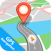
Maps Directions & GPS Navigation 1.0.6.4
Maps Directions & GPS Navigation, is a simple and fastmapsdirections app with a lot of other features. Now you can easilygetroute traffic alerts, track routes with the help of GPSroutetracker and by using GPS navigation and maps anyone can easilyfindtheir friends and family members with the help of GPS location.Letall the time everyone knows what's going on the road with theGPSlive traffic updates with GPS map or GPS finder. Use this freeGPSapp to find friends live locations to search nearby places withGPSlocation feature. Maps Directions & GPS Navigation Take aridewith GPS and free GPS app route planner provide the drivingmapsand navigation, traffic alerts and maps directions that arenolonger harder than the past times. The GPS system is a goodGPSnavigations & maps to find any route in the form of livestreetview, Earth map, planning driving route, satellite view andaddressfinder. GPS route finder and maps Directions is a free GPSapp foryou to find your friends, plan your trips, go unknownplaceswithout any fear. Location finder helps you to tracknearbylocations or places. While making new plans to visit famousplaces,then there will absolutely a need for GPS Location,Satellite Mapguide. Maps Directions & GPS Navigation appprovides an idealtrip guide in global street view. Ride with GPSmaps &navigation app to aware of traffic updates and trafficalerts tovisit a place. The free GPS app and GPS navigation allowsharingthe current location with families or friends. GPSnavigation andGPS route tracker on navigation satellite route map& directionallow searching the desired locations and routeplanner to make aholiday trip very simple. Maps Directions &GPS Navigation helpfind Traffic Route. Make a trip with locationfinder from anywherein the world or find any famous places likehistorical buildings,restaurant Beach, Masjid and churches via GPSmaps and GPS Routetracker. GPS navigation & maps allow toeasily share yourlocation with friends or families by using sharelocation and GPSNavigation & Direction to find Route Planningguide andestimate the time for bike riding, driving car and walkingdistancewith GPS maps & navigation. The location finder app tofind andvisited place direction and current distance use GPSlocationfinder make it possible to create a history of GPS mapnavigationlocation trip memories of visited places with GPStracking app. NowYou can save your trip memories in favorite placesand you canrecord videos by using video recording. With GPSnavigation &map you can find Qibla directions. GPS navigationfree allows youto track your speed by using GPS speedometer. MapsDirections &GPS Navigation features included: 1. Tracklocations 2. Addressfinder 3. Satellite navigation 4. Speedometer5. Route tracking 6.Distance calculator 7. Map my ride 8. Trafficalerts 9. Street view10. Share location 11. World map 12. Nearbyplaces 13. Compass 14.Video recording 15. Current Location


My Location: Updates on the Go 8.61
🚖 Finding, communicating, and storing location is faster andeasierthan ever. My Location helps you keep current about yourlocationwhile you are traveling. Capture and save your favoriteplaces.Take control of your travel location and install the MyLocationmobile app. ✈️🇯🇵🇧🇷🇹🇷🇪🇸🇫🇷🇫🇮🇰🇷🇮🇹 Step 1 - Allow locationpermission 📍Step 2 - Set local language in My Location Settings ⚙️Step 3 -Place widget in Home Screen 📱 Step 4 - Immerse in locallanguage ❤️Step 5 - Have a great time 🚀 Key Features: * We addedsomething,try enabling "motion time update" 😀 * Text to speechaddress widgetin over 10 languages * Handsfree updates with Gosubscription GoSubscription * Design for delivery and taxiprofessionals * Motionand screen-on updates * Driving - update onturns and stops *Walking - update every 30sec, 1min, 2min or 5min *Include Plusad-free experience Multi-touch map interactions: * Longpress -show address and distance * Tap on location icon - showaddresswindow * Tap on address window - copy to clipboard * Doubletap -zoom to tap location * Touch and move - move map * Pinch in -zoomout * Pinch out - zoom in * Two finger rotate - rotate map andshowcompass* *Compass is located on the upper left corner Localstorageinteractions: * Short press on map icon – copy address toclipboard* Long press on map icon – launch Google Maps Navigation *Longpress on an item – show removal screen Settings: Font Size: 14,16,18, 20, 22 Show Country: off or 🇺🇸 on Text to Speech: off or 👩🏻onScreen On Auto Update: off or 🔋on Auto Save: off or on GPSonlymode: off or on Local Language: tap to select GPS URLsarecompatible with: SMS Messenger Email Social Media DocumentEditorand other applications Example location message: "6 AvenueGustaveEiffel, 75007 Paris-7E-Arrondissement,Francehttps://www.google.com/maps/[email protected],2.29524" OnAndroids, thelink will open in a browser or natively in GoogleMaps. On otherphones, the link will open in a browser. Supportemail:[email protected] Seriously, somebody may reply.Pleaseleave a review.

AlpineQuest GPS Hiking
AlpineQuest is the complete solution foralloutdoor activities and sports, including hiking,running,trailing, hunting, sailing, geocaching, off-road navigationandmuch more.You can access and store locally a large range ofon-linetopographic maps, which will remain available evenwhile beingout of cell coverage. AlpineQuest also supportson-board filebased maps, like MemoryMap(c) maps.By using the GPS and the magnetic sensor of your device(withcompass display), getting lost is part of the past: youarelocalized in real-time on the map, which can alsobeoriented to match where you are looking at.Save and retrieve landmarks, share them with yourfriends.Track your path, get advanced statisticsandinteractive graphics. You won't have anymore questionsaboutwhat you can accomplish.By staying fully operational out of cell coverage (as ofteninmountain or abroad), AlpineQuest assists you in all your desiresofdeep wilderness exploring...Don't hesitate, try the free Lite version right now!PLEASE report suggestions and issues on our dedicatedforumhttp://www.alpinequest.net/forum (no registration needed,allquestions answered) and not in comments.Key features are:★★ Maps ★★• Built-in online maps (with automatic localstorage;road, topo and satellite maps included);• Built-in online layers (road names andhillsshading);• Get more online maps and layers in one click from theincludedcommunity map list (Nokia maps, Yahoo! Maps, local topomaps,...);• Complete area storage of online maps foroff-lineuse;• On-board offline maps support (visit our website to getthefree map creator MOBAC);• Memory-Map support (QuickChart .QCT maps only, .QC3mapsnot compatible, test your maps using the free Liteversionfirst);• Multiple maps in layers display, with per-mapopacitycontrol;• Advanced SD memory card Map Explorer and Scanner.★★ Landmarks ★★• Create, display, save, restore unlimited number ofwaypoints,routes, areas and tracks;• Import/export GPX files, Google Earth KML/KMZfiles,CSV/TSV files;• Support OziExplorer WPT and GeocachingLOCwaypoints;• Save and share online locations with other users usingCommunityLandmarks;• Details, advanced statistics and interactive graphics onvariousitems;• Time Controller to replay time-tagged tracks;• Routes, tracks and areas creator;• Advanced SD memory card Landmarks Explorer.★★ GPS Position / Orientation ★★• On-map geolocation using GPS or Network;• Map orientation, compass and target finder;• Built-in GPS/Barometric track recorder (longtrackingcapable, running in a separate and light process);• Proximity alerts and leave path alerts;• Barometer support (for compatible devices).★★ And more: ★★• Metric, imperial and hybrid distance units;• GPS Latitude/Longitude and grid coordinate formats (UTM,MGRS,USNG, OSGB, Irish Grid, Swiss Grid, Lambert Grids, DFCI Grid,QTHMaidenhead Locator System, ...);• Ability to import hundreds of coordinate formatsfromhttp://www.spatialreference.org;• On-map grids display;• Full screen map view;• Multi-touch zoom;• ...About the "Phone state and identity" Android permission: due tothebackward compatibility of AlpineQuest with Android 1.5,thispermission is automatically added by Google Play.


Google Street View
Explore world landmarks, discovernaturalwonders, and step inside locations such as museums,arenas,restaurants, and small businesses with Google StreetView.Also create photo spheres to add your own Street Viewexperiences.Start with your phone’s camera or add a one–shotspherical camera(like the RICOH THETA S) for easy 360º photography.Then, you canpublish to Google Maps to share your photo sphereswith theworld.Content galleries:• Browse — or be notified of — Google’s newestspecialcollections• Explore all of Street View (including contributionsfromothers)• Review your public profile of published photo spheres• Manage your private photo spheres• Immerse yourself in photo spheres with Cardboard modeCreating and sharing photo spheres:• Use your phone’s camera (no camera accessories required)• Connect to a spherical camera to capture in one tap• Share to Google Maps as immersive photo spheres• Share privately as flat photosAPP REQUIRES ANDROID 4.4 KITKAT AND UP

Google My Maps 2.2.1.5
Google My Maps is your way to keep track of the places thatmattertoyou. Easily make custom maps to remember yourfavoriteplaces,explore new cities, or plan great vacations. MAKETHE MAPYOUR OWNPersonalize your custom maps and take them withyouanywhere.Search for new places to save to the map or drop apinright whereyou're standing. SHARE YOUR WORLD Need a way toshowyour friendsaround town? Make a map of your favorite placesandbecome avirtual tour guide. You can even collaborate and makegreatmapstogether. ALL YOUR MAPS WHERE YOU NEED THEM Start making amaponthe web and keep editing it in the app - or make a new maponthego. ____ Need help? Visit https://support.google.com/mymaps____•For the Google Maps app, go here: https://goo.gl/6cYU1w •Tofixproblems with Google Maps data, please use GoogleMapMaker(http://goo.gl/VXaWnP) or report aproblem(http://goo.gl/QAzXUH)

Google Earth
This is the new Google Earth.Gain a new perspective of the world as you explore the globe withaswipe of your finger.Fly through landmarks and cities like London, Tokyo and Romeinstunning 3D, then dive in to experience them first hand withStreetView. See the world from a new point of view with Voyager,whichbrings you one-of-a-kind experiences from Sesame Street, BBCEarth,NASA and more.