Top 49 Apps Similar to Polar Alignment - Polaris hour


DSO Planner Free (Astronomy) 3.8.2
DSO Planner Free is an astronomy observation planningtoolwithexcellent star charting capabilities made by activeandexperiencedamateur observers with a passion forvisualobservations. FreeEdition comes equipped with Yale brightstarcatalog (9 000 starsto 6.5m) and 220 deep sky objects (MessierandCaldwell catalogscontaining the brightest galaxies,nebula,globular clusters, openclusters and planetary nebula).Considerother Editions for morestars / objects. Applicationfeatures: +Planning tool. Filter anyobjects database by observerlocation, skycondition, astronomicalequipment, time range ofobservation andobject features (type,dimension, magnitude, minimalaltitude,visibility and other fieldsof own custom catalogs).Removeduplicate objects when searching inintersecting databases.Createup to 4 observation lists. Easilytrack observed and remainingto beobserved objects with notetaking tool + Double Star catalog.50brightest double stars fromYale catalog. Info Panel with PAandseparation for each component.+ Unique visibility tool.Onlyobjects that are visible withselected equipment in the currentskyconditions could be shown onthe Star Chart + Cross-matchnamesdatabase. Search objects by lesscommon names + FamousSteveGottlieb Notes attached to NGCICobjects + Offlineimages.Integrated set of deep sky object images+ DSS imagerysupport.Download DSS (Digitized Sky Survey) imagesof any skyportion intooffline cache and overlay it on the starchart + PushTofordobsonian mounts with setting circles. Levelyour dobsonianmountand perform one star alignment. The programwillautomaticallyrecalculate az/alt numbers to easily hunt theobject +Nebulacontours. Contours of famous nebulae + Objectcontours.Ellipse inreal dimension and orientation on the skychart + BrightSolarSystem objects. Sun, Moon, Mercury, Venus,Mars, Jupiter,Saturnshown on the sky chart + Night mode. Redkeyboard and menus +Notetaking. Take text and/or audio notes +Observing places. GPS,manualcoordinates, custom lists. Databasewith 24 000 citiesworldwide +Equipment. Keep track of all yourtelescopes andeyepieces. Use themfor object visibilitycalculation and starcharting + Twilightcalculator. Sun, Moon rise/ transit / set. MoonPhase. Civil,Nautical, Astronomicaltwilights. + 2 visual themes(bright anddark) + Powerfulshare/export/import capabilities (ofdatabases,observation lists,notes) Disclaimer

Solar Clock: Circadian Rhythm 3.0.1
Widget available on Premium pack!Do you experience different levels of sleepiness andalertnessthroughout the day? Would you like improve your sleepcycle? Haveyou ever felt poorly because of jet lag?Improve your sleep cycle, productivity and reduce jet lagwiththis app.Solar Clock: Circadian Rhythm syncs the Solar time withyourLocal time and shows important events based onCircadianrhythm.What is the Circadian Rhythm?All species have a timing mechanism, or 'clock,' thatcontrolsperiods of activity and inactivity. These clocks are knownascircadian rhythms and refer the cycle of physiologicalandbiological processes that fluctuate on a roughly 24-hourtimetable.You have probably noticed these tendencies yourself,feeling moreenergetic and alert during peak periods of the day andmorelethargic and run-down at other times of the day. Circadianrhythmsalso impact body temperature, pain sensitivity, mentalalertness,physical strength, and the senses.http://en.wikipedia.org/wiki/Circadian_rhythmhttp://en.wikipedia.org/wiki/Circadian_rhythm_sleep_disordersCircadian disruptions such as jet lag put us in conflict withournatural sleep patterns, since the shift in time and light cuesonthe brain forces the body to alter its normal pattern toadjust.This is why jet lag can leave travelers feeling poorly andhavingmore difficulty thinking and performing well. But thesesymptomscan also occur in everyday life, when the circadian rhythmisdisrupted by keeping long and irregular hours.Solar Clock: Circadian Rhythm helps you to keep aregularsleep schedule and allow plenty of time for qualitysleep,allowingthese two vital biological components, the sleep/wakerestorativeprocess and the circadian rhythm, to help you perform atyourbest.The app will notify when a circadian event starts.The alarm will adjust gradually as sunrise time changethroughoutthe year.Use the app as a natural alarm clock that you can set towakeup.Enjoy Solar Clock and reconnect with yourcircadianrhythm!By downloading this app, you agree to the EULAathttp://livewallpapers.aqreadd.com/eulaCheck out our account or website for more freeapps:http://www.aqreadd.com/apps/Follow us onFacebook:https://www.facebook.com/aqreaddapps?ref=hlFollow us on Twitter: https://twitter.com/AQREADD_appsFeel free to contact us for any issue or suggestion bye-mail:[email protected]::


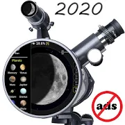
Telescope calculator (no ads) 3.5.1
Calculation of parameters and characteristics oftelescopesusingdifferent eyepieces and visualization. Settings:-language(Russian, English, Hungarian, Spanish, German,French,Romanian,Croatian, Italian, Sinhala, Norwegian, Persian,Polish,Japanese,Portuguese, Korean, Catalan, Dutch, Arabic,Greek,Malay,Luxembourgish, Hindi, Indonesian , Ukrainian,Hebrew,Sardinian,Czech, Swedish, Finnish, Chinese, Bengali,Tamil,Slovenian,Turkish, Bosnian, Thai, Bulgarian, Vietnamese) -scale -text fontsize - input by the slider - comparison oftelescopes -bookmarks -Moon phases - help - swipe Telescope: - Listoftelescopes -Diameter - Focal length - Focuser Eyepiece: -Eyepiecelist - Focallength - Field of view - Barlow lens Camera: -list ofcameras -pixel size - image size - matrix size -BinningCalculations: -Magnification - Stellar magnitude - Field ofview -Maximum fieldof view - f-number - Diameter of exit pupil -Angularresolution -Size of craters on Moon - 2D, 1.4D, 1D, 0.7D,0.5D -Sun - ISSPlanets: - Mercury - Venus - Earth - Mars - Jupiter-Saturn -Uranus - Neptune - Pluto Asteroids: - Ceres - Pallas -Juno- Vesta- Ida - Gaspra Satellite: - Moon - Titan - Io - Europa-Ganymede -Callisto - Titania - Ray Messier: M1, M8, M13, M16,M17,M20, M27,M31, M33, M42, M45, M51, M57, M58, M63, M64, M74,M78,M81, M82,M83, M88, M97, M99, M100, M101, M104, M108 NGC: 891,2359,2392,2440, 4565, 4631, 5189, 6302, 6543, 6960, 6979, 7000,7662IC:1805, 1848, 2118


DSO Planner Basic (Astronomy) 3.4.0
DSO Planner Basic is an astronomyobservationplanning tool with excellent star charting capabilitiesmade byactive and experienced amateur observers with a passion forvisualobservations. Basic Edition version comes equipped with Yalebrightstar catalog (9 000 stars to 6.5m), 600 000 stars to 10.7mfromTycho-2 catalog, 3 100 brightest objects from NGCICcatalog,observable comets (around 700) and 500 brightest minorplanets. Theapplication excels at creating observation plans on thefly, haspowerful note taking capabilities, PushTo and GoTo supportandnight (red) mode.Consider Plus/Pro Edition if you need more objects/starsandopportunity to create your own object databases.Before installation please make sure that you have at least 100MBof free space on your internal SD card to downloadapplicationdatabases! (Note: due to Google Play rules this datacannot bemoved to your external SD card - you must have 100 MB freeon yourinternal SD card!)+ Deep sky catalogs. NgcIc (3 100 objects includingMessier,Caldwell and Herschel 400 objects)+ Double Star catalog. 500 double stars from Yale catalog shownonStar Chart. Info Panel with PA and separation foreachcomponent.+ Comet support. Orbital elements of around 700 observablecometscould be automatically updated via internet+ Famous Steve Gottlieb Notes attached to NGCIC objects+ Cross-match names database. Search stars / objects by lesscommonnames+ DSS imagery support. Download DSS images of any sky portionintooffline cache and overlay it on the star chart+ Offline images. Integrated set of images of mostNgcIcobjects+ Nebula contours. Contours of famous nebulae+ Object contours. Ellipse in real dimension and orientation+ Night mode. Fully red screen with red keyboard and menus+ PushTo for dobsonian mounts with setting circles. Levelyourdobsonian mount and perform one star alignment. The appwillautomatically recalculate az/alt numbers to easily hunttheobject+ GoTo for Meade and Celestron controllers withbluetoothdongle+ Unique visibility tool. Only objects that are visiblewithselected equipment in the current sky conditions could be shownonthe Star Chart+ Planning tool. Filter any objects database by observerlocation,sky condition, astronomical equipment, time range ofobservationand object features (type, dimension, magnitude, minimalaltitude,visibility). Remove duplicate objects when searchinginintersecting databases. Create up to 4 observation lists.Easilytrack observed and remaining to be observed objects withnotetaking tool+ Import tool. Import observation lists in Sky Safari and SkyToolsformat+ Note taking. Take text and/or audio notes+ Observing places. GPS, manual coordinates, custom lists.Databasewith 24 000 cities worldwide+ Equipment. Keep track of all your telescopes and eyepieces.Usethem for object visibility calculation and star charting. Use500popular eyepieces database+ Twilight calculator. Calculation of the full darkness foracurrent night and for a month ahead+ 2 visual themes (bright and dark)+ Powerful share/export/import capabilities (ofdatabases,observation lists, notes)Disclaimer


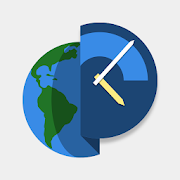
TerraTime
Visually stunning virtual Earth: Realsatellitephotos drive a simulation of day/night, clouds, seasons,sun, moonand more. Plus, our unique clock (with widget) tracksdaylight,phases of the moon, sunrise, sunset and transit times.It'severything you need to stay connected to the world youlivein.Great for travelers, astronomers, weather watchers,geographers,teachers, photographers, fishermen and other outdoortypes - aswell as just about any geek you can think of.Superbly stylish, incredibly detailed and unbeatably useful-LifeOfAndroid.comTerraTime is unique. It is bold and different...-AndroidApps ReviewPossibly the most beautiful phone app I’ve seen.Highlyrecommended. - AndroidAstronomer.comThe overall beauty of the app is well, its beauty!-CoolSmartPhone.comIt's spot-on no matter where you look at it in the world-The Sun (UK newspaper)Features:• Globe and map depict real-time night-side shadow (on EarthandMoon)• Photorealistic simulations include clouds, city lights, seaice,and more, generated from actual satellite imagery• Optional dynamic imagery downloads for an even morenear-real-timedisplay• Daylight clock and compass show sunrise & sunset; moonphase,rise & set; twilight & transit times• Multiple clock/compass styles (currently Material, Classic,andWave - with more coming soon)• Experimental Camera View plots sun and moon pathsinaugmented reality• Globe and map are fully interactive, using touchscreen ordevicesensors• Easily shows any date, any location• Clock and globe widgets• Live wallpapers for real-time globe and daylight map• Android Wear watch faces (4 styles) and complications (10)Please, if you have any issues, email us! There's a linkinthe app's About screen.

MGRS GPS 2.2
MGRS GPS allows you to see your MGRS location on the mapofyoursmart phones and tablets. You can store thoselocationsaswaypoints. In addition, you can share the waypointwithyourfriends through NFC, Bluetooth, Google+, Email, Messagingandmore.Waypoints can be shared as plain text or a Google KMLfile.Awaypoint can be created using the device's current locationortheuser can enter the grid reference manually throughthe"createwaypoint" dialog. In addition, the app now is able tocreatea newwaypoint when the user long press on the GPS map. Theappcomeswith an App Widget that provides you the latestlocationreadingreceived by the MGRS GPS app.The widget can bedisplayed onthehome screen as well as the lock screen (lock screenwidgetrequiresAndroid version 4.2 and above).


Mavrx Scout 4.4.1
Achieve total operational awareness allseasonlong with Mavrx Scout. Take the power of imaging, analytics,andcomprehensive reporting to the field with automatic issuedetectionand quantified alerts delivered to you and your teamanytime,anywhere. Prioritize fields to scout and sample, navigateto areasat risk, and record observations with just a few clicks.Utilizehigh-resolution or satellite layers to direct scoutingactivities,on or offline. Monitor field conditions like rainfalland GDDs, andaccess our large database of issues -- from weeds todiseases,insects, and disorders -- to record what you’re seeing.Addgeotagged notes, photos, and voice memos to reports tovalidateservices you offer to your client base, then email thosereportsdirectly from the field.This software application incorporates research andeducationalcontent from a variety of independent researchinstitutions theIowa State University of Science andTechnology.Continued use of GPS running in the background candramaticallydecrease battery life.FEATURES:• Bring timely, actionable high-resolution imagery and maplayerswith you to the field• Receive automatic notifications to alert you to potentialcropperformance issues and yield at risk• Seamlessly import and export any and all data for optimalsharingand analysis• Take geotagged field observations, photos, and voice memoswhileyou're working• Quickly update crop growth stages from your device• Access all imagery, map layers, and reports onlineoroffline• Scout with our large database of weeds, diseases, insects,anddisorders• Track rainfall, field velocity, and GDDs acrossyouroperation• Easy navigation between your organization’s field hierarchyABOUT MAVRX:Mavrx is an analytics company leveraging imagery to drive thenextrevolution in farm efficiency. With its network of aircraftandsatellites, Mavrx provides total field awareness enablinggrowersand their service providers to maximize yields and reducecosts.Mavrx combines computer vision algorithms and machinelearning todetect, predict, and alert to changes in crop conditionsto helpyou prioritize where you scout, sample, and ultimatelyachieve youryield goals every season.To sign up, visit https://www.mavrxfarm.comFor more information, email [email protected] or call(844)GO-MAVRX.


Mapillary 3.177
Mapillary is a service forcrowdsourcingstreet-level photos of the places you care about, bysimply usingyour phone. Together we are creating a visualrepresentation of theworld that anyone can explore.This app lets you:- take photos and upload them to the Mapillary service;- find areas with photos, view and navigate them onyourphone;- photo map your neighborhood, holiday spot or adventure from acar,on the bike or walking;- contribute to a crowdsourced street-level view of thewholeworld;- share the places you care about with others, usingmaplinks.Home: This is your personal feed where you will see a summaryofyour activity, such as the photos you have uploadedandnotifications that are relevant to you.Explore: Here you can experience virtual tours of theplacescaptured by Mapillary community members all over theworld.Capture: Opens the camera and lets you capture photo sequencestoupload - this is your way of contributing.Upload: When you have captured a photo sequence (or many), youwillgo here to upload it.You can review your sequences before uploading, removingunwantedphotos.Profile: This is your profile, where you can see youruploadstatistics and your own photo sequences.
Altimeter Ler Live Gps Geotracker 2.6
Modern Altimeter GPS+ app is for folks who care for hikingandbikingin mountainous terrain. GPS is getting very accurateinterms ofdistance indication. The choice between unit systemisperhaps animportant thing, just for your convenience the appisbeing equippedwith both of them (Imperial andMetric).Surprisingly strongbarometer measures the weight of theairpressure above a given pointand determines elevation oftwopoints. This app has a creativeand user-friendlystyledesign, simple and comprehensivefunctionalities. Featuresincluded- Imperial and Metric unitsettings. - GPS accuracyindicator. -GPS distance accuracyindicator. - Density of air ,indicator.Search any place and dropsearch pin with place info.Built inlibrary Map integration - GOOGLEmaps - Satellite mapsmode. -Hybrid maps mode. - Standard maps mode.- Terrain maps mode.-Tracking location changes trajectory. Compass- Compass withcamera- Take a pictures with coordinates - Showsdevicereal-timeorientation to magnetic fields. - Ability toswitchbetween trueand magnetic North. - Location coordinates(longitude,latitude). -Course Track information - Time elapsed. -Distance. -Averagespeed. - Max speed. - Altitude. Tracking - Speedtracking inmph orkm/h based on MPH or KM/H mode. - Distancetracking in milesorkilometers based on MPH or KM/H mode. - Timetracking. -Longitude,latitude coordinates. - Save locations drop apinWeather --Temperature information. -- Wind --Visibility--Sunrise,Sunset -- High/Low Temperature. --Abilitytoswitch between Celsius and Fahrenheit.


OruxMaps Donate
ATTENTION, THIS IS THE VERSION 'DONATE'. IFYOUWANT, YOU CAN TRY THE FREE VERSION, WHICH IS IDENTICALTOTHIS.IMPORTANT!: NOT ALL ONLINE MAP SOURCES ARE NOW DOWNLOADABLE.SELECTANOTHER SOURCE IF YOU CAN NOT FIND THE OPTION TO DOWNLOADAMAP.Map viewer, track logger.You can use OruxMaps for your outdoor activities (running,treking,mountain bike, paragliding, flying, nauticsports,....)100% no adversisementsOnline and offline maps. Support to multiple formats:-OruxMaps format. You can use maps from Ozi Explorer transformedwita PC tool.-.ozf2-.img garmin (vectorial) -no full support is provided-.-.mbtiles-.rmap-.map (vectorial from mapsforge). Support to custom themessimilatthan Locus themes.Support to Wms, you can use the application as a WMS viewer.Support to APRS sources.3D view.Support to multiple external devices:-GPS bluetooth.-Heart rate monitors, bluetooth Zephyr, Polar (includingbluettohsmart devices, like polar H7).-ANT+ (speed, cadence, heart rate, distance,...).-AIS information systems (experimental), for nautical sports,usingWifi o BT.More features:Support to KML KMZ and GPX formats.Share your position with your friends, display the position ofyourfriends in your device.Download online maps for offline use.Text to speech support.Profiles; save your preferences in your SD card.Statistics with graphics.Follow routes, with different alarms to alert you if you are nearawaypoint, or you are far from the route.Create/save wayponits, attaching photo/audio/videoextensions.Custom waypoints types, with your icons.Basic support to Geocaching.Correct the altitude of your tracks/routes using DEM files(offline)or online services.Search/download tracks from:-everytrail.com-gpsies.comSearch or create tracks using online services from Cloudmadeoroffline using Broute app.Upload tracks to:-mapmytracks.com-trainingstagebuch.org-ikimap-wikirutas-openxploraLive tracking using:-mapmytracks.com-okmap application-gpsgate protocolMore info here: www.oruxmaps.com


Compass Pro - with camera view 2.0
A very accurate compass withmanyfunctions:Spirit level, magnetic field, geo data (location).With the camera function you can 'look through' your device,focuson a point and get the exact cardinal point.No ads!Features:* Choose individual layout colors* Portrait and landscape mode (optimized for tablets)* Location (GPS or network)* Spirit level: acoustic and visiual feedback, decimalplaces,calibration, x and y values can be swapped* The rotation in horizontal position can be measured withthecompass* Strength of the magnetic field is displayed* App can be moved to sd-card* ...ONLY IN PRO VERSION:* No ads!* Set visual and acoustic indicator with a tolerance* Location can be displayed in decimal format* ...INFO:- You can't take pictures with this compass. If you want totakepictures as well, get the 'Level Camera' app in thePlayStore.- The precision of the compass depends on your sensor. Magnetsandelectric fields have a magnetic field and thus have an influenceonthe compass.PERMISSIONS:'Location': only used to display your location.'Camera': camera view can be set as background.


Mobile Observatory - Astronomy
Mobile Observatory is the perfect toolforanybody interested in the sky's wonders, from the occasionalskygazer to the passionate amateur astronomer.Do you want to know if the next lunar eclipse is visible fromyourlocation or when the next bright comet is visible? Would youliketo be notified by your smart phone next time, Jupiter and theMoonmeet in the sky? Do you want to know what the blazing brightobjectin the evening sky is? Do you want to be always up-to-datewhichcelestial events that are visible from your location? Thenthis appis a must-have for you!Mobile Observatory does not only include a live, zoomable skymapwhich tells you what sky object you are looking at but providesyouwith loads of detailed extra information on stars, planets,deepsky objects, meteor showers, comets, asteroids, lunar andsolareclipses as well as detailed ephemeris of all included skyobjectsand an interactive top-down view of the Solar System. Allthat injust one app!Main Features- Zoomable sky map showing stars, planets, asteroids, andmore(above and below the horizon)- Interactive top-down view of the Solar System- Live mode (point device on sky and get information on whatyousee)- Calendar showing detailed descriptions of celestial events- Push celestial events to your phone's calendar and set areminderalarm- Rise, set, and transit times for any object- Position of any object in the sky (altitude and direction)- Twilight times, length of day- Bright Star Catalog (~9000 stars) with detailed information- More than 400 000 additional stars from the PPM StarCatalog(Android 3.1 or higher required)- 2500 selected NGC objects (galaxies, clusters, ...)- Messier Catalog (110 objects) complete with images- Caldwell Catalog (110 objects) complete with images- Hidden Treasures Catalog (109 objects) complete with images- Meteor streams (begin, maximum, hourly rate, ...)- Lunar and solar eclipses information- Lunar librations, ascending node, maximum declination- Bright comets (automatically selected according to thedate)- Dwarf planets: The five known dwarf planets- Minor planets: bright, near Earth, trans-Neptune (more than10000in the database)- Update database online: download up-to-date orbital elementsofcomets and minor planets- Moon phases, the apparent view of the sun and planets- Current image of the Sun and sunspot number- Automatically generated visibility report for any object- Simulation of light pollution- Intuitive User Interface: quickly find what you arelookingfor- Widget with rise & set times of the Sun and Moon- Maintain your favorite locations in a list- Automatic location determination from the mobile networkorGPS- Select a location from a built-in database or online viaGoogleMaps- 400 observatory locations- Choose any time and date- Detailed ephemeris, visibility information of all objects- Dates of conjunctions between any object with planets ortheMoon- 3D-view of the Moon and the planets- Accurate calculations for dates between 1900 and 2100


LEE Stopper Exposure Guide 1.4
This is the official exposure guide for photographers usingLEEFilters range of Stopper long exposure camera filters.It'sdesigned to help you get the most from your Big, Little andSuperStopper filters - accurately calculating the precise exposureyourequire and offering a flexible timer for very long shutterspeeds.Tap the menu at the top to select your Stopper: 6 Stops =LittleStopper 10 Stops = Big Stopper 15 Stops = Super Stopper Turntheleft hand wheel to dial in your metered shutter speed (beforeyouinsert any filters) and read the adjusted exposure on therighthand wheel. The app converts a full range of shutter speeds in1/3stop increments. Use the built-in countdown timer for anyexposureover 30 seconds and see in a glance how long you have left.Forvery long exposures you’ll also get a reminder notificationplusall countdowns finish with an alarm and a timestamp. There’salso ahandy User Guide and links to a variety of informativeandinspirational web resources to support your LEE FiltersStopperphotography.
