Top 39 Apps Similar to Omicrono


Linxup 4.3.4
The Linxup app is a companion application to the LinxupGPStrackingsystem. The easy-to-use app lets you locate andmonitoryour fleetvehicles directly from your Android device.Thisapplicationrequires an active Linxup tracking device andaccount.Features: -Instant GPS tracking of any vehicle in yourfleetequipped with aLinxup GPS tracking device. - View abreadcrumblocation history foreach vehicle. Clickable icons providespeed,direction, and stopsinformation. - Map views with both mapandsatellite options. - Viewdetailed reports of yourvehicles'activity. **Activate yourtracking device on the web portalandthen plug it into the vehicle.Ensure that your tracking deviceisreporting location status beforelogging into themobileapplication.

Pocket RxTx Pro
NOTE: If you just discovered this application, pleaseconsidertoinstall the Free version first. All the differencesbetweenthefree and paid version are explained in the applicationuserguide.This is the most significant upgrade to date. Pleasecheck mywebsite or read the application user guide for all thechanges.Forany issue, send me an email or post in the applicationforum.Icount on your understanding and help to maketheapplicationbetter. There is a dedicated applicationforumhere:https://www.yo3ggx.ro/forum/viewforum.php?f=15Online(multilanguage)userguide:https://www.yo3ggx.ro/pocketrxtx/doc30/i.html User guideinPDFformat(Enlishonly):https://www.yo3ggx.ro/pocketrxtx/doc30/pocketrxtx_v3.0.pdf


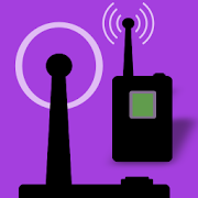
FreqFinder 2.27
For use with transmitters byLectrosonics,Comtek, Sennheiser, Zaxcom, and more.FreqFinder calculates the intermodulation products of userenteredtransmitter channels and then suggests options of channelsthatwill be compatible with user transmitters already in use.Recommended for use with 12-24 transmitter systems depending ontheprocessing power of your device and the spread ofyourtransmitters.US Customers: TVDB in-app purchase now available. Accesses theFCCdatabase for local TV broadcast towers and estimates thefieldstrength at your location for better channel selection.

SSA Capture RF Geotagger 2.0.5.0
Get detailed network parameters such as signal strength,UL/DLspeeds, cell ID etc. directly on your Android smartphoneanddisplay the data in overlay on geotagged photos for easysharing.SSA Capture is the simplest and fastest way for RFtechnicians toreport back to base after field operations, or forend users to lettheir service providers know of any issue in thenetwork. Simplytake a picture through the app - the overlay textwill display yourprecise location and all relevant signalparameters - and click“share” to send! Captured images and theiroverlaid data aredisplayed on a convenient map-based interface,making photos ofdifferent locations easy to find. App highlights: -Supports 3G,LTE, 5GNR(NSA) and Wi-Fi signal logging, and basic 2Gsignal level- Performs UL/DL throughput tests - Displays networkparameters andlocation coordinates on photos - Allows users to addtext tocaptured images - Uses geotagging to display captured imageson aGoogle Maps-based interface Tutorials: - PPSwalkthrough(recommended for use on PC): http://goo.gl/immYj7 -PDF:http://goo.gl/ygKAFl NB: SSA Indoor displays networkparametersrecorded by your mobile phone – unfortunately, somedevices do notmeasure all signal parameters available, and othersmay lackprecision in their readings. SSA Indoor cannot guaranteetheaccuracy of your Android device’s signal measurement.


PHOTOMOD GeoCalculator 1.3.001
PHOTOMOD GeoCalculator performs coordinate transformationsaccordingto Russian State Standard GOST R 51794-2001 andInterstate StandardsGOST 32453-2013 (GOST R 51794-2008) and GOST32453-2017. Itimplements transformations between Cartesiangeocentric and geodetic(latitude, longitude, height above theellipsoid) reference framesbased upon geodetic datums WGS 84,Pulkovo 42, Pulkovo 95, GSK-2011,PZ-90, PZ-90.02, PZ-90.11 andITRF-2008, as well as projectedcoordinate systems SK-42, SK-95 andGSK-2011 (based on Gauss-Krugermap projection). In addition sometransformations not covered by thestandards are supported, namelyones involving WGS 84/UTM referencesystem and EGM96 geoid model.Coordinates to be transformed can betyped-in manually, measured inGoogle Maps or set to the currentdevice location.