Top 45 Apps Similar to Free Navigator GPS


Waze - GPS, Maps, Traffic Alerts & Live Navigation 4.81.0.4
Avoid traffic jams, police traps, andaccidentswith Waze, the #1 real-time navigation app. Get thefastest routesto your favorite locations and new destinations, allfor free.Waze is a community of 85 million drivers. Here’s why:◦ Automatically reroute around traffic as conditions change ontheroad◦ Get police & speedcam alerts while you drive◦ Hear road directions by celebrity voices or the average Joe◦ Record your own custom voice directions to guide you ontheroad◦ Know how long your drive will take before you start driving◦ Find gas stations and the cheapest gas prices on your drive◦ Earn points and gain status as you contribute with roadinfo◦ Low data usage from your phone◦ Waze works anywhere in the worldFor drivers who really don’t like to waste time or money:◦ Get notified when it’s time to leave for your destinationbysetting your drive in advance◦ Let Waze tell you when it’s time to leave for your eventsbysyncing your calendar with Waze◦ Save time looking for parking with Waze parking suggestionsbyyour destination◦ Choose to be routed on toll roads or to avoid them◦ Get a sound alert if you exceed the speed limit withthespeedometerYou have full control over your privacy settings. Learn moreaboutthe Waze privacy policy, including what information isaccessed andhow it is used: www.waze.com/legal/privacy

GPS Navigation
FREE GPS navigation & offline mapsFREE map updatesFREE trip planning & POI searchGPS Navigation is a free offline gps navigation based onPremiumMaps, with multiple map updates per year. Free versionincludes 7days Premium with voice guided navigation. After 7 daysuse offlinemaps and trip planning for free or upgrade to unlimitedvoiceguided Premium navigation.Free features:~ car & pedestrian navigation~ speed limit warnings~ 3D mapsPremium:~ multi language voice guided navigation~ lane guidance~ HUD~ travelbook~ support~ speed camera warnings~ navigate to photoAvailable maps:AfricaAlgeria, Angola, Benin, Botswana, Burkina Faso, Burundi,Cameroon,Capeverde, Central African Republic, Chad, Comoros,DemocraticRepublic of Congo, Congo, Djibouti, Egypt, EquatorialGuinea,Eritrea, Ethiopia, Gabon, Gambia, Ghana, Guinea,Guinea-Bissau,Kenya, Lesotho, Liberia, Libya, Madagascar, Malawi,Mali,Mauritania, Mauritius, Mayotte, Morocco, Mozambique,Namibia,Niger, Nigeria, Reunion, Rwanda, Saint Helena, SaotomeandPrincipe, Senegal, Seychelles, Sierra Leone, Somalia, SouthAfrica,South Sudan, Sudan, Swaziland, United Republic of Tanzania,Togo,Tunisia, Uganda, Western Sahara, Zambia, ZimbabweAsiaAfghanistan, Armenia, Azerbaijan, Bangladesh, Bhutan, BritishIndianOcean Territory, Brunei Darussalam, Burma, Cambodia, China,EastTimor, Georgia, Hong Kong, India, Indonesia, Japan,Kazakhstan,Kyrgyzstan, Laos, Macau, Malaysia, Maldives, Mongolia,Nepal, NorthKorea, Northern Mariana Islands, Philippines,Singapore, SouthKorea, Sri Lanka, Taiwan, Tajikistan, Thailand,Turkmenistan,Uzbekistan, VietnamEuropeAlbania, Andorra, Austria, Belarus, Belgium, Bosnia andHerzegovina,Bulgaria, Croatia, Cyprus, Czech Republic, Denmark,Estonia, FaroeIslands, Finland, France, Germany, Gibraltar,Greece, Guernsey,Hungary, Iceland, Ireland, Italy, Jersey, Latvia,Liechtenstein,Lithuania, Luxembourg, Macedonia, The FormerYugoslav Republic of,Malta, Moldova, Republic of, Monaco,Montenegro, Netherlands,Norway, Poland, Portugal, Romania, RussianFederation, San Marino,Serbia, Slovakia, Slovenia, Spain, Sweden,Switzerland, Turkey,Ukraine, United Kingdom, Vatican, KosovoMiddle EastBahrain, Iran (Islamic Republic of), Iraq, Israel, Jordan,Kuwait,Lebanon, Oman, Pakistan, Palestine, Qatar, Saudi Arabia,Syria,United Arab Emirates, YemenNorth AmericaAnguilla, Antigua and Barbuda, Bahamas, Barbados, AmericanSaoma,Belize, Bermuda, British Virgin Islands, Canada, CaymanIslands,Costarica, Cuba, Dominica, Dominican Republic, ElSalvador,Greenland, Grenada, Guatemala, Haiti, Honduras, Jamaica,Mexico,Montserrat, Nicaragua, Panama, Puerto Rico, Saint Kitts andNevis,Saint Luca, Saint Pierre and Miquelon, Saint Vincent,Trinidad andTobago, Turks and Caicos Islands, Virgin IslandsUnited StatesAlabama, Alaska, Arizona, Arkansas, California,Colorado,Connecticut, Delaware, District of Columbia, Florida,Georgia,Hawaii, Idaho, Illinois, Indiana, Iowa, Kansas,Kentucky,Louisiana, Maine, Maryland, Massachusetts, Michigan,Minnesota,Mississippi, Missouri, Montana, Nebraska, Nevada, NewHampshire,New Jersey, New Mexico, New York, North Carolina, NorthDakota,Ohio, Oklahoma, Oregon, Pennsylvania, Puerto Rico, RhodeIsland,South Carolina, South Dakota, Tennessee, Texas, Utah,Vermont,Virgin Islands (U.S.), Virginia, Washington, WestVirginia,Wisconsin, WyomingOceaniaAustralia, Cook Islands, Fiji, French Polynesia, Kiribati,MarshallIslands, Micronesia, Nauru, New Caledonia, New Zealand,Niue,Palau, Papua New Guinea, Pitcairn, Samoa, Solomon Islands,Tokelau,Tonga, Tuvalu, Vanuatu, Wallis and Futuna, Cocos islands,ChristmasislandsSouth AmericaArgentina, Bolivia, Brazil, Chile, Colombia, Ecuador,FalklandIslands, French Guiana, Guadeloupe, Guyana, Martinique,Paraguay,Peru, Saint Barthelemy, Saint Martin, Suriname,Uruguay,Venezuela


TomTom GO Navigation 3.2.12
Get Offline Navigation, Online Experience with TomTomGONavigation:Downloadable GPS Sat Nav offline maps, preciselivetraffic, andspeed camera alerts*, both updated inreal-time.Download now usingthe 30-DAY FREE TRIAL offer to get thebestdriving experience. 😎KEEP YOUR MAPS UPDATED WHILE SAVINGYOURMOBILE DATA • Maps À LaCarte: Save your mobile data withofflinemaps available in 150countries, always ad-free. You decidewhichmap to download, basedon what you need. • Weekly Map Updates:Helpyou steer clear ofblocked roads and drive within speedlimits,even when you areoffline. • Moving Lane Guidance: Endtheguesswork - know what laneis yours and what exit totake.Proprietary maps coming from 20+years of experience, provideyouhigh-quality turn-by-turn guidanceon your ways. STAYCONNECTEDWITH REAL-TIME UPDATES: • TomTomTraffic: Avoid traffic anddangerzones in real-time withintelligent route • Speed CameraWarnings*:Helping you drive saferand hassle-free with speed alertsandwarnings for fixed and mobilespeed cameras. • Online Search:Yourgo-to destinations, as well aspopular attractions andessentialPOIs, are stored on the app. Onceconnected, you cansearchdestinations from the catalogue of TomTom.• Share ETA: Shareyourestimated time of arrival with coworkers,friends, and familyviathe messaging platform of your choice. DRIVESAFELY AND BE AWAREOFSPEED CAMERAS: • Points of Interest: Searchand finddestinations,scenic areas, and attractions on the way andwhen youarrive atyour destination. • Alternative Routes: See waysaroundtrafficcongestion backed by precise distance and timecalculations •Driveto Photo: Remember the name of that place?! Ifyou geotaggedthephotos you took there, the app will take youthere! • DrivetoContacts: Get easier route planning to the peopleyou know,withthe contacts stored on your phone. • Ad-Free: Avoidannoyingadsfor the most efficient journey without interruption. •NEW! :Nowworks with Android Auto After the free trial, you canselect oneofthe following auto-renewing subscription plans: $1.99- 1month$8.99 - 6 months $12.99 - 12 months Cancel or changeyourplananytime. Drive with TomTom Go Navigation, thestate-of-the-artGPSSat Nav around! 💯 If you have questions,feedback, or inputonsomething we may have missed, please follow us& share on:+Facebook @ TomTom + Twitter @ TomTom + Instagram@TomTomDriversDisclaimers: · The use of this app is governed bytheTerms andConditions at tomtom.com/en_us/legal/. ·Additionallaws,regulations, and local restrictions may apply. Youuse thisapp atyour own risk. * The Speed Camera Services must onlybe usedinaccordance with laws and regulations of the country whereyouaredriving. This functionality is specifically prohibitedinsomejurisdictions. It is your responsibility to comply withsuchlawsbefore activating the services. You can enable anddisableSpeedCamera warnings on TomTom GO Navigation. Learnmoreat:tomtom.com/en_us/navigation/mobile-apps/go-navigation-app/disclaimer/**Offerlimited to one free trial period per user. At the end ofthetrial,your subscription will be charged unless you cancel itatleast 24hours in advance.


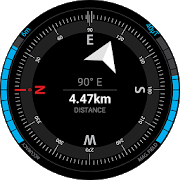
Free Navigation 1.2.5
You can keep your hands on the steeringwheelof your car and navigate safely on roads that do notknow.To operate the navigator ONLINE, you first need to download themapof the affected area.Enable GPS and speaks with your voice, navigation willstartimmediately.Features:- Address House Fast- Phone book (you can delete all data stored at one time oreverysingle address with swipe)- POI (you can delete all data at once or individually with eachPOIswipe)- Where 'my car? Very useful to find the car in large parkinglots,or unfamiliar places.If you are tired of all the icons in the form of maps, GPS,compass,cars and roads, download this simple and easyapplication!Navigator does not use "Google APIs."


SNAV navigator free
Features: - Address Book - Home and 4 shortcut keys -QuickVoiceSearch - Selection of navigation type: car, bicycle,walking,train/ bus - Avoid motorways and tolls SNAV Google™Navigatorsimplifiesthe use of Google Maps™ or Waze™ thanks to thequickstart of thenavigation process, simply by using your voice,withoutusing yourhands when you are driving. Snav Navigator isuseful foruse in thecar. You can program your home address, fivefavoritesand canremember the latest destinations, which makes iteasy toreach yourdestination while also avoiding motorways andtolls.Great fordrivers who don't want to be distracted too much bythesmartphonewhile driving, SNAV Navigator will make theplanningprocess of atrip much easier and less annoying when engagedin thesteeringwheel. Snav Navigator does not use any "Google API".GoogleMaps™and Google Voice™ must be installed to work. Remember -Don'tdrinkand drive!


Navmii GPS World (Navfree) 3.7.22
Navmii is a free navigation and traffic appfordrivers.Navmii combines FREE voice-guided navigation, livetrafficinformation, local search, points of interest and driverscores.Offline maps stored locally, for use without aninternetconnection. Over 24 million drivers use Navmii and our mapsareavailable for more than 150 countries.• Real voice-guided navigation• Real-time traffic and road information• Works with GPS only – internet not needed• Offline and Online Address search• Driver Scoring• Local Place search (powered by TripAdvisor, FoursquareandWhat3Words)• Fast routing• Automatic rerouting• Search using Postcode/ City/ Street/ Points of interest• Heads-Up Display (HUD) – upgrade• Community map reporting• HD accurate maps• + Much, much moreWe have thousands of 5-STAR REVIEWS:- why buy a satnav when navmii does it all- unbeatable value and functionality- love, love this app!Navmii features on-board OpenStreetMap (OSM) maps, which arestoredon your device and therefore you don’t need no dataconnection(unless of course you use the connected services). UseNavmiiabroad to avoid high roaming costs!We're always eager to hear about your experience of usingNavmii.You can contact us anytime by email, on Twitter or Facebookusingthe details below:- Twitter: @NavmiiSupport- Email: [email protected] Facebook: www.facebook.com/navmiigpsNote: continued use of GPS running in the backgroundcandramatically decrease battery life.


Map of Mexico 1.20
This application turns your Androiddeviceintoa GPS navigator with offline maps.You can search easily locations in Mexico and you can addthemtoyour route.Discover interesting places near you:accommodation,parking,restaurants, bars, clubs, cinemas, theatres,auto services,shops,parks, schools, hospitals, sport areas.It includes detailed maps of the biggest cities inMexico:MexicoCity, Ecatepec, Guadalajara, Puebla, Leon,Juarez,Tijuana,Zapopan, Monterrey, Nezahualcoyotl, Chihuahua,Naucalpan,Merida,San Luis Potosi, Aguascalientes and others.This application is based on Osmand project under theGNUGPLv3license and uses high quality data from OSM.


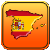
Map of Spain 1.24
Offline map for SpainUse it as your GPS navigator!It's free and you don't need an internet connection to seethemap!Search addresses or points of interest.Get routing to destination.It includes a detailed list of points of interest fortourists,accommodation, parking, restaurants, bars, clubs,cinemas,theatres, auto services, shops, parks, schools, hospitals,sportareas.The application has detailed maps of major cities in Spain:Madrid,Barcelona, Valencia, Sevilla, Zaragoza, Malaga, Murcia,Palma, LasPalmas, Bilbao, Alicante, Cordoba, Valladolid, Vigo,Gijon,L'Hospitalet de Llobregat, A Coruna , Vitoria-Gasteiz,Granada,Elche, Oviedo, Santa Cruz de Tenerife, Badalona, Cartagenaandothers.This application is based on Osmand project under the GNUGPLv3license and uses high quality data from OSM.

Magic Earth Pro Navigation 7.1.17.23.850E41D.0D5E129
MAPS– Professional TomTom maps– 3D maps– Satellite maps– Wikipedia– Weather– Add points-of-interestNAVIGATION– Car Navigation- Lane Guidance- Multiple Stops- Road Signs- Speed Cameras- Speed WarningsHD TRAFFIC– Alternative routes– Avoid traffic– Updated every minuteOFFLINE MAPS– No mobile internet costs– Navigate without internet– Country maps– Regional mapsNOTES:* Upgrading from ROUTE 66 Navigate is entirely free andyourexisting licenses in ROUTE 66 Navigate will automatically workinMagic Earth Pro.* Navigation, Speed cameras and HD Traffic are premiumservicesavailable as in-app purchases.* Some features not available in all countries.* Some features require internet connection.


Navigatore
With Navigatore app you get access to GPSmapsand navigation in your smartphone. App uses latest mapsandsatelite images for the most accurate navigation. You can alsoseelive traffic information in the map or on your route.Features:- accurate gps navigation - turn by turn navigation from starttoyour destination- voice instructions - focus on the road, no need to lookatnavigation- offline map - save mobile data when you download your route /mapfor offline usage- nearby - find best restaurants, gas stations, etc...


Map of Argentina 1.24
This application turns your Android deviceintoa GPS navigator with offline maps.You can search easily locations in Argentina and you can add themtoyour route.Discover interesting places near you: accommodation,parking,restaurants, bars, clubs, cinemas, theatres, auto services,shops,parks, schools, hospitals, sport areas.It includes detailed maps of the biggest cities in Argentina:BuenosAires, Cordoba, Rosario, Mendoza, San Miguel de Tucuman, LaPlata,Mar del Plata, Salta, Santa Fe de la Vera Cruz, SanJuan,Resistencia, Santiago del Estero, Corrientes, Bahia Blanca,SanSalvador de Jujuy and others.This application is based on Osmand project under the GNUGPLv3license and uses high quality data from OSM.

BackCountry Navigator TOPO GPS
Download topo maps for an offlineoutdoornavigator! Use your phone or tablet as an offroad topomappinghandheld GPS with the bestselling outdoor navigation appforAndroid! Explore beyond cell coverage for hiking andotherrecreation.Download topo maps for the US and many other countries inadvance,so you won't need cell coverage for navigation. Use storagememoryfor maps.New: Android Wear support to see navigation at a glanceonwristUse GPS waypoints from GPX or KML files, or enter yourowncoordinates using longitude/latitude, UTM, MGRS, or gridreference.Using GOTO makes a waypoint a locus for navigation.This uses many publicly available map sources as freedownloads.Some additional content available as an in apppurchase:-Accuterra Topo Map Source for $19.99/year. This can bepurchasedand used with or in instead of the free sources.- Boundary maps for 12 western states from the Bureau ofLandManagement(BLM) Overlay for topo maps valued by hunters.-GMU boundaries in some states-Lake Contours in several states.-Content from US TrailMaps including:-ATV, Whitewater, and Equestrian Trail MapsSee the menu under More-> "Purchasing AddOns". They can beshownon top of topo maps.You may try the DEMO version to make sure you like the maps inyourcountry.About topo (topographic) maps: Topo maps show terrain throughcolorand contours, and are useful for navigation offroad. Topo mapsandGPS can be used for hiking, hunting, kayaking, snowshoeing,&backpacker trails.You can create your own maps with Mobile Atlas Creator, or specifyacustom tile server. Built in sources include:OpenStreetMaps from MapQuestOpenCycleMaps showing terrain worldwideUS Topo Maps from Caltopo and the USGSUSTopo: Aerial Photography with markup.Canada Topo Maps from ToporamaMarine maps: NOAA RNC Nautical Charts (coastal)USGS Color Aerial photographyTopographic Maps of Spain and ItalyTopo maps of New ZealandJapan GSI maps.Many of the above sources are generally free to use.Use offline topo maps and GPS on hiking trails without cellservice.The GPS in your Android phone can get its position fromGPSsatellites, and you don’t have to rely on your data plan togetmaps. Have more fun and safe GPS navigation inthebackcountry.Use as a geocaching navigator by getting a pocket queryasGPX.Besides geocaching, use GPS for recording tracks and GPSwaypointson your trip, all the while tracking your GPS quest ontopographicmaps. It may replace your Garmin handheld GPS.Here are some of the outdoor GPS activities BackCountryNavigatorhas been used for:As a hiking GPS both on hiking trails and off trail.Camping trips to find that perfect camping site or the way backtocamp with GPS.Hunting trips for hunting wild game in rugged areas.Doing recon for a hunt or as your hunting GPSFishing: make it your fishing GPS.Search and Rescue (SAR).Trekking the Pacific Crest trail or other long term hiking.Kayak and canoe treks on inland lakes and streams or marine,coastalwaters.Backpacker trips: using topo maps of wilderness areas andnationalforests for navigation on trails with the GPS in yourrucksack orbackpack.Find your own ways to have fun in the outdoors. Be a maverickbyventuring beyond cell service boundaries with your GPS. Becomeapro at navigation with GPS for the outdoors.BackCountry Navigator has been on WM devices and preloaded ontheTrimble Nomad outdoor rugged device. This Android version ismoreflexible, featured, and fun. Create a memory with maps.For a one time fee, this a great addition to the outdoor gearyoubought at Cabelas, REI, or another outdoor store. Many havefoundthe Android GPS in a phone or tablet to substitute for aGarmin GPSor Magellan GPS, such as the Garmin GPS units Montana,Etrex, orOregon. Android can be your handheld GPS.

Navigator PRO 1.9.4
ON SALE FOR A LIMITED TIME!If you are in your country or abroad, online or offline, in yourcaror you travel by foot, Navigator PRO will guide you to arrivetodestination as fast as possible. Download this app to get apowerfulAndroid navigation tool and you can be confident thatyou'll arrivewhere you want no matter what.Navigator PRO is an Android GPS app that lets you find placesasfast as possible whether you have an Internet connection or notbyusing offline maps, so you avoid phone charges in your countryorabroad.The Best Navigation ApplicationNavigator PRO is simply the best choice whether you drive, youwalkor you go by bike. Enter your destination by address, nameorgeographic coordinates, and Navigator PRO will find the bestroute.The app uses the GPS locator in your Android device todetermineyour position and guides you by voice, so you can keepyour eyes onthe road, sidewalk or trail. It can even tell you thenames ofstreets, give you guidance to choose the lane and let youknow whenyou can expect to reach your destination. Did you makeanaccidental wrong turn? No worries. Navigator PRO will find youandupdate the route to get back on track.Easy to Use Online or OfflineWhether you've got an interent connection or not, Navigator PROletsyou find yourself on the map or look up a place that you wishtovisit. You can save favorite addresses to find again and again.Areyou in a new place or do you want to discover some hidden spotsinyour hometown? Discover points of interest and you can see thebestway to get to them with just a few taps of the screen.The Best Maps for Pedestrians & CyclistsNavigator PRO will help you discover routes for walking, hikingandbiking. You can discover bus stops, tram stops or train stationstohelp you find the best public transportation. You can even usetheapp to find out your current speed and altitude.The following are just some of the features ofNavigatorPRO:• Clear HD display of offline maps that will help you avoidroamingcharges• It's suitable for when you drive, you go by bike or by foot• Voice-guided, turn by turn navigation to help you be attentiveatthe road• You can add intermediate points on your itinerary• It displays street names and it offers lane guidance so youeasilyget sign info at motorway exits• If you deviate from the route then the app automaticallyfindsanother route• You can search addresses or places by categories orgeographicalcoordinates• It displays stop signs an you can get warnings when exceedingthespeed limit.• Displays your orientation and position on the map, your speedandeven the altitude• You can add intermediate points on your itinerary• The map will be aligned to your direction of movement• The places are displayed in English or local language• And so much more…How do I use maps on my SD Card?Go to General settings->Data storage folder and choose afolderon extSdCard.Starting Android version 4.4.x Android has changed the rules sothatno application can write to the external SD card anywhereoutsideits new standard folder Android/data/[PACKAGE-NAME].So you can only place the data in the standard SDfolder:(extSdCard)/Android/data/com.navigatorpro.gpsThis application is based on Osmand project under the GNUGPLv3license and uses high quality data from OSM.

Map of Italy 1.25
This app turns your Android device into aGPSnavigator with offline maps.You can search easily locations in Italy and you can add themtoyour route.Discover interesting places near you: accommodation,parking,restaurants, bars, clubs, cinemas, theatres, auto services,shops,parks, schools, hospitals, sport areas.It includes detailed maps of the biggest cities in Italy:Roma,Milano, Napoli, Torino, Palermo, Genova, Bologna, Firenze,Bari,Catania, Venezia, Verona, Messina, Padova, Trieste,Brescia,Taranto, Prato, Parma, Reggio Calabria and others.This application is based on Osmand project under the GNUGPLv3license and uses high quality data from OSM.
I-Taxi Navigator 1.0.1
NAJBOLJI NAČIN DA NARUČITETAXIUZRENJANINUI-Taxi Navigator aplikacija je najbolji način da pozovetetaxiuZrenjaninu – besplatna i jednostavna za korišćenje,omogućavaVamda lako i brzo obezbedite taxi vozilo na željenojadresi:- Pozovite taxi jednostavno sa jednim klikom (ne moratedapamtitebrojeve telefona, izlažete se trošku pozivanja, čekatenaodgovordispečerskog centra, da zaustavljate taxi na ulici iligatražitepo taxi stajalištima),- Potrebno je samo par sekundi i dva dodira ekranadapozovetetaxi,- Nema potrebe nikome da objašnjavate gde se nalazite,aplikacijaćeautomatski locirati Vašu adresu koristeći GPS uVašemuređaju,- Pratite taxi koji dolazi po Vas na mapi u realnom vremenu,- Aplikacija je brza, krajnje jednostavna za upotrebu(userfrendly)i nema nikakvih troškova u vezi sanjenimkorišćenjem.Obezbedite sebi udobnu i bezbednu vožnju sanajboljimtaxiprevoznikom u Zrenjaninu koji se ovim poslom baviod2004godine.Vozila su nova, redovno servisirana, klimatizovana i čista.Da li znate da ste uz nas i vi osigurani?Naši taxisti nisu samo provereni i iskusni vozači već i,presvega,dobri ljudi u koje se može imati poverenje.Sa nama uvek dobijate višeSa nama znate zašto se voziteKako aplikacija funkcioniše:- I-Taxi Navigator aplikacija će Vas automatskilociratikoristećiGPS u Vašem uređaju,- Možete izmeniti adresu ukoliko je potrebno,- Pritisnite: "Naruči sada",- Vrlo brzo ćete biti obavešteni da steuspešnoporučiliI-taxi,- Pratite Vaše vozilo na mapi u realnom vremenu dokdolazipovas.Posebne opcije:- Možete sami da odredite broj putnika, tip vozila (karavan),- Posebne zahteve (prevoz kućnih ljubimaca, dostava i drugo),- Rezervišite vozilo unapred za željeni termin,- Ostvarite specijalne bonuse preuzimanjem aplikacijekojomseautomatski učlanjujete u I-TAXI klubprivilegovanihkorisnika.Mi poštujemo naše stranke i njihovo vreme!Nastojimo da obezbedimo najbolji kvalitet uslugeponajnižojceniZATO:Preuzmite i koristite I-Taxi Navigator mobilnu aplikacijuTHE BEST WAYTOTAXINARUČITE U POEMSI-Taxi Navigator application is the best way to invite thetaxiinZrenjanin - Dress and jednostavna to benefit, omogućava youtoLakoand fast obezbedite taxi vehicle željenoj address:- Ask the taxi with significa Simply click (no need topamtiteNumberof phone outs are trošku polling, čekate theanswerdispečerskogcenter to pause taxi on the street or by taxiyoulooking forStand)- It takes only a few seconds and two touch panel screen tosummonataxi- No need to Niko objašnjavate Where is nalazite, iftheapplicationbeen automatically locate vasu adresu koristeći GPSinyouruređaju,- Pratite taxi koji you come after you on the mapinrealnomweather- The application is fast, Ultimate jednostavna forupotrebu(userfrendly) and no nikakvih troškova u tieswithitsexploitation. Obezbedite itself udobnu and bezbednu soft top withmosttaxioperators in Zrenjanin koji it's proprietary transactionbaviof2004.Vehicles are new, regularly serviced,air-conditionedandclean.Do you know how you are extra spacious us and you?Our taxista pets not only Provera and iskusni commutersmoreand,above all, good people in Koje the men imaticonfidence.Sa you get an uvek moreWhy with us you know how to driveHow funkcioniše application:- I-Taxi Navigator application when you koristećibeenautomaticallylocate the GPS in your uređaju,- What you will izmenit adresu ukoliko necessary,- Press "Naruči now"- Very fast troops be obavešteni that you havesuccessfullyporučiliI-taxi,- Pratite your vehicle on the map in realnom weather doc Icomeafteryou. Special options:- What you will themselves to order the number of passengers,typeofvehicle (wagon)- Particular requirements (Shipping Pet, delivery and other)- Book a vehicle unapred for the desired dates,- Ostvarite Special bonuses preuzimanjem applicationskojomtheAutomatic učlanjujete in I-TAXI club privilegovanihUser.We Honor our customers and their weather!Nastojimo to Provide the best quality services atapricenajnižojTherefore:Preuzmite and take advantage of I-TaxiNavigatormobilnuaplikaciju


NAVIGON Europe
Whether on holiday, taking a weekend triporheading off somewhere as yet unfamiliar – with NAVIGON, you canbesure of getting there quickly and safely! Transform yourSmartphoneinto a full-performance mobile navigation system thatincludesonboard maps so that you can always find your way – evenwhen nointernet connection1 is available.Important: Following installation, the app needs further data(maps,etc.) which have to be loaded via WiFi (WLAN).*** Scope of function ***- Support of 18 languages- Onboard map material: only save the road maps on yourSmartphonethat you really need. That way, you save on memory spaceand cannavigate even when no internet connection isavailable.- Intelligent address entry, including voice entry(1): thanks tothefirst-class, simplified address entry, which can be operatedusingthe keypad or via voice input, you can find your destinationevenmore quickly.- Precise voice commands, including street names: so that youcanconcentrate on driving the car.- The latest traffic reports(1, 2): avoid annoyingjamsautomatically.- Hazard warnings(1, 2): you can choose to receive alerts ofdangerspots such as mobile speed traps.- POI search: find your destination even without enteringtheaddress directly – locally, Community-based or usingAugmentedReality.- Real signage and road sign displays: you always have anoverviewthanks to photo-realistic views of junctions and roadsigns.- Dynamic lane assistant: at junctions where the exit is unclearoron motorway exits, be guided into the right lane everytime.- Speed assistant: NAVIGON warns you visually or audibly if youareexceeding the permitted speed limit.- Optimal route: choose the right option for you, from up tothreesuggested routes.- Route planning: plan longer trips with several destinationsenroute.- Expanded pedestrian navigation: navigate to your destinationonfoot too – or use Urban Guidance1,2 if you also want toincludepublic transport.- Many other in-app purchases possible: alternative petrolstations,3D maps showing mountains and valleys, and muchmore.*** Maps ***- Latest Map Guarantee for the latest HERE maps(3)(formerlyNavteq), with the following coverage: AL, AN, AT, BA, BE,BG, BY,CH, CZ, DE, DK, EE, ES, FI, FR, GI, GR, HR, HU, IE, IM, IS,IT, LI,LT, LU, LV, MC, MD, ME, ME, MT, NL, NO, PL, PT, RK, RO, SE,SI, SM,RS, SK, TR, UK, VA- NAVIGON FreshMaps(2): For a one-off payment, you get thelatestmap updates from experts up to four times a year, for twoyears! Itmeans that your app is always up-to-date, containing thelatestchanges to the road network and any amount of new pointsofinterest.*** Please note the following ***The correct positioning of your Smartphone in the vehicleisimportant for optimum GPS reception. For that reason, werecommendthe Garmin Smartphone Universal Mount with additionalUSBconnection so that you can also charge your Smartphone duringyourtrip. Continuous use of GPS can shorten battery life. Availableinspecialist stores or directly from the Garmin Shopatwww.garmin.com.Please also note our FAQ area at www.navigon.com.This version of NAVIGON can require up to 3.4GB of freememory(depending on the number of maps you download). Due to thehighdata volume, we recommend using WiFi (WLAN). On first startupashort data connection (ca. 25kB) is mandatory to registeryourproductNAVIGON wishes you a lot of fun from your navigation!(1)To be able to provide you with the latest reports at alltimes,some functions require an internet connection (e.g. trafficreportsor speed camera alerts). However, the navigation systemitself,including address search, speed display, driving laneassistant andmuch more, does not require the internet.(2)Available as an additional in-app purchase.(3)You get the maps most up-to-date at the time you purchasetheapp

Add GPS Places to Google Maps 1.4
Now add your book store, gym, store oranyother gps location to Google Maps easily with 'Add GPS PlacestoGoogle Maps'.Select the location on Google Maps and provide the detailslikename, address, phone and website for the respective place andaddit to Google Maps for public search so other people can searchthemon Google Maps.Once you submit a request to Google Maps to add a place, therequestwill go through moderation process and you can track theapprovalstatus within application.Once the place is approved as Google Maps place/location,peoplewill be able to search it in Google Maps in Google.You can reach to more people by placing your store or shop toGoogleMaps.People can easily find place of your store or shop usingGoogleMaps.


Easy Auto 6.3
Easy GPS Navigation Easy solution for make driving easierandsaferThe new tool which lets us access all importantsettingsduring ourdriving. It has such an easy interface whereyou'll findeasy whatto do ★SELECT THE NAVIGATOR: Quick access toGoogle Mapsservice.★PHONE YOUR CONTACTS: Open the dial withouthaving anaccident ordistractions. ★MUSIC ACCESS: Quickly access toyourmusic. Soconnect your mobile easily to your car speakers.★FINDYOUR CARLAST LOCATION: After each driving, save yourlocation,you'll besaving your current location to easy remember theplacewhere youlast parked your car.You can alternate between3differentsearching modes: Google Maps, Radar View and 3DaugmentedRealityView ★AND MORE OPTIONS: Customize you backgroundinterface,yourbutton's colors, language. ★VERY EASY TO USE. Thistool isdesignedfor your comfort and it'll try to bring you thebestdrivingexperience ★MOST IMPORTANT. We are open to you! We areopento anysuggestions or improvements you could think would bebetterto theapp =D! Thank you for downloading this app. Enjoy theapp,and rateus to make us improve.
GPS Navigator and Maps Tracker 1.6
Enter starting and ending location andgetnearest walking route and driving route information. GPSnavigationsystem helping you to save your quality time.GPSNavigator and MapsTracker explore your needed travel planning &GPS navigationsystem provide information about your walkingdistance Places.Explore through navigation app your currentlocation information,discover around addresses and bicyclenavigation view yourdestination information. with GPS navigationsystem GPS testexplore Streets , motorway , highway informationwant to discoveraround you as per your travel planning. Whetheryour needed city,satellite, traffic, public transit, bicycleNavigation or evenwalking around, you can always view or reviewyour locationinformation with Maps & GPS Navigationsystem.Travel planning:World Maps with GPS navigation system, bicycle navigation&Location TrackerTravel around the world and navigate using any methodoftransportation:Location tracker via GPS app ( latitude , longitude) orIP-addressif availablewith GPS navigation system local traffic help you explorethefastest trip route worldwide information.Navigation maps with GPS for city, traffic and publictransportroutes view.Route planner for cars, bikes and walking to any globalneededaddress review.FEATURES:Discribe Exact GPS Location informationFind Location information .Things to do & trips.Very Quick SearchExplore Shortest Route information on MapGet Latitude From Google MapsDistance to the Target Addresses include Time and KilometersDescribe Latitudes & Longitudes information fordiscoverMultiple countries worldwide AddressesWith navigation apps free find museums, airport transports,walkingtravel planning,fast food, Wine Trails, bike tours,nationalparks,fishing tours, jungle, parking, canoe tours,hotels,restaurants, gas stations.Use Coordinates in Live MapsExplore Direction information: by Foot, by Bus or by Car.Directions Explanations

Maps Navigation Directions 1.0
Maps Navigation Directions is TheWorld’sMostInstalled turn-by-turn GPS navigation App for Android.Findyourcurrent location or search for an address andnavigateusinggooglemaps or OpenStreetMap (OSM) to yourdestination.Travelaround the globe or look around the world with aswipe ofyourfinger and get live Maps, GPS Navigation andDirections!You can enjoy free map updates, gps, POIs, route planning&freenavigationWith our app you will always find your location andwillnavigatewith ease. Doesn’t matter what transportation you useasour appincludes City, Satellite, Public Transit, Traffic,Cyclingand evena map for Hiking.FEATURESCombine maps with these layers including fascinating data• Way points for places you want to visit• Graphics optimized for tablet & HD displays• Photos on map - Photos from worldwide photosharingdatabasePanoramio (100 million photos)• Street view on map -See the world on street levelwithstreetview• Live Webcams on map - See thousands of livewebcamsworldwide• Three Alternative Routes to choose from• Easy Drag & Drop route editing• Avoid Toll Roads on your routeMAP TYPES•City map with more details than googlemaps – you willnavigatethecity with ease!•Satellite view from googlemaps – enjoy the view from the spaceSEARCHIt uses your location to propose results in thearea.Autocompletefunction for addresses and search terms makessearchesso easy.Autocomplete function can work with•Addresses (street name & house number, city)•ZIP code•POI Nearby points of interest like stations,shopping,museums,hotels, restaurants and moreRecognition of your location via GPS (latitude,longitude)orIP-address if available.App is optimized for smartphones and tablets.Maps, Navigation & Directions uses googlemapsandOpenStreetMap(OSM).Explore your city on dozens of maps - cycling,satellite,worldwide,walking and hiking, street, traffic, publictransit,even weathermaps. If you live in United Kingdom (UK) e.g.Londonor Leeds,Edinburgh or Liverpool, Manchester or Bristol,BirminghamorSheffield.You can even watch thousands of live webcamsto seewhatis the weather or the traffic in the city!MAPS AVAILABLE FOR FREEAlgeria, Andorra, Angola, Argentina, Australia,Austria,Azerbaijan,Bahrain, Belgium, Benin, Botswana, Brazil,Brunei,Bulgaria, BurkinaFaso, Cameroon, Canada, Canary Islands,Colombia,Croatia, CzechRepublic, Cyprus, Democratic Republic ofCongo,Denmark, Egypt,Estonia, Finland, France, Gabon, Germany,Ghana,Gibraltar, Greece,Hong Kong, Hungary, Chile, Indonesia,Iran,Iraq, Ireland,Italy,Israel, India, Kenya, Kuwait, Latvia,Lesotho,Liechtenstein,Lithuania, Luxembourg, Macau, Malawi,Malaysia,Mali, Malta,Mauritania, Mauritius, Mayotte, Mexico,Monaco,Morocco, Mozambique,Namibia, Netherlands, New Zealand,Niger,Nigeria, Norway, Oman,Pakistan, Philippines, Poland,Portugal,Qatar, Republic of Congo,Reunion, Romania, Russia, SanMarino,Saudi Arabia, Senegal, Serbia,Singapore, Slovakia, Slovenia,SouthAfrica, Spain, Swaziland,Sweden, Switzerland, Taiwan,Tanzania,Thailand, Togo, Tunisia,Turkey, Uganda, Ukraine, UnitedArabEmirates, United Kingdom,Uruguay, USA, Vatican,Vietnam,Venezuela, Zambia, Zimbabwe, India,Saint Barthelemy,Guadeloupe,French Guiana, Saint Martin,Martinique, Iceland,Lebanon, Jordan,Burundi, Rwanda, Albania,Belarus, Bosnia andHerzegovina, TheFormer Yugoslav Republic ofMacedonia, Moldova

Maps, Navigation & Directions
Maps, Navigation & Directions lets youplanyour trips, route your travel and find restaurants nearby.Find yourcurrent location or search for an address andnavigate.Whether you need city, satellite, traffic, public transit,cyclingor even hiking maps, you can always find your location withMaps,Navigation & Directions uses the fastes link to popularMapsapplication!Maps, Navigation & Directions: World best knowMapsapplication.Travel around the world and navigate using any methodoftransportation:• Route planner for cars, bikes and walking to anyglobaladdress• GPS navigation with local traffic help you find the fastesttriproute• Voice GPS for step-by-step travel directions from the mosttrustedmaps• Location tracker via GPS (latitude, longitude) or IP-addressifavailable• Itinerary manager for bus schedules, nearby hotels and more• Navigation maps with GPS for city, traffic and publictransportroutesMAPS - Maps range from satellite maps to bike maps and streetview.Traffic conditions and transit maps are also available:• Street view – See exteriors for museums, restaurantsandmore• Traffic maps – See current traffic conditions to avoidtrafficjams• Cycling map with bike routes and contour lines - Plan yournextcycling tour• Walking maps – Explore your city on-foot withdetailedwalk-friendly maps• Hiking GPS – Find hiking trails or plan your nextbackpackingtrip• Satellite view – Enjoy the view from the space• Maps, Navigation & DirectionsTRANSIT – Get Maps, Navigation & Transit for Over 15,000Towns& Cities:• Bus routes & tracker – Get directions and maps in over15Kareas• Train station locations and schedules• Bike paths for cycling• Subway maps and stationsFIND NEAR ME – Search to Find:• Food near you• Hotels• Bars near you• Gas stations• ATMs• Addresses (street name & house number, city)• Nearby city and neighborhood zip codesPlaces Around Me: Find hotels, restaurants, shopping,museums,stations, hospitals and more ‘near me’REAL TIME TRAFFIC:• get the best real time traffic information and see traffic flowonthe roads to get you faster to the destinationGAS PRICES• find the bes price of gas on your route or nearestgasstationMAPS COVERAGE:Maps of New York, NYMaps of Los Angeles, CAMaps of Chicago, ILMaps of Brooklyn, NYMaps of Queens, NYMaps of Houston, TXMaps of Manhattan, NYMaps of Philadelphia, PAMaps of Phoenix, AZMaps of San Antonio, TXMaps of Bronx, NYMaps of San Diego, CAMaps of Dallas, TXMaps of San Jose, CAMaps of East San Gabriel Valley, CAMaps of Austin, TXMaps of Jacksonville, FLMaps of San Francisco, CAMaps of Indianapolis, INMaps of Columbus, OHMaps of Fort Worth, TXMaps of Charlotte, NCMaps of Detroit, MIand many many more