Top 50 Apps Similar to Barometer HD


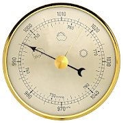


Weather Station with barometric pressure sensor 2.8.7.1
Simple, nice and retro weather station. Our barometer appshowsmaindata: temperature, barometric pressure and humidity.Themes,Graph,Forecast and different Data Providers are also inside.Seepressurewith built-in barometric pressure sensor (not foralldevices)! Thisapp is pleasant and easy to use. It lookslikevintage barometerwith modern technology inside. Onlycorrectweather data withoutanything superfluous (like map, widgetsetc.).Free versionincludes: • Temperature (could measure in °C and°F onthe samescreen) • Wind speed (switch between km/h, mph, mps)•Atmosphericpressure (3 different pressure units of barometer-inHg, hPa, mmHg)• Relative humidity in live time • 7commonlanguages (EN, IT, DE,ES, RU, UK, PL) • barometric pressuresensorYou can also switchbetween classic and forecast viewsPremiumversion: • Forecast for4-7 days (depends on data provider) •Morewind meteo data • Sunriseand sunset data • 3additionalmeteorological live-time datachannels • 3 additionalbackgroundthemes • charts of changingindicators by day or hourlyStayinformed about the weather.Barometer will show you airpressure,hygrometer will show humidityand thermometer – a realtemperature.All local weather informationin your pocket. Rain, snowor evenstorm outside will no longersurprise you. FEATURES: • A lotofrealistic themes to make yourWeather Station unique •Ergonomicdesign: comfortable userinterface in both positions(vertical andhorizontal) • A lot ofdevice configurations forpersonal usage •Compare meteo data fromdifferent providers, sourcesand channels •You can switch betweenanalog style graphic and modernstylegraphics • Celsius andFahrenheit - together on one screenAweather station is a facility,either on land or sea,withinstruments and equipment for measuringatmospheric conditionstoprovide information for weather forecastsand to study theweatherand climate. The measurements taken includetemperature,barometricpressure, humidity, wind speed, winddirection.Atmosphericpressure, sometimes is the pressure exertedby the weightof air inthe atmosphere of Earth. Low-pressure areashave lessatmosphericmass above their location, whereashigh-pressure areashave moreatmospheric mass above their location.Again, we havebuilt-inbarometric pressure sensor support. Itallows to readcurrentatmospheric pressure in realtime. Humidity isthe amount ofwatervapor in the air. Our app shows you relativehumidity, itisexpressed as a percent, measures the currentabsolutehumidityrelative to the maximum (highest point) forthattemperature.Humans are sensitive to humid air because thehumanbody usesevaporative cooling as the primary mechanismtoregulatetemperature. Under humid conditions, the rate atwhichperspirationevaporates on the skin is lower than it would beunderaridconditions. Because humans perceive the rate of heattransferfromthe body rather than temperature itself, we feel warmerwhentherelative humidity is high than when it is low.AnalogWeatherStation always identify exactly where you are. Youhaveopportunityto enable GPS detection or search for your city. Youcansee localweather, alert about rain, snow, strong wind andotherweatherevents. And you can be sure of the accuracy oftheforecast.Updates and more features are coming. Stay tuned forthecurrentweather with vintage Analog Weather Station! Find outwhentheweather will be sunny, cloudy or snowy, there will besevererainor atmospheric pressure will increase in realtime mode!


Fishing Times
Fishing Times provides you with an easy toreadinterface for current, past and future fishing conditions.Major andMinor Times, Day Rating, Tide Times, Sunrise, Sunset,Moonrise,Moonset and Moonphase are displayed in a Solunar Clockview and canalso be viewed in a calendar.You can easily switch the selected date to plan yourfishingtrips ahead.The Solunar Clock interface will give you instant informationonbest times.You can now also manage multiple locations.How to read and use the App:- Green Bars indicate good major and minor fishing times(majorlonger, minor shorter bar)- Blue Bars indicate low and high tide times.- Center indicates moonphase- Gray current time indicator- top right of screen has a day rating indicator ( 1-4 fishes,fairto excellent )- sun and moon icons for sun/moon rise and set- swipe left or right to change the dateThe displayed fishing information ispoweredhttp://www.fishingreminder.com


Fishing Times Free
This app offers an easy to read solunarfishingcalendar, tide times and sun/moon information to plan yourfishingtrips.The free version is ad supported and is limited to a 3dayforecast.How to read and use the App:- Green Bars indicate major and minor fishing times (majorlonger,minor shorter bar)- Blue Bars indicate low and high tide times.- Center indicates current moon phase- Grey line represents the current time- top right of screen has a day rating indicator ( 1-4 fishes,fairto excellent )- icons for sun/moon rise and set- swipe left or right to change datesPlease contact me if you have any suggestions forfurtherimprovements!This application is powered by http://www.fishingreminder.com


GoWild Hunting Fishing Outdoor 10.32
GoWild is a free social community that helps outdoorenthusiastsimprove their skills, find better gear and earn rewards.GoWildmembers unlock rewards as you share your story and purchasegear.Download today and see why hundreds of thousands ofoutdoorsmen andwomen have joined GoWild. • EARN REWARDS • As youearn points forsharing trophies, outdoor trips, gear reviews andpurchases,, youget points on your profile. Those points help unlockRewards, suchas gift cards, knives, gun cleaning kits, tshirts,stickers, andeven free fishing trips. • FIND THE BEST GEAR •Members in ourcommunity tag the gear they’re using, which helps youfind the bestoutdoor gear on the market. You can show off your GearSetups, orjust browse to see what other members are using to findsuccess inthe field. Best of all? You earn points every time youshare yourgear in a post. • TROPHIES WELCOME• Save your fishing andhuntingmemories, along with your unique stats. Load in your PBTrophieswithout harassment. Trophies rack up BIG points. • FINDLOCALEXPERTS • The Near Me feature connects you to local expertanglers,hunters and outdoor enthusiasts. Filter across 60+ topics.• GREATCONTENT, EASIER TO FIND • Followers are not necessary onGoWild. Asa forum, GoWild makes it easy to find content about thetopics youlove. The app’s content is fully customizable—see thekind ofcontent you want, nothing you don’t.


Topo GPS Spain 6.2.0
Makes from your phone or tablet a complete GPS device withthedetailed topographic map of Spain. Viewed maps will be storedonyour device so that Topo GPS can also be used without aninternetconnection. Why should you buy an expensive GPS device ifyou caninstall Topo GPS on your phone or tablet for only 3,99 €?Topo GPScontains all functions of a regular GPS device for lessmoney, hasa much more detailed map, and is more convenient tooperate. Theaccuracy of the position determination is in favorableconditionsabout 5 m. Ideal for walking, hiking, cycling,mountainbiking,horse-riding, geocaching, trail running and otheroutdooractivities. Also suited for outdoor professionals. Map *Completetopographic map of Spain , newest edition. * Very detailedmaps,with buildings, cultivation, all roads including thesmallestforest trails, contour lines, and characteristic elementsin thelandscape. * Future updates of the map are included for free.* Themap can be zoomed and moved. * All maps of a certain regioncan bemade offline accessible using the map download screen. *Percentageof map that is offline accessible is indicated on the topleft ofthe map. * Map tiles can be stored on external storage, likeforexample an SD-card. Intuitive interface * Clear menu withmostimportant functions. * Different dashboard panels withdistance,time, speed, altitude and coordinates. * Clear manualatwww.topo-gps.com. Routes * Recording of routes, with pauseandrestart possibility. * Planning of routes via route points.*Importing routes in gpx and zipped gpx format. * Editing routes.*Sharing routes. * Free access to route collection Topo GPS.*Searching routes with filters. * Routes can be organizedintofolders. * Maps of a route can be made offlineaccessible.Waypoints * Adding waypoints by pressing on map. *Adding waypointsthrough address or coordinates. * Supportedcoordinate systems:WGS84 decimal, WGS84 degree minutes (seconds),UTM and MGRS. *Importing waypoints in gpx and zipped gpx format. *Sharingwaypoints. * Editing waypoints. * Photos can be added towaypoints.* Searching waypoints with filters. * Waypoints can beorganizedinto folders. Your location * Location and movementdirectionindicated by arrowed marker. * Displayable in WGS84decimal, WGS84degree minutes (seconds), UTM and MGRS coordinates. *Sharing andsaving as waypoint. In app purchases * Topographic mapsof Belgium,Denmark, Finland, France, Germany, Great Britain,Netherlands,Norway, New Zealand and Sweden. * OpenStreetMap worldmap. If youare recording a route, the GPS will run in thebackground.Continued use of GPS running in the background candramaticallydecrease battery life. Rdzl, the company behind TopoGPS, does notobtain in any way the location of the user of TopoGPS. Rdzl doesnot obtain your routes and waypoints, unless youshare a route withTopo GPS. Rdzl does not register which map tilesyou havedownloaded. We sell our product, not our user data.

DSO Planner Free (Astronomy) 3.8.2
DSO Planner Free is an astronomy observation planningtoolwithexcellent star charting capabilities made by activeandexperiencedamateur observers with a passion forvisualobservations. FreeEdition comes equipped with Yale brightstarcatalog (9 000 starsto 6.5m) and 220 deep sky objects (MessierandCaldwell catalogscontaining the brightest galaxies,nebula,globular clusters, openclusters and planetary nebula).Considerother Editions for morestars / objects. Applicationfeatures: +Planning tool. Filter anyobjects database by observerlocation, skycondition, astronomicalequipment, time range ofobservation andobject features (type,dimension, magnitude, minimalaltitude,visibility and other fieldsof own custom catalogs).Removeduplicate objects when searching inintersecting databases.Createup to 4 observation lists. Easilytrack observed and remainingto beobserved objects with notetaking tool + Double Star catalog.50brightest double stars fromYale catalog. Info Panel with PAandseparation for each component.+ Unique visibility tool.Onlyobjects that are visible withselected equipment in the currentskyconditions could be shown onthe Star Chart + Cross-matchnamesdatabase. Search objects by lesscommon names + FamousSteveGottlieb Notes attached to NGCICobjects + Offlineimages.Integrated set of deep sky object images+ DSS imagerysupport.Download DSS (Digitized Sky Survey) imagesof any skyportion intooffline cache and overlay it on the starchart + PushTofordobsonian mounts with setting circles. Levelyour dobsonianmountand perform one star alignment. The programwillautomaticallyrecalculate az/alt numbers to easily hunt theobject +Nebulacontours. Contours of famous nebulae + Objectcontours.Ellipse inreal dimension and orientation on the skychart + BrightSolarSystem objects. Sun, Moon, Mercury, Venus,Mars, Jupiter,Saturnshown on the sky chart + Night mode. Redkeyboard and menus +Notetaking. Take text and/or audio notes +Observing places. GPS,manualcoordinates, custom lists. Databasewith 24 000 citiesworldwide +Equipment. Keep track of all yourtelescopes andeyepieces. Use themfor object visibilitycalculation and starcharting + Twilightcalculator. Sun, Moon rise/ transit / set. MoonPhase. Civil,Nautical, Astronomicaltwilights. + 2 visual themes(bright anddark) + Powerfulshare/export/import capabilities (ofdatabases,observation lists,notes) Disclaimer


Kwindoo Tracking 2.1.9
Use KWINDOO to hook up to sailing regattasandstay instantly informed aboutany news or changes in effect regarding your upcoming race.You will get invitations to join races, from organisers whouseKWINDOO.com for their regatta. The race administrator will seeifyou join or decline.You will see the NOR and the sailing instructions and getpushnotifications about any changes. You will also see theactualchange itself.You will receive Active Race information Messages in theARIMsection of your app.These can be instructions or informations. These are providedforthe entire fleet or a class. No individual messaging is possibletoa single boat.Your phone will provide GPS tracking for the race. This can beseenby the organiser and by your fans and family, too.The organiser can pre-set an emergency call number to be used atasingle button press, should that be needed.Use "quit the race" function to inform your race administratorandnot to search and or wait for you in case you gave upastage.Use KWINDOO to hook uptosailing regattas and stay Informed about Instantlyany news or changes in effect Regarding your upcoming race.You will get invitations to join races, from organizersforKWINDOO.com Who Use Their regatta. The race will seeadministratorif you join or decline.You will see the NOR and the sailing instructions and getpushnotifications about any changes. You will also see theactualchange Itself.You will receive the Active Messages in the Arima Raceinformationsection of your app.These instructions can enter or Information. These are providedforthe Entire fleet or class. No Individual messaging is Possibleto asingle boat.Your phone will provide GPS tracking for the race. This Can BeSeenby the organizer and by fans and your family, too.The organizer can pre-set call an emergency number to be Used atasingle button press, hurt Should you needed.Use "Quit the Race" function to inform your administrator andraceand not to search or wait for you in case you gave upthestage.