Top 22 Apps Similar to Russia Travel Guide With Me

MAPS.ME – Map with Navigation and Directions v14.2.71484-googleRelease
Free, fast, detailed and entirely offlinemapswith turn-by-turn navigation – trusted by over 90milliontravelers worldwide.OFFLINE MAPSSave mobile data, no internet is required.FREE FOREVERAll maps inside and all features are free. Always were andalwayswill be.NAVIGATIONUse driving, walking and cycle navigation anywhere intheworld.INCREDIBLY DETAILEDDirections to points of interest (POI), hiking trails andplacesmissing from other maps.UP-TO-DATEMaps are updated by millions of OpenStreetMap contributorsdaily.OSM is an open-source alternative to Google Maps, MapquestandWaze.FAST AND RELIABLEOffline search, GPS navigation along with optimized mapstoeffectively save memory space.BOOKMARKSSave locations you love and share them with your friends.AVAILABLE WORLDWIDEEssential for home and travel. Paris, France? Check.Amsterdam,Netherlands? Check. Barcelona, Spain? Check. New York,Chicago,Florida, Las Vegas, Nevada, Seattle, San Francisco,California,USA? Check! Rome, Italy? Check. London, UK? Check.TRAFFIC DATANew online city traffic maps. Check out updates on traffic infoandfastest driving routes in 36 countries!AND MORE!– Search through different categories e.g. restaurants,cafes,tourist attractions, hotels, ATMs and public transport(metro,bus…)– Make hotel bookings via Booking.com directly from the app– Share your location via text message or social media– When cycling or walking, the app shows whether the way isuphillor downhillContinued use of GPS running in the background candramaticallydecrease battery life.If you have any questions, visit our HelpCenter:support.maps.me.If you are unable to find the answer to your question, contactusat: [email protected] us on FB: http://www.facebook.com/mapswithme |Twitter:@MAPS_ME

Offline Maps & Navigation
Here we created another great navigationappbased on offline maps.You can enjoy unlimited navigation features, lifetime freemapupdates with no hidden costs. Our real-time traffic helps youtoavoid traffic jams. Features: - Free offline GPS navigation- Offline maps- Lifetime free map updates- Speed limit warnings- 3D buildings - Large POI database- Pedestrian, car, or even bee-line navigation- Night mode based on local sunset time Advanced:- Real-time traffic- Multi-language voice navigation- Speed camera warnings- Lane guidance- Track recording- Navigate to photo- Travelbook- Support Free version includes 90 days Advanced features with voiceguidednavigation. After 90 days use offline maps and trip planningforfree or upgrade to unlimited voice guided premiumnavigation.

Geo Tracker - GPS tracker 5.1.5.2972
You can find answers to most commonquestionsin the FAQ section of mywebsite:https://geo-tracker.org/faq/?lang=enIf you're looking for an excellent gps tracker, if you're a fanofaction sports and long distance travel - this app is foryou!Record tracks of your trips and share them with your friends!Geo Tracker can help:• making the reverse journey in an unfamiliar area withoutgettinglost
• tell your friends how to repeat your route
• use someone else's route that is stored in GPX or KML• mark important or interesting points of your trip.The application is able to record, even when switched off. Verylongtracks could be recorded without problems - you are limitedbystorage memory only. Recorded tracks are saved in GPX orKMLformat, so they can be used in certain applications such asOziExplorer or Google Earth.When showing track on the map, the application keepsdevicebacklight, which simplifies track navigation usage.Geo Tracker is based on public API of Yandex.Maps, so in tripsoverRussia and CIS countries you'll have the most detailed map ofthearea.Application can calculate track statistics - boldly show offyourachievements to your friends :)Geo Tracker calculates:• Max & average speed on the track;• Time and average speed moving;• Max & min altitude, altitude difference;• Vertical distance, ascent & speed;• Min, max & average slope;There are also some fine charts of speed & elevation;If you have a proposal how to enchance the application or facedsomeproblem - please feel free to contactme:[email protected]. Thanks!Useful tips & tricks to solve common GPS issues withyoursmartphone:• If you start the tracking please wait with recording youractivityuntil the GPS signal is found.• Restart your smartphone and make sure that you have "clearview"of the sky before you start (no disturbing objects likehighbuildings, forest, etc.).• The reception conditions are permanently changing because theygotinfluenced by the following factors: weather, season,positioning ofsatellites, areas with bad GPS coverage, highbuildings, forest,etc.).• Go to phone settings, choose "Location" and activate it.• Go to phone settings, choose "Date & time" and activatethefollowing options: "Automatic date & time" and "Automatictimezone". It may occur that it takes longer until the GPS signalisfound if your smartphone is set to the wrong time zone.• Deactivate the airplane mode in your phone settings.If none of these tips & tricks helped to solve yourissues,deinstall the app and reinstall it again.Be aware that Google uses in their Google Maps app not only theGPSdata but also additional data of the current locationfromsurrounding WLAN networks and/or mobile networks.


Map of Philippines 1.24
This is an application that turns your Android device into aGPSnavigator with offline maps. You can search easily locationsinPhilippines and you can add them to your route.Discover interesting places near you: accommodation,parking,restaurants, bars, clubs, cinemas, theatres, auto services,shops,parks, schools, hospitals, sport areas.It includes detailed maps of the biggest cities inPhilippines:Manila, Quezon City, Caloocan, Davao City, Cebu City,ZamboangaCity, Antipolo, Pasig, Taguig, Cagayan de Oro,Parañaque,Dasmariñas, Valenzuela, Las Piñas, General Santos,Makati, Bacoor,Bacolod, Muntinlupa, San Jose del Monte andothers.This application is based on Osmand project under the GNUGPLv3license and uses high quality data from OSM.

Navitel Navigator GPS & Maps v11.11.917
Navitel Navigator is a precise offlineGPSnavigation with free geosocial services and detailed maps of64countries. Try popular navigation for 7 day free!______________________________* 20M DOWNLOADS WORLDWIDE ** TOP 5 NAVIGATION IN 12 COUNTRIES!*ADVANTAGES• Offline navigation. No Internet connection required for the useofthe program and maps: No additional expenses on roamingordependency on mobile connection.• Access to maps at any time: Maps are downloaded to theinternalmemory of a device or an SD-card.• Map subscription: Map purchase for a limited period (1 year)withprices starting at 10.99$.SPECIAL FEATURES• 3 alternative routes with display of time and distance for eachofthem.• Navitel.Traffic. Information on all traffic jams in thecoveredarea, available in real time.• Navitel.Friends/Cloud. Messaging with friends, trackingtheirlocation and routing towards them. Program settings andwaypointsare stored in the NAVITEL cloud storage. Log intoNavitel.Friends/Cloud service using your social networkprofile(Facebook, Twitter, VKontakte)• Navitel.Weather. Weather forecast information for the nextthreedays anywhere in the world.• Dynamic POI. Fuel prices, movie showtimes and otherusefulinformation.• Navitel.Events. Road accidents, road works, speed cams andotherevents marked on the map by users.• Navitel.SMS. Message exchange with friends whilenavigating.• SpeedCam warnings. Information on radars, video recordingcamerasand speed bumps.• 3D Mapping. Three-dimensional maps with texture and numberoffloors support.• 3D Road interchanges. Displaying multilevel road interchangesin3D mode.• Line Assist. Route calculations taking multilane trafficintoaccount and visual prompts while following the route.• Multilanguage support. Support of the interface and voicepromptsin multiple languages.• Turn-by-turn voice guidance. Voice guidance while moving alongtheroute, warnings on battery charge and connection tothesatellites.• Dashboard. More than 100 different gauges: time, speed,weatherand other parameters.• Fast route calculation. Instant calculation and routing ofanylength and complexity.• Unlimited number of waypoints for routing. Easy routingwithunlimited number of waypoints.• Customizable user interface. Ability to adapt theprograminterface and map display mode for your own needs.• Multitouch support. Quick access to map scaling androtationfunctions via the multitouch input.• Purchase through the program menu.• GPS / GLONASS.OFFLINE NAVIGATION MAPS FOR PURCHASEAlbania, Andorra, Armenia, Austria, Azerbaijan, Cilumbia,Belarus,Belgium, Bosnia and Herzegovina, Brazil, Bulgaria, Croatia,Cyprus,Czech Republic, Denmark, Estonia, Finland, France,Georgia,Germany, Gibraltar, Greece, Hungary, Iran, Iceland, Isle ofMan,Italy, Kazakhstan, Kyrgyzstan, Latvia, Liechtenstein,Lithuania,Luxembourg, Macedonia, Maldives, Malta, Mexico, Moldova,Monaco,Montenegro, Netherlands, Norway, Peru, Poland,Portugal,Philippines, Romania, Russia, San Marino, Serbia,Slovakia,Slovenia, Spain, Sweden, Switzerland, Tajikistan, Turkey,Ukraine,United Kingdom, Uzbekistan, Vatican.If you have any questions contact us: [email protected]. We willbehappy to help you.CONNECT WITH USFacebook: http://www.facebook.com/NavitelWorldTwitter: https://twitter.com/NavitelNInstagram: http://instagram.com/navitel_en
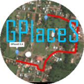
Maps GPS Places 1.8
Registren la empresa donde trabajan:GPlaceS surgió como un proyecto que busca aprovechar al máximolalocalización GPS y Google Map v2. Si eres un empresario osoloalguien que desea registrar una cuenta para una empresa ygestionartodos los servicios que ofrece dicha empresa, ya quetendrás elcontrol de tu cuenta y de los productos o servicios quepublicasserán administrados por el dueño de la cuenta.Pero si eres un usuario que desea calificar o votar porlasempresas que se encuentran registradas, podrás registrar unacuentade usuario la cual te permitirá calificar a lasempresasregistradas desde 1 a 5 estrellas y muy pronta, podrásopinar sobrelas empresas que calificas.GPlaceS se encuentra en fase beta, es por ello que concadapersona que registre su empresa en nuestra base dedatos,lograremos una aplicación estable y con muchos lugaresdondeescoger. por lo que pido a las personas que votan con unaestrella,piensen primero que esta aplicación tiene sus bases dedatosintactas y que entre mas empresarios conozcan esta app,masopciones de búsqueda exitosas tendrán. GPlaces se encuentraendesarrollo y por el momento las cuentas son gratis.Características*Registrar cuenta gratis*Localización GPS de tu empresa en cualquier parte delmundo.(Google Map)*Registro de varias categoría para tu empresa (Hotel,Restaurante,Soda)*Registro de productos o servicios*Estado de empresa open/closed*búsqueda por categoría, distancia, cantidad de resultadoycoordenada.*Calificación a lugares visitados*Información de la empresaMuy pronto se podrán comprar productos y servicios desde lamismaaplicación.Record the companywherethey work:GPlaceS emerged as a project that seeks to maximize theGPSlocation and Google Map v2. If you are a businessman orjustsomeone who wants to register an account for a company andmanageall the services offered by the company, as you will havecontrolof your account and the products or services you post willbeadministered by the account holder.But if you're a user who wishes to qualify or vote forthecompanies that are registered, you can register a useraccountwhich will allow you to qualify from the registered from 1to 5stars and very prompt companies can review the companiesthatqualify.GPlaceS is in beta, which is why each person registeringyourcompany in our database, we will achieve a stable and plentyofplaces to choose application. so I ask people to vote with astar,think first that this application has data bases intact andthatthe more entrepreneurs know this app, more options havesuccessfulsearch. GPlaces is under development and currentlyaccounts arefree.Features* Register Free Account* GPS of your company at any location in the world.(GoogleMap)* Record multiple categories for your business (Hotel,Restaurant,Soda)* Registration of products or services* Company State open / closed* Search by category, distance, number of resultsandcoordinate.* Rated to places visited* Company InfoSoon be able to buy products and services from thesameapplication.

All-In-One Offline Maps 3.6c
All-In-One OfflineMaps offers you toaccessa wide range of maps for free.Bored to wait for maps to display? Once displayed, mapsarestored and remain available, quickly, even with nonetworkaccess.• Want more than just roads on your maps? You will findwhatyou need here;• Used to go to places with poor network coverage?Everythingwill stay available;• Used to go abroad? You won't be lost anymore;• Have a data allowance limit? It will reduceyourusage.★★ Maps ★★A lot of maps are available, including classical roadmaps,topographic maps, aerial (satellite) maps and various layersthatcan be added over any maps: OpenStreetMap (Roads, Topo),GoogleMaps, Bing Maps, USGS National Map (Hi-res topo, Aerialimagery),Worldwide Military Soviet topo maps, etc.• All maps can be stacked in layers, with preciseopacitycontrol.• Select and store large areas in few clicks.• Stored space is clear and can be easily deleted.★★ Display, store and retrieve unlimited landmarks ★★You can add various items on the map such as waypoints,icons,routes, areas and tracks.You can easily manage them using the powerful SD-CardLandmarksExplorer.★★ On-map GPS Location & Orientation ★★Your real location and direction are clearly displayed on themap,which can be rotated to match your real orientation (dependsondevice capabilities).Easy turn on/off to save battery.And also:• Metric, imperial and hybrid distance units;• GPS Latitude/Longitude and grid coordinate formats (UTM,MGRS,USNG, OSGB Grid, Irish Grid, Swiss Grid, Lambert Grids, DFCIGrid,QTH Maidenhead Locator System, ...);• Ability to import hundreds of coordinate formatsfromhttp://www.spatialreference.org;• On-map grids display;• Full screen map view;• Multi-touch zoom;• ...★★ Need more? ★★If you are a real adventurer, try AlpineQuest GPS Hiking,thecomplete outdoor solution based on All-In-One OfflineMaps,loadedwith a powerful GPS Location Tracker andmore:http://www.alpinequest.net/google-play


Maps & GPS Navigation OsmAnd+
OsmAnd+ (OSM Automated NavigationDirections)is a map and navigation application with access to thefree,worldwide, and high-quality OpenStreetMap (OSM) data.Enjoy voice and optical navigation, viewing POIs (pointsofinterest), creating and managing GPX tracks, using contourlinesvisualization and altitude info, a choice between driving,cycling,pedestrian modes, OSM editing and much more.OsmAnd+ is the paid application version. By buying it, yousupportthe project, fund the development of new features, andreceive thelatest updates.Some of the main features:Navigation• Works online (fast) or offline (no roaming charges when youareabroad)• Turn-by-turn voice guidance (recorded andsynthesizedvoices)• Optional lane guidance, street name display, and estimated timeofarrival• Supports intermediate points on your itinerary• Automatic re-routing whenever you deviate from the route• Search for places by address, by type (e.g.: restaurant,hotel,gas station, museum), or by geographical coordinatesMap Viewing• Display your position and orientation• Optionally align the picture according to compass oryourdirection of motion• Save your most important places as Favorites• Display POIs (point of interests) around you• Display specialized online tiles, satellite view (fromBing),different overlays like touring/navigation GPX tracksandadditional layers with customizable transparency• Optionally display place names in English, local, orphoneticspellingOnly this week 50% OFFUse OSM and Wikipedia Data• High-quality information from the best collaborative projectsofthe world• OSM data available per country or region• Wikipedia POIs, great for sightseeing• Unlimited free downloads, directly from the app• Compact offline vector maps updated at least once a month• Selection between complete region data and just roadnetwork(Example: All of Japan is 700 MB or 200 MB for the roadnetworkonly)Safety Features• Optional automated day/night view switching• Optional speed limit display, with reminder if you exceedit• Optional speed-dependent zooming• Share your location so that your friends can find youBicycle and Pedestrian Features• Viewing foot, hiking, and bike paths, great foroutdooractivities• Special routing and display modes for bike and pedestrian• Optional public transport stops (bus, tram, train) includinglinenames• Optional trip recording to local GPX file or online service• Optional speed and altitude display• Display of contour lines and hill-shading (viaadditionalplugin)Directly Contribute to OSM• Report data bugs• Upload GPX tracks to OSM directly from the app• Add POIs and directly upload them to OSM (or laterifoffline)• Optional trip recording also in background mode (while deviceisin sleep mode)OsmAnd is open-source and actively being developed. Everyonecancontribute to the application by reporting bugs,improvingtranslations or coding new features. The project is in alivelystate of continuous improvement by all these forms ofdeveloper anduser interaction. The project progress also relies onfinancialcontributions to fund coding and testing ofnewfunctionalities.Approximate map coverage and quality:• Western Europe: ****• Eastern Europe: ***• Russia: ***• North America: ***• South America: **• Asia: **• Japan & Korea: ***• Middle East: **• Africa: **• Antarctica: *Most countries around the globe available as downloads!From Afghanistan to Zimbabwe, from Australia to the USA.Argentina,Brazil, Canada, France, Germany, Mexico, UK, Spain,...


GPS Essentials
The most complete GPS tool available:Navigate,manage waypoints, tracks, routes, build your owndashboard from 45widgets.❧❧❧❧❧ Dashboard ❧❧❧❧❧Shows navigation values such as: Accuracy, Altitude, Speed,Battery,Bearing, Climb, Course, Date, Declination, Distance, ETA,Latitude,Longitude, Max Speed, Min Speed, Actual Speed, TrueSpeed, Sunrise,Sunset, Moonset, Moonrise, Moon Phase, Target,Time, TTG,Turn.❧❧❧❧❧ Compass ❧❧❧❧❧Show the orientation of the earth's magnetic field, showsanarbitrary tracking angle and the current target. Also amarineorienteering compass.❧❧❧❧❧ Tracks ❧❧❧❧❧Record tracks and view them on map. Export KML files and importintoGoogle Maps, Google Earth and others.❧❧❧❧❧ Routes ❧❧❧❧❧Manage routes and view them on map. Import KML files fromGoogleMaps, Google Earth and others. Create turn-by-turninstructionsbetween waypoints.❧❧❧❧❧ Camera ❧❧❧❧❧A camera HUD (heads-up display) view to show your waypoints,takepictures and share them.❧❧❧❧❧ Map ❧❧❧❧❧A map to show your waypoints. Convert mail addresses ofyourcontacts to waypoint so that they can be used within theapp.Supports Google Maps, MapQuest, OpenStreetMap and others.Supports Google Maps v2: Indoor Maps, Traffic, Buildings,Satelliteand Terrain layers and map rotation.❧❧❧❧❧ Waypoints ❧❧❧❧❧A list of all your waypoints with export and import (KML, KMZ,GPXand LOC format).❧❧❧❧❧ Satellites ❧❧❧❧❧A sky view of the current positions that shows satellitesinview.❧❧❧❧❧ Features ❧❧❧❧❧Supported position formats: UTM, MGRS, OSGB,Degree-Minute-Second,Degree-Minute-Fractions, Decimal, Mils.Supports over 230datums.Waypoints, routes and tracks can be exported as KML or GPX filesandsent by email or uploaded to Google Docs or DropBox.Please open the web page below for more info, send me emailsforsupport. I CANNOT HELP IF YOU SIMPLY PLACE A COMMENT HERE.Purchase the "GPS Essentials Donation Plugin" on Android Marketifyou want to support development.The latest beta release is available athttp://www.gpsessentials.comfor download. Try out the latestfeatures and help us improve GPSEssentials!If you are on Facebook, come and join GPS Essentials for thelatestinfo: http://www.gpsessentials.comTHIS APP WILL SHOW ADVERTISING. IF YOU DON'T LIKE THIS,PLEASEREFRAIN FROM INSTALLING/UPDATING.GPS Essentials is not affiliated with any political party norwithany other organization mentioned in the ads, and it hasnoconnection with any economic interests. If you don't like theads,please contact AdMob.WHAT ARE THE PERMISSIONS GOOD FOR?✓ Coarse/Fine location: To access network locations and GPS✓ Full internet access: To read map tiles, send bug reports✓ Modify/delete USB storage contents: To write waypoints, tracksandimages onto the SD card✓ Read phone state and identity: To tag pictures with the deviceID(can be switched off in settings)✓ Take pictures and videos: Camera HUD, take pictures✓ Your accounts: Required to run Google Maps v2


Magic Earth Pro Navigation 7.1.17.23.850E41D.0D5E129
MAPS– Professional TomTom maps– 3D maps– Satellite maps– Wikipedia– Weather– Add points-of-interestNAVIGATION– Car Navigation- Lane Guidance- Multiple Stops- Road Signs- Speed Cameras- Speed WarningsHD TRAFFIC– Alternative routes– Avoid traffic– Updated every minuteOFFLINE MAPS– No mobile internet costs– Navigate without internet– Country maps– Regional mapsNOTES:* Upgrading from ROUTE 66 Navigate is entirely free andyourexisting licenses in ROUTE 66 Navigate will automatically workinMagic Earth Pro.* Navigation, Speed cameras and HD Traffic are premiumservicesavailable as in-app purchases.* Some features not available in all countries.* Some features require internet connection.


Санкт-Петербург Путеводитель 5.1.3
Что может наше приложение Санкт ПетербургПутеводительПутеводитель:- полная поддержка русского языка; -справочнаяинформацию омножестве достопримечательностей: адреса,стоимость,график работы,номер телефона и др.; - сохранение самыхинтересныхобъектов всписке избранных; Навигатор: - отслеживаниетекущегоместоположенияпо координатам GPS или сотовой сети; -вычислениеближайшихдостопримечательностей, расстояния и направлениядо них;Схемаметро: - актуальная схема метро Санкт-Петербурга;-рассчетколичества станций и времени движения между станциями;-поискближайшей станции и расстояния до нее. Для получениядоступакОффлайн картам Санкт-Петербурга установите Proверсию.Позволяетбез доступа в интернет получить информацию омножествесамыхинтересных достопримечательностях Санкт-Петербурга.СанктПетербургПутеводитель удобно использовать даже вроуминге,получаякоординаты посредством GPS.