Top 42 Apps Similar to Galactio MY GPS Navigation


BackCountry Navigator TOPO GPS
Download topo maps for an offlineoutdoornavigator! Use your phone or tablet as an offroad topomappinghandheld GPS with the bestselling outdoor navigation appforAndroid! Explore beyond cell coverage for hiking andotherrecreation.Download topo maps for the US and many other countries inadvance,so you won't need cell coverage for navigation. Use storagememoryfor maps.New: Android Wear support to see navigation at a glanceonwristUse GPS waypoints from GPX or KML files, or enter yourowncoordinates using longitude/latitude, UTM, MGRS, or gridreference.Using GOTO makes a waypoint a locus for navigation.This uses many publicly available map sources as freedownloads.Some additional content available as an in apppurchase:-Accuterra Topo Map Source for $19.99/year. This can bepurchasedand used with or in instead of the free sources.- Boundary maps for 12 western states from the Bureau ofLandManagement(BLM) Overlay for topo maps valued by hunters.-GMU boundaries in some states-Lake Contours in several states.-Content from US TrailMaps including:-ATV, Whitewater, and Equestrian Trail MapsSee the menu under More-> "Purchasing AddOns". They can beshownon top of topo maps.You may try the DEMO version to make sure you like the maps inyourcountry.About topo (topographic) maps: Topo maps show terrain throughcolorand contours, and are useful for navigation offroad. Topo mapsandGPS can be used for hiking, hunting, kayaking, snowshoeing,&backpacker trails.You can create your own maps with Mobile Atlas Creator, or specifyacustom tile server. Built in sources include:OpenStreetMaps from MapQuestOpenCycleMaps showing terrain worldwideUS Topo Maps from Caltopo and the USGSUSTopo: Aerial Photography with markup.Canada Topo Maps from ToporamaMarine maps: NOAA RNC Nautical Charts (coastal)USGS Color Aerial photographyTopographic Maps of Spain and ItalyTopo maps of New ZealandJapan GSI maps.Many of the above sources are generally free to use.Use offline topo maps and GPS on hiking trails without cellservice.The GPS in your Android phone can get its position fromGPSsatellites, and you don’t have to rely on your data plan togetmaps. Have more fun and safe GPS navigation inthebackcountry.Use as a geocaching navigator by getting a pocket queryasGPX.Besides geocaching, use GPS for recording tracks and GPSwaypointson your trip, all the while tracking your GPS quest ontopographicmaps. It may replace your Garmin handheld GPS.Here are some of the outdoor GPS activities BackCountryNavigatorhas been used for:As a hiking GPS both on hiking trails and off trail.Camping trips to find that perfect camping site or the way backtocamp with GPS.Hunting trips for hunting wild game in rugged areas.Doing recon for a hunt or as your hunting GPSFishing: make it your fishing GPS.Search and Rescue (SAR).Trekking the Pacific Crest trail or other long term hiking.Kayak and canoe treks on inland lakes and streams or marine,coastalwaters.Backpacker trips: using topo maps of wilderness areas andnationalforests for navigation on trails with the GPS in yourrucksack orbackpack.Find your own ways to have fun in the outdoors. Be a maverickbyventuring beyond cell service boundaries with your GPS. Becomeapro at navigation with GPS for the outdoors.BackCountry Navigator has been on WM devices and preloaded ontheTrimble Nomad outdoor rugged device. This Android version ismoreflexible, featured, and fun. Create a memory with maps.For a one time fee, this a great addition to the outdoor gearyoubought at Cabelas, REI, or another outdoor store. Many havefoundthe Android GPS in a phone or tablet to substitute for aGarmin GPSor Magellan GPS, such as the Garmin GPS units Montana,Etrex, orOregon. Android can be your handheld GPS.


Galactio TH GPS Navigation Map v2.01.03
Galactio powered by POWERMAP is themostadvanced, full featured Android based GPS navigation systemforThailand. Maps, 3D Landmarks and Offline navigation allinone!And what’s more – it’s completely free!Unlike similar Android based GPS navigation systems, Galactioofferslocalized information at your fingertips to help plan yourjourneyand, most importantly, help find the most optimal route toyourdestination, saving you time and money. Galactio is the onlyhighly-localised GPS navigation system for Thailand. It makesnavigationeasier, faster and hassle free – even whenoffline.With advanced connectivity and convenience features, sharingyourlocation, drives and favourite places with friends and familyhasnever been easier* Galactio-TH, GPS Navigation is currently available forfullThailand.Feature List:1. Feature-rich and interactive maps2. Personalisation features3. Rich 3D Landmarks4. Share real-time position and ETA with contacts5. Real-time traffic updatesMore features to come.....


GPS Driving Route & Tracker 1.2
Want to track anyone location ? Are youStuckanywhere and you can't find the right destination fromyourlocation then you must have a GPS Driving Route &Trackerbecause this map tracker is one of the best location finderin playstore where you can easily navigate the distance scale andalso getyour current location through waze map.With GPS Driving Route & Tracker you can see your trafficroute& plan your way of destination like point to point ortrackyour location world wide anywhere.GPSDirection karta tracker is multi tasking application which showsyouthe map and also provide you the details of route planningsystem,where you can easily and fastly find your way like you areat car,bike ,and also if you are a pedestrian.GPS Driving Route & Tracker is a best GPS tracker whichtrackyour street or road sector through GPS system .GPS Driving Route & Tracker helps you to save your uniquetimeto find any place through map server and also find yourlocationpoint to get your satellite access base ,This GPSnavigation & location tracker helps you to track yourfriendswhen ever you want to find your route or friend locationthen getthis map location tracker to make your life easy.

BackCountry Nav Topo Maps GPS
Use your Android as an offroad topo mappingGPSwith the bestselling outdoor navigation app for Android! TrythisDEMO to see if it is right for you, then upgrade to thepaidversion.Use offline topo maps and GPS on hike trails without cellservice!The GPS in your Android phone can get its position fromsatellites,and you don’t have to rely on your data plan to getmaps. Have morefun and safe GPS adventures in thebackcountry.Preload FREE offline topo maps, aerial photos, and road maps onyourstorage memory, so they are ready when you need them.Add custom GPS waypoints in longitude and latitude, UTM or MGRSgridreference. Import GPS waypoints from GPX files. Choose iconsforwaypoints much like in MapSource. (This app uses the WGS84datum,NAD27 is available in settings).Use GPS for hunting a waypoint or geocache, for recording tracksandGPS waypoints on your trip, all the while tracking your questontopographic maps.About topo (topographic) maps: Topo maps show terrain throughcolorand contours, and are useful for navigation offroad. Topo mapsandGPS can be used for hiking, hunting, kayaking, snowshoeing,&backpacker trails.The app has many built in map sources and allows you to createyourown maps with Mobile Atlas Creator. Built in sourcesinclude:OpenStreetMaps and NASA landsat data worldwide.OpenCyle Maps are topo maps that show terrain worldwide.USGS Color Aerial photography.Topographic Maps of Spain and Italy.Outdoor maps of Germany and AustriaTopo maps of New ZealandHere are some of the outdoor GPS activities BackCountryNavigatorhas been used for:Hiking both on hiking trails and off trail.Camping, to find the perfect camping site or the way backtocamp.Hunting trips for hunting wild game in rugged areas, includingreconfor the hunt.Bait fishing or fly fishing with a buddy.Search and Rescue (SAR) with GPS.Kayak and canoe trips on inland lakes and streams or marine,coastalwaters.Backpacker trips: using topo maps of wilderness areas andnationalforests to navigate on trails with the GPS.Snow adventures including snowmobiling, skiing (alpine orcrosscountry) and snowshoeing. Create a memory. Map it out.This a great addition to the outdoor gear you bought atCabelas,REI, or another outdoor store. Your android phone couldsubstitutefor a Garmin or Magellan outdoor handheld GPS! Youstorage hasmemory for maps.Find your own ways to have fun in the outdoors. Be a maverickbyventuring into new territory beyond cell service boundaries.Becomea pro at navigation with GPS.BackCountry Navigator has been previously available on WMdevicesand preloaded on the Trimble Nomad outdoor rugged device.ThisAndroid version is more flexible, featured, and fun.

Magic Earth Pro Navigation 7.1.17.23.850E41D.0D5E129
MAPS– Professional TomTom maps– 3D maps– Satellite maps– Wikipedia– Weather– Add points-of-interestNAVIGATION– Car Navigation- Lane Guidance- Multiple Stops- Road Signs- Speed Cameras- Speed WarningsHD TRAFFIC– Alternative routes– Avoid traffic– Updated every minuteOFFLINE MAPS– No mobile internet costs– Navigate without internet– Country maps– Regional mapsNOTES:* Upgrading from ROUTE 66 Navigate is entirely free andyourexisting licenses in ROUTE 66 Navigate will automatically workinMagic Earth Pro.* Navigation, Speed cameras and HD Traffic are premiumservicesavailable as in-app purchases.* Some features not available in all countries.* Some features require internet connection.


GPS Navigation & GPS Tracker 1.2
GPS Navigation and Maps sygic positionmaproute finder which update every latitude of earth and give youtheright path by district to district also,gps tracker is one ofthebest traffic control app which receive the directions fromradarand update your map when you stuck at anywhere.GPS map finder and route finder is a free app which provide youabest alternative and demo of default map direction system ofyoumobile.Gps navigation and tracker location is an gps map which trackyourride and provide you the map where you are, gps map is andirectionlocator app which has own location system of trackingyourway.GPS navigation and maps sygic position map route finder whichupdateevery latitude of earth and give you the right path bydistrict todistrict also,gps tracker is one of the best trafficcontrol appwhich receive the directions from radar and update yourmap when youstuck at anywhere.GPS Navigation & and Direction Tracker is an accurate andmostadvanced application which find your routes and navigate yourmapthrough traffic control systems,gps navigation locator is atimetracking best tool which give you the fastest and easy waypointfrom east to west and north to south worldwide,gps directionfinderclear your routes & reduce your miles and time throughradarbase system.Gps navigation and direction tracker is an car gps which informsyouthat where did I park the car,Also an phone gps that has unlimited traffic tracker systemwhichprovide you the best tracking app.GPS location finder & tracker also locate your directionsandgive you the right track or way,with gps navigator anddirectionfinder provide the the info of different street routes andalsothis wise dil lane saint system remove issues and provideyourplaces according to your route.GPS location finder & tracker also locate your directionsandgive you the right track or way,with gps navigator anddirectionfinder provide the the info of different street routes andalsothis wise dil lane saint system remove issues and provideyourplaces according to your route.Gps direction tracker in an tracker studio which copy themapdirection & paste it into to your middle map directionreceivesystem.GPS navigation and maps sygic position map route finder whichupdateevery latitude of earth and give you the right path bydistrict todistrict also,gps tracker is one of the best trafficcontrol appwhich receive the directions from radar and update yourmap when youstuck at anywhere.GPS navigator location and tracker is an accurate and mostadvancedapplication which find your routes and navigate your mapthroughtraffic control systems,gps navigation locator is a timetrackingbest tool which give you the fastest and easy way pointfrom eastto west and north to south worldwide,gps direction finderclearyour routes & reduce your miles and time through radarbasesystem.Gps direction tracker in an tracker studio which copy themapdirection & paste it into to your middle map directionreceivesystem.GPS map finder and route finder is a free app which provide youabest alternative and demo of default map direction system ofyoumobile.GPS map finder and route finder is a free app which provide youabest alternative and demo of default map direction system ofyoumobile.Gps navigation and tracker location is an gps map which trackyourride and provide you the map where you are, gps map is andirectionlocator app which has own location system of trackingyourway.
Easy Auto 6.3
Easy GPS Navigation Easy solution for make driving easierandsaferThe new tool which lets us access all importantsettingsduring ourdriving. It has such an easy interface whereyou'll findeasy whatto do ★SELECT THE NAVIGATOR: Quick access toGoogle Mapsservice.★PHONE YOUR CONTACTS: Open the dial withouthaving anaccident ordistractions. ★MUSIC ACCESS: Quickly access toyourmusic. Soconnect your mobile easily to your car speakers.★FINDYOUR CARLAST LOCATION: After each driving, save yourlocation,you'll besaving your current location to easy remember theplacewhere youlast parked your car.You can alternate between3differentsearching modes: Google Maps, Radar View and 3DaugmentedRealityView ★AND MORE OPTIONS: Customize you backgroundinterface,yourbutton's colors, language. ★VERY EASY TO USE. Thistool isdesignedfor your comfort and it'll try to bring you thebestdrivingexperience ★MOST IMPORTANT. We are open to you! We areopento anysuggestions or improvements you could think would bebetterto theapp =D! Thank you for downloading this app. Enjoy theapp,and rateus to make us improve.

NAVIGON Europe
Whether on holiday, taking a weekend triporheading off somewhere as yet unfamiliar – with NAVIGON, you canbesure of getting there quickly and safely! Transform yourSmartphoneinto a full-performance mobile navigation system thatincludesonboard maps so that you can always find your way – evenwhen nointernet connection1 is available.Important: Following installation, the app needs further data(maps,etc.) which have to be loaded via WiFi (WLAN).*** Scope of function ***- Support of 18 languages- Onboard map material: only save the road maps on yourSmartphonethat you really need. That way, you save on memory spaceand cannavigate even when no internet connection isavailable.- Intelligent address entry, including voice entry(1): thanks tothefirst-class, simplified address entry, which can be operatedusingthe keypad or via voice input, you can find your destinationevenmore quickly.- Precise voice commands, including street names: so that youcanconcentrate on driving the car.- The latest traffic reports(1, 2): avoid annoyingjamsautomatically.- Hazard warnings(1, 2): you can choose to receive alerts ofdangerspots such as mobile speed traps.- POI search: find your destination even without enteringtheaddress directly – locally, Community-based or usingAugmentedReality.- Real signage and road sign displays: you always have anoverviewthanks to photo-realistic views of junctions and roadsigns.- Dynamic lane assistant: at junctions where the exit is unclearoron motorway exits, be guided into the right lane everytime.- Speed assistant: NAVIGON warns you visually or audibly if youareexceeding the permitted speed limit.- Optimal route: choose the right option for you, from up tothreesuggested routes.- Route planning: plan longer trips with several destinationsenroute.- Expanded pedestrian navigation: navigate to your destinationonfoot too – or use Urban Guidance1,2 if you also want toincludepublic transport.- Many other in-app purchases possible: alternative petrolstations,3D maps showing mountains and valleys, and muchmore.*** Maps ***- Latest Map Guarantee for the latest HERE maps(3)(formerlyNavteq), with the following coverage: AL, AN, AT, BA, BE,BG, BY,CH, CZ, DE, DK, EE, ES, FI, FR, GI, GR, HR, HU, IE, IM, IS,IT, LI,LT, LU, LV, MC, MD, ME, ME, MT, NL, NO, PL, PT, RK, RO, SE,SI, SM,RS, SK, TR, UK, VA- NAVIGON FreshMaps(2): For a one-off payment, you get thelatestmap updates from experts up to four times a year, for twoyears! Itmeans that your app is always up-to-date, containing thelatestchanges to the road network and any amount of new pointsofinterest.*** Please note the following ***The correct positioning of your Smartphone in the vehicleisimportant for optimum GPS reception. For that reason, werecommendthe Garmin Smartphone Universal Mount with additionalUSBconnection so that you can also charge your Smartphone duringyourtrip. Continuous use of GPS can shorten battery life. Availableinspecialist stores or directly from the Garmin Shopatwww.garmin.com.Please also note our FAQ area at www.navigon.com.This version of NAVIGON can require up to 3.4GB of freememory(depending on the number of maps you download). Due to thehighdata volume, we recommend using WiFi (WLAN). On first startupashort data connection (ca. 25kB) is mandatory to registeryourproductNAVIGON wishes you a lot of fun from your navigation!(1)To be able to provide you with the latest reports at alltimes,some functions require an internet connection (e.g. trafficreportsor speed camera alerts). However, the navigation systemitself,including address search, speed display, driving laneassistant andmuch more, does not require the internet.(2)Available as an additional in-app purchase.(3)You get the maps most up-to-date at the time you purchasetheapp

Maps, Navigation & Directions
Maps, Navigation & Directions lets youplanyour trips, route your travel and find restaurants nearby.Find yourcurrent location or search for an address andnavigate.Whether you need city, satellite, traffic, public transit,cyclingor even hiking maps, you can always find your location withMaps,Navigation & Directions uses the fastes link to popularMapsapplication!Maps, Navigation & Directions: World best knowMapsapplication.Travel around the world and navigate using any methodoftransportation:• Route planner for cars, bikes and walking to anyglobaladdress• GPS navigation with local traffic help you find the fastesttriproute• Voice GPS for step-by-step travel directions from the mosttrustedmaps• Location tracker via GPS (latitude, longitude) or IP-addressifavailable• Itinerary manager for bus schedules, nearby hotels and more• Navigation maps with GPS for city, traffic and publictransportroutesMAPS - Maps range from satellite maps to bike maps and streetview.Traffic conditions and transit maps are also available:• Street view – See exteriors for museums, restaurantsandmore• Traffic maps – See current traffic conditions to avoidtrafficjams• Cycling map with bike routes and contour lines - Plan yournextcycling tour• Walking maps – Explore your city on-foot withdetailedwalk-friendly maps• Hiking GPS – Find hiking trails or plan your nextbackpackingtrip• Satellite view – Enjoy the view from the space• Maps, Navigation & DirectionsTRANSIT – Get Maps, Navigation & Transit for Over 15,000Towns& Cities:• Bus routes & tracker – Get directions and maps in over15Kareas• Train station locations and schedules• Bike paths for cycling• Subway maps and stationsFIND NEAR ME – Search to Find:• Food near you• Hotels• Bars near you• Gas stations• ATMs• Addresses (street name & house number, city)• Nearby city and neighborhood zip codesPlaces Around Me: Find hotels, restaurants, shopping,museums,stations, hospitals and more ‘near me’REAL TIME TRAFFIC:• get the best real time traffic information and see traffic flowonthe roads to get you faster to the destinationGAS PRICES• find the bes price of gas on your route or nearestgasstationMAPS COVERAGE:Maps of New York, NYMaps of Los Angeles, CAMaps of Chicago, ILMaps of Brooklyn, NYMaps of Queens, NYMaps of Houston, TXMaps of Manhattan, NYMaps of Philadelphia, PAMaps of Phoenix, AZMaps of San Antonio, TXMaps of Bronx, NYMaps of San Diego, CAMaps of Dallas, TXMaps of San Jose, CAMaps of East San Gabriel Valley, CAMaps of Austin, TXMaps of Jacksonville, FLMaps of San Francisco, CAMaps of Indianapolis, INMaps of Columbus, OHMaps of Fort Worth, TXMaps of Charlotte, NCMaps of Detroit, MIand many many more

GPS Navigation 3.0
GPS Navigation is The World’s MostInstalledturn-by-turn GPS navigation App for Android.Navigation is a free Android application providing you easy andfastaccess to GPS Navigation apps.Maps will always choose the best route to get you toyourdestination faster.Navigation accurately calculates geographical location formostautomobile and smartphone users during journey or voyage. Mapquestis here to help get you where you need to go, wherever lifetakesyou. Is your go-to app for live maps , GPS , and livetrafficupdates.

Navier HUD Navigation Premium 2.5.3
Relative links about Navier HUD- How to Turn Your Nexus 7 Tablet into a Futuristic Heads-UpDisplay(HUD) for Your Carhttp://goo.gl/rXzC1V- Top 5 Automotive Android Appshttp://www.thegeekscafe.com/tips-tricks/105-mobile-apps/mobile-apps-tips-for-android-os/181-top-5-automotive-android-apps.htmlNavier HUD for Windows Phone is coming!http://goo.gl/N91fVpNavier HUD for IOS is coming!http://goo.gl/7Pz5qH------------------------------------What's difference in Premium version:1. No ads2. Syncs your data on different devices3. Several premium-only parts**Please make sure that your device works well with freeversionbefore you buying it **NOTE: Needs 3G connection when navigationNAVIER HUD – New navigation conceptNavier HUD is an application available on Android phones. NavierHUDuses the HUD (Head-up display) concept to help driverswithouthaving to take their eyes off the road. The drivinginformation areprojected on to the windshield when using Navier HUDwhile thephone lie down in front of the windshield. Navier HUD hasa simplenavigation function to hint people toward a selecteddestinationjust follow the routing instruction. For the use of HUD,drivinginformation and instruction are designed as simple symbolsto helpdrivers easy to recognize.[Safer driving]Navier HUD (head-up display) projects navigational instructionsonthe windshield, effectively providing essential information tothedriver without having to take your eyes off the road.[Turn-by-turn navigation]The navigational instructions are designed to be read clearly inHUDmode. Simple instructions and signals is the main goalhere.Turn-by-turn speech instructions are supported (notalllanguages).[Usable for different vehicles]Navier HUD can be used for driving, biking, jogging... Youcanswitch between HUD and normal mode for regular use on aphoneholder.[Customize your layout]Navier HUD lets you create your own panel layout with parts likeacompass, routing instructions, average speed, routeprogress,distance travelled. Just choose the parts you need andarrange themhowever you like.--------------------------------------------------------☆ Better Navier HUD experience with HudlyHudly, project your phone onto a transparent screen onyourwindshield. Easily access the info you need from yourfavoritemobile apps.Find them on Kickstarter at: http://kck.st/2bphlQM Act nowforKickstarter special pricing!


Maps Tracker and GPS Navigator 1.0
The nicest GPS test, status and diagnoseapp!Ifyour gps navigation works horrible use this app to gpstest,diagnoseand fix your problem. GPS Route Finder is a easyandGraphical baseduser interface which acts as it says. Easilydeleteyour completephone location history just by clicking on theclearhistory Tab.Best Mobile Locator App for your Android device.Viewyour completelocator points on map with date wise.Shareyourcurrent location withone click. Easy way to share yourcurrentaddress with position.GPSRoute Finder is your personalapplicationthrough which you caneasily track all the locations youhavevisited. Its a simple appthat helps you to track yourownlocations on date wise. Just pinstart point and end point andgetwalking route and drivingroute.
GPS Navigation & Direction 1.0
GPS Navigation & Direction is free Android app of MapsandLocations, which will help you to find any local place as wellasgive you direction trough high end navigate experience to reachitsuccessfully. Best navigation app will give you trackinalternative ways to find accurate place. Gps navigation thattalksto you when your drive and give you ultimately result tofinddestination which is near to you. GPS directions drivingroutetracker is best source in this year to find friend locationandtrack it on your car to reach exact location throughdrivingnavigation app free. Some time we miss our location andcan’t findplaces where we want to reach them. No worries at all,real timeroute share with GPS navigation will give you real timemaps whereyour find current location and tracker to other placewhere youwant to reach. Navigation from one place to other placeoralternative places is very confusing while driving or walking.But,this best direction tracker will exact maps of those placesandalternative places in the same category. If you arewalking,driving or just want to check current location withdesirelocation, find out many tracks as you want being a tourist inanycountry, city in the globe. Offline GPS car driving easynavigationall India map or any other country include world globePakistan,South Korea, Africa, USA, Russia and so on will give youdirectionand location of the places. If you are searching for thenearestbus stop, ATM machine, bank branch, airport, bar, hospital,medicalstores, general departmental store, cabs and much more juston oneclick. Then what are you thinking for, just install GPSnavigationfree app and enjoy unlimited offline sites where you wantto visitaccording to your need. Features: - Free GPS navigation,real timestreets, roads and alternatives ways - Plan routeaccording totraffic and light system - Manage time with Kilo metersanddistance - Easy and simple UI - Given many default places -Trackerwith alternative routes - Latest lane guidance withnavigation Ifyou live our app, please leave a positive review fordevelopermotivation and give us feedback to improve our app.

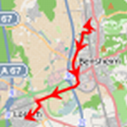
GPS Map Navigation Apps Review 1.1
Review and comparison of Google Maps andWazenavigation and mapping apps.The contents of this app is for informational purposes only.Itpresents real-world results of data usage and batteryconsumptionof the most popular GPS navigation apps under standardconditions.Google Maps and Waze are popular apps for Androidsmartphhones andtablets, and as such were reviewed in thiscomparitiveanalysis.The proliferation of smartphone apps that providethisfunctionality has allowed the ability to use GPS navigationtoroute trips. Using media heavy navigation apps over 3G / HSDPA/LTE can incur network carrier costs. The question is how muchdatado these mapping apps use, as this will determine whether itisfeasible to use on a regular basis. Some apps also offer cachingofmap data for previously travelled routes, thus reducing thedataconsumption when these routes are used again. Batteryconsumptionof these apps are also significant, as they access theGPS radio,internet data and heavy graphics. The comparative datausage on newand repeat routs, as well as battery consumption forGPS apps ispresented here, in order to help users make an informeddecision onwhich apps best suite their requirements.


Truck GPS Navigation 5.0.225
-- NO INTERNET REQUIRED --THE NAVIGATION APPLICATION FOR PROFESSIONALS NOWAVAILABLEFORYOUR TABLET AND SMARTPHONETry the application for free for 7 daysNavionTruck Truck Navigation for Trucks is a GPSnavigationsystemfor Tablet and Android Smartphone speciallydesignedforprofessionals, a system that enables you toindicatethemeasurements of the vehicle, Height, Length, Weight, No.ofAxles,No. of Trailers and if the vehicle carriesanydangeroussubstance.The GPS application enables storing the maps in thedevice,orwhen purchasing the license, the maps will becomeavailable inthecloud to be downloaded as needed, in this way theydo notoccupyspace in your device.You can carry out searches of places during creation oftherouteor find thousands of points of interest specific fortruckson theway such as: all sorts of Businesses, FruitandVegetablewarehouses, Load and Unload Zones, Markets and anendlessamount ofservice points such as parking zones,restaurants,information andpayment points for entry and circulationoftrucks.INFORMATION FOR TRUCKS· Configuration of measurements and dangerous cargo.· Signals for indicating streets and roads with restrictions.· Alternative routes in route creation: Fast route, short routeandacombination of both.· Option for avoiding toll-gates and specific roads.· Lane Assistant, 3D Map.· Search system according to address, zip code,contact,indicationof a point on the map, search of pointofinterest,coordinates.· Speed limit of the road with an option ofpersonalisedspeedwarning.· Live traffic situation of the road (OPTIONAL). With thisoptionaroute is created according to traffic incidents:Accidents,Jams,Road works…· Logistic points of interest for trucks thatincludeCompanies,Loading Zones, Parking zones…· Location of speed radars with pre-warning at a distancefromtheradar location.· Leisure and rest points of interest forTrucks:Hotels,Restaurants, Parking Zones, Washing Aeras, PetrolStations,RestAreas, Clubs…· Payment indications for truck circulation:Toll-gates,Highways,Toll Collect, CNADNR, Eurogavinette, GO, M6,Myto,Mytocz,Viatoll...· Export and import of favourites, routes from your PC.OTHER OPTIONS· Chat service between friends and colleagues thathaveourAPP.· Information about weather conditions in the area.· Currency Exchange Rates.WORKS WITHOUT 3G/4G COVERAGEThe navigation app does not need mobile data in ordertonavigate,maps are stored in the telephone or tablet.STORE YOUR FAVORITESThe navigation app enables you to save your favorites andbeableto export them, in the same way if you havestoredfavoritesalready, you can upload them to the app easily.MAPS OF THE WORLDHigh quality HERE maps of 196 countries in all theContinentsin21 languages and voice guides in 26 languages.PERSONALIZED TECHNICAL SUPPORTNeed more information? Visit our webpagewebhttp://store.naviontruck.com.Access your account in our webpagehttp.//store.naviontruck.com,go to technical services andsolveyour questions.If you have any doubts or comments, send them [email protected], we will be happy to help you.FREQUENT QUESTIONSAccess http://store.naviontruck.com and consult our FAQaboutourGPS navigation system.When you acquire a map license, you will receive FREEUPDATESFORLIFE and CUSTOMISED TECHNICAL SUPPORT.IMPORTANT NOTEWe use high quality maps by Navteq (HERE), whicharequitepossibly the most precise offline maps.At some points it is posible that the maps arenottotallyprecise, for this reason we work on a daily basis inordertoupdate all the roads and streets, unfortunately there canalwaysbea chance that there is an error on the road, thus werecommendthatyou study the route prior to starting the trip.TRY THE APPLICATION FOR FREE


Free Navigation 1.2.5
You can keep your hands on the steeringwheelof your car and navigate safely on roads that do notknow.To operate the navigator ONLINE, you first need to download themapof the affected area.Enable GPS and speaks with your voice, navigation willstartimmediately.Features:- Address House Fast- Phone book (you can delete all data stored at one time oreverysingle address with swipe)- POI (you can delete all data at once or individually with eachPOIswipe)- Where 'my car? Very useful to find the car in large parkinglots,or unfamiliar places.If you are tired of all the icons in the form of maps, GPS,compass,cars and roads, download this simple and easyapplication!Navigator does not use "Google APIs."


GPS Navigator Path Finder 1.0
GPS Navigator Path FinderGps Navigator Route Tracker is a gps navigation basedPathTrackerfor live traffic route tracking. Route tracker &masjidfinderto nearby mosques. Hiking gps route finder to thebestcompassresorts. Live online, offline gps navigation systemfortrafficmaps tracking equipment. Vehicle unit route trackingsystemwithunderground interactive streets maps for walking routeandpathfinder. Route planner and route finder to givedrivingroutedirections for hiking gps tours to western compassresorts.Locatormaps with gps coverage mapping system includesphysical mapsof USAalso. Live traffic route finder & tracker inmobiledevices toprovide accurate route & gps locations freetoyourdestination. Locator gps navigator to give actualhikinggpspositions with coordinates. Human tracker andATMs,Hospitals,Mosques, compass resorts, Banks, gas fillingstations,Hotels,Police Stations, Fire Stations finder. In fact it’sa gpxgeotracker which tracks effectively in all altitudes.Effective use of gps technology has enabled toprovidebeneficialoffline gps navigation maps vehicle units carsroutetrackersystem. Gps path tracking software tracks path by gps.Andprovidesyou my exact location anywhere in the world earthmapslocations.Online world address locator maps and drivingdirectionsto travelto any western location maps. All Detailedtrails,Traveldirections with hiking & biking google gps maps.GpsNavigatorRoute Tracker uses google GPS Sensor in phones torecordgeographicstatistics. It tracks, records and allows to sharepathanddistance with others while driving or walking alongroute.GpsNavigator Route Tracker provides real time datawhilenavigation,maps out path, shows google path alternativesallowingyou saveroute/rout for future reference.
GPS Navigation & Map Tracker 0.2
GPS map finder and route finder is a freeappwhich provide you a best alternative and demo of defaultmapdirection system of you mobile.Gps navigation and tracker location is an gps map which trackyourride and provide you the map where you are, gps map is andirectionlocator app which has own location system of trackingyourway.GPS navigation and maps sygic position map route finder whichupdateevery latitude of earth and give you the right path bydistrict todistrict also,gps tracker is one of the best trafficcontrol appwhich receive the directions from radar and update yourmap when youstuck at anywhere.Gps navigation and direction tracker is an car gps which informsyouthat where did I park the car,Also an phone gps that has unlimited traffic tracker systemwhichprovide you the best tracking app.GPS location finder & tracker also locate your directionsandgive you the right track or way,with gps navigator anddirectionfinder provide the the info of different street routes andalsothis wise dil lane saint system remove issues and provideyourplaces according to your route.GPS navigator location and tracker is an accurate and mostadvancedapplication which find your routes and navigate your mapthroughtraffic control systems,gps navigation locator is a timetrackingbest tool which give you the fastest and easy way pointfrom eastto west and north to south worldwide,gps direction finderclearyour routes & reduce your miles and time through radarbasesystem.Gps direction tracker in an tracker studio which copy themapdirection & paste it into to your middle map directionreceivesystem.


Corner HUD Navigation Corner
Corner HUD is a navigation App which canbeused to find a route to your destination. It providesturn-by-turnvocal instruction and fancy UI layout duringnavigation. You cancreate a customized theme for your map by usingthe theme editor inthe App. Changing colors of the map'sbackground, street network,routing path, ... is allowed in CornerHUD. The head-up displayfeature let you reflecting the drivinginformation on yourwindshield as a jet fighter cockpit. It does notrequire any otherequipment besides your smartphone.**NETWORK CONNECTION IS REQUIREDFEATURES* It is a navigation App with vocalturn-by-turninstructions* It has a customizable map view* It can be a head-up-display reflector* No map download is required before navigation (needsnetworkconnection)Read me before using :Make sure you have turn on GPS & Wifi on your phone, andcheckthe Google Play Service, which is available on Google Play,isup-to-date as well as only the Android 4.0 and up versionissupported by current version.See how to use Corner HUD in the following link:http://whilerain.com/2014/12/07/corner-hud/