Top 50 Apps Similar to Altimeter professional

Accurate Altimeter 2.2.32
The most downloaded Altimeter on the PlayStoreis now updated with a new interface and new features!- Altitude estimation with three different methods to be alwayssureto get a reliable measure, even without internetconnection.- Historical charts to see your excursions elevation gain.- Map with your elevation and contour lines.- Pictures with impressed place name and altitude.Altitude can be estimated:- With satellites triangulation. Slow and less accurate but itworkseven with no internet connection.- Taking the ground elevation at your current position fromaninternet web service.- Using the pressure sensor of your device (if available).Itcalibrates itself on pressure from the nearest weather stationtoimprove accuracy.As additional PRO features you can also:- compensate systematic error of pressure sensor- record altitude without opening the App- remove advertising


Altimeter & Altitude Widget 4.57
DS Altimeter is an elevation meter,elevationlogger, and altitude mapper. In addition to showing andoptionallytracking your altitude, the app allows you to search thealtitudefor other locations as well.You can select from the best sources of elevationdata,including:1. Location based altitude from NASA's Shuttle RadarTopographyMission2. Satellite based altitude (GPS altitude) corrected toheightabove mean sea level (AMSL)3. Get actual land survey altitude values for your locationfromthe United States Geologic SurveyDevices equipped with a barometer sensor can also obtainpressurealtitude which is converted to true altitude. For the mostprecisereadings, calibrate the pressure altitude by entering areferencevalue or by selecting one from the app's dynamic list ofnearestairfields.USGS (United States Geologic Survey) altitude results arealsoavailable for customers in the contiguous United States, CanadaandMexico.DS Altimeter also works offline: barometric altitude andGPSaltitude corrected to elevation above sea level do not requireaninternet connection.NEW IN DS ALTIMETER: Record altitude profiles and elevationtracksfor your favorite journeys to the highlands, the lowlandsandeverything in-between!Upgrade the application to pro and gain access to even morefeaturesincluding the Altimeter Widget and variousbarometricaltimeter calibration methods.Going skiing? Record your ski run with DS Altimeter, then viewyourski trail with its elevation points on the included maps.Mininumand maximum altitude points for your run will beclearlyshown.Altitude mapping, altitude search and bathymetry (lake andseadepths) are also included with DS Altimeter. Tap anywhere on amapto get the altitude or water depth at that location.* The perfect altimeter for skiing, hiking, mountain climbingandother outdoor sports, boating, marine navigation and anytimeyouare curious about your elevation!


Compass Steel
FEATURES:• Ad-free compass app.• Choose from multiple color themes.• Choose between 2 heading modes - True heading (based onTruenorth) and Magnetic heading (based on Magnetic north).• Sun direction indicator.• Moon direction indicator.• Set and save a target direction.• Tilt-compensated and self-calibrates as you use.• High contrast design improves readability.PERMISSIONS:• Requires access to location coordinates to calculateTrueheading.Any suggestions or feedback are warmly welcomed.


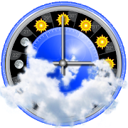
Weather Station with barometric pressure sensor 2.8.7.1
Simple, nice and retro weather station. Our barometer appshowsmaindata: temperature, barometric pressure and humidity.Themes,Graph,Forecast and different Data Providers are also inside.Seepressurewith built-in barometric pressure sensor (not foralldevices)! Thisapp is pleasant and easy to use. It lookslikevintage barometerwith modern technology inside. Onlycorrectweather data withoutanything superfluous (like map, widgetsetc.).Free versionincludes: • Temperature (could measure in °C and°F onthe samescreen) • Wind speed (switch between km/h, mph, mps)•Atmosphericpressure (3 different pressure units of barometer-inHg, hPa, mmHg)• Relative humidity in live time • 7commonlanguages (EN, IT, DE,ES, RU, UK, PL) • barometric pressuresensorYou can also switchbetween classic and forecast viewsPremiumversion: • Forecast for4-7 days (depends on data provider) •Morewind meteo data • Sunriseand sunset data • 3additionalmeteorological live-time datachannels • 3 additionalbackgroundthemes • charts of changingindicators by day or hourlyStayinformed about the weather.Barometer will show you airpressure,hygrometer will show humidityand thermometer – a realtemperature.All local weather informationin your pocket. Rain, snowor evenstorm outside will no longersurprise you. FEATURES: • A lotofrealistic themes to make yourWeather Station unique •Ergonomicdesign: comfortable userinterface in both positions(vertical andhorizontal) • A lot ofdevice configurations forpersonal usage •Compare meteo data fromdifferent providers, sourcesand channels •You can switch betweenanalog style graphic and modernstylegraphics • Celsius andFahrenheit - together on one screenAweather station is a facility,either on land or sea,withinstruments and equipment for measuringatmospheric conditionstoprovide information for weather forecastsand to study theweatherand climate. The measurements taken includetemperature,barometricpressure, humidity, wind speed, winddirection.Atmosphericpressure, sometimes is the pressure exertedby the weightof air inthe atmosphere of Earth. Low-pressure areashave lessatmosphericmass above their location, whereashigh-pressure areashave moreatmospheric mass above their location.Again, we havebuilt-inbarometric pressure sensor support. Itallows to readcurrentatmospheric pressure in realtime. Humidity isthe amount ofwatervapor in the air. Our app shows you relativehumidity, itisexpressed as a percent, measures the currentabsolutehumidityrelative to the maximum (highest point) forthattemperature.Humans are sensitive to humid air because thehumanbody usesevaporative cooling as the primary mechanismtoregulatetemperature. Under humid conditions, the rate atwhichperspirationevaporates on the skin is lower than it would beunderaridconditions. Because humans perceive the rate of heattransferfromthe body rather than temperature itself, we feel warmerwhentherelative humidity is high than when it is low.AnalogWeatherStation always identify exactly where you are. Youhaveopportunityto enable GPS detection or search for your city. Youcansee localweather, alert about rain, snow, strong wind andotherweatherevents. And you can be sure of the accuracy oftheforecast.Updates and more features are coming. Stay tuned forthecurrentweather with vintage Analog Weather Station! Find outwhentheweather will be sunny, cloudy or snowy, there will besevererainor atmospheric pressure will increase in realtime mode!


Compass Steel 3D
FEATURES:• Choose from multiple color themes• Choose between 2 heading modes - True heading (based onTruenorth) and Magnetic heading (based on Magnetic north).• Sun direction indicator• Moon direction indicator• Sunrise and sunset times• Moonrise and moonset times• Self-calibrates as you use• Marine-style compassPERMISSIONS:• Requires access to location coordinates to calculateTrueheading.
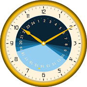
Sunday - Astronomical Clock 1.12
When does the sun go down? Is it longenoughbright to finish the work outside? Do i reach the viewpointpointin time to see a magnificent sunset?Such questions are answered by Sunday. It has theastronomicallaws of the Sun Run programmed to predict the course ofthesun.In Islam, the prayer times depend on the position of the sun.Thefive ritual prayers of Salad, Fajr (dawn), Dhuhr (noon),Asr(Afternoon), Maghrib (Sunset) and Ischa (evening) can bedisplayedaccording to different standards. A compass shows thedirection toMecca.The Sabbath (Shabbat) is in Judaism, the seventh day of theweek,a rest day on which no work is to be done. The start onFridayevening 18 minutes before sunset may also be displayedwithSunday.Set your own place via an integrated urban table or use GoogleMaps.Animate date and time by wiping across the screen orautomaticanimation. Explore cosmic rhythms and proportions of thesun at anytime and place on Earth.Use Sunday as app, wallpaper or widget.

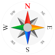
Compass Level & GPS
Take advantage of accurate andintegratedcompass, level and gps tools in one screen.For lovers of D.I.Y. and fans of self-assembling: this makes youanexpert in placing furniture, hanging up a shelf or frame.For tracking, hiking and camping fanatics: now you will never beoffcourse, always having the right position and direction.This tool is handy and very accurate - try it yourself!Advice: for a better accuracy, first calibrate once.✓ Compass Usage• Find and keep track of the right heading• Get information of your current position or atargetposition• Find your parked car through the target position feature.✓ Level Usage• Proper positioning of furniture• Straight installation of a shelf or a frame• Quickly level out your motor home or caravan✓ Features• Automatic horizontal and vertical level display• Choose Sound and/or Vibration when level• Manual compass and level calibration available• 'Hold / Release' button, for easy readout• Screen Capture: no notes, just copy• Sensor sensitivity and update-cycle adaptable• Powerful GPS feature: set target position, and find thedirectionand distance.✓ Remarks (Compass)• Sensor accuracy may differ depending on the device used• For better accuracy, keep away from magnetic fields andelectronicdevices.** Usermanual:http://lemonclip.blogspot.kr/2014/02/compass-level-user-manual.html• If you encounter any problem with this App or incorrectwording,please contact us via:- https://www.facebook.com/CompassLevel- [email protected]


eWeather HDF - weather app 8.6.3
eWeather HDF is a weather app with an accurate weather forecastandbarometer. Unique weather widgets include weather clockwidget,storm radar widget, sun and moon widget, barometer widget,weatheralerts, moon phase, earthquake widget, ten day forecast etc.Thehigh accuracy of the forecast is achieved by using tworeliablemeteorological agencies, a large number of meteorologicalstationsand unique information processing. Barometer app: bothatmosphericpressure and sea level pressure. Barometric pressuretrackerinforms you about pressure changes in the past and future 24hours.Rising pressure leads to the sun. Pressure drop leads torain.Fishing barometer: Graph of pressure changes combined withsunriseand sunset, moonrise and moonset, hourly forecast of rainand windwith tides table helps to predict fishing weather. The seaand airtemperature, precipitation and cloud cover for any place intheworld are in a few years archive. The travel weather helps youtochoose the right time and place for the upcoming trip andcomparethe current temperatures and precipitation in this year andthepast years. Earthquake app: earthquake map with earthquakealertnotifications filtered by magnitude, depth and distance fromyourlocation. Earthquake tracker data provided by the USGS. Ourappdisplays icons for temperature, precipitation, andbarometricpressure in the status bar. You can add notifications forwind,earthquake, humidity, UV index, geomagnetic storm, moonphasefiltered by low or high threshold, etc. Severe weatheralerts,tornado tracker, hail probability, heavy rain and windalerts areprovided by National Weather Service (NWS) & NOAA.Hurricanetracker and typhoon information are provided by GDACS. Theapp canbe used as a home weather station with an analog or digitalclock.It is very convenient to use an old phone or tablet that isnolonger needed by hanging it on the wall or placing it on astand.The lunar calendar displays the lunar day, moon phases, sunandmoon eclipses. The moon calendar widget has sunrise andsunsettimes, solar and lunar eclipses, spring and autumn equinox,summerand winter solstice, daylight hours, times before sunsetandsunrise, etc. The hourly forecast includes not only temperatureandprecipitation, but also air humidity, wind speed and direction,dewpoint, visibility on the roads, perceived temperature and evenaMETAR report. An hourly forecast of the level ofultravioletradiation (UV index ) allows you to correctly plan howmuch andwhen you can be in the open sun to avoid sunburn.Precipitation mapshows weather radar (for the US and Japan) withreal data andfuture forecasts. The weather map has a variety oflayers includinga wind map, temperature map, satellite images, etc.The NOAA radarwidget can be any size from 1x1 to 5x5. The radar appmakes rainradar forecast up to 60 minutes. Space weather isavailable as ageomagnetic index with geomagnetic storm alert. Icewarning andfreshly fallen snow will help you in the evening to beaware ofpossible problems that may occur in the morning whiledriving. Theair quality app contains the concentration of ozone(O3), fine(PM25) and coarse (PM10) particulate matter, dioxide(NO2) andnitrogen oxide (NO), carbon monoxide (CO) etc. fromvarioussources: AirNow, Copernicus, ECMWF, etc. The tide appprovides tidetables for some locations. Sea temperature is givenbased onmeasurements from buoys and satellites. The app collectslocationdata to display current conditions for your currentlocation in thestatus bar and widgets, even when the app is closedor not in use.With our app, you'll always know exactly what thelocal weatherwill be like in the coming week.


AndMeasure (Area & Distance) 2.0.7
The AndMeasure tool allows you tomeasuredistances and calculate area between points on a map.The tool has virtually unlimited applications. Use itPROFESSIONALLYfor measuring distances and areas in landscaping,lawn care, waterline measuring, paving and fencing. Use it infarming, agricultureand forestry to measure your fields andforests. Realtor's can useit for showing clients distances tocertain landmarks.For RECREATIONAL use, it can be used in measuring off-roadroutes,plotting running courses, water trips, range estimation attheshooting/driving range. Use it in Golf for gettingreal-timedistance to the green.★★★ Featured on AgWeb.com powered by Farm Journal ★★★"This app could be an easy way for farmers to measure newfields."March 2012Features:● Use it as a ruler on a map to calculate the distancebetweenmultiple points● Calculate areas in acres, sq miles, sq feet, m2, km2,Hectare,Ares● Measure the distance to your location from multiple pointsinreal-time using the "continuous mode" feature● Switch between Satellite, Hybrid, Terrain and normalmapmode● Find your current location via GPS or Network● Share measurement and screenshot via email and Google Drive● Add markers to the map either via tap or by dragging from the"addbutton" to get super accuracy● Move markers around to get precise measurementKeywords: map, maps, area, distance, length, ruler, gps, golf,areacalculator, range finder, map measure, area measure,distancemeasure, field area measure, surface measurement, realestate,realtor, GPS measure, solar, landscape, areacalculation,planimeter, efarmer, perimeter, landscaping, garden,fencing,acreage, terrain, geographical, property, geo,agricultural,calculator, forest, farm, field measure, location,roof area,solar, solar panel roof area, outdoor, snow removal,farmlogs, landcalculatorLanguages: English (write an email if you want to help withothertranslations)Get it at:https://play.google.com/store/apps/details?id=com.megelc.andmeasureFacebook:http://www.facebook.com/andmeasurePrivacy Policy:AndMeasure does not store any personal information at all.HoweverGoogle Analytics is used in the app to better understand howtheapp is used and performs.The Google Privacy Policy can be found here:http://www.google.com/intl/en/policies/privacy/

