Top 23 Apps Similar to PhotoMap GPS Location on Photo


Survey Cam: Geotag & timestamp 1.1.2
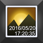
Survey cam is an App which can help while surveying on the fieldbya finely crafted camera having all the requisites in supportofsurveyors. Civil engineers, Photographers,Archaeologists,researchers, etc can take maximum benefits of suchan amazing toolduring their site survey. Photos & videoscaptured here willhave easy GPS location stamps, Notes, DateTimestamps & manymore. This App can make your survey work as easyas possible. ● KeyFeatures of survey GPS map camera: In-App camerato make yourphotos & videos outshine well with GPS stamps ⃞Photo &Video Settings: Adjust Timer, Ratio, Grid & Sound ofyourchoice to click your perfect pictures or videos. ⃞ TextSettings:Font style: Set the font style according to yourpreference TextSize: Adjust Text size from given values Font color:Select colorof fonts from multiple color options Background color&Transparency: Set stamp background color ⃞ Logo Settings: LogoSize- Adjust Logo size as required ⃞ Stamp Settings: StampPosition:Select positions from Top Left, Top Right, Bottom Right,BottomLeft ⃞ Survey details as stamps on Photo: All the detailsrelatedto Survey, add directly on Photo itself 🔰 Project Name: Ifyou areworking on any project, add project name on photo/video 🔰CompanyName: You can also mention Company’s name info 🔰 Notes:Write anyspecification that you want to add on photo/video, simplyaddsurvey notes. 🔰 GPS Coordinates: Add exact GPS coordinatesonphoto/video 🔰 Date & Time: Easily add Date Time stampwithgeotags. 🔰 Address: Add GPS stamp on photos by geo taggingimages 🔰Accuracy: Define accuracy of the GPS photo location 🔰Altitude: AddAltitude watermark while geotagging photos Here youcan make FileName having following details: Add Project name,Company name,Note, Coordinates, Date & Time, Address, Altitudeto file nameitself. ● Why do you need to have this app on yourdevice? → Easyto add geotag on photos as well as text on photo& Text onvideo → InApp GPS Camera with timestamp &Geolocation → GPSphoto tagger for all Geo tagging camera relatedwork → Datetimestamp on photo & video with GPS map camera →Camera withNotes to add text on photo as like autostamp anddatestamp → Topsurvey with Date time stamp & GPS map stamp is afinecombination → Geotagging app for adding real time as timestampcamera and location while surveying ● Who can use this surveyGPSmap camera with Geotagging & timestamp camera App? ▸Civilengineers while surveying and leveling construction sites canclickphoto/video with this app ▸ Researchers can get highlybenefitedwhile sharing field images of land survey to others withexactlocation details available on the photo map. ▸ ThoseCoveringaccident scenes or disaster management firms may get theadvantageof this app specially designed for them ▸While landsurveying,camera timestamp & photo GPS location helps ingetting all thedetails available on the photo before sharing ▸ Ontimes when realtime and location is involved to be shared toothers. ▸App can helparchaeologists to click photo/video with exactlocation details& Date to time stamps. Download this App tosupport your surveywork and even while exploring new fields.If youhave moresuggestion or query write us on: