CatFish Apps

UnwiredMaps 高度補正データ 1.00
地図アプリUnwiredMaps(Ver1.19以降)で可能な現在位置の高度表示を補正するデータです。このアプリをインストールした上でUnwiredMapsの設定[高度補正]をオンにすることで、UnwiredMapsの高度表示値が補正されます。■解説GPSにより得られる高度値は実際の海面からの高度とは異なります。すなわち、海抜0m地点で測位した高度値は0mにはなりません。このアプリは、その誤差を補正するためのデータです。補正は地球全域に適用されます。■注意GPSの精度や補正データの解像度は荒いものであり、補正されるとはいえ得られる高度値は不正確かつ不安定です。生命、財産、尊厳等、重要なものに影響を及ぼす利用方法はお控えください。例:「ここの標高は100mだぜー(ドヤァ」 ←おおむね間違っており尊厳が損なわれる危険があります端末性能にもよりますが、ひどい場合には100~200mレベルで誤差が生じます。■詳しい解説このパッケージにはデータのみが格納されており、単独で動作するものではありません。アメリカ国家地球空間情報局(NationalGeospatial-IntelligenceAgency,NGA)が提供しているジオイド高データ EGM96 -WW15MGH.DAC がそのまま格納されています。Unwiredmaps本体に組み込むにはサイズが大きすぎ、利用しない人には無駄なデータですのでプラグイン扱いとしました。データは地球全球のジオイド高を15分間隔で記録したものです。15分は東京近辺では22.5kmの距離に相当します。UnwiredMapsではこれを単純に線形補完して任意地点のジオイド高を得ています。■データのソース2016.9時点のhttp://earth-info.nga.mil/GandG/wgs84/gravitymod/egm96/binary/binarygeoid.htmlより、WW15MGH.DACを利用しています。ライセンス条項が見当たりませんでしたので、取得したデータファイルの内容をそのまま搭載させていただいています。The data forcorrectingthe altitude display of the current position possible inthe mapapp UnwiredMaps (later Ver1.19).By turning on the UnwiredMaps setting of [altitude correction]onyou install this app, advanced display value of UnwiredMapsiscorrected.■ DescriptionAltitude value obtained by the GPS is not the same as the highfromthe actual sea level. In other words, advanced valuepositioning isabove sea level 0m point is not a 0m.This app is data for correcting the error.Correction is applied to the earth throughout.■ NoteResolution of GPS accuracy and correction data is a roughthing,advanced value obtained say that is corrected is incorrectandunstable.Life, property, dignity, etc., affect usage to thoseimportantplease refrain.Example: "Here altitude 100m D'Azay (Doyaa" There is a riskofimpaired dignity is wrong ← generallyDepending on the terminal performance, but the error willoccurat 100 ~ 200m level in the worst case.■ detailed commentaryThis package is stored only data, does not operate alone.National Geospatial-Intelligence Agency(NationalGeospatial-Intelligence Agency, NGA) geoid height datathat isproviding EGM96 - WW15MGH.DAC is stored as it is.Too large in size to incorporate in Unwiredmaps body, was madetoplug-in to handle because it is useless data for people who donotuse.Data is what was recorded the geoid height of the Earth globalat15-minute intervals.15 minutes is equivalent to the distance of 22.5km in theTokyoarea.In UnwiredMaps by simply linear interpolation this has earnedthegeoid height of any point.■ source of data2016.9 point of http://earth-info.nga.mil/GandG/wgs84/gravitymod/egm96/binary/binarygeoid.htmlThan, WW15MGH.DACIt uses the.Since the license terms was not found, but I am as it isequippedwith the contents of the acquired data files.


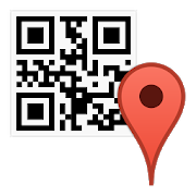
Geo2QR :Map QR code 1.00
This application displays the geo intent sent by the mapapplicationas QR code on the screen. By reading this with a QRcode reader, youcan display the location on another terminal witha map. If you havea Map2Geo installed terminal, you can displaythe QR code from a mapapplication that can not send thegeointent.https://play.google.com/store/apps/details?id=catfish.android.map2geo■Attention・Depending on the QR code reader app, you may not beable to launchthe map application. …As Tested reader app, there isa QR codescanner(https://play.google.com/store/apps/details?id=com.google.zxing.client.android).■Howto use [For a terminal with Map2Geo installed] 1.Select apoint inthe map app, execute [SHARE]. 2.When [Map QR code] isselected fromthe share list, the QR code will be displayed. 3.Whenyou read it onanother terminal, options such as [Show map] etc.are displayed.[For terminals that do not have Map2Geo installed]1.Performs a geointent transmission operation in the applicationthat can send geointent and specify the destination as [Map QRcode], the QR codewill be displayed. 2.When you read it on anotherterminal, optionssuch as [Show map] etc. are displayed.*Applications that can sendgeo intent are limited, and the namesof functions are also various.■Tips ・If Map2Geo is also installedon the terminal that reads theQR code, the kind of map applicationthat can be displayed willincrease. …"Transfer to other map" isdisplayed on the recipient'soption, and non-standard mapapplications can be used. ■Aboutlicense ・This software includesthe work that is distributed in theApache License 2.0.…ZXing:open-source, multi-format 1D/2D barcodeimage processinglibrary


WiFi Portal Opener 1.00
This app displays the login screen of access points such asfreeWiFi that require authentication. Normally, the loginscreendisplay is automatically suggested from the OS.However,occasionally there are access points for which login screendisplayis not suggested. This app is useful in that case. ■How touseAfter connecting to the WiFi access point, activate this appwhen"!"-attached WiFi icon is in the notification area.■AttentionThere may be access points and devices that can not bedealt withsince I have not elaborated it.


UnwiredMaps -オフライン地図- 1.27
GoogleMapsなど、インターネット上で公開されている地図画像をオフラインで見ることができるアプリです。オンライン時に取得した地図を覚えておきますので、ネットワークにつながってない状態でも地図が見られます。※歩行中、運転中、操縦中の地図閲覧はお控えください■機能 ・地図の表示、拡大・縮小、回転・地図上への現在位置の表示・追従、進行方向への回転、航跡表示・速度、高度、距離、到達予測時間、俯角の表示・表示の拡大、コントラスト調整・端末シェイク、近接センサ、画面タップパターンによるアプリ操作・外部・内部各電源接続時個別の動作設定・メディアプレイヤーへの再生指示発行 ・画面レイアウトを編集可能・他アプリへの地図座標の転送/他アプリからの起動■注意・ネットワークに繋がった状態で見た部分の地図のみ、オフラインでも見ることができます …見たことがない場所、縮尺の部分はオフラインでは見ることができません・場所の検索機能はありません。見るだけです・中華人民共和国内では地図と現在位置にズレが生じます。補正するには設定の中国内位置補正をオンにしてください …香港、台湾では補正不要です■高度表示について ・高度表示機能は追加アプリケーション"UnwiredMaps高度補正データ"をインストールすることで実際の高度値に補正されます …設定画面からマーケットに移動できます …高度補正データをインストールしていない場合、GPSが提供する生の高度値が表示されます・GPSが提供する高度データは補正を適用してもなお不安定かつ不正確です。航空機の運行や測量などの生命、財産に関わる用途には計測値を利用しないで下さい。 …100~200m単位で値がぶれることがあります■到達予測時間表示について・現在速度進んだ場合に現在位置から地図中心までどれだけかかるかを表示します・表示をタッチすると所要時間と到達時刻の表示が切り替わります・飛行機で、あの島まであと何分くらいだろ?みたいな時に御利用ください■俯角表示について・現在位置が海抜300m以上(根拠:なんとなく)の状態で表示されます・現在位置から地図中心・海抜0mに対する見下ろし角度を表示します・飛行機から、あの島はどの辺に見えるんだろ?という時に御利用ください■アプリが要求する権限について ・位置情報 …現在位置の取得に使用しています ・画像/メディア/ファイル …地図画像の記憶に使用しています ・マイク …音声コマンド入力に使用しています・その他 …ネットワークへのフルアクセス:地図画像の取得に使用しています …バイブレーション制御:コマンド入力時のバイブレーションに使用しています …スリープ無効:外部電源接続時のスリープ無効化に使用しています■備考 ・当アプリはGoogleMapsAPIの利用規約に違反しているとのことで、Googleマップチームからの警告を受けています。 予告なくアプリの公開が停止される可能性がありますのであしからず御了承ください。・基本的に作者の需要と好みでつくり込んでいるので、要望とかは聞き流されるとお考え下さい■おまけ・そのまま使うとGoogleMapsの地図画像を表示するようになっていますが、小難しい設定をこなせばインターネット上に公開されている任意の地図画像を扱えます …腕に覚えのある人はこちらもご参照ください。 https://sites.google.com/site/appscatfish/android/unwiredmaps/tileurl・地図データ管理用PCアプリケーションを用意してありますが、最近のWindowsでは動かないんじゃないでしょうか。気になる人はウェブサイトを参照してください・Ver1.13から音声コマンドが試験実装されています。が、あんまり使い物になりません …シェイク・タップ・近接センサによるコマンドに[音声コマンド]を割り当てることで試用できます …[拡大|縮小|現在地|移動|終了|再生|停止|次の曲|前の曲|回転|進行方向を上に|北を上に]の各機能を認識します■つぶやき・このアプリ持って全都道府県まわってきました。いろんな景色は典子と見たかった。・ほんというとあと二人の方と一緒に過ごしたかった。気持ちを言葉にすると悲しいので避けてたけど。
