Top 35 Apps Similar to Free Political World Map


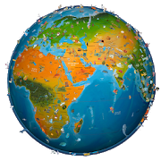
Atlas 2021 2.6
*** NEW RELEASE *** *** 50% OFF For a Limited Time! ***ViewqualityWorld Maps conveniently and easily on your AndroidDevice!FeaturesUp-To-Date World Maps! Did you know? -------------SouthSudanbecame the world's 195th country following separationfromSudan on9 July 2011 Carry your pocket Atlas wherever you go foraquickreference. *** FEATURES *** - Full Screen maps - OFFLINEmaps.NoInternet connection is required. Contains ========= -DetailedWorldMap - Political World Map - Physical World Map - MapofAsia,Africa, Antarctic, Arctic, Central America, Europe,NorthAmerica -Bonus World Time Zones - Countries Featured:Australia,UnitedStates, United Kingdom, Canada, China, India, andMore. Aquickreference Atlas that will allow you to quicklylocatecountries suchas United Kingdom, United States, Australia,India,France, Germany,Thailand, China, India and many more!Instructions============= -Press the 'Menu' button on your deviceto view theMap SelectionMenu. Users Love Atlas 2021 Download Atlas2021 andexplore worldmaps conveniently on your device today!


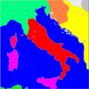
ZonzoFox Italy Official Guide & Maps
Tourist guide of Italy: information aboutthebest cities to visit available on your smartphone,evenoffline!Free tourist guides of the best Italian cities, natural areasandbeaches. The smartest guide to discover Italy.Information about what to see, where to eat (typicalfood),nightlife, shopping and trips in the neighborhoods.A personal digital assistant for every tourist: like alocal,ZonzoFox helps travellers make choices while gettinginspired,planning and visiting, and creates tailor-made city-walksinreal-time providing step-by-step information.Discover what to see, where to eat (typical food),nightlife,shopping, trips in the neighborhoods, guided tours,experiences,deals,...Complete free tourist guides of the best Italiandestinationsavailable in the app:- Milan- Venice- Florence- Rome- Pisa- Bologna- Verona- Turin- Siena- Palermo- Lecce- Bari- Genoa- Padua- Perugia- Mantua- Parma- Lucca- Vicenza- Arezzo- Trieste- Pavia- Pistoia- Piacenza- La Spezia- Livorno- Savona- Treviso- Brindisi- Modena- Messina- Naples- Aosta- Bergamo- Catania- Campobasso- Cesena- Gravina in Puglia- Matera- Altamura- Ravenna- Rimini--------More destinations for weekend or daily trips in theneighborhoodsare available as mini-guides:- Pompei- Costiera Amalfitana- Cinque Terre- Capri- Chianti- Portofino- Garda Lake- Murano & Burano- San Gimignano- Ostuni- Alberobello- Val d'Orcia- Como Lake- Portovenere- Polignano a Mare- Castellana Caves- Maggiore Lake- Castel del Monte- Lerici- Sanremo- Aquileia- Piacenza Hills- Spoleto- Quarries of Carrara- Oltrepo Pavese- Versilia- Iseo & Franciacorta- Tarquinia- Cerveteri- Itria Valley- Lunigiana- Mugello- Garfagnana- Viareggio- Trani- Molfetta- Monopoli- Pietrasanta- San Miniato- Vinci- Portogruaro- Brindisi Inland- Gallipoli & Ionic Salento- Otranto & Adriatic Salento- Santa Maria di Leuca- Taormina- Montalbano EliconaThe app covers the most touristic Italian regions:Tuscany,Lombardy, Veneto, Sicily, Apulia, Piedmont, Liguria...More than 1500 beaches listed. Each beach is provided with manykindof information such as type of sea, sand, bar andrestaurantsnearby.Including practical information, maps, telephone numbers, andmuchmore!Available offline too in pdf (free) or as premiumin-appfunctionality.You can login with your Google or Facebook account to saveyourfavorite point of interests!NEW: Summer Edition with more than 1400 natural areas and1500beaches added: Sardinia, Sicily, Apulia, Calabria and otherpopularbeach destinations in Italy.A great advisor for trip!Cities:Rome Milan Venice Florence Pisa Verona Turin Siena Italy RomeMilanVenice Florence Pisa Verona Turin Siena Italy Rome MilanVeniceFlorence Pisa Verona Turin Siena Italy Rome Milan VeniceFlorencePisa Verona Turin Siena Italy Rome Milan Venice FlorencePisaVerona Turin Siena Italy


World atlas & map MxGeo Pro 6.8.10
World atlas, world map and educational appforgeography. Contains 240 countries and territories of the worldwithcomprehensive economic and geopolitical data. Political mapswithregional units (provinces), capitals and majorcitiesincluded.Designed for smartphones and tablets.• Maps, flags and comprehensive data for 240 countriesandterritories of the world• Interactive political world, continent and country maps• Shaded relief layer for world and continent maps• Geography quiz challenge for playful learning• Country comparison, favorites and distance calculator• Configurable world clock with time zone display• World-explorer: the smallest, largest, wealthiest, andmostpopulated countries of the world• Selectable color themes for map display• All data and maps included, no online connection required• No advertising or In App Purchases• No permissions requiredExplore the world through political continent and countryofflinemaps. Whether Europe, Africa, Asia, Oceania, South andNorthAmerica: maps of all continents and countries are included.Learnwhere each country in the world is located. View itspositionhighlighted on a digital globe. Create your favorite colortheme orchoose from different color schemes for map display.Do you know the flag of Mauritius? Yes? Perfect. Do you also knowinwhich country the Mount Everest is located? “World atlas &worldmap MxGeo Pro” Quiz helps you acquire a geographic literacyin aplayful manner.Choose from six geo guessing games:• Test your knowledge about the capitals in the world• Recognize the proper country flag based on the outline map• Do you know the top-level domains of the world's countries?• Guess the highlighted country on the virtual globe• Do you know the ISO countries codes of the world?• Do you know the mountains of the world?Each quiz offers seven regional variants: World, Europe,Africa,Asia, Oceania, South or North America.Geo learning app and educational game which is fun foreveryonewhether children, adults, seniors or teachers. Get readyfor yournext stay abroad while enjoying this great world almanacincludingtime zones and statistical data, such as populationgrowth,unemployment rate, average age, gross domestic product (GDP)bysector and other key figures. Or prepare for your nextgeographylesson with this genius digital world map. If nottraveling ourworld atlas lets you explore the world just onlyvirtually.Enjoy the comprehensive atlas of the World including Europe,Asia,North America, Africa, Oceania and South America with allcountriesand regional units, capitals and flags.


Topo GPS Spain 6.2.0
Makes from your phone or tablet a complete GPS device withthedetailed topographic map of Spain. Viewed maps will be storedonyour device so that Topo GPS can also be used without aninternetconnection. Why should you buy an expensive GPS device ifyou caninstall Topo GPS on your phone or tablet for only 3,99 €?Topo GPScontains all functions of a regular GPS device for lessmoney, hasa much more detailed map, and is more convenient tooperate. Theaccuracy of the position determination is in favorableconditionsabout 5 m. Ideal for walking, hiking, cycling,mountainbiking,horse-riding, geocaching, trail running and otheroutdooractivities. Also suited for outdoor professionals. Map *Completetopographic map of Spain , newest edition. * Very detailedmaps,with buildings, cultivation, all roads including thesmallestforest trails, contour lines, and characteristic elementsin thelandscape. * Future updates of the map are included for free.* Themap can be zoomed and moved. * All maps of a certain regioncan bemade offline accessible using the map download screen. *Percentageof map that is offline accessible is indicated on the topleft ofthe map. * Map tiles can be stored on external storage, likeforexample an SD-card. Intuitive interface * Clear menu withmostimportant functions. * Different dashboard panels withdistance,time, speed, altitude and coordinates. * Clear manualatwww.topo-gps.com. Routes * Recording of routes, with pauseandrestart possibility. * Planning of routes via route points.*Importing routes in gpx and zipped gpx format. * Editing routes.*Sharing routes. * Free access to route collection Topo GPS.*Searching routes with filters. * Routes can be organizedintofolders. * Maps of a route can be made offlineaccessible.Waypoints * Adding waypoints by pressing on map. *Adding waypointsthrough address or coordinates. * Supportedcoordinate systems:WGS84 decimal, WGS84 degree minutes (seconds),UTM and MGRS. *Importing waypoints in gpx and zipped gpx format. *Sharingwaypoints. * Editing waypoints. * Photos can be added towaypoints.* Searching waypoints with filters. * Waypoints can beorganizedinto folders. Your location * Location and movementdirectionindicated by arrowed marker. * Displayable in WGS84decimal, WGS84degree minutes (seconds), UTM and MGRS coordinates. *Sharing andsaving as waypoint. In app purchases * Topographic mapsof Belgium,Denmark, Finland, France, Germany, Great Britain,Netherlands,Norway, New Zealand and Sweden. * OpenStreetMap worldmap. If youare recording a route, the GPS will run in thebackground.Continued use of GPS running in the background candramaticallydecrease battery life. Rdzl, the company behind TopoGPS, does notobtain in any way the location of the user of TopoGPS. Rdzl doesnot obtain your routes and waypoints, unless youshare a route withTopo GPS. Rdzl does not register which map tilesyou havedownloaded. We sell our product, not our user data.


IGN maps (E-walk plugin) 1.0.30
E-WALK PLUGIN This app in an E-walk plugin (a plugin is anappthatadds features to another app). You need E-walk to usethisplugin:https://play.google.com/store/apps/details?id=com.at.ewalk.free.Theplugin adds to E-walk the ability to use the French IGNmaps,andIGNrando'. WARNING: these features mostly cover Franceonly.IGN MAPSThe IGN maps are highly detailed and cover thetotality offrenchterritory. Some maps are only available atcertain zoomlevels. Theyare the same as the ones used on theGéoportailwebsite(http://www.geoportail.gouv.fr). The IGN mapsplugin addsto E-walk 8base maps : • ortho images: a highresolution satelliteimagery (zoomlevels 2 - 19) • scan: a scan ofpaper IGN maps (zoomlevels 2 - 18)• scan express (classic): a scanof paper IGN mapsoften updated butwith less details (zoom levels 6- 18) • scanexpress (standard): ascan of paper IGN maps oftenupdated but withless details, withanother style (zoom levels 6 -18) • ICAO maps:International CivilAviation Organisation maps(zoom levels 6 - 11)• administrativeslimits: administrativeslimits map (zoom levels 6- 10) • elevationmap: digital terrainmodel (zoom levels 6 - 14) •army staff map(1820-1866): historicalmap from 18th century (zoomlevels 6 - 15)And 8 overlay maps: •cadastral parcels (black): mapof numericalcadastral information(zoom levels 2 - 20) • cadastralparcels(white): map of numericalcadastral information (zoomlevels 2 - 20)• cadastral parcels(orange): map of numericalcadastral information(zoom levels 2 -20) • administrative limits:map of administrativelimits (zoomlevels 6 - 18) • buildings: mapof constructions (zoomlevels 12 -18) • geographical names: mapshowing names of cities,towns, etc...(zoom levels 12 - 18) •Histolitt coastline: mapshowing the limitbetween land and marinearea (zoom levels 6 - 18) •hydrography: mapof lakes, reservoirs,rivers, creeks, etc... (zoomlevels 6 - 18)LICENCES The pluginallows to see the maps through twolicences:Discovery licence(free), and Adventure licence (5.99$USD /month or14.99$USD /year). The Discovery licence is limited by amonthlyquota sharedbetween all the users. Once the quota isexceeded, themaps can'tbe displayed until the next month. With theAdventurelicence, youcan also download the maps beforehand on yourdevice,in order touse them without any internet access.IGNrando’IGNrando'(https://ignrando.fr) is a website provided bythe IGN,allowingyou to visualize treks and points of interest amongthetens ofthousands available. You can also add and share yours.Thosetreksand points of interest are mostly available in Franceonly.WithE-walk, you can synchronize the treks and points ofinterestthatyou like on your device. Thereby, they will beavailableanywhere,and you'll no longer need an internet access tosee them.