Top 31 Apps Similar to Handy Daily Data Logger


GPS Logger Pro 3.3.3
The purpose GPS Logger Pro is to log yourGPScoordinates , speed and distance to a file on your SDcard.Features:- Background logging GPS latitude, longitude, altitude, speed,paceand total distance- Log with the selection of activities including running,walking,biking, skiing, snow boarding, driving and customizeactivity- Powerful history filter- Google map thumbnail in history- Attach photos to session- Share route and photos with your friends- Export GPX , KML (For Google Earth) and CSV (ForExcel)files- Export TCX (Garmin) and FITLOG (SportTracks) file- Bar chart statistics- Support file upload to your Dropbox using built-inDropboxuploader- Show/hide items- No limitation of no. of GPS logging data- No limitation of time interval- Build-in file manager to launch csv, kml files- Mutli-language : English, German, French,Italian,Spanish,Portuguese, Trad. Chinese, Simplified ChineseandJapanese- No adsThe saved files are stored in the SDCard\GPSLogger_Pro folderPermission* Modify/delete SD card contents is used to write CSV file toSDcard* Prevent phone from sleeping is used to keep the screen onforlogging dataHow to use the app ?Press "GPS" icon to enable GPS.Press "Start" button to start logging GPS data. To stoplogging,press the "Stop" buttonNote :1. For those who need support please email to thedesignatedemail.Do NOT use either the feedback area to write questions, it isnotappropriate and that is not guaranteed that can read them.


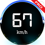
Accurate Speedometer Pro - GPS Speed Meter 1.4
Most accurate high precise intuitive digital HUD ( head up display)distance meter ( 📏 Odometer ) & speedometer app for Car,Bike,Bus, unicycle, scooter, Skiing and walking or running ( 🏎️ 🛵🚌 ⛷️🏃♂️ ). Measure in five velocity scales km/h ( Kilometer perhour ),mph ( Miles per hour ), mps ( Meter per second ), Knots (nauticalmile per hour ), ft/s ( Feet per second ). No matter youare drivingreverse or forward just get most accurate speed anddistancetraveled in your desired scale. Features : a) Pro GPSSpeed meter /Odometer : 1 ) Ads free version work without anyinternetconnection. Track your speed in km/h mph, knots etc. Trackdistancetraveled in km & miles. 2 ) Intuitive UI with PortraitandLandscape Screen Orientation and best GUI with 4 differentSkin-packDay / Night themes. 3 ) Light and fast app for betterbattery powersaving optimized. 4 ) Record the max speed of yourjourney trip. 5 )No matter you are in a public transport, metrotrain or bus, justget the exact real time speed and distancetraveled. b ) ⏰ SpeedWarning Alarm : 1 ) Enable and set speedlimit value. When speedgoes beyond limit it will start alarm. 2 )Safety tool if yourvehicle speedo has died prevents you fromover-speeding and speedingtickets. 3 ) Easily switch to any scalefrom km/h to mph, knots,fts, mps. c ) ⏺️ Top Speed : 1 ) Autosaves max speed in anyselected units scales. 2 ) Record andoverride top speed when breaksprevious one. 3 ) Easily tap andReset to 0 before starting newrace. d ) 🪞 HUD View : 1 ) HUD viewmirror the display of carwindscreen . 2 ) Help stays eyes alwayson road. 3 ) Day time add adark shade plastic or glass towindshield for better display. Uses:1 ) Best set where carspeedometer in mph or km/h . Just set yourdesired one and availthe speed limit safety. 2 ) Get your speed in5 different velocityscales with instant run time top speed tracker.3 ) Best forwalking, running, riding, boating, biking, driving,flying, skiing,skating, swimming and jogging to get your instantreal speed. 4 )Check to know if your vehicle speedometer worksaccurate. SpeedTest 🎞️ videos shows instant speed view and realtime speed updatewith car speedometer.https://www.youtube.com/watch?v=hvCz8nvxeRE 🌐Languages Support :This app supports up to 48 locale languages.Privacy Policy:https://topappsusa.com/privacypolicy.php 👍 FollowUs : 1)https://topappsusa.com/apps.php2)https://www.facebook.com/Android-Apps-105385021073142/ Disclaimer:First make sure your smart phone GPS location sensor hardwareworksgood and haven't any issue with 🛰️ satellite connection.SafetyTips: While driving place your phone in any stand to make getspeedView at a glance. Use Best way to get speed with HUD display.Alsoset warning alarm to avoid over speeding. This app does notrequireany internet connection.


RESTask for Tasker
Opt in for betatesting:https://play.google.com/apps/testing/com.freehaha.restaskThis is a Tasker plugin providing alternative interface toaccessRESTful APIs (targeting GET, POST, PUT, DELETE).This app is intended to work as a plugin to Tasker and doesnotprovide a launcher icon so one must have Tasker installed inorderto utilize this application.*README*Variables can be set synchronously or asynchronously.With the default sync setting, the task will wait until therequestis finished or is timed-out before executing the next taskand youwill be able to set the return code/response to localvariables.Note that in synced mode you can only set localvariables, i.e.,variables with all lower-cased letters, this is alimitation oftasker API.However, in async mode, the task will finish immediately and workinthe background so you will not be able to set local variables init(you can still use local variables for the parameters andstuff).With this mode, you can only set global variables as localvariableswill not be accessible to other tasks. Following is howto enablesetting global variables in async mode:1. To enable global variable set, you have to enable 'AllowExternalAccess' in Tasker ( menu -> preference -> misc ->AllowExternal Access')2. Return variables name should be global (with at least onecapitalletter) because it is set asynchronously in a differenttask andwill not be accessible if it is set as a localvariable.3. Since the request is performed asynchronously,returnedcode/response might not be available immediately. If youwant tocapture the returned code/response, you can set an action to'WaitUntil' the variable 'is set'. But remember to clear thevariablebeforehand because these variables are global and willremain aftertasks finished..---CookiesThe cookies will be found in the %hdr_set_cookie variable ifyourresponse header variable prefix is set to %hdr. If therearemultiple Set-Cookie headers they will stored in the samevariableseparated by newlines.---Feel free to leave comments or send email to me if you haveanysuggestions to improve this application.Special thanks to Arno Puder for helping me test the app.

GPS Essentials
The most complete GPS tool available:Navigate,manage waypoints, tracks, routes, build your owndashboard from 45widgets.❧❧❧❧❧ Dashboard ❧❧❧❧❧Shows navigation values such as: Accuracy, Altitude, Speed,Battery,Bearing, Climb, Course, Date, Declination, Distance, ETA,Latitude,Longitude, Max Speed, Min Speed, Actual Speed, TrueSpeed, Sunrise,Sunset, Moonset, Moonrise, Moon Phase, Target,Time, TTG,Turn.❧❧❧❧❧ Compass ❧❧❧❧❧Show the orientation of the earth's magnetic field, showsanarbitrary tracking angle and the current target. Also amarineorienteering compass.❧❧❧❧❧ Tracks ❧❧❧❧❧Record tracks and view them on map. Export KML files and importintoGoogle Maps, Google Earth and others.❧❧❧❧❧ Routes ❧❧❧❧❧Manage routes and view them on map. Import KML files fromGoogleMaps, Google Earth and others. Create turn-by-turninstructionsbetween waypoints.❧❧❧❧❧ Camera ❧❧❧❧❧A camera HUD (heads-up display) view to show your waypoints,takepictures and share them.❧❧❧❧❧ Map ❧❧❧❧❧A map to show your waypoints. Convert mail addresses ofyourcontacts to waypoint so that they can be used within theapp.Supports Google Maps, MapQuest, OpenStreetMap and others.Supports Google Maps v2: Indoor Maps, Traffic, Buildings,Satelliteand Terrain layers and map rotation.❧❧❧❧❧ Waypoints ❧❧❧❧❧A list of all your waypoints with export and import (KML, KMZ,GPXand LOC format).❧❧❧❧❧ Satellites ❧❧❧❧❧A sky view of the current positions that shows satellitesinview.❧❧❧❧❧ Features ❧❧❧❧❧Supported position formats: UTM, MGRS, OSGB,Degree-Minute-Second,Degree-Minute-Fractions, Decimal, Mils.Supports over 230datums.Waypoints, routes and tracks can be exported as KML or GPX filesandsent by email or uploaded to Google Docs or DropBox.Please open the web page below for more info, send me emailsforsupport. I CANNOT HELP IF YOU SIMPLY PLACE A COMMENT HERE.Purchase the "GPS Essentials Donation Plugin" on Android Marketifyou want to support development.The latest beta release is available athttp://www.gpsessentials.comfor download. Try out the latestfeatures and help us improve GPSEssentials!If you are on Facebook, come and join GPS Essentials for thelatestinfo: http://www.gpsessentials.comTHIS APP WILL SHOW ADVERTISING. IF YOU DON'T LIKE THIS,PLEASEREFRAIN FROM INSTALLING/UPDATING.GPS Essentials is not affiliated with any political party norwithany other organization mentioned in the ads, and it hasnoconnection with any economic interests. If you don't like theads,please contact AdMob.WHAT ARE THE PERMISSIONS GOOD FOR?✓ Coarse/Fine location: To access network locations and GPS✓ Full internet access: To read map tiles, send bug reports✓ Modify/delete USB storage contents: To write waypoints, tracksandimages onto the SD card✓ Read phone state and identity: To tag pictures with the deviceID(can be switched off in settings)✓ Take pictures and videos: Camera HUD, take pictures✓ Your accounts: Required to run Google Maps v2


SailDroid
The Sailing AppApp for sailors, yachts and boats, containinga set of nautical applications:- Magnetic Compass- Speedometer in knots, mph or km/h, Course over Ground- Position- Mark or edit waypoints- Import Waypoints from gpx file- Distance measurement in nautical miles and meters. Also usefulforanchoring.- Course to WaypointAll in large, high contrast characters

Nuwa 2.2.7.0
Nuwa is a survey & data collection App developed byTersusGNSSInc. With Nuwa you can connect Tersus David GNSSreceiverviaBluetooth or USB that turns any Android devices intoRTKbase,rover or GIS data collector. This App providesvariousbuilt-insurvey tools. Key Features: 1) AssistswithBluetooth/USBconnection 2) Configure base/rover setup 3)Visualizedinterfacefor receiver operations 4) Data management(import/export)


GPS Speed
GPS Speed can trackyourspeed,distance,time,location and also can get starttime,timeelapsed,avg speed,max speed,altitude...Features included- Save your track info.- Switch between analog and digital speedometer- Switch between mph or km/h mode.- Display satellites status.- Speed chart.- Map integration,get your location.……Facebook:https://www.facebook.com/SpeedometerGPS


CartoDruid - GIS offline tool 0.60.16
CartoDruid is a GIS application developed by InstitutoTecnológicoAgrario de Castilla y León (ITACyL) thought as a tool tosupportthe fieldwork aiming to solve the problem of disconnectededitingof georeferenced information. In many field areas, mobilecoverageis insufficient to work in a reliable way. CartoDruidprovides asolution to this problem allowing the visualization onraster andvectorial layers stored on the device and allowing thecreation ofnew geometries (entities), drawing them directly on thescreen orusing embeded or external GPS. CartoDruid doesn't requierepreviousGIS (Geographic Information Systems) knowledge and it'seasy toconfigure and use. This allows any person to use it tomanagefieldwork information and then export generated data to usethem inexternal applications. What can CartoDruid do?: - VisualizeonlineGoogle Maps. - Use vectorial cartography loaded on aSpatiaLitedatabase. - USe rasterimaginery loaded on a RasterLitedatabase. -Consume online WMS services. - Create new layers on thedevice. -Configure filtering on vectorial layers to determinevisiblegeometries based on their attributes. - Configuresymbologies andlabels based on SQL expressions (easily). -Configure searches onlayers using SQL queries. - Configureidentification forms based onSQL queries. - Edit the attributes ofa geometry. - Manually drawgeometries: points, lines and polygons.- Draw and edit geometriesbased on GPS data. - Edit geometriesusing several useful tools:split using polyline, circular split,merge geometries, multipartexplosion. Graphically move existingvertices of geometries. -Create new geometries intersecting layers.- Automatically savegeorreferenced data: creating and update datesand others. -Associate pictures to entities. - SIGPAC search basedon existingdownloaded data. - Length and area measurement tools,defining themeasurement units. - Guided and line based navigationto help theuser reach her destination. - Manage bookmarks. - Importvectorialdata using CSV files. - Import SpatiaLite databases. -Exportseveral formats: SQLite, KML and CSV. - TOC (Table ofContents)management: sorting, symbologies, hierarchical sorting(folders). -Works with SHP (ESRI ShapeFile) as an exprimentalfeature. -Controlling the operations that can be performed on alayer viaconfiguration (overlaps. move vertices. deleteentities,identification and edition, ...) Go visitwww.cartodruid.es to seethe complete list, download examples andlearn how to start!