


Description
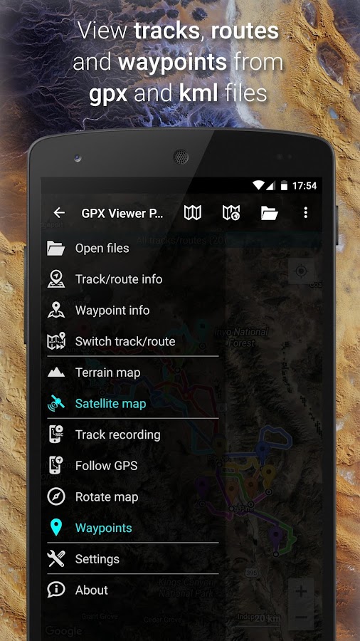
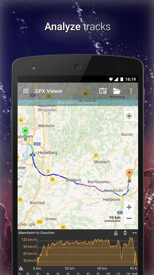
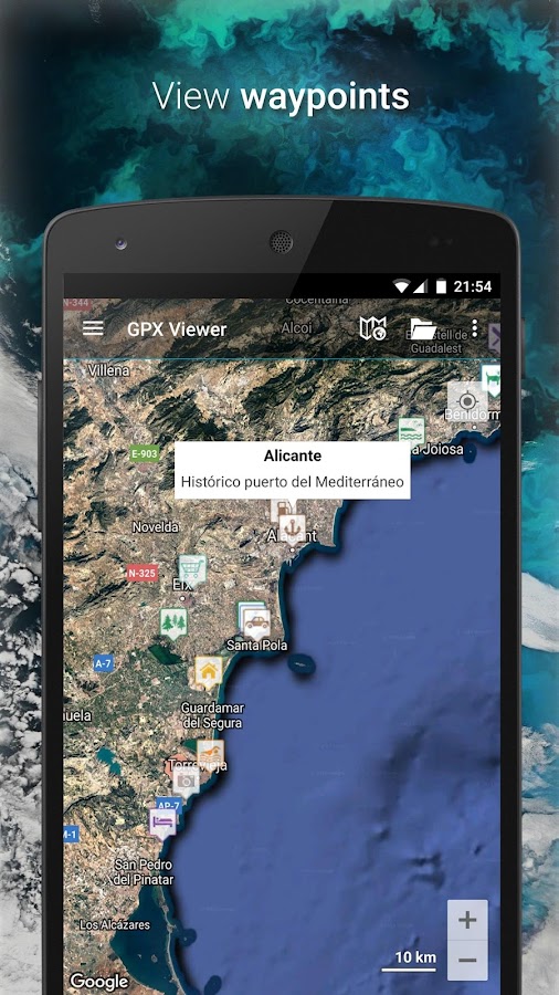
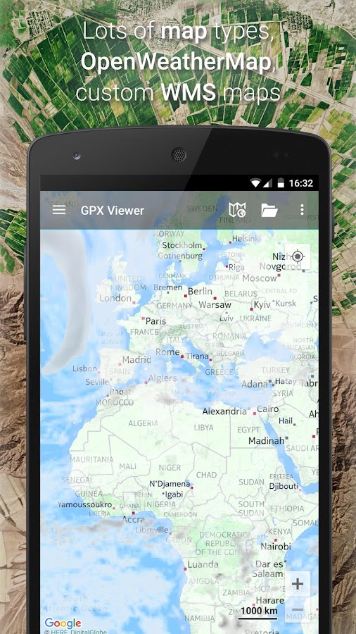
App Information GPX Viewer PRO
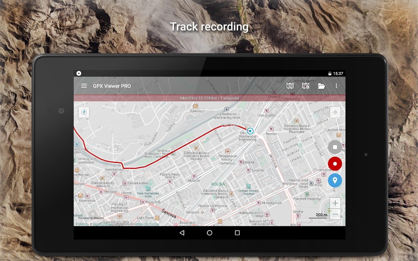
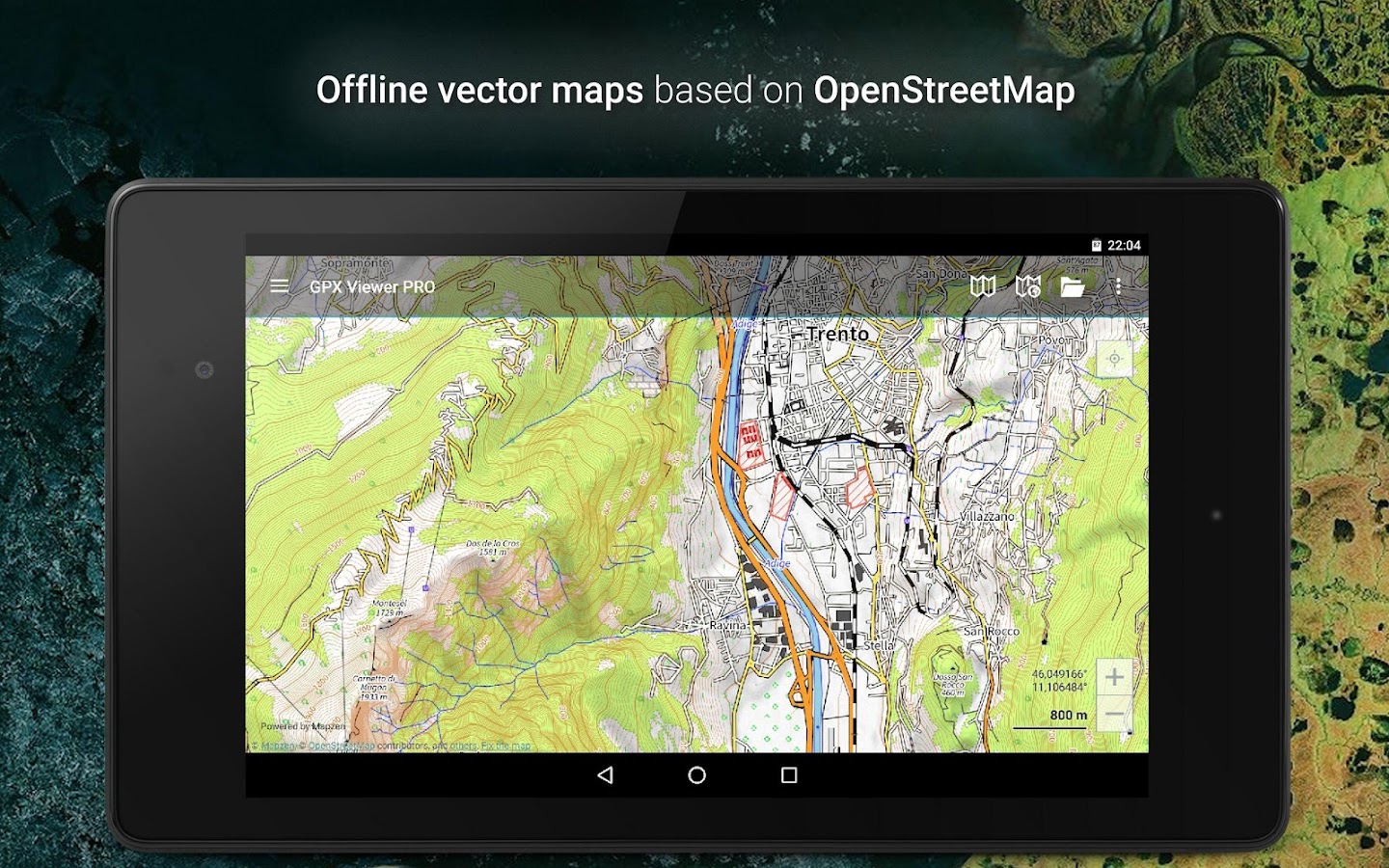
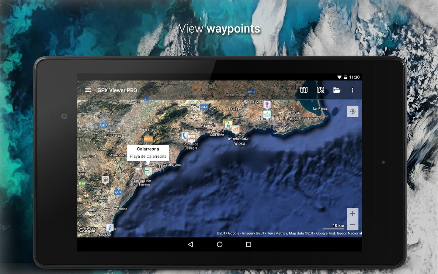
- App NameGPX Viewer PRO
- Package Namecom.vecturagames.android.app.gpxviewer.pro
- UpdatedOct 25, 2023
- File SizeUndefined
- Requires AndroidAndroid 5.0
- Version1.44.4
- DeveloperVectura Games OÜ
- Installs100K+
- PriceFree
- Categoryinfo_outline</i></button></div>
- DeveloperSepapaja 6 Tallinn 15551 Estonia
- Google Play Link
Vectura Games OÜ Show More...


Similar Apps Show More...


OruxMaps Donate APK
ATTENTION, THIS IS THE VERSION 'DONATE'. IFYOU WANT, YOU CAN TRY THE FREE VERSION, WHICH IS IDENTICAL TOTHIS.IMPORTANT!: NOT ALL ONLINE MAP SOURCES ARE NOW DOWNLOADABLE. SELECTANOTHER SOURCE IF YOU CAN NOT FIND THE OPTION TO DOWNLOAD AMAP.Map viewer, track logger.You can use OruxMaps for your outdoor activities (running, treking,mountain bike, paragliding, flying, nautic sports,....)100% no adversisementsOnline and offline maps. Support to multiple formats:-OruxMaps format. You can use maps from Ozi Explorer transformedwit a PC tool.-.ozf2-.img garmin (vectorial) -no full support is provided-.-.mbtiles-.rmap-.map (vectorial from mapsforge). Support to custom themes similatthan Locus themes.Support to Wms, you can use the application as a WMS viewer.Support to APRS sources.3D view.Support to multiple external devices:-GPS bluetooth.-Heart rate monitors, bluetooth Zephyr, Polar (including bluettohsmart devices, like polar H7).-ANT+ (speed, cadence, heart rate, distance,...).-AIS information systems (experimental), for nautical sports, usingWifi o BT.More features:Support to KML KMZ and GPX formats.Share your position with your friends, display the position of yourfriends in your device.Download online maps for offline use.Text to speech support.Profiles; save your preferences in your SD card.Statistics with graphics.Follow routes, with different alarms to alert you if you are near awaypoint, or you are far from the route.Create/save wayponits, attaching photo/audio/videoextensions.Custom waypoints types, with your icons.Basic support to Geocaching.Correct the altitude of your tracks/routes using DEM files(offline) or online services.Search/download tracks from:-everytrail.com-gpsies.comSearch or create tracks using online services from Cloudmade oroffline using Broute app.Upload tracks to:-mapmytracks.com-trainingstagebuch.org-ikimap-wikirutas-openxploraLive tracking using:-mapmytracks.com-okmap application-gpsgate protocolMore info here: www.oruxmaps.com


BackCountry Nav Topo Maps GPS APK
Use your Android as an offroad topo mappingGPS with the bestselling outdoor navigation app for Android! Trythis DEMO to see if it is right for you, then upgrade to the paidversion.Use offline topo maps and GPS on hike trails without cell service!The GPS in your Android phone can get its position from satellites,and you don’t have to rely on your data plan to get maps. Have morefun and safe GPS adventures in the backcountry.Preload FREE offline topo maps, aerial photos, and road maps onyour storage memory, so they are ready when you need them.Add custom GPS waypoints in longitude and latitude, UTM or MGRSgrid reference. Import GPS waypoints from GPX files. Choose iconsfor waypoints much like in MapSource. (This app uses the WGS84datum, NAD27 is available in settings).Use GPS for hunting a waypoint or geocache, for recording tracksand GPS waypoints on your trip, all the while tracking your queston topographic maps.About topo (topographic) maps: Topo maps show terrain through colorand contours, and are useful for navigation offroad. Topo maps andGPS can be used for hiking, hunting, kayaking, snowshoeing, &backpacker trails.The app has many built in map sources and allows you to create yourown maps with Mobile Atlas Creator. Built in sources include:OpenStreetMaps and NASA landsat data worldwide.OpenCyle Maps are topo maps that show terrain worldwide.USGS Color Aerial photography.Topographic Maps of Spain and Italy.Outdoor maps of Germany and AustriaTopo maps of New ZealandHere are some of the outdoor GPS activities BackCountry Navigatorhas been used for:Hiking both on hiking trails and off trail.Camping, to find the perfect camping site or the way back tocamp.Hunting trips for hunting wild game in rugged areas, includingrecon for the hunt.Bait fishing or fly fishing with a buddy.Search and Rescue (SAR) with GPS.Kayak and canoe trips on inland lakes and streams or marine,coastal waters.Backpacker trips: using topo maps of wilderness areas and nationalforests to navigate on trails with the GPS.Snow adventures including snowmobiling, skiing (alpine or crosscountry) and snowshoeing. Create a memory. Map it out.This a great addition to the outdoor gear you bought at Cabelas,REI, or another outdoor store. Your android phone could substitutefor a Garmin or Magellan outdoor handheld GPS! You storage hasmemory for maps.Find your own ways to have fun in the outdoors. Be a maverick byventuring into new territory beyond cell service boundaries. Becomea pro at navigation with GPS.BackCountry Navigator has been previously available on WM devicesand preloaded on the Trimble Nomad outdoor rugged device. ThisAndroid version is more flexible, featured, and fun.


MyTrails 2.1.11 APK
No ads even in the free version! Perfect for hiking,riding,cycling, running, skiing or orienteering Premium topo mapsUsein-app purchases to subscribe to high-quality,special-purposemaps. Flexible offline mode and competitive pricing.• OS OpenData(GB) • IGN TOP25, TOP50, Cadastre, Satellite andLittoral (marinemaps) (FR) http://www.frogsparks.com/mytrails/ign/Full-screentrail map oriented with the built-in compass and GPSKnow exactlywhich direction you are going. Uncluttered map area,withunobtrusive controls and a traditional scale with trackdurationand distance. Hardware-accelerated map drawing allowssmooth andsnappy display even with tens of thousands of trackpoints. Stats40+ stats to choose from! Display them on a dedicatedscreen(including stats for multiple tracks at once), on theHUDoverlaying the map or even on Android Wear. Graphs Freelydefineaxes (over 30 combinations) to visualize your tracks,includingelevation profiles, speed vs. time, etc. Free online mapsPick frommany built-in online map sources (OpenStreetMap, Yahoo,Bing,Google and many other global and local providers). Add moremapsources using the configurable map sources (URL or WMS).Onlypremium maps are guaranteed: we may be forced to remove accesstoany of the free maps if requested by the rights-holders; thisisregardless of whether you are using the Pro or Freeversion.Offline maps Save battery and data charges. The mapdisplaysinstantaneously. No need to use desktop-based tools tocreateoffline maps, you can do it in MyTrails, in the background.RecordGPS tracks Visualize your track at any time and analyse yourcourseduring or after the outdoor activity. Display multiplecolorizedGPS tracks at once (Pro) Visualize your previous outingsand thoseuploaded to GPS community sites, so that you always pick agreattrail. Visualize the key indicators of the track (altitude,speed,rate of ascent, slope, GPS accuracy, etc.) right on the mapwith adetailed legend. Waypoints Manually add waypoints toindicatememorable spots or upcoming turns. Waypoints areautomaticallygenerated when getting directions or when you take abreak. Shareand archive tracks (Pro) Share your tracks on MyTrails, GPSies,UtagawaVTT and la-trace.com. Download tracks sharedby other usersin your vicinity. Gestures Easily switch betweenactive maps byswiping three fingers left to right in the map view.Pull down theHUD with information on your speed and altitude byswiping threefingers down your screen. Full tablet support Planyour outing on alarge-screen tablet, go out and have fun, and whenyou're back,view the track in full glory. Use Dropbox to seamlesslysynchronizebetween devices. FAQ: http://www.frogsparks.com/faq/Permissions:please see the FAQ


