

Description
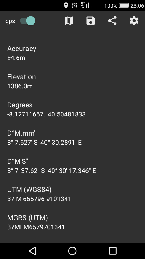
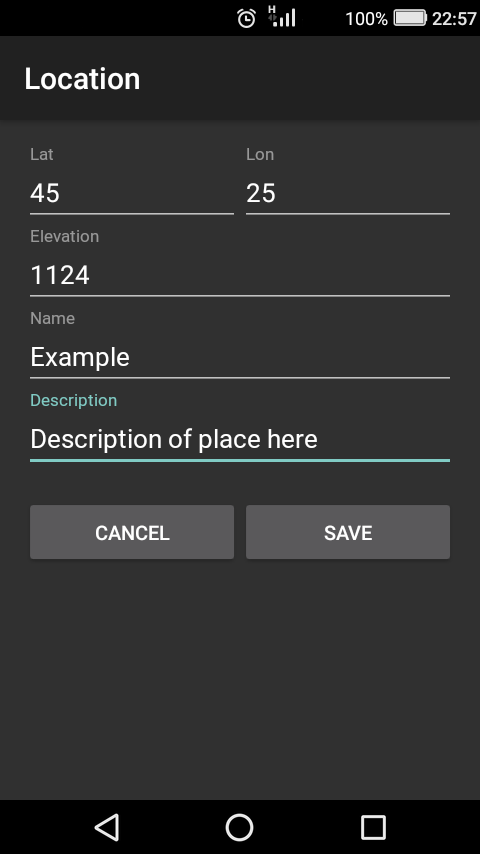
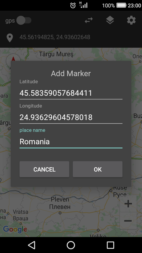
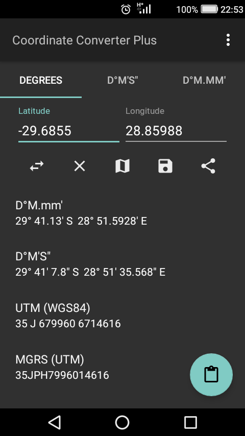
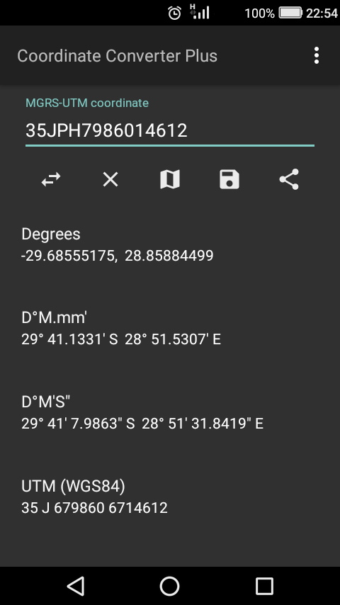
App Information Coordinate Converter Plus
- App NameCoordinate Converter Plus
- Package Namecom.tennyson.degrees2utm
- UpdatedApr 27, 2023
- File SizeUndefined
- Requires AndroidAndroid 4.1
- Version23.4.27.90
- DeveloperTennyson Chingombe
- Installs100K+
- PriceFree
- Categoryinfo_outline</i></button></div>
- DeveloperHatfield Harare Zimbabwe
- Google Play Link
Coordinate Converter Plus Version History
Select Coordinate Converter Plus Version :-
Coordinate Converter Plus 2.18.31 APK File
Publish Date: 2017 /5/25Requires Android: Android 2.3+ (Gingerbread, API: 9)File Size: 4.0 MBTested on: Android 7.0 (Nougat, API: 24)File Sha1: a3c946d0f268741045168ddf0467255b790dcd06 -
Coordinate Converter Plus 1.7 APK File
Publish Date: 2016 /2/11Requires Android: Android 2.2+ (Froyo, API: 8)File Size: 1.4 MBTested on: Android 5.0 (Lollipop, API: 21)File Sha1: 0eb0a1471f3f3ddb1d520e959a3c38f4e235c6e6
Tennyson Chingombe Show More...


Express recharge - any network 1.7 APK
Express recharge is a simple but convenientappfor recharging your account and checking voice and databalances.Express recharges is a ussd dialing app that works forall networksthat use ussd short codes. The key features are1. Recharging your account from air time scratch cards2. Checking voice balance3. Checking data balance4. Add or remove ussd long codes as needed.Supported countries:Afghanistan(+93)Albania(+355)Algeria(+213)Amer.Samoa(1-684)Andorra(+376)Angola(+244)Anguilla(+264)Antigua/Barbuda(+268)Argentina(+54)Armenia(+374)Aruba(+297)Australia(+61)Austria(+43)Azerbaijan(+994)Bahamas(1-242)Bahrain(+973)Bangladesh(+880)Barbados(1-246)Belgium(+32)Belize(+501)Bermuda(1-441)Bolivia(+591)Bosnia(+387)Brazil(+55)Brit.v.islands(1-284)Bulgaria(+359)Cameroon(+237)Canada(+1)Cayman Islands(1-345)Chile(+56)China(+86)Colombia(+57)Costa Rica(+506)Cote d'ivoire(+225)Croatia(+385)Cuba(+53)Cyprus(+357)Czech Republic(+420)Denmark(45)Dominica(1-767)dominican rep.(1-809)Ecuador(+593)Egypt(+20)El Salvador(+503)Estonia(+372)Ethiopia(+251)Falk.Islands(+500)Fiji(+679)Finland(+358)France(+33)French Guiana(+594)Georgia(+995)Germany(+49)Ghana(+233)Gibraltar(+350)Greece(+30)Grenada(1-473)Guadeloupe(+590)Guatemala(+502)Guinea(+224)Guyana(+592)Haiti(+509)Honduras(+504)Hong Kong(+852)Hungary(+36)Iceland(+354)India(+91)Indonesia(+62)Iran(+98)Iraq(+964)Ireland(+353)Israel(+972)Italy(+39)Jamaica(1-876)Jordan(+962)Kazakhstan(+7)Kuwait(+965)Latvia(+371)Lebanon(+961)Liberia(+231)Libya(+218)Liechtenstein(+423)Lithuania(+370)Luxembourg(+352)Macedonia(+389)Madagascar(+261)Malawi(+265)Malaysia(+60)Maldives(+960)Mali(+223)Malta(+356)Martinique(+596)Mauritania(+222)Mauritius(+230)Mexico(+52)Moldova(+373)Monaco/Kosovo(+377)Morocco(+212)Mozambique(+258)N.Antilles(+599)Namibia(+264)Netherlands(+31)New Zealand(+64)Nicaragua(+505)Nigeria(+234)Norway(+47)Oman(+968)Pakistan(+92)Palestine(+970)Panama(+507)Paraguay(+595)Peru(+51)Philippines(+63)Poland(+48)Portugal(+351)Puerto Rico(+1787)Qatar(+974)Romania(+40)Russia(+7)Rwanda(+250)Samoa(685)Saudi Arabia(+966)Senegal(+221)Singapore(+65)Slovakia(+421)Slovenia(+386)South Africa(+27)Spain(+34)Sri Lanka(+94)Sudan(+249)Sweden(+46)Switzerland(+41)Syria(+963)Taiwan(+886)Tajikistan(+992)Tanzania(+255)Thailand(+66)Togo(+228)Trinidad/Tobago(+1-868)Tunisia(+216)Turkey(+90)U.A.Emirates(+971)Uganda(+256)UK(+44)Ukraine(+380)Uruguay(+598)USA(+1)Uzbekistan(+998)Venezuela(+58)Vietnam(+84)Yemen(+967)Zambia(+260)Zimbabwe(+263)


 1.12")


Similar Apps Show More...


Coordinator-Collect Coordinate 7.2.0 APK
Using Coordinator app, you can collect coordinate data from land onwhatever coordinate system you want, choosing from defined systems.You can use Google Maps or Here Maps as a basemap. You can collectGPS coordinates. You can use the app as a GPS tracker. You can viewa coordinate data on the map and also search by address and seethat on the map. You can get directions to that point. You cansearch by longitude/latitude. You can convert an existingcoordinate into another coordinate system. You can do this bytyping coordinates manually or opening an XLSX file which containscoordinates. You can display circumference and area measurements ofsome coordinates by opening the file which created before. Also youcan measure distance and area for some coordinates which determinedmanually on the map. You can display a KML file on the map. Thereis also a compass tool. Coordinator app contains several usefultools for people interested in coordinates, maps and geographicinformation systems (GIS). All of the features above are free. Onthe other hand if you become a Coordinator Pro subscriber, you canbenefit from many extra features in addition to these features.With Coordinator Pro, subscribers can use some extra features suchas Cloud Database Functions (creating points, lines & polygons,sharing your layers with teammates, working simultaneously withteammates, working offline and synchronizing, etc), exporting toKML & Excel files, making elevation & address querying andso on. It is ad-free. Besides longitude/latitude, subscribers canfind out the altitude value of a point on the Google Maps or HereMaps. You can search by address and so that locate it on the GoogleMaps and learn the GPS coordinate (longitude/latitude ornorthing/easting) value of this place. The address locating featureworks based on Google Maps services and it's very effective. If youare a subscriber, you can use the Coordinator Web app. So that youcan use the cloud database features of the Coordinator app on theweb page on your computer and monitor the data instantly. You canview/track and edit cloud database data on the web page. In thisway, you can instantly monitor the data movements made in themobile app in the field, in the web browser on your computer. Thecoordinate systems of the countries, which the app is mostdownloaded, are added to the app. Current list of the countries andtheir coordinate systems defined in this app: World - GPS(WGS 84)World - WGS 84 - 6 ̊ UTM United States - "NAD 1983 HARN State PlaneCoordinate Systems(meters & feet)" and "Military Grid ReferenceSystem (MGRS)" Algeria - "Nord Sahara 1959 / UTM 6 ̊ " Azerbaijan -"Pulkovo 1942 / Gauss-Kruger 3 ̊ " and "Pulkovo 1942 / CS63"Bulgaria - "Pulkovo 1942(58) GK 6 ̊ " Germany - "DHDN/3 ̊ GK" and"ETRS89 UTM 6 ̊" India - "Kalianpur 1975 / India" and "Kalianpur1975 / UTM 6 ̊" Indonesia - "Indonesia 1974 UTM 6 ̊" and "DGN 1995Indonesia TM3 ̊" Iran - "ED50(ED77) / UTM 6 ̊" Iraq - "Nahrwan 1967/ UTM 6 ̊" and "ED50 / Iraq National Grid" and "Karbala 1979 / UTM6 ̊" Israel - "Palestine 1923/Palest. Grid" and "Palestine1923/Israeli CS Grid" and "Israel 1993/Israeli TM Grid" Lebanon -"Deir ez Zor / Levant Ster." and "Deir ez Zor / Syria Lambert"Mauritania - "Mauritania 1999 / UTM 6 ̊" Morocco - "Merchich / NordMaroc" and "Merchich / Sud Maroc" Netherlands - "Amersfoort / RDNew" and "Amersfoort / RD Old" Palestine - "Palestine 1923/Palest.Grid" and "Palestine 1923/Israeli CS Grid" and "Israel 1993/IsraeliTM Grid" Philippines - "Luzon 1911 / Philippines" and "PRS92 /Philippines" Romania - "Dealul Piscului 1930 / Stereo 33" and"Pulkovo 1942(58) / Stereo 70" Russia - "Pulkovo 1942 /Gauss-Kruger 3 ̊" Saudi Arabia - "Ain el Abd / UTM 6 ̊" and "Ain elAbd / Aramco Lambert" Syria - "Deir ez Zor / Levant Ster." and"Deir ez Zor / Syria Lambert" Turkey - "ITRF 96 - 3 ̊" and "ED 50 -3 ̊" and "ITRF 96 - 6 ̊" and "ED 50 - 6 ̊" United Arab Emirates -"Nahrwan 1967 / UTM"

Coordinate Master 3.7 APK
This powerful geodesy app allows you toconvert coordinates between many of the world's coordinate systems,compute geoid offsets, and estimate the current or historicmagnetic field for any location. It also includes surveying toolsto compute the point scale factor and grid convergence.The app uses the PROJ4 library and a lookup file containingprojection and datum parameters to support over 1700 coordinatesystems. Lat/lon, UTM, US State Plane, and many, many others aresupported. You can also create your own coordinate systems if youknow the parameters.The app also supports affine transformations toallow you to set up local grid systems. Seehttp://www.binaryearth.net/Miscellaneous/affine.html fordetails.The app either takes manual coordinate input or uses your currentGPS location. The computed location can be displayed in Google Mapsvia your web browser with a single button press. It also supportsMGRS grid references.You can export any lat/lon, UTM or transverse Mercator coordinatesystems to a HandyGPS datum (.hgd) file for use as a custom datumin HandyGPS.The magnetic field calculator page computes the Earth's current orhistorical magnetic field at a given location. The magneticdeclination computed is useful for compass navigation since itrepresents the difference between true north and magnetic north.Field inclination and total intensity are also computed. This tooluses the International Geomagnetic Reference Field model (IGRF-12).See http://www.ngdc.noaa.gov/IAGA/vmod/igrf.html for full details.Years from 1900 through to 2020 are supported.The app can also compute the geoid height offset for a givenlocation, using the EGM96 model. Geoid offset can be subtractedfrom the height reported by GPS to give your actual height abovesea level.Online help for the app is available athttp://www.binaryearth.net/CoordinateMasterHelpNOTE: A version of this app is now also available foriPhones.Permissions required: (1) GPS - to determine your location, (2) SDcard access - to read and write user projections file.

Shapefile over Map APK
Load your own shapefiles with this GeographicInformation System (GIS) directly from the sdcard of your mobiledevice and visualize them over a map. You can also edit the valuesof its dbf table and use it in offline mode, loading maps from yourmemory card.With this GIS application, you can select and load a shp file orload an entire folder automatically.You can select one of these shp files and mark it as the activelayer and if you use a long press over one of them you can changeits coordinate system, its color or make it invisible.The map will display a series of icons, belonging to each of therecords in the active layer, which when pressed will allow you toview and edit information from its corresponding attributetable.The application also allows you to view your current position viaGPS and center the map on it.You can choose between several online map servers.Support for all UTM Projections (WGS84, SAD69 and NAD83)The .prj file is readed and the coordinate system is automaticallyassigned.Now you can save your sessions (a configured shapefile list).Now also includes a tool to measure distances, areas andperimeters.New tool to search shapes by dbf field valueNew functionality to add and delete dbf fieldsNew functionality to add WMS serversA Quick Help has been addedNew drawing system. Now move the map is fasterMore memory available to load larger shapefiles(only in Androidversions 3.0 or later)New layers administration systemNew tool to load the last sessionNew auto zoom tool to the active layerNew Settings option to change measure units, GPS update time andcharacter codificationsTo use a map in offline mode, simply download it previously (forexample using Mobile Atlas Creator (using OsmAnd tile storageformat)). You must copy the map to the folder you have set onsettings and it should be in the formatMAPNAME/ZOOM/X/Y.png.tile

PHOTOMOD GeoCalculator 1.3.001 APK
PHOTOMOD GeoCalculator performs coordinate transformationsaccording to Russian State Standard GOST R 51794-2001 andInterstate Standards GOST 32453-2013 (GOST R 51794-2008) and GOST32453-2017. It implements transformations between Cartesiangeocentric and geodetic (latitude, longitude, height above theellipsoid) reference frames based upon geodetic datums WGS 84,Pulkovo 42, Pulkovo 95, GSK-2011, PZ-90, PZ-90.02, PZ-90.11 andITRF-2008, as well as projected coordinate systems SK-42, SK-95 andGSK-2011 (based on Gauss-Kruger map projection). In addition sometransformations not covered by the standards are supported, namelyones involving WGS 84/UTM reference system and EGM96 geoid model.Coordinates to be transformed can be typed-in manually, measured inGoogle Maps or set to the current device location.


