


Description
App Information Airports Maps
- App NameAirports Maps
- Package Nameorg.ssandon.map
- UpdatedAug 30, 2019
- File SizeUndefined
- Requires AndroidAndroid 4.1
- Version1.8
- DeveloperStéphane Sandon
- Installs-
- PriceFree
- CategoryMaps & Navigation
- Developer9 rue Adrien Ricard 38000 GRENOBLE
- Google Play Link
Stéphane Sandon Show More...


VAC Atlas Viewer 2.14 APK
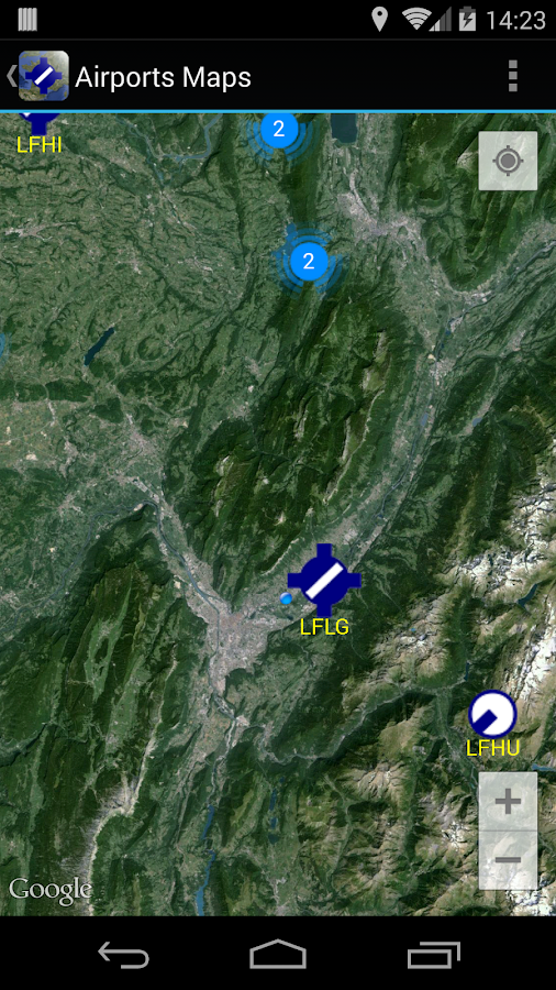
Dear Friends Pilots,VAC Atlas Viewer is an application designed to simplify yourflights.****SD-Card (Android 4.4 and above) : since v2.10 the directory/Android/data/org.ssandon.viewer is created on the sdcard at theinstall.On Samsung the path looks like that (verify it !) :/storage/extSdCard/Android/data/org.ssandon.viewer/files/DownloadTo use the external sdcard for download setup this path in thesettings and re-launch the app.****This application downloads and shows French airports maps. Withthis application you will always have airports maps with you(usefull for flight planning, or even during flight).VAC Atlas Viewer is available on the market to France'sneighbours, but remember the maps are for French Airspace only.**** Warning ON ****Be Careful:VAC Atlas Viewer is a software application : it can fail or crash !So be sure to have the originals maps with you !**** Warning **** OFFNow that was said, here's a quick overview of the differentsfeatures :- Database update on demand from the SIA web site (translation =Aeronautical Information Service).- Displays Airports in a fast scroll list.- Icons for each types of Airfield (Public, Restricted,Altiport).- Airports altitude is displayed.- Download maps localy on you device.- Delete maps.- Displays maps (requires an external PDF reader that is notprovided).- Search by ICAO code or by Name (dynamic filtering).- Alphabetically sort by name or airport ICAO code.- Sorting according to distance (when GPS is activated) : displaysthe distance and bearing to reach the airports.- Use both "GPS" and "Network" provider to enable the location inflight but also indoor (for a flight planning for exemple).- Mode "online" or "downloaded" (the latter is useful in flight orwhen no network coverage is available to show only the downloadedmaps).- Choice of the download directory (you can use the SDCard).- Choice of display units for altitude and distance, "Feet" or"Meters".- Save user preferences (sorting & mode) between executions fora consistent user experience.- User interface in French and English (the maps are both Frenchand English but it depends mainly of SIA here).- Free application, ad free !The ergonomics and operation of the application have beendesigned to allow in-flight use (no networks).Before each operation requiring a network connection, a warning boxappears to warn you (and also because it can cost depending youroperator).At first run, the application will update its database from theofficial SIA website : it uses few bandwidth (~ 70K) but it cantake up to 1 minute and half depending on the CPU of your device.All subsequent updates will be at your request via the Help menu!Every first display of a map the application requestsconfirmation to download (again you can set where you want todownload in the preferences : make sure the directory iswritable).Once a map is downloaded it appears in the "Download" mode.A short-Tap allows you to view the map with a PDF reader (notsupplied).A Long Tap deletes the maps that you no longer want to keep.From the help screen you can update the database : if therevision has changed you will need to update your maps (becausethey become obsolete). I suggest you to use a file explorer like"Ghost Commander" to clean up the download directory.If the revision has changed on the SIA site and you have notdone an update, you'll get an error on all new download. That'sbecause the revision is not checked (see above). So you will needto make an update via the help menu.Others features on the way.Good flights.Stéphane (Pilot @ LFLG).


Similar Apps Show More...

AirMate 1.7.1 APK
Airmate is a free and easy to use application for pilots, providinghelp for flight planning and navigation, and including many socialsharing features. Thanks to Airmate flight planning tools, you willget instant access to airport data and aviation maps worldwide andup to date weather and NOTAMs. IFR and VFR airport plates arefreely available in US (FAA charts), all Europe, and more than 200other countries. Many of them are georeferenced and could beoverlaid on the aviation chart. A powerful Plate Manager allows todownload in advance all airport plates in a country, they could beeasily printed and viewed. During the flight, the moving map willdisplay the aircraft location along the route, show airports andaeronautical data details. A profile view is available to displayterrain elevation across the route. Airmate includes a worldwideaeronautical database updated free of charge with airports,navigation beacons, waypoints, airways, regulated and restrictedareas. Topographic maps and elevation data for most countries maybe downloaded free of charge, as well as additional aviation mapoverlays such US Sectionals. Airmate will also record your flightsand allow to replay them later or export the flight path in gpxformat. A Satellite map display mode in flight planning or replaymode allows to familiarize with significant landmarks. Airmate willsave planned and flown flights, user waypoints and user aircraftsin the cloud and sync them between your devices. Airmate bringsnumerous social features to the community. Pilots may leaveratings, tips and comments to share their experience with fellowpilots, and report fuel prices and landing fees. They could findfriends, instructors, flight schools, aviation events and aircraftto rent near their home airport or any visited airport.


cats.maps_navigation Top Show More...

ta3lim siya9a maroc belvideo 1.4.2 APK
امتحان رخصة السياقة بالمغرب 2015 هوتطبيقمغربيوبالدارجة المغربية خاص بمساعدة كل المقدمين علىاجتيازامتحانرخصةالسياقة بالمغرب كلهذا باللهجة التب يعرفها الجميع في المغرب وهي الدارجةالمتداولةأهم مايميز تطبيق امتحان رخصة السياقة بالمغرب انهنفسأسئلةالامتحاناتالموجودة في مدارس تعليم السياقة بالمغربكل الأسئلة المحتملة للامتحانات الموجودة في مدارس تعليمالسياقةأسؤلة صوتية أي مسموعة ومقروءة في نفس الوقتوغيرها من الميزات الكثير الكثيروشكرااta3lim siya9a belmagherib application jadidafihal3adidminalvideouhatta3lim wa ta3lam kayfa tata3lam salasil rokhesa siya9asiya9a ta3lim maroc fih jadid kol mayakhos rokhesat siya9afih majmo3a mina doross 3la chakli video salihalikolisanasawa2an2015 wella 2016 ila ghayeri thalik minal2a3wamامتحانرخصةالسياقةبالمغرب2015 هو تطبيق مغربي و بالدارجة المغربية خاصبمساعدةكلالمقدمين علىاجتياز امتحان رخصة السياقة بالمغرب كلهذا باللهجة التب يعرفها الجميع في المغرب وهي الدارجةالمتداولةأهم مايميز تطبيق امتحان رخصة السياقة بالمغرب انهنفسأسئلةالامتحاناتالموجودة في مدارس تعليم السياقة بالمغربكل الأسئلة المحتملة للامتحانات الموجودة في مدارس تعليمالسياقةأسؤلة صوتية أي مسموعة ومقروءة في نفس الوقتوغيرها من الميزات الكثير الكثيروشكرااta3lim siya9a belmagherib implementation Jadidafihal3adidminalvideouhatta3lim wa ta3lam kayfa tata3lam Salasil rokhesa siya9asiya9a ta3lim Morocco fih jadid kol mayakhos rokhesat siya9afih majmo3a mina doross 3la chakli video salihalikolisanasawa2an2015 wella 2016 ila ghayeri thalik minal2a3wam

Map of China 1.24 APK
This is an application that turnsyourAndroiddevice into a GPS navigator with offline maps. Youcansearcheasily locations in China and you can add them toyourroute.Discover interesting places near you:accommodation,parking,restaurants, bars, clubs, cinemas, theatres,auto services,shops,parks, schools, hospitals, sport areas.It includes detailed maps of the biggest cities inChina:Shanghai,Beijing, Chongqing, Shenzhen, Guangzhou, Tianjin,Wuhan,Dongguan,Foshan, Chengdu, Nanjing, Shenyang, Xi'an,Hangzhou,Harbin,Suzhou, Qingdao, Dalian, Zhengzhou, Shantou,Jinan,Changchun,Kunming, Hong Kong, Changsha, Taiyuan, Xiamen,Hefei,Ürümqi,Fuzhou and others.This application is based on Osmand project under theGNUGPLv3license and uses high quality data from OSM.

Map of Hungary 1.24 APK
This app turns your Android device intoaGPSnavigator with offline maps.You can search easily locations in Hungary and you can addthemtoyour route.Discover interesting places near you:accommodation,parking,restaurants, bars, clubs, cinemas, theatres,auto services,shops,parks, schools, hospitals, sport areas.It includes detailed maps of the biggest cities inHungary:Budapest,Debrecen, Szeged, Miskolc, Pecs, Gyor,Nyiregyhaza,Kecskemet,Szekesfehervar and others.This application is based on Osmand project under theGNUGPLv3license and uses high quality data from OSM.


Map of Germany 1.25 APK
Install this app on your device andyou'llgetan GPS navigator with offlline maps.You'll get access to the interesting points that can be foundonyourway: accommodation, parking, restaurants, bars,clubs,cinemas,theaters, auto services, shops, parks, schools,hospitals,sportareas.Audio and visual guidance will help you reachyourdestination.The application has detailed maps of major cities inGermany:Berlin,Hamburg, Munich, Koln, Frankfurt am Main,Stuttgart,Dortmund, Essen,Dusseldorf, Bremen, Hannover, Leipzig,Duisburg,Nurnberg, Dresden ,Bochum, Wuppertal, Bielefeld, Bonn,Mannheimand others.This application is based on Osmand project under theGNUGPLv3license and uses high quality data from OSM.

АВТОтема. Всё для Вашего авто. 1.0.7 APK
Загружайте и пользуйтесь самой полнойбазойместдля ремонта и техобслуживания автомобиля. Приложениедоступноболеечем в 300 городах России, Украины, Киргизии иКазахстана.Установите приложение, и оно покажет на картеближайшиеСТО,автомойки, автозаправки и магазины автозапчастей врадиусе2хкилометров от Вас.В приложении есть адреса и телефоны автосервисов,времяработы,ссылки на сайты и отзывы клиентов. Звоните вавтосервисыпрямо изприложения, и здесь же смотрите схему проезда –приложениепокажетудобный маршрут до нужного местатехобслуживания.АВТОтема поможет найти компанию для тюнинга автомобиляилисервис,которому можно доверить ремонт двигателя, кузоваилиходовойчасти!• Если нужен поиск в другой части города, используйте«долгийтап»(прикоснитесь и удерживайте) в нужной точке накарте• Пользуйтесь тематическим разделами (автосервис,автомойка,АЗС,шиномонтаж, автозапчасти, тюнинг, автостоянка)• Чтобы увидеть автосервисы в других городах, выберете нужныйгородвменюАВТОтема – бесплатное приложение без рекламы!Краткий список городов: Москва,Санкт-Петербург,Новосибирск,Абакан (Минусинск), Алматы,Альметьевск, Армавир,Архангельск,Астана, Астрахань, Барнаул,Белгород, Бийск, Бишкек,Благовещенск,Братск, Брянск, ВеликийНовгород, Владивосток,Владимир, Волгоград,Вологда, Воронеж,Горно-Алтайск,Днепропетровск, Донецк,Екатеринбург, Иваново, Ижевск,Иркутск,Йошкар-Ола, Казань,Калининград, Калуга,Каменск-Уральский,Караганда, Кемерово, Киев,Киров,Комсомольск-на-Амуре, Кострома,Краснодар, Красноярск,Курган, Курск,Ленинск-Кузнецкий, Липецк,Магнитогорск, Махачкала,Миасс, Мурманск,Набережные Челны, Находка,Нижневартовск, НижнийНовгород, НижнийТагил, Новокузнецк,Новороссийск, Норильск,Ноябрьск, Одесса, Омск,Орёл, Оренбург,Павлодар, Пенза, Пермь,Петрозаводск,Петропавловск-Камчатский,Псков, Пятигорск (КМВ),Ростов-на-Дону,Рязань, Самара, Саранск,Саратов, Смоленск, Сочи,Ставрополь, СтарыйОскол, Стерлитамак,Сургут, Сыктывкар, Тамбов,Тверь, Тобольск,Тольятти, Томск, Тула,Тюмень, Улан-Удэ,Ульяновск, Уссурийск,Усть-Каменогорск, Уфа,Хабаровск, Харьков,Чебоксары, Челябинск,Чита, Южно-Сахалинск,Якутск, Ярославль.Download and usethemostcomprehensive database of places for vehiclerepairandmaintenance. The application is available in more than300citiesin Russia, Ukraine, Kyrgyzstan and Kazakhstan.Install the app and it will show on the map thenearestservicestations, car washes, gas stations and auto partsshops arewithina radius of 2 kilometers from you.The application has addresses and telephone numbersofservicestations, working hours, links to websites, andcustomerreviews.Call garages directly from the application, andhere seelocationmap - it shows a convenient route to thenecessarymaintenancespace.Avtotema help to find a company for tuning a car or aservicethatcan be trusted to repair the engine, body andrunninggear!•, use the "long tap" (touch and hold) at the desired pointonthemap If you want to search in a different part of thecity• Use thematic sections (auto repair, car wash, gasstation,tire,spare parts, tuning, car park)• To see the garages in other cities, select the city you wantonthemenuAvtotema - free application without ads!A short list of cities: Moscow, SaintPetersburg,Novosibirsk,Abakan (Minusinsk), Almaty, Almetyevsk,Armavir,Arkhangelsk,Astana, Astrakhan, Barnaul, Belgorod,Biysk,Bishkek,Blagoveshchensk, Bratsk, Bryansk, Novgorod,Vladivostok,Vladimir,Volgograd, Vologda, Voronezh,Gorno-Altaisk,Dnepropetrovsk,Donetsk, Ekaterinburg, Ivanovo,Izhevsk, Irkutsk,Yoshkar-Ola,Kazan, Kaliningrad, Kaluga,Kamensk-Uralsky, Karaganda,Kemerovo,Kiev, Kirov,Komsomolsk-on-Amur, Kostroma, Krasnodar,Krasnoyarsk,Kurgan, Kursk,Leninsk-Kuznetsky, Lipetsk,Magnitogorsk,Makhachkala, Miass,Murmansk, Naberezhnye Chelny,Nakhodka,Nizhnevartovsk, NizhnyNovgorod, Nizhniy Tagil,Novokuznetsk,Novorossiysk, Norilsk,Noyabrsk, Odessa, Omsk, Orel ,Orenburg,Pavlodar, Penza, Perm,Petrozavodsk,Petropavlovsk-Kamchatsky,Pskov, Pyatigorsk (CMS),Rostov-on-Don,Ryazan, Samara, Saransk,Saratov, Smolensk, Sochi,Stavropol, StaryOskol, Sterlitamak,Surgut, Syktyvkar , Tambov,Tver, Tobolsk,Tolyatti, Tomsk, Tula,Tyumen, Chelyabinsk, Ulyanovsk,Ussuriysk,Ust-Kamenogorsk, Ufa,Khabarovsk, Kharkov, Cheboksary,Chelyabinsk,Chita,Yuzhno-Sakhalinsk, Yakutsk, Yaroslavl.

MAROC Plaques Immatriculation 1.1 APK
Vous vous ennuyez en route ?Vous êtes en vacances et vous regardez plein de voituresd'oùvousvoulez connaitre la provenance ?Ou bien peut être vous êtes tenté de défier un ami delaprovenanced'une voiture ?Cette application " MAROC Plaques d'immatriculation"Vavouspermettre de faire ça." MAROC Plaques d'immatriculation" est uneapplicationpermettantl'identification des véhicules enregistrésauroyaume.Bored on the way?You're on vacation and you look full of cars where you wanttoknowthe source?Or may be you are tempted to challenge a friend to the originofacar?This application "MOROCCO License Plates" Go you to do that."MOROCCO License Plates" is an applicationallowingtheidentification of vehicles registered in theKingdom.

广州地铁 Guangzhou Metro 7.0.1 APK
广州地铁-rGuide 全新登场新增站点周边丰富的消费信息!出行指引、消费信息一站解决!【主要功能】◆操作最简便:无论是查询车程还是车站资料,最快只需点击2次即可完成!◆选站最快速:独创的GPS自动定位、线路图直接点击、站名地标搜索,总让您以最快速度选到车站!◆离线车站交互式地图,信息最完整:除了调用标准地图服务外,提供独家出口地标及街道离线地图!◆多种语言选择:两种语言界面,通行两岸三地:简体、繁体!◆站点攻略:不仅仅提供线路查询,更多消费指南供你参考!rGuide,助您畅享地铁生活!任何反馈请提交至:微博:@rGuide (weibo.com/rguide)QQ群:233911718微信:1690775453邮箱:[email protected]网站:www.rguide.infoGuangzhouMetro-rGuidenewdebutAdd a wealth of consumer information around the site!Travel guide, consumer information a stop solution![Main features]◆ Operation easiest: either drive or station dataquery,simplyclick two times the fastest to complete!◆ choose the fastest station: original automaticGPSpositioning,wiring diagrams directly click on the stationnamelandmark search,the total allows you to choose the fastestspeed tothestation!◆ Offline Station interactive maps, most completeinformation:Inaddition to calling the standard map service,providingexclusiveexport landmarks and street offline map!◆ choice of languages: two languages interface, accessthethreeplaces: Simplified and Traditional!◆ site Raiders: not only provide line queries, moreconsumerguidefor your reference!rGuide, to help you enjoy life subway!Please submit any feedback to:Twitter: @ rGuide (weibo.com / rguide)QQ group: 233 911 718Micro letter: 1690775453E-mail: [email protected]: www.rguide.info