Top 50 Apps Similar to Clinometer
Compass Level & GPS
Take advantage of accurate andintegratedcompass, level and gps tools in one screen.For lovers of D.I.Y. and fans of self-assembling: this makes youanexpert in placing furniture, hanging up a shelf or frame.For tracking, hiking and camping fanatics: now you will never beoffcourse, always having the right position and direction.This tool is handy and very accurate - try it yourself!Advice: for a better accuracy, first calibrate once.✓ Compass Usage• Find and keep track of the right heading• Get information of your current position or atargetposition• Find your parked car through the target position feature.✓ Level Usage• Proper positioning of furniture• Straight installation of a shelf or a frame• Quickly level out your motor home or caravan✓ Features• Automatic horizontal and vertical level display• Choose Sound and/or Vibration when level• Manual compass and level calibration available• 'Hold / Release' button, for easy readout• Screen Capture: no notes, just copy• Sensor sensitivity and update-cycle adaptable• Powerful GPS feature: set target position, and find thedirectionand distance.✓ Remarks (Compass)• Sensor accuracy may differ depending on the device used• For better accuracy, keep away from magnetic fields andelectronicdevices.** Usermanual:http://lemonclip.blogspot.kr/2014/02/compass-level-user-manual.html• If you encounter any problem with this App or incorrectwording,please contact us via:- https://www.facebook.com/CompassLevel- [email protected]
Compass & Spirit Level Pro 2.0
A very reliable compass combined with a spirit level. No ads!Evenif you hold your device in an upright position in front of you,theexact cardinal point will be displayed. The rotation inhorizontalposition can be measured with the compass. The precisionof thecompass depends on your sensor. Magnets and electric fieldshave amagnetic field and thus have an influence on the compass.Manygreat features: * Set layout colors the way you like it *Choosebetween portrait and landscape mode (optimized for tablets) *Movethe app to your sd-card Spirit level: * Acoustic andvisualfeedback when the angles are in the set range * Values canbedisplayed with decimal places * Easy calibration (i.e.forlevelling out the bulge of your camera) * Adjust the sensibilityofthe measurement * X and Y values can be swapped ONLY IN THISPROVERSION: * No ads * Display the magnetic field in micro Tesla(µT)* The range for visual feedback can be customized Somefeedbackwould make me happy :) Please write an email to reportanyproblems.
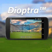
Dioptra™ Lite - a free camera tool 1.0.10
Dioptra™ Lite - a camera position and angle measurementtoolfornavigation, surveying, positioning, and measurement - -withover35,000 users! Stay tuned for an enhanced Dioptra app in2020withmore features, better sharing integration, andsupportingmorephones and devices! Instructions: Press the on-screencamerabuttonto save an image. View saved images in your device'sgalleryapp.[⊹] Dioptra™ Lite provides the following informationlikeatheodolite optical instrument - • yaw indicator (compass)•pitchindicator (tilt degrees) • roll indicator (tilt degrees)alongwith- • GPS position • azimuth and bearing to photo subjectTheancientgreek "dioptra" was a classical astronomicalandsurveyinginstrument, dating from the 3rd century BCE. Thedioptrawas asighting tube or, alternatively, a rod with a sight atbothends,attached to a stand. If fitted with protractors, it couldbeusedto measure angles. [⊹]
Compass Steel 3D
FEATURES:• Choose from multiple color themes• Choose between 2 heading modes - True heading (based onTruenorth) and Magnetic heading (based on Magnetic north).• Sun direction indicator• Moon direction indicator• Sunrise and sunset times• Moonrise and moonset times• Self-calibrates as you use• Marine-style compassPERMISSIONS:• Requires access to location coordinates to calculateTrueheading.
Accurate Compass Pro
An accurate and useful compass in yourpocket!Accurate Compass has a great 3D view along with an intuitiveuserinterface. This tool works exactly like a normal compass andiseasy to use for:-checking (magnetic) North, South, East, and West,-navigating unfamiliar places,-finding out the bearing of objects in the distance,-or just checking which way your garden faces!The compass also shows the bearing (in degrees) in a side windowandits 3D view will work even when your device is not heldparallel tothe ground.This app is the same as Accurate Compass, but withouttheadverts!Note that this app relies on the magnetometer of your mobiledeviceso accuracy may vary. Also, please check that your deviceisn’tbeing affected by a magnetic field. There is advice oncalibratingyour device within the app.
Compass Pro - with camera view 2.0
A very accurate compass withmanyfunctions:Spirit level, magnetic field, geo data (location).With the camera function you can 'look through' your device,focuson a point and get the exact cardinal point.No ads!Features:* Choose individual layout colors* Portrait and landscape mode (optimized for tablets)* Location (GPS or network)* Spirit level: acoustic and visiual feedback, decimalplaces,calibration, x and y values can be swapped* The rotation in horizontal position can be measured withthecompass* Strength of the magnetic field is displayed* App can be moved to sd-card* ...ONLY IN PRO VERSION:* No ads!* Set visual and acoustic indicator with a tolerance* Location can be displayed in decimal format* ...INFO:- You can't take pictures with this compass. If you want totakepictures as well, get the 'Level Camera' app in thePlayStore.- The precision of the compass depends on your sensor. Magnetsandelectric fields have a magnetic field and thus have an influenceonthe compass.PERMISSIONS:'Location': only used to display your location.'Camera': camera view can be set as background.
AndMeasure (Area & Distance) 2.0.7
The AndMeasure tool allows you tomeasuredistances and calculate area between points on a map.The tool has virtually unlimited applications. Use itPROFESSIONALLYfor measuring distances and areas in landscaping,lawn care, waterline measuring, paving and fencing. Use it infarming, agricultureand forestry to measure your fields andforests. Realtor's can useit for showing clients distances tocertain landmarks.For RECREATIONAL use, it can be used in measuring off-roadroutes,plotting running courses, water trips, range estimation attheshooting/driving range. Use it in Golf for gettingreal-timedistance to the green.★★★ Featured on AgWeb.com powered by Farm Journal ★★★"This app could be an easy way for farmers to measure newfields."March 2012Features:● Use it as a ruler on a map to calculate the distancebetweenmultiple points● Calculate areas in acres, sq miles, sq feet, m2, km2,Hectare,Ares● Measure the distance to your location from multiple pointsinreal-time using the "continuous mode" feature● Switch between Satellite, Hybrid, Terrain and normalmapmode● Find your current location via GPS or Network● Share measurement and screenshot via email and Google Drive● Add markers to the map either via tap or by dragging from the"addbutton" to get super accuracy● Move markers around to get precise measurementKeywords: map, maps, area, distance, length, ruler, gps, golf,areacalculator, range finder, map measure, area measure,distancemeasure, field area measure, surface measurement, realestate,realtor, GPS measure, solar, landscape, areacalculation,planimeter, efarmer, perimeter, landscaping, garden,fencing,acreage, terrain, geographical, property, geo,agricultural,calculator, forest, farm, field measure, location,roof area,solar, solar panel roof area, outdoor, snow removal,farmlogs, landcalculatorLanguages: English (write an email if you want to help withothertranslations)Get it at:https://play.google.com/store/apps/details?id=com.megelc.andmeasureFacebook:http://www.facebook.com/andmeasurePrivacy Policy:AndMeasure does not store any personal information at all.HoweverGoogle Analytics is used in the app to better understand howtheapp is used and performs.The Google Privacy Policy can be found here:http://www.google.com/intl/en/policies/privacy/
Altimeter & Altitude Widget 4.57
DS Altimeter is an elevation meter,elevationlogger, and altitude mapper. In addition to showing andoptionallytracking your altitude, the app allows you to search thealtitudefor other locations as well.You can select from the best sources of elevationdata,including:1. Location based altitude from NASA's Shuttle RadarTopographyMission2. Satellite based altitude (GPS altitude) corrected toheightabove mean sea level (AMSL)3. Get actual land survey altitude values for your locationfromthe United States Geologic SurveyDevices equipped with a barometer sensor can also obtainpressurealtitude which is converted to true altitude. For the mostprecisereadings, calibrate the pressure altitude by entering areferencevalue or by selecting one from the app's dynamic list ofnearestairfields.USGS (United States Geologic Survey) altitude results arealsoavailable for customers in the contiguous United States, CanadaandMexico.DS Altimeter also works offline: barometric altitude andGPSaltitude corrected to elevation above sea level do not requireaninternet connection.NEW IN DS ALTIMETER: Record altitude profiles and elevationtracksfor your favorite journeys to the highlands, the lowlandsandeverything in-between!Upgrade the application to pro and gain access to even morefeaturesincluding the Altimeter Widget and variousbarometricaltimeter calibration methods.Going skiing? Record your ski run with DS Altimeter, then viewyourski trail with its elevation points on the included maps.Mininumand maximum altitude points for your run will beclearlyshown.Altitude mapping, altitude search and bathymetry (lake andseadepths) are also included with DS Altimeter. Tap anywhere on amapto get the altitude or water depth at that location.* The perfect altimeter for skiing, hiking, mountain climbingandother outdoor sports, boating, marine navigation and anytimeyouare curious about your elevation!


