Top 20 Apps Similar to SJ-GPS
BlackVue 2.59
The Official BlackVue Dash Cameras app.The BlackVue app supports all the BlackVue models withWi-Ficompatibility.The BlackVue app features three modes: BlackVue Cloud,BlackVueWi-Fi, and Internal Memory.BLACKVUE WIFI:Access your dashcam in a direct connection over Wi-Fi. To doso,connect first to your BlackVue from your phone’s Wi-FiNetworkmenu.Once connected, you can go to the BlackVue app’s BlackVue Wi-Fimenuto access all the videos stored on your dashcam’s microSDcard,check Live View to adjust your camera’s angle if needed, andmodifyyour BlackVue’s settings.You can also apply a firmware update over-the-air afterdownloadingthe firmware to your phone. If you are already connectedto yourBlackVue, make sure to connect to an Internet-enabled Wi-Finetworkto download the latest firmware from the app: the FirmwareDownloadoption is accessible from the sliding menu (swipe left toright inthe Main Menu of the app).INTERNAL MEMORY:Once you have downloaded videos from your dashcam to yourphone,they will appear in this menu. From here, you can organizeyourfiles into folders and save videos to your phone’sphoto/videoalbum.BLACKVUE CLOUD:BlackVue Over the Cloud is a BlackVue-exclusive and freeservice(with option to pay for more) that lets you access yourBlackVuefrom anywhere, anytime, from the BlackVue app (or theBlackVueViewer).Creating your BlackVue Over the Cloud account is simple andfree.After creating your account, the app lets you registeryourCloud-compatible BlackVue and set it up to connect to a hotspotandenjoy the following features:▶ Remote Live View – Remotely monitor your car in real time.▶ Two-way Voice Communication – Talk with people in the carfromyour phone.▶ Emergency Alarm – Receive notifications on your phone whenpresetevents occur.▶ Video Backup – Move files from your dashcam to the Cloudstorageor your phone, right from the app.▶ GPS Tracking – Visualize on a map your car’s locationandspeed.▶ Remote Video Playback – Play videos stored in the Cloud or inyourdashcam anytime from your phone or tablet.▶ Cloud compatibility:– DR650S Series (1CH/2CH/2CH IR/2CH TRUCK)– DR650GW Series (1CH/2CH/2CH IR/2CH TRUCK)SUPPORTED DASHCAM MODELS:All Wi-Fi-compatible BlackVue models.Available features depend on the BlackVue model you use.If you have any problems using the app, don’t hesitate tocontactCustomer Support at [email protected] MORE INFO AND NEWS ABOUT BLACKVUE, VISIT:Homepage: www.blackvue.comFacebook: www.facebook.com/BlackVueOfficialInstagram: www.instagram.com/blackvueofficialYouTube: www.youtube.com/BlackVueOfficialTwitter: www.twitter.com/BlackVue
Compass Pro - with camera view 2.0
A very accurate compass withmanyfunctions:Spirit level, magnetic field, geo data (location).With the camera function you can 'look through' your device,focuson a point and get the exact cardinal point.No ads!Features:* Choose individual layout colors* Portrait and landscape mode (optimized for tablets)* Location (GPS or network)* Spirit level: acoustic and visiual feedback, decimalplaces,calibration, x and y values can be swapped* The rotation in horizontal position can be measured withthecompass* Strength of the magnetic field is displayed* App can be moved to sd-card* ...ONLY IN PRO VERSION:* No ads!* Set visual and acoustic indicator with a tolerance* Location can be displayed in decimal format* ...INFO:- You can't take pictures with this compass. If you want totakepictures as well, get the 'Level Camera' app in thePlayStore.- The precision of the compass depends on your sensor. Magnetsandelectric fields have a magnetic field and thus have an influenceonthe compass.PERMISSIONS:'Location': only used to display your location.'Camera': camera view can be set as background.
AllBikesNow 2.8.2
AllBikesNow is the ideal application for usersofself-servicebicycle systems operated by JCDecaux, numberoneworldwide forself-service bicycle hire. AllBikesNow usesthegeolocation andmapping functions of your smartphone in ordertosimplify theaccess to the service by informing you inreal-timeabout theavailability of stations and the status ofyouraccount.AllBikesNow provides an immediate and effectiveresponse tothefollowing questions: - Where to find a bike aroundme? - Wheretoreturn my bike? - Where to find a station near to agivenaddress?- What is the status of my favorite stations? - How tobeinformedin case of the unavailability of bikes/ parking atmyfavoritestations? - What is my account status? - How much didwasmy lastjourney cost? AllBikesNow also guides you towardsthestations ofyour choice through GPS navigationcapabilitiesintegrated intoyour smartphone. AllBikesNow isavailable forself-service bicyclesystems of the following towns andcities:Amiens (Velam), Besançon(VéloCité), Brisbane (CityCycle),Bruxelles(Villo), Cergy (VelO2),Créteil (Cristolib), Dublin(DublinBikes),Göteborg(Styr&Stall), Kazan (Veli'k), Lillestrom(Bysykkel),Ljubljana(Bicikelj), Luxembourg (Veloh), Lyon (Velo’V),Marseille(le vélo),Mulhouse (VéloCité), Namur (Libiavelo),Nancy(VélOstan’lib),Nantes (Bicloo), Paris (Vélib), Rouen(Cy’clic),Santander(Tusbic), Séville (Sevici), Stockholm(Cyclocity),Toulouse(VélôToulouse), Toyama (Cyclocity), Valence(Valenbisi) andVilnius(Cyclocity). Languages: Dutch, English,French, German,Japanese,Lithuanian, Norwegian, Portuguese, Russian,Swedish,Slovenian,Spanish.
Airplane Descent Calculator LT 1.3.2
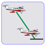
Airplane Descent Calculator Pro $3,99 Suppose you are at10.000feetand need to descend to 2.000 feet. Where do you beginyourdescent?Airplane Descent Calculator Lite allows you tocalculatethedistance in which the plane should begin the descent togettargetaltitude, for a specific descent rate (vertical speed)andgroundspeed (horizontal speed). Many times during anaircraftflight, trueground speed differs from precomputed groundspeed,so, during theflight is necessary to calculate how far weneed tobegin thedescent. To avoid needing to go down at 3.000feet/minutein aCessna 150, to descend from the current altitude torunwayaltitude.This App is Free, has No Ads, and not specialpermissionsneeded.You can also check Airplane Descent CalculatorPro whichallows to:- Calculate the distance to begin the descentfor aspecific descentrate - Calculate the descent rate to getaspecific altitude fromyour current distance - Automaticallygetcurrent altitude andground speed from GPS NOTE: ApplicationNOTcertified for RealFlight. If you use it, it is at your ownrisk!!!
RaceChrono Pro
RaceChrono Pro is a versatile lap timer,datalogging and data analysis app designed especially for useinmotorsports, replacing your traditional lap timers anddataloggers. RaceChrono Pro app also enables you to record videosandoverlay them with the logged data.RaceChrono apps have strong following, currently over 100.000activeusers. If you look around at pits during your race or trackday,chances are that you’ll see someone using RaceChrono. Evenmanyprofessionals, such as factory test drivers and racedrivinginstructors, are known to use this app! No matter whetheryou ridemotorbikes, drive go-karts or cars, on closed circuit orspecialstage tracks – this is the motorsports app for you.RaceChrono Pro has following major features:• Lap timing with sectors and optimal lap• Track library of over 2000 pre-made race tracks• Custom user defined circuit and point-to-point tracks• Smoothly scrolling data analysis with synchronised graph, mapandvideo• Predictive lap timing and time delta graph• Hardware accelerated video export withconfigurable dataoverlay• Multiple camera recording and picture-in-picturevideoexport• Video recording using internal camera• Remote control of GoPro® HERO 2, 3, 3+, 4 and 5 cameras 1)• Linking and synchronising video files from almost allactioncameras• Support for external GPS receivers• Support for OBD-II readers; both Bluetooth and Wi-Fi• Support for Bluetooth LE heart rate monitors• Unlimited session length, good for 24 hour races• Session data export in .ODS (session summary for Excel),.NMEA,.VBO and .CSV formats1) This product and/or service is not affiliated with, endorsedby,or in any way associated with GoPro Inc. or its productsandservices. GoPro, HERO, and their respective logos are trademarksorregistered trademarks of GoPro, Inc.


