Top 50 Apps Similar to Smart Luxmeter


Accurate Altimeter 2.2.32
The most downloaded Altimeter on the PlayStoreis now updated with a new interface and new features!- Altitude estimation with three different methods to be alwayssureto get a reliable measure, even without internetconnection.- Historical charts to see your excursions elevation gain.- Map with your elevation and contour lines.- Pictures with impressed place name and altitude.Altitude can be estimated:- With satellites triangulation. Slow and less accurate but itworkseven with no internet connection.- Taking the ground elevation at your current position fromaninternet web service.- Using the pressure sensor of your device (if available).Itcalibrates itself on pressure from the nearest weather stationtoimprove accuracy.As additional PRO features you can also:- compensate systematic error of pressure sensor- record altitude without opening the App- remove advertising

Sensors Toolbox 1.6.03
Sensors toolbox is the absolute all-in-one diagnostic tool thatletsyou know virtually everything about your mobile device status.Getfull information about all sensors supported by yourtablet,smartphone or wearable device. View in comfortable layoutall datafrom your mobile device sensors in real time, make asensors tests.Check data on chart (graphic view) and text outputavailable foreach sensor and check a detailed description of eachdetectors andparameters. All multi tools and sensors device youneed in one app:altimeter, metal detector, NFC reader, compass,thermometer, stepcounter, sport tracker and much more. This sensorstool box appgives you access to data from: - accelerometer readings(linearacceleration and gravity sensors) - gyroscope (calibratedanduncalibrated) - device 3D orientation - proximity sensor -stepdetector and counter, kinetics sensors - significant motion-rotation vector sensors - other motion and position sensors -lightsensor (lux, lx) - magnetometer, ambient magnetic fieldvaluesstrength (micro Tesla, µT) - barometer, pressure sensor -relativehumidity sensor - temperature sensor - location,accuracy,altitude, maps, speed and GPS NMEA data (latitude,longitude,provider, satelites) - battery status, voltage,temperature, healthand technology - sound level meter andmicrophone meter (decibel) -heart rate sensor - NFC sensor andreader - device front and backcamera resolution - samrtphonedisplay size, resolution andtechnology - device, phone memory, RAMand CPU parameters - IMEInumber - multitouch info and otherssensors available in yourmobile device. With this sensors multitoolapp you can check whatkind of sensors contain your device and testall of this. Itsupports all the sensors an android device and youcan check a lotof data from sensors supported by your hardware. Ifyou have anyproblems with this app or ideas to develop, please sendus messageto [email protected] Have a fun at work with thisultimate tool!

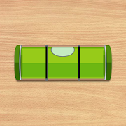


Bubble Level - Spirit Level
Bubble level also known as spirit level is a free,handy,accurate,simple to use and incredibly useful tool for yourAndroiddevice. Aspirit level or bubble level is an instrumentdesigned toindicatewhether a surface is horizontal (level) orvertical(plumb). Vialson modern level meter have a slightly curvedglasstube which isincompletely filled with a liquid, usually acoloredspirit oralcohol, leaving a bubble in the tube. Atslightinclinations thebubble travels away from the center position,whichis usuallymarked. Bubble Level app tries to mimic the reallevelmeter anddisplays the data as real level meter would. Anextensionof thespirit level is the bull's eye level: acircular,flat-bottomeddevice with the liquid under a slightlyconvex glassface with acircle at the center. It serves to level asurfaceacross a plane,while the tubular level only does so inthedirection of the tube.Bubble Level app tries to mimic therealbull's eye level anddisplays the data as real bull's eyelevelwould. Where any why useBubble Level? A bubble level is adeviceused in construction,carpentry and photography thatdetermines ifobjects on whichyou're working are level. Usedproperly, a bubblelevel can helpyou create flawlessly level piecesof furniture,staircases andhomes. A bubble level is also helpfulwhen setting upa tripod forphotographs or when hanging paintings orother items onthe wall.


Windowmaker Measure 3.0.9
ALL YOUR PROJECTS IN YOUR POCKET Measure is capable of: •Measuring- Fill out dimensions, store photos, and add written oraudio notesto each item as you measure it. • QuotingPRO - Select aDesignStyle for your window or door and send a document directlyfromyour phone or tablet to the client or to your office forfurtherprocessing. • SpeedPRO - connect directly to your lasermeasure,remove repeated data entry, and send documents on the spot.Measureis purpose built for: • Builders or homeowners to request aquotefrom a window/door supplier. • Supplier sales representativestorecord estimated sizes for a quotation. • Supplier surveyorstorecord precise sizes to be used for manufacturing. HereatWindowmaker we have over 40 years of experience developingandsupplying software for window/door estimating andmanufacturing.This app is the product of that experience. Wewelcome feedback.Please get in touch with us [email protected] PRO –Subscribe to Windowmaker Measure PROto use this feature.


AndMeasure (Area & Distance) 2.0.7
The AndMeasure tool allows you tomeasuredistances and calculate area between points on a map.The tool has virtually unlimited applications. Use itPROFESSIONALLYfor measuring distances and areas in landscaping,lawn care, waterline measuring, paving and fencing. Use it infarming, agricultureand forestry to measure your fields andforests. Realtor's can useit for showing clients distances tocertain landmarks.For RECREATIONAL use, it can be used in measuring off-roadroutes,plotting running courses, water trips, range estimation attheshooting/driving range. Use it in Golf for gettingreal-timedistance to the green.★★★ Featured on AgWeb.com powered by Farm Journal ★★★"This app could be an easy way for farmers to measure newfields."March 2012Features:● Use it as a ruler on a map to calculate the distancebetweenmultiple points● Calculate areas in acres, sq miles, sq feet, m2, km2,Hectare,Ares● Measure the distance to your location from multiple pointsinreal-time using the "continuous mode" feature● Switch between Satellite, Hybrid, Terrain and normalmapmode● Find your current location via GPS or Network● Share measurement and screenshot via email and Google Drive● Add markers to the map either via tap or by dragging from the"addbutton" to get super accuracy● Move markers around to get precise measurementKeywords: map, maps, area, distance, length, ruler, gps, golf,areacalculator, range finder, map measure, area measure,distancemeasure, field area measure, surface measurement, realestate,realtor, GPS measure, solar, landscape, areacalculation,planimeter, efarmer, perimeter, landscaping, garden,fencing,acreage, terrain, geographical, property, geo,agricultural,calculator, forest, farm, field measure, location,roof area,solar, solar panel roof area, outdoor, snow removal,farmlogs, landcalculatorLanguages: English (write an email if you want to help withothertranslations)Get it at:https://play.google.com/store/apps/details?id=com.megelc.andmeasureFacebook:http://www.facebook.com/andmeasurePrivacy Policy:AndMeasure does not store any personal information at all.HoweverGoogle Analytics is used in the app to better understand howtheapp is used and performs.The Google Privacy Policy can be found here:http://www.google.com/intl/en/policies/privacy/


Altimeter & Altitude Widget 4.57
DS Altimeter is an elevation meter,elevationlogger, and altitude mapper. In addition to showing andoptionallytracking your altitude, the app allows you to search thealtitudefor other locations as well.You can select from the best sources of elevationdata,including:1. Location based altitude from NASA's Shuttle RadarTopographyMission2. Satellite based altitude (GPS altitude) corrected toheightabove mean sea level (AMSL)3. Get actual land survey altitude values for your locationfromthe United States Geologic SurveyDevices equipped with a barometer sensor can also obtainpressurealtitude which is converted to true altitude. For the mostprecisereadings, calibrate the pressure altitude by entering areferencevalue or by selecting one from the app's dynamic list ofnearestairfields.USGS (United States Geologic Survey) altitude results arealsoavailable for customers in the contiguous United States, CanadaandMexico.DS Altimeter also works offline: barometric altitude andGPSaltitude corrected to elevation above sea level do not requireaninternet connection.NEW IN DS ALTIMETER: Record altitude profiles and elevationtracksfor your favorite journeys to the highlands, the lowlandsandeverything in-between!Upgrade the application to pro and gain access to even morefeaturesincluding the Altimeter Widget and variousbarometricaltimeter calibration methods.Going skiing? Record your ski run with DS Altimeter, then viewyourski trail with its elevation points on the included maps.Mininumand maximum altitude points for your run will beclearlyshown.Altitude mapping, altitude search and bathymetry (lake andseadepths) are also included with DS Altimeter. Tap anywhere on amapto get the altitude or water depth at that location.* The perfect altimeter for skiing, hiking, mountain climbingandother outdoor sports, boating, marine navigation and anytimeyouare curious about your elevation!