Top 10 Games Similar to Map of South Africa


BackCountry Navigator TOPO GPS
Download topo maps for an offlineoutdoornavigator! Use your phone or tablet as an offroad topomappinghandheld GPS with the bestselling outdoor navigation appforAndroid! Explore beyond cell coverage for hiking andotherrecreation.Download topo maps for the US and many other countries inadvance,so you won't need cell coverage for navigation. Use storagememoryfor maps.New: Android Wear support to see navigation at a glanceonwristUse GPS waypoints from GPX or KML files, or enter yourowncoordinates using longitude/latitude, UTM, MGRS, or gridreference.Using GOTO makes a waypoint a locus for navigation.This uses many publicly available map sources as freedownloads.Some additional content available as an in apppurchase:-Accuterra Topo Map Source for $19.99/year. This can bepurchasedand used with or in instead of the free sources.- Boundary maps for 12 western states from the Bureau ofLandManagement(BLM) Overlay for topo maps valued by hunters.-GMU boundaries in some states-Lake Contours in several states.-Content from US TrailMaps including:-ATV, Whitewater, and Equestrian Trail MapsSee the menu under More-> "Purchasing AddOns". They can beshownon top of topo maps.You may try the DEMO version to make sure you like the maps inyourcountry.About topo (topographic) maps: Topo maps show terrain throughcolorand contours, and are useful for navigation offroad. Topo mapsandGPS can be used for hiking, hunting, kayaking, snowshoeing,&backpacker trails.You can create your own maps with Mobile Atlas Creator, or specifyacustom tile server. Built in sources include:OpenStreetMaps from MapQuestOpenCycleMaps showing terrain worldwideUS Topo Maps from Caltopo and the USGSUSTopo: Aerial Photography with markup.Canada Topo Maps from ToporamaMarine maps: NOAA RNC Nautical Charts (coastal)USGS Color Aerial photographyTopographic Maps of Spain and ItalyTopo maps of New ZealandJapan GSI maps.Many of the above sources are generally free to use.Use offline topo maps and GPS on hiking trails without cellservice.The GPS in your Android phone can get its position fromGPSsatellites, and you don’t have to rely on your data plan togetmaps. Have more fun and safe GPS navigation inthebackcountry.Use as a geocaching navigator by getting a pocket queryasGPX.Besides geocaching, use GPS for recording tracks and GPSwaypointson your trip, all the while tracking your GPS quest ontopographicmaps. It may replace your Garmin handheld GPS.Here are some of the outdoor GPS activities BackCountryNavigatorhas been used for:As a hiking GPS both on hiking trails and off trail.Camping trips to find that perfect camping site or the way backtocamp with GPS.Hunting trips for hunting wild game in rugged areas.Doing recon for a hunt or as your hunting GPSFishing: make it your fishing GPS.Search and Rescue (SAR).Trekking the Pacific Crest trail or other long term hiking.Kayak and canoe treks on inland lakes and streams or marine,coastalwaters.Backpacker trips: using topo maps of wilderness areas andnationalforests for navigation on trails with the GPS in yourrucksack orbackpack.Find your own ways to have fun in the outdoors. Be a maverickbyventuring beyond cell service boundaries with your GPS. Becomeapro at navigation with GPS for the outdoors.BackCountry Navigator has been on WM devices and preloaded ontheTrimble Nomad outdoor rugged device. This Android version ismoreflexible, featured, and fun. Create a memory with maps.For a one time fee, this a great addition to the outdoor gearyoubought at Cabelas, REI, or another outdoor store. Many havefoundthe Android GPS in a phone or tablet to substitute for aGarmin GPSor Magellan GPS, such as the Garmin GPS units Montana,Etrex, orOregon. Android can be your handheld GPS.

NAVIGON Europe
Whether on holiday, taking a weekend triporheading off somewhere as yet unfamiliar – with NAVIGON, you canbesure of getting there quickly and safely! Transform yourSmartphoneinto a full-performance mobile navigation system thatincludesonboard maps so that you can always find your way – evenwhen nointernet connection1 is available.Important: Following installation, the app needs further data(maps,etc.) which have to be loaded via WiFi (WLAN).*** Scope of function ***- Support of 18 languages- Onboard map material: only save the road maps on yourSmartphonethat you really need. That way, you save on memory spaceand cannavigate even when no internet connection isavailable.- Intelligent address entry, including voice entry(1): thanks tothefirst-class, simplified address entry, which can be operatedusingthe keypad or via voice input, you can find your destinationevenmore quickly.- Precise voice commands, including street names: so that youcanconcentrate on driving the car.- The latest traffic reports(1, 2): avoid annoyingjamsautomatically.- Hazard warnings(1, 2): you can choose to receive alerts ofdangerspots such as mobile speed traps.- POI search: find your destination even without enteringtheaddress directly – locally, Community-based or usingAugmentedReality.- Real signage and road sign displays: you always have anoverviewthanks to photo-realistic views of junctions and roadsigns.- Dynamic lane assistant: at junctions where the exit is unclearoron motorway exits, be guided into the right lane everytime.- Speed assistant: NAVIGON warns you visually or audibly if youareexceeding the permitted speed limit.- Optimal route: choose the right option for you, from up tothreesuggested routes.- Route planning: plan longer trips with several destinationsenroute.- Expanded pedestrian navigation: navigate to your destinationonfoot too – or use Urban Guidance1,2 if you also want toincludepublic transport.- Many other in-app purchases possible: alternative petrolstations,3D maps showing mountains and valleys, and muchmore.*** Maps ***- Latest Map Guarantee for the latest HERE maps(3)(formerlyNavteq), with the following coverage: AL, AN, AT, BA, BE,BG, BY,CH, CZ, DE, DK, EE, ES, FI, FR, GI, GR, HR, HU, IE, IM, IS,IT, LI,LT, LU, LV, MC, MD, ME, ME, MT, NL, NO, PL, PT, RK, RO, SE,SI, SM,RS, SK, TR, UK, VA- NAVIGON FreshMaps(2): For a one-off payment, you get thelatestmap updates from experts up to four times a year, for twoyears! Itmeans that your app is always up-to-date, containing thelatestchanges to the road network and any amount of new pointsofinterest.*** Please note the following ***The correct positioning of your Smartphone in the vehicleisimportant for optimum GPS reception. For that reason, werecommendthe Garmin Smartphone Universal Mount with additionalUSBconnection so that you can also charge your Smartphone duringyourtrip. Continuous use of GPS can shorten battery life. Availableinspecialist stores or directly from the Garmin Shopatwww.garmin.com.Please also note our FAQ area at www.navigon.com.This version of NAVIGON can require up to 3.4GB of freememory(depending on the number of maps you download). Due to thehighdata volume, we recommend using WiFi (WLAN). On first startupashort data connection (ca. 25kB) is mandatory to registeryourproductNAVIGON wishes you a lot of fun from your navigation!(1)To be able to provide you with the latest reports at alltimes,some functions require an internet connection (e.g. trafficreportsor speed camera alerts). However, the navigation systemitself,including address search, speed display, driving laneassistant andmuch more, does not require the internet.(2)Available as an additional in-app purchase.(3)You get the maps most up-to-date at the time you purchasetheapp


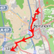


AfriGIS Navigator with Traffic 1.8.3
AfriGIS Navigator with Traffic offers youacomplete voice guided navigation system with integratedlogbookfunctionality for your mobile device, on data for SouthAfrica.Use your GPS smartphone as a complete navigation device.Key features and benefits include:• Integrated Logbook functionality – logs trips &tollfees• NearMe locating Accommodation, Food Outlets, FillingStations,Stores, Education facilities and more in your area• Real time traffic updates every 5 minutes• Automatically adjusts ETA based on live traffic conditions• Selects the best route based on live traffic conditions• 3D Navigation views, voice commands & a bird's eye viewwithsatellite imagery• Send to friend menu option, share locations with the handyInboxfeature – never type an address again, simply Inbox it!• Tell a Friend, share the app per SMS• Find addresses and points of interest instantly, using freetextsearch• Trip summary• Route history• Dynamically updates routes for travelling sales peopleanddelivery driversThe AfriGIS Navigator application is built on thespecificoperating system of your phone, leveraging the uniquefeatures ofyour handset. The application makes use of the AfriGISNavigationServer via the mobile Internet, integrated with our highqualityAfriGIS map set.For more innovative solutions visit www.afrigis.co.za.Please Note: Continued use of GPS running in the backgroundcandecrease battery life.

Map of Poland 1.22
This app turns your Android device into aGPSnavigator with offline maps.You can search easily locations in Poland and you can add themtoyour route.Discover interesting places near you: accommodation,parking,restaurants, bars, clubs, cinemas, theatres, auto services,shops,parks, schools, hospitals, sport areas.It includes detailed maps of the biggest cities in Poland:Warsaw,Cracow, Łódź, Wrocław, Poznań, Gdańsk, Szczecin, Bydgoszcz,Lublin,Katowice and others.You can download different regions: GreaterPoland,Kuyavian-Pomeranian, Lesser Poland, Łódź, Lower Silesian,Lublin,Lubusz, Masovian, Opole, Podlaskie, Pomeranian,Silesian,Subcarpathian, Świętokrzyskie, Warmian-Masurian,WestPomeranian.This application is based on Osmand project under the GNUGPLv3license and uses high quality data from OSM.