Top 13 Apps Similar to Locus - addon GpsTrace


BackCountry Navigator TOPO GPS
Download topo maps for an offlineoutdoornavigator! Use your phone or tablet as an offroad topomappinghandheld GPS with the bestselling outdoor navigation appforAndroid! Explore beyond cell coverage for hiking andotherrecreation.Download topo maps for the US and many other countries inadvance,so you won't need cell coverage for navigation. Use storagememoryfor maps.New: Android Wear support to see navigation at a glanceonwristUse GPS waypoints from GPX or KML files, or enter yourowncoordinates using longitude/latitude, UTM, MGRS, or gridreference.Using GOTO makes a waypoint a locus for navigation.This uses many publicly available map sources as freedownloads.Some additional content available as an in apppurchase:-Accuterra Topo Map Source for $19.99/year. This can bepurchasedand used with or in instead of the free sources.- Boundary maps for 12 western states from the Bureau ofLandManagement(BLM) Overlay for topo maps valued by hunters.-GMU boundaries in some states-Lake Contours in several states.-Content from US TrailMaps including:-ATV, Whitewater, and Equestrian Trail MapsSee the menu under More-> "Purchasing AddOns". They can beshownon top of topo maps.You may try the DEMO version to make sure you like the maps inyourcountry.About topo (topographic) maps: Topo maps show terrain throughcolorand contours, and are useful for navigation offroad. Topo mapsandGPS can be used for hiking, hunting, kayaking, snowshoeing,&backpacker trails.You can create your own maps with Mobile Atlas Creator, or specifyacustom tile server. Built in sources include:OpenStreetMaps from MapQuestOpenCycleMaps showing terrain worldwideUS Topo Maps from Caltopo and the USGSUSTopo: Aerial Photography with markup.Canada Topo Maps from ToporamaMarine maps: NOAA RNC Nautical Charts (coastal)USGS Color Aerial photographyTopographic Maps of Spain and ItalyTopo maps of New ZealandJapan GSI maps.Many of the above sources are generally free to use.Use offline topo maps and GPS on hiking trails without cellservice.The GPS in your Android phone can get its position fromGPSsatellites, and you don’t have to rely on your data plan togetmaps. Have more fun and safe GPS navigation inthebackcountry.Use as a geocaching navigator by getting a pocket queryasGPX.Besides geocaching, use GPS for recording tracks and GPSwaypointson your trip, all the while tracking your GPS quest ontopographicmaps. It may replace your Garmin handheld GPS.Here are some of the outdoor GPS activities BackCountryNavigatorhas been used for:As a hiking GPS both on hiking trails and off trail.Camping trips to find that perfect camping site or the way backtocamp with GPS.Hunting trips for hunting wild game in rugged areas.Doing recon for a hunt or as your hunting GPSFishing: make it your fishing GPS.Search and Rescue (SAR).Trekking the Pacific Crest trail or other long term hiking.Kayak and canoe treks on inland lakes and streams or marine,coastalwaters.Backpacker trips: using topo maps of wilderness areas andnationalforests for navigation on trails with the GPS in yourrucksack orbackpack.Find your own ways to have fun in the outdoors. Be a maverickbyventuring beyond cell service boundaries with your GPS. Becomeapro at navigation with GPS for the outdoors.BackCountry Navigator has been on WM devices and preloaded ontheTrimble Nomad outdoor rugged device. This Android version ismoreflexible, featured, and fun. Create a memory with maps.For a one time fee, this a great addition to the outdoor gearyoubought at Cabelas, REI, or another outdoor store. Many havefoundthe Android GPS in a phone or tablet to substitute for aGarmin GPSor Magellan GPS, such as the Garmin GPS units Montana,Etrex, orOregon. Android can be your handheld GPS.


BackCountry Nav Topo Maps GPS
Use your Android as an offroad topo mappingGPSwith the bestselling outdoor navigation app for Android! TrythisDEMO to see if it is right for you, then upgrade to thepaidversion.Use offline topo maps and GPS on hike trails without cellservice!The GPS in your Android phone can get its position fromsatellites,and you don’t have to rely on your data plan to getmaps. Have morefun and safe GPS adventures in thebackcountry.Preload FREE offline topo maps, aerial photos, and road maps onyourstorage memory, so they are ready when you need them.Add custom GPS waypoints in longitude and latitude, UTM or MGRSgridreference. Import GPS waypoints from GPX files. Choose iconsforwaypoints much like in MapSource. (This app uses the WGS84datum,NAD27 is available in settings).Use GPS for hunting a waypoint or geocache, for recording tracksandGPS waypoints on your trip, all the while tracking your questontopographic maps.About topo (topographic) maps: Topo maps show terrain throughcolorand contours, and are useful for navigation offroad. Topo mapsandGPS can be used for hiking, hunting, kayaking, snowshoeing,&backpacker trails.The app has many built in map sources and allows you to createyourown maps with Mobile Atlas Creator. Built in sourcesinclude:OpenStreetMaps and NASA landsat data worldwide.OpenCyle Maps are topo maps that show terrain worldwide.USGS Color Aerial photography.Topographic Maps of Spain and Italy.Outdoor maps of Germany and AustriaTopo maps of New ZealandHere are some of the outdoor GPS activities BackCountryNavigatorhas been used for:Hiking both on hiking trails and off trail.Camping, to find the perfect camping site or the way backtocamp.Hunting trips for hunting wild game in rugged areas, includingreconfor the hunt.Bait fishing or fly fishing with a buddy.Search and Rescue (SAR) with GPS.Kayak and canoe trips on inland lakes and streams or marine,coastalwaters.Backpacker trips: using topo maps of wilderness areas andnationalforests to navigate on trails with the GPS.Snow adventures including snowmobiling, skiing (alpine orcrosscountry) and snowshoeing. Create a memory. Map it out.This a great addition to the outdoor gear you bought atCabelas,REI, or another outdoor store. Your android phone couldsubstitutefor a Garmin or Magellan outdoor handheld GPS! Youstorage hasmemory for maps.Find your own ways to have fun in the outdoors. Be a maverickbyventuring into new territory beyond cell service boundaries.Becomea pro at navigation with GPS.BackCountry Navigator has been previously available on WMdevicesand preloaded on the Trimble Nomad outdoor rugged device.ThisAndroid version is more flexible, featured, and fun.


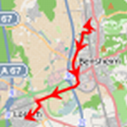
Locus 1.2.2
If you are a team leader working togetherwithyour teammates with field jobs, you need the ability tomonitormovements of your teammates on the field. If you are aparent, youmay want the peace of mind that comes with knowing whereyour teenis at all times. For all your such needs, LOCUS is thesolutionthat will work for you. Locus is a wonderful smartphone appthatuses your people’s mobile handset’s internal location servicestodetermine their location and keep you informed abouttheirlocations real-time.


Semafory Bratislava 1.0
Automatické odpočítavanie času do zelenej navybranýchkompatibilných križovatkách v Bratislave. Prípadnénepresnosti vodpočte prosím nahlasujte tu:http://www.semafory.sk/nepresnostAktuálna presnosť: 93% (+/- 2sekundy) Aktuálne pokrytie: 49%svetelných križovatiek v BratislavePODPOROVANÉ KRIŽOVATKY: -Račianska x Jarošova - Bajkalská xTrnavská - Bajkalská x Drieňová- Bajkalská x Trenčianska -Vajnorská x Jarošova - Vajnorská xPolus MT1 - Vajnorská x Poluspriechod pre chodcov - Vajnorská xRiazanská - Vajnorská x Polus MT2- Vajnorská x Tomášikova -Tomášikova x Lakeside Park - Tomášikova xŽST NM - Tomášikova xTrnavská - Galvaniho x Ivanska cesta -Račianske mýto - Šancova xKukučínova chodci - Trnavské mýto -Trnavská x Miletičova -Trnavská x Jégého - Rožňavská x Slovinská -Rožňavská x Rádiová -Nábrežie a.g.L.Svobodu x Most SNP - Rázusovonábrežie x Most SNP -Rázusovo nábrežie x Rigeleho - Rázusovo nábr.x Reduta -Dostojevského rad x Landererova - Landererova xOlejkárska -Dostojevského rad x Továrenská - Karadžičova x Mlynskénivy -Mlynské nivy x 29. augusta - Karadžičova x Poľná -Karadžičova xZáhradnícka - Krížna x Legionárska - a ďalšie...Aktuálne pokrývameuž všetky svetelné križovatky v Bratislave, ktorésú kompatibilné.Križovatky s dynamickým riadením nie súpodporované. KOMPATIBILNÉNAVIGÁCIE: - Waze - Sygic - MapFactorNavigator - Locus - aďalšie... ČASTÉ OTÁZKY: Q: Bude podporovaná ajPetržalka a ďalšieokrajové mestské časti? A: Aktuálne v Bratislavepokrývame užvšetky križovatky, ktoré sú kompatibilné s aplikáciou.Ostatnékrižovatky sú v dynamickom režime, čiže bohužiaľ nie jemožné ichpodporovať. Q: Budú podporované aj iné mestá akoBratislava? A:Áno, plánujeme pokrytie rozšíriť maximálne ako tobude možné.Aktuálne už testujeme prvú križovatku v Košiciach. Q:Som nakompatibilnej križovatke, ale odpočítavanie sa mi nezobrazí.A:Niektoré križovatky majú zatiaľ nahodený cyklus iba v pondelokažpiatok od 6:30 do 19:00. Usilovne pracujeme narozšírenípodporovaných časov. Q: Odpočítavanie nesedí preodbočovací pruh vktorom som zaradený. A: Detekcia radenia do pruhovzávisí odpresnosti vášho GPS prijímača a aktuálnych podmienok. Vprípade akvám funkcia detekcie pruhu nevyhovuje, môžete si juvypnúť vnastaveniach - v takomto prípade uvidíte ako hlavný semaforprerovný smer, a ostatné semafory po stranách. Iný semafor simôžeteprepnúť jednoduchým kliknutím. Na zlepšení funkciedetekciejazdného pruhu pracujeme. Q: Funguje aplikácia aj offline?A: Nie,aplikácia potrebuje pripojenie na server pre zistenieaktuálnejsynchronizácie semaforov.

