Top 36 Apps Similar to TomTom MyDrive

Offline Maps & Navigation
Here we created another great navigationappbased on offline maps.You can enjoy unlimited navigation features, lifetime freemapupdates with no hidden costs. Our real-time traffic helps youtoavoid traffic jams. Features: - Free offline GPS navigation- Offline maps- Lifetime free map updates- Speed limit warnings- 3D buildings - Large POI database- Pedestrian, car, or even bee-line navigation- Night mode based on local sunset time Advanced:- Real-time traffic- Multi-language voice navigation- Speed camera warnings- Lane guidance- Track recording- Navigate to photo- Travelbook- Support Free version includes 90 days Advanced features with voiceguidednavigation. After 90 days use offline maps and trip planningforfree or upgrade to unlimited voice guided premiumnavigation.

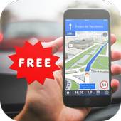
TomTom MyDrive™
EASILY PLAN YOUR DAILY DRIVE WITHREAL-TIMETRAFFICChoose the best route to take before you get in the car. Set upyourpersonal traffic checker for any delays on your commute andseewhere traffic is right now. Optionally share your destinationwith aTomTom GPS device* for navigation through traffic.Additionally, connecting your phone while driving enablesyourTomTom device to receive real-time traffic information.BENEFITS:>> Know before you go: We're passionate about traffic soyoudon't need to be. Get highly accurate traffic information, inrealtime.>> Set your personal traffic checker: Want to knowabouttraffic on your commute? Get reports before you go in caseofdelays on the way.>> Set your destination and sync it with your GPS*: Setwhereyou're going using phone contacts, saved favorites, a tap onthemap, or just type it in. Then send it to your GPS device* anditwill guide you through traffic.>> Make your map personal: Easily add and manage yourhome,work and other favorite destinations.GOOD TO KNOW:-Please note that this app will not update your GPS devicesoftware.Instead, you can download the latest map or software foryour GPSdevice by visiting tomtom.com/getstarted from yourcomputer.-You can get TomTom's world-class, turn-by-turn navigationbydownloading our navigation app: TomTom GPSNavigationTraffic.*Supported TomTom models include:TomTom GO 40 / 50 / 60 / 40S / 50S / 60S / 400 / 500 / 600TomTom Rider 400Your TomTom device needs to be connected to the internet toexchangeinformation with the MyDrive app.

GPS Navigation 20.0
Navigating from one place to the other has become easy with thehelpof GPS devices that gets its information directly fromsatellites.This interesting Android application GPS Navigationhelp users toget access to links that connect to websites thatprovide them withlive maps of locations they intend to navigateto. Users candownload softwares that can provide them with thecorrect directionsalong with accurate landmarks as they receivelive information fromsatellites. One can use this applicationwhile driving and it willautomatically direct to the desiredlocation.

MAPS.ME – Map with Navigation and Directions v14.2.71484-googleRelease
Free, fast, detailed and entirely offlinemapswith turn-by-turn navigation – trusted by over 90milliontravelers worldwide.OFFLINE MAPSSave mobile data, no internet is required.FREE FOREVERAll maps inside and all features are free. Always were andalwayswill be.NAVIGATIONUse driving, walking and cycle navigation anywhere intheworld.INCREDIBLY DETAILEDDirections to points of interest (POI), hiking trails andplacesmissing from other maps.UP-TO-DATEMaps are updated by millions of OpenStreetMap contributorsdaily.OSM is an open-source alternative to Google Maps, MapquestandWaze.FAST AND RELIABLEOffline search, GPS navigation along with optimized mapstoeffectively save memory space.BOOKMARKSSave locations you love and share them with your friends.AVAILABLE WORLDWIDEEssential for home and travel. Paris, France? Check.Amsterdam,Netherlands? Check. Barcelona, Spain? Check. New York,Chicago,Florida, Las Vegas, Nevada, Seattle, San Francisco,California,USA? Check! Rome, Italy? Check. London, UK? Check.TRAFFIC DATANew online city traffic maps. Check out updates on traffic infoandfastest driving routes in 36 countries!AND MORE!– Search through different categories e.g. restaurants,cafes,tourist attractions, hotels, ATMs and public transport(metro,bus…)– Make hotel bookings via Booking.com directly from the app– Share your location via text message or social media– When cycling or walking, the app shows whether the way isuphillor downhillContinued use of GPS running in the background candramaticallydecrease battery life.If you have any questions, visit our HelpCenter:support.maps.me.If you are unable to find the answer to your question, contactusat: [email protected] us on FB: http://www.facebook.com/mapswithme |Twitter:@MAPS_ME
Voice GPS Navigation Advice 3.0.0
Navigating from one place to the otherhasbecome easy with the help of GPS devices that gets itsinformationdirectly from satellites. This interesting Androidapplication GPSNavigation help users to get access to links thatconnect towebsites that provide them with live maps of locationsthey intendto navigate to.GPS Navigation Satellite systems have become so widespread thattheyare almost taken for granted. However, the fact that they aresouseful is leading to an expansion of available systems.This application will show your location and with applicationsuchas GPS NavigationGPS Navigation for car may be able to answer:- the roads or paths available,- traffic congestion and alternative routes,- roads or paths that might be taken to get tothedestination,- if some roads are busy (now or historically) the best routetotake,- The location of food, banks, hotels, fuel, airports orotherplaces of interests,- the shortest route between the two locations,- the different options to drive on highway or back roads.GPS Navigation app can work with data connection or with GPSalone.Navigator has in a way improved the lifestyles of people bymakingtravelling easy especially to unknown places. This androidappcontains content that provide users with information onGPSnavigation and its uses. App developers are exerting efforttoprovide users with an amazing array of features. Open StreetMapsupport, turn by turn voice guidance, high quality map, 3Dviews,precision positioning, and integrated social media are justsome ofthe amazing features.This app advise you to find the roads or paths availablefrominterest GPS directions apps and voice directions have becomesowidespread.This is the best voice GPS Navigation Advice. We do not provideanyvoice GPS navigation service or route finder serviceinanyway.

Sygic Truck & RV GPS Navigation 21.3.0
High-quality GPS navigation designed for professional drivers&their large vehicles. Trusted by 3 million drivers ofTrucks,Camions, HGVs, RVs, Caravans, Campers, Vans, Buses, Cars& manyof the world’s leading delivery fleets. Lots of smartfeatures,beautiful 3D offline maps, and easy to use interfaceprovide aproductive and enjoyable navigation experience. SygicTruck GPSNavigation is the best copilot on your routes! TRUCKSPECIFIC MAPS& ROUTING • Special routing for Truck / Camion /LGV / HGV/Delivery Van calculated for the vehicle & load. •High quality3D offline maps. Free map updates several times peryear. Maps arestored offline on your device so internet connectionis notrequired, works with GPS signal. • 3 route alternativesaredisplaying total time, distance, and elevation of the route.•Profiles for 3 different trucks. Set the parameters suchasdimensions, weight, transported material (HAZMAT), numberoftrailers, and the app will select the best route for the vehicle.•Last-mile functionality displaying restricted part of the routeina different color POIs • Millions of Truck specific PointsofInterests • Include gas stations, weigh stations, and restareas.PROFESSIONAL PLANNING & OPTIMALISATION • Advancedrouteplanning to avoid toll roads, U-turns, hazards such as lowbridges,narrow roads, or restricted areas (emission zones, schoolzones).Set preferences such as right turns or arrival with thedestinationon the right side. • Plan & optimize your Multi-Stoproute. Addup to 150 waypoints, and they will be re-arranged toachieve thebest efficiency. • Plan your route with Google Maps& easilydispatch to the app with Sygic Truck Route Sender -free extensionin Chrome and Firefox browser. DESIGNED FOR RV /CARAVAN / CAMPER /BUS • Profile configuration for RV / Caravan /Camper / Motorhome /Bus • Special routing for RV / Caravan / Camper/ Motorhome / Buscalculated for the vehicle & load. • Routesand directionsdesigned for RVs based on your vehicle size • RVspecific POIs:Campgrounds, parking stations, rest areas and moreSAFETY FEATURES• Spoken voice instructions with road indication •Dynamic LaneAssistant & Junction View • Speed Limits &Speed CamerasWarnings ADD-ONS • Live Services include Real-timeTrafficinformation + Mobile Speed Cameras Database + Fuel Prices +ParkingPlaces • Head-Up Display (HUD): Projects navigationinstructionsonto your windshield AVAILABLE MAP REGIONS • NorthAmerica • Europe(with Russia) • Australia & New Zealand •Brazil • Middle East• Africa You can test-drive Premium feature forthe first 14 daysafter installation. After 14 days, you cancontinue using the basicfeatures or upgrade to the Premium license.Also available fromSygic: Should you have any questions, pleasevisitsygic.com/support. We are here for you 7 days a week. If youlikeour app, please leave a review. Thank you for your support.PrivacyPolicy: www.sygic.com/company/privacy-policy Terms ofUse:www.sygic.com/company/terms-of-use By installing, copying orusingall or any portion of this software you accept all the termsandconditions of this agreement: https://www.sygic.com/company/eula


GPS Navigation Maps 3.0
It simply opens Google Navigation,GPSNavigation by applink, or Be-on-road in one click, rather thanafew.This is The World’s Most Installed Offline turn-by-turnGPSnavigation App for Android powered. GPS Navigation Mapsareinstalled on the SD card so there is no need for anInternetconnection when navigating.You can enjoy free navigation, gps, offline TomTom maps,POIs,route planning & free map updates.• offline / online gps navigation• offline / online maps• Intuitive voice navigation in multi-language• High quality TomTom maps stored on the device• Cross-border routing & navigation without the need toswitchbetween countries or to a less detailed map• Works with GPS only, internet is not needed• Millions of free pre-installed POIs• Free map updates & Free POI database updates• Free updates of Fixed speed cameras• Head-up Display (HUD) available as in app purchase• Spoken Street Names to focus on the road• Three Alternative Routes to choose from• Easy Drag & Drop route editing• Waypoints for places you want to visit• Avoid Toll Roads on your route• Graphics optimized for tablet & HD displays• Car Audio Integration – Bluetooth or cable• track recording• 3D Cities & Landscape for easy orientation• Pedestrian navigation to walk and explore• Dynamic Lane Guidance for safe lane changes• Junction View to highlights highway exists• Warnings for exceeded Speed Limit• Warnings for fixed speedcams• Police trap warnings from other driversThe most easy way to know where you are.Worldwide Maps, Exact GPS. Try!


GPS Navigation & Map by Aponia
The world's most versatile anduser-friendlyGPS navigation with offline maps.FIND YOUR DESTINATION IN AN EASY WAYAponia GPS Navigation converts your Android smartphone ortabletinto a fully functional mobile navigation system withon-boardmaps, thus avoiding data transfer for map display,routecalculation etc.The most complex and user-friendly GPS navigation app in theworldwith Intel x86 support also.Maps are stored on the device for offline use.Both app and maps are updated for free.The application is compatible with over 300 Android smartphonesandtablets.FAST, SMART AND UNDEMANDING▪ No. 1 paid GPS navigation with a growing number ofsatisfiedusers.▪ On-board navigation – the maps are stored directly inyoursmartphone or tablet, thus avoiding extra expensesfor data.▪ The application is capable of navigating to a zip code,housenumber or an address book contact.▪ Extensive map database with high quality maps.▪ Turn-by-turn voice guidance with a large registeroflanguages.USER-FRIENDLY▪ Complex junctions simplified by lane arrows anddirectionsigns.▪ Alternative routes.▪ Powerful multi-stop trip planning and optimization.▪ Favorites – easy access to home, work and favorite places.▪ Navigation activation via a tap on the map.SAFE▪ Speed camera alerts with FREE updates.▪ Speed limit indicator and warnings.▪ Automatic day-night modes.CLEVER▪ The navigation finds the fastest route based on livetrafficflow.▪ If there’s a delay based on the traffic flow, theappautomatically finds a new route.▪ Color-coded live traffic map and status bar.PLUS ALL THE FEATURES YOU'D EXPECT FROM A NAVIGATION.


Truck GPS Navigation by Aponia
The world's most versatile anduser-friendlyGPS navigation for truck drivers.Truck GPS Navigation is a truck-specific navigation systemdesignedto provide safe and reliable routing on truck-legalroads.Truck drivers know that choosing the wrong route leads towastedfuel, out-of-route kilometers, lost time and money and insomecases also safety issues.Unlike standard car navigation systems, Truck GPSNavigationcalculates efficient routes based on the vehicleprofileinformation, routing parameters and load type, includinghazardousmaterials.The driver can choose a profile configuration based onlength,height, width, weight, max. axle load, and whether he iscarryinghazardous goods.The maps are on-board, which means they are stored directly onthedevice for offline use. At the same time both the maps andtheapplication can be easily updated free of charge.TRY OUT THE APP FOR FREE WITH OUR FREE TRIAL!

Yanosik navi antyradar kamera 3.5.6.0
Informuj i bądź informowany oaktualnejsytuacji na drodze. Korzystając z aplikacji dowiesz się ozbliżaniusię do kontroli prędkości, utrudnień czy fotoradarów.Yanosik tonajskuteczniejszy system ostrzegania dla kierowców, któryłączy wsobie funkcje legalnego antyradaru, nawigacji onlineiwideorejestratora.Yanosik gromadzi wokół siebie największą społeczność kierowcówwPolsce. Miesięcznie korzysta z niego ponad 1,5 mlnużytkowników,którzy każdego miesiąca pokonują ponad 350 mln km, aco 3 sekundy wsystemie pojawia się nowe zgłoszenie!Yanosik to wszechstronny asystent kierowcy, oferuje m.in.:- ostrzeganie (o fotoradarach, kontrolach prędkości,patrolachnieoznakowanych, kontrolach ITD, odcinkowym pomiarze,zagrożeniachna drodze),- nawigację omijającą korki (technologia Smart Traffic),- wideorejestrator,- komputer pokładowy (po połączeniu z Yanosik Connect-yanosik.pl/connect),- ubezpieczenia YU! - pierwsza, powszechna oferta bazującananajnowocześniejszym rozwiązaniu, które uzależnia cenęubezpieczeniaod stylu jazdy (http://payhowyudrive.pl/),- wspólne przejazdy (www.yanosiktls.pl),- asystenta parkingowego (informacja o strefie,płatnośćmobilna),- opinie o restauracjach oraz stacje paliw wraz z cenami.******* English *******Yanosik informs you about various traffic events on roads.Informand be informed about speed cameras, accidents andotherthreats.Inform and beinformedabout the current situation on the road. Using theapplication youwill learn about approaching a speed control,hindrance or speedcameras. Yanosik is the most effective warningsystem for drivers,which combines the functions of legal radardetector, navigation,online and paperless recorder.Yanosik gathers around him the largest community of driversinPoland. Monthly use it more than 1.5 million users each monthtoovercome more than 350 million km, and every 3 seconds inthesystem, a new application!Yanosik is a versatile assistant driver offers m.in .:- warning (speed camera, controls the speed patrolunmarked,controls ITD segmental measurement, hazards on theroad).- navigation, avoiding traffic jams (Smart TechnologyTraffic)- the DVR,- on-board computer (in combination with Yanosik Connect-yanosik.pl/connect)- insurance YU! - first, general offer based on the mostmodernsolution, which makes the price of insurance against drivingstyle(http://payhowyudrive.pl/)- shared rides (www.yanosiktls.pl)- Parking assistant (zone information, mobile payment)- Reviews of restaurants and gas stations with prices.******* ******* AngielskiYanosik INFORMS you about traffic events on various roads.Informand be informed about speed cameras, accidents andotherthreats.

Maps & GPS Navigation OsmAnd+
OsmAnd+ (OSM Automated NavigationDirections)is a map and navigation application with access to thefree,worldwide, and high-quality OpenStreetMap (OSM) data.Enjoy voice and optical navigation, viewing POIs (pointsofinterest), creating and managing GPX tracks, using contourlinesvisualization and altitude info, a choice between driving,cycling,pedestrian modes, OSM editing and much more.OsmAnd+ is the paid application version. By buying it, yousupportthe project, fund the development of new features, andreceive thelatest updates.Some of the main features:Navigation• Works online (fast) or offline (no roaming charges when youareabroad)• Turn-by-turn voice guidance (recorded andsynthesizedvoices)• Optional lane guidance, street name display, and estimated timeofarrival• Supports intermediate points on your itinerary• Automatic re-routing whenever you deviate from the route• Search for places by address, by type (e.g.: restaurant,hotel,gas station, museum), or by geographical coordinatesMap Viewing• Display your position and orientation• Optionally align the picture according to compass oryourdirection of motion• Save your most important places as Favorites• Display POIs (point of interests) around you• Display specialized online tiles, satellite view (fromBing),different overlays like touring/navigation GPX tracksandadditional layers with customizable transparency• Optionally display place names in English, local, orphoneticspellingOnly this week 50% OFFUse OSM and Wikipedia Data• High-quality information from the best collaborative projectsofthe world• OSM data available per country or region• Wikipedia POIs, great for sightseeing• Unlimited free downloads, directly from the app• Compact offline vector maps updated at least once a month• Selection between complete region data and just roadnetwork(Example: All of Japan is 700 MB or 200 MB for the roadnetworkonly)Safety Features• Optional automated day/night view switching• Optional speed limit display, with reminder if you exceedit• Optional speed-dependent zooming• Share your location so that your friends can find youBicycle and Pedestrian Features• Viewing foot, hiking, and bike paths, great foroutdooractivities• Special routing and display modes for bike and pedestrian• Optional public transport stops (bus, tram, train) includinglinenames• Optional trip recording to local GPX file or online service• Optional speed and altitude display• Display of contour lines and hill-shading (viaadditionalplugin)Directly Contribute to OSM• Report data bugs• Upload GPX tracks to OSM directly from the app• Add POIs and directly upload them to OSM (or laterifoffline)• Optional trip recording also in background mode (while deviceisin sleep mode)OsmAnd is open-source and actively being developed. Everyonecancontribute to the application by reporting bugs,improvingtranslations or coding new features. The project is in alivelystate of continuous improvement by all these forms ofdeveloper anduser interaction. The project progress also relies onfinancialcontributions to fund coding and testing ofnewfunctionalities.Approximate map coverage and quality:• Western Europe: ****• Eastern Europe: ***• Russia: ***• North America: ***• South America: **• Asia: **• Japan & Korea: ***• Middle East: **• Africa: **• Antarctica: *Most countries around the globe available as downloads!From Afghanistan to Zimbabwe, from Australia to the USA.Argentina,Brazil, Canada, France, Germany, Mexico, UK, Spain,...

GPS Navigation Free Advice 1.2
Do you want to change your android deviceintoa navigational tool? If you are one of the Android users whodon’tfind the default map app sufficient, there are a lot of coolandfeature-packed GPS navigation apps waiting for you at theGooglePlay Store. Thanks to the creative developers behind thesefree andpaid apps, driving and travelling nowadays won’t be asdifficultand problematic. If only Alice in Wonderland had anAndroid phone.The apps in the list have paid and free versions.This applicationguide you for android apps includes, How to Findthe Right GPS Appand guide you for buy the best GPS Devices andbuying guide. Userscan get information on how to download thenavigation system ontotheir systems or smart phones and use them inthe days whenrequired. This app also gives users sample informationon the needof GPS in car, cyclists and how it helps to locateplaces andaddresses of the unknown places they intend to visit.This app advise you to find the roads or paths availablefrominterest gps directions apps. Traffic congestion andalternativeroutes is important for you to find destination. You canenjoy freenavigation, gps, offline tomtom maps,Sygic GPS, POIs,Satellite MAProute planning & free map update. The location ofairports,restaurant(food), hotels, banks, fuel or other places ofinterestsis best for you to share local in social media.you cansave thetime by find shortest route between the two locations.youcan getdifferent options to drive on highway or back roads.GPS Navigation app can work with data connection or withGPSalone. Navigator has in a way improved the lifestyles of peoplebymaking travelling easy especially to unknown places. Thisandroidapp contains content that provide users with information onGPSnavigation and its uses. App developers are exerting efforttoprovide users with an amazing array of features.OpenStreetMapsupport, turn by turn voice guidance, high qualitymap, 3D views,precision positioning, and integrated social mediaare just some ofthe amazing features.

Navigation MapaMap Poland 10.23.0-1-g18fc740
Door to door navigation with the largest database of addressesinPoland (8 million). Thanks to the social functions warnsagainstthe police, speed cameras, accidents and speeding. OFFLINEMAPS Theapplication contains an accurate map of Poland, which needsto bedownloaded only ones during the installation. Therefore noInternetconnection is required while navigating. Map data contains:-Detailed road map of Poland - Thousands city plans - Paidparkingzones - Topographic data - Speed cameras - POI data base -Speedlimits - Hiking trails - Terrain data - Cycle ways KEYNAVIGATIONFUNCTIONS: - Automatic determination of the route -Automatic routerecalculation - Planning a route with VIA points -Warning aboutspeeding - Saving a trace of the path - Import /export the plannedroute - Automatic change map scale - Warning ofspeed cameras -Automatic day / night mode - Traffic informationsystem - Paidparking zones - Function chainages roads - View 2D /3D - LaneAssistant - Trip computer - POI search - And many more ...ON-LINESOCIAL FUNCTIONS: - Warning and exchange of informationabout speedcameras - Warning and exchange of information aboutpolice control- Warning and exchange of information aboutaccidents, traffic jamsand road works TOURIST INFORMATION You canuse MapaMap navigationduring hiking or cycling – the producer tookcare of map database,which contains hiking trails, cycle ways andterrain data for wholePoland. FREE TRIAL After a period of 7 daysyou are able to extendyour license: - for 30 days (9 PLN) - for 365days (49 PLN) - toLifeTime Maps which provides unlimited use andmap updates (99 PLN)

GPS Map and Navigation 1.0
GPS Map and Navigation is a programthatallowsyou to find the easiest and fastest route foryourdestination.Simply search for the beginning and end of theroute.You will knowthe details of the trip. And get the besttravelroutes.GPS Map and Navigation will facilitate you in helpingyoufindplaces. Near you Details and directions are available onthesitethat you know and have access to, for example,ATM,restaurants,shopping malls and so on.GPS Map and Navigation provides three types of mapstodemonstrateclear understanding of your destination and routeforyou duringthe trip / journey.Features:- Find a place destination- Find the fastest and easiest route for your destination.- Find Address on any map of the area.- Find places around you, for example, ATM,restaurants,shoppingmalls and so on.- Save your favorite locations.- Supports different map types: normal,satellite,terrainmaps.- Driving Directions- Search for trailsNote: app is free, supported by advertising.

Navitel Navigator GPS & Maps v11.11.917
Navitel Navigator is a precise offlineGPSnavigation with free geosocial services and detailed maps of64countries. Try popular navigation for 7 day free!______________________________* 20M DOWNLOADS WORLDWIDE ** TOP 5 NAVIGATION IN 12 COUNTRIES!*ADVANTAGES• Offline navigation. No Internet connection required for the useofthe program and maps: No additional expenses on roamingordependency on mobile connection.• Access to maps at any time: Maps are downloaded to theinternalmemory of a device or an SD-card.• Map subscription: Map purchase for a limited period (1 year)withprices starting at 10.99$.SPECIAL FEATURES• 3 alternative routes with display of time and distance for eachofthem.• Navitel.Traffic. Information on all traffic jams in thecoveredarea, available in real time.• Navitel.Friends/Cloud. Messaging with friends, trackingtheirlocation and routing towards them. Program settings andwaypointsare stored in the NAVITEL cloud storage. Log intoNavitel.Friends/Cloud service using your social networkprofile(Facebook, Twitter, VKontakte)• Navitel.Weather. Weather forecast information for the nextthreedays anywhere in the world.• Dynamic POI. Fuel prices, movie showtimes and otherusefulinformation.• Navitel.Events. Road accidents, road works, speed cams andotherevents marked on the map by users.• Navitel.SMS. Message exchange with friends whilenavigating.• SpeedCam warnings. Information on radars, video recordingcamerasand speed bumps.• 3D Mapping. Three-dimensional maps with texture and numberoffloors support.• 3D Road interchanges. Displaying multilevel road interchangesin3D mode.• Line Assist. Route calculations taking multilane trafficintoaccount and visual prompts while following the route.• Multilanguage support. Support of the interface and voicepromptsin multiple languages.• Turn-by-turn voice guidance. Voice guidance while moving alongtheroute, warnings on battery charge and connection tothesatellites.• Dashboard. More than 100 different gauges: time, speed,weatherand other parameters.• Fast route calculation. Instant calculation and routing ofanylength and complexity.• Unlimited number of waypoints for routing. Easy routingwithunlimited number of waypoints.• Customizable user interface. Ability to adapt theprograminterface and map display mode for your own needs.• Multitouch support. Quick access to map scaling androtationfunctions via the multitouch input.• Purchase through the program menu.• GPS / GLONASS.OFFLINE NAVIGATION MAPS FOR PURCHASEAlbania, Andorra, Armenia, Austria, Azerbaijan, Cilumbia,Belarus,Belgium, Bosnia and Herzegovina, Brazil, Bulgaria, Croatia,Cyprus,Czech Republic, Denmark, Estonia, Finland, France,Georgia,Germany, Gibraltar, Greece, Hungary, Iran, Iceland, Isle ofMan,Italy, Kazakhstan, Kyrgyzstan, Latvia, Liechtenstein,Lithuania,Luxembourg, Macedonia, Maldives, Malta, Mexico, Moldova,Monaco,Montenegro, Netherlands, Norway, Peru, Poland,Portugal,Philippines, Romania, Russia, San Marino, Serbia,Slovakia,Slovenia, Spain, Sweden, Switzerland, Tajikistan, Turkey,Ukraine,United Kingdom, Uzbekistan, Vatican.If you have any questions contact us: [email protected]. We willbehappy to help you.CONNECT WITH USFacebook: http://www.facebook.com/NavitelWorldTwitter: https://twitter.com/NavitelNInstagram: http://instagram.com/navitel_en


GPS Map and Navigation 1.0
GPS Map and Navigation is a programthatallowsyou to find the easiest and fastest route foryourdestination.Simply search for the beginning and end of theroute.You will knowthe details of the trip. And get the besttravelroutes.GPS Map and Navigation will facilitate you in helpingyoufindplaces. Near you Details and directions are available onthesitethat you know and have access to, for example,ATM,restaurants,shopping malls and so on.GPS Map and Navigation provides three types of mapstodemonstrateclear understanding of your destination and routeforyou duringthe trip / journey.Features:- Find a place destination- Find the fastest and easiest route for your destination.- Find Address on any map of the area.- Find places around you, for example, ATM,restaurants,shoppingmalls and so on.- Save your favorite locations.- Supports different map types: normal,satellite,terrainmaps.- Driving Directions- Search for trailsNote: app is free, supported by advertising.

Navigation MapaMap Europe 10.23.0-2-g245efc6
7 - Day FREE TRIAL of the GPS navigation system for EUROPE.MapaMapEUROPA for Android™ is the latest GPS navigation systemcontainsmaps of 49 European countries. Our solution is anOFF-LINEnavigation system which stores all the maps on yourdevice.Therefore no Internet connection is required duringnavigationwhich helps to avoid roaming costs in foreign countries.MAP DATA -49 following European countries: Albania, Andorra,Austria,Belgium, Belarus, Bosnia and Herzegovina, Bulgaria,Croatia,Cyprus, Czech Republic, Denmark, Estonia, Faroe Islands,Finland,France, Germany, Gibraltar, Greece, Great Britain,Hungary,Ireland, Italy, Kosovo, Latvia, Liechtenstein,Lithuania,Luxembourg, Macedonia, Malta, Moldova, Monaco, Montenegro,Netherlands, Norway, Poland, Portugal, Romania, Russia, SanMarino,Serbia, Slovakia, Slovenia, Spain, Sweden, Switzerland,Turkey,Ukraine, Vatican All maps can be one-time download andinstall onyour phone, or use a special function “map manager” anddownloadonly those countries which at the moment we are interestedin themost. Navigation software and map of Poland is manufacturedanddeveloped by Emapa S.A. Maps of other European countriesaresupplied by TomTom. Navigation is dedicated for consumermobiledevices based on Android™ operating system. NAVIGATIONFUNCTIONS: -Automatic determination of the optimal route to yourdestination -Automatic recalculation if you deviate from the route- Preciseguidance turn by turn to the destination - The volume ofmessagesdepends on the speed - Planning a route with multiplepoints of VIA- Warning about speeding - Saving a trace of the path- Import /export the planned route - Automatic change map scale -Warning ofspeed cameras (only in Poland) - Automatic day / nightmode -Traffic information system (only in Poland) - Paid parkingzones(only in Poland) - Road chainage (only in Poland) - View 2D /3D -Lane Assistant - Trip computer - POI search - And many more...ON-LINE SOCIAL FUNCTIONS (only in Poland): - Warning andexchangeof information about speed cameras - Warning and exchangeofinformation about police control - Warning and exchangeofinformation about accidents, traffic jams and road worksMapaMapEUROPA for Android™ is also a useful solution for anyonewhochooses to travel abroad, by plane, train or bus.Navigationcontains a database of over 1.5 million POIs, which canbe easilyhit the airport, railway station, hotel or restaurantchoice.Navigation also has thousands of detailed urban plans thatwillenable the efficient movement of European cities.TRAFFICINFORMATION SYSTEM - FOR POLAND MapaMap Navigation forAndroid™offers a traffic information system in Poland. On deviceswithaccess to the Internet will take into account traffic jamsduringroute calculation. On devices without access to the Internetwillpresent on the map statistic information about traffic on theroadsin Poland. FREE TRIAL After a period of 7 days you are abletoextend your license: - for 30 days (25 PLN) - for 365 days(99PLN)

Wisepilot - GPS Navigation
With Wisepilot's free turn-by-turnnavigation,voice guide, and speed signs as well as speed limitalerts you canbe sure to feel safe and sound all the way to yourdestination. Theapp will automatically keep track of your traveldata, likedistance, time and average speed.Wisepilot covers the entire world using OpenStreetMap, whichisfrequently updated to always contain the latest info. The appneedsinternet access but don't worry, it's designed to use lessdatathan other online GPS apps.If you like Wisepilot, become a Premium user! Get theupgradeincluding live traffic information and speed camerawarnings, bothperfect additions to your free navigation.Questions, comments, concerns? We welcome all kinds offeedback!You'll reach us through any of the followingchannels:http://www.appello.com/supporthttp://www.facebook.com/Wisepilothttps://twitter.com/WisepilotGPS

Yandex.Navigator 14.2.0
Yandex.Navigator helps drivers plot theoptimalroute to their destination. The app takes traffic jams,accidents,road works, and other road events into account whenplotting yourroute. Yandex.Navigator will present you with up tothree variantsof your journey, starting with the fastest. If yourselected journeytakes you over toll roads, the app will warn youabout this inadvance.Yandex. Navigator uses voice prompts to guide you along yourway,and displays your route on your device’s screen. Additionally,youcan always see how many minutes and kilometers you havetogo.You can use your voice to interact with Yandex.Navigator so thatyoudon't have to take your hands off the wheel. Just say "Hey,Yandex"and the app will start listening for your commands. Forexample,"Hey, Yandex, let's go to 1 Lesnaya Street" or "Hey,Yandex, take meto Domodedovo Airport". You can also let Navigatorknow about roadevents you encounter (such as "Hey, Yandex, thereis an accident inthe right lane") or search for locations on themap (by simplysaying "Hey, Yandex, Red Square").Save time by choosing recent destinations from your history.Lookthrough your recent destinations and favorites from any ofyourdevices—they are saved in the cloud and available when andwhereyou need them.Yandex.Navigator will guide you to your destinations inRussia,Belarus, Kazakhstan, Ukraine, and Turkey.The app suggests enabling the Yandex search widget forthenotification panel.

GPS Navigation 1.0
GPS Navigation is a program that allowsyoutofind the easiest and fastest route for yourdestination.Simplysearch for the beginning and end of the route.You will knowthedetails of the trip. And get the best travelroutes.GPS Navigation will facilitate you in helping you findplaces.Nearyou Details and directions are available on the sitethat youknowand have access to, for example, ATM, restaurants,shoppingmallsand so on.GPS Navigation provides three types of maps todemonstrateclearunderstanding of your destination and route for youduring thetrip/ journey.Features:- Find a place destination- Find the fastest and easiest route for your destination.- Find Address on any map of the area.- Find places around you, for example, ATM,restaurants,shoppingmalls and so on.- Save your favorite locations.- Supports different map types: normal,satellite,terrainmaps.- Driving Directions- Search for trailsNote: app is free, supported by advertising.

Navit v0.5.4-fdroid.3-44-ga829597
Navit for Android is an open source (GPL) car navigation system.Itwill display your position on a map (in bird-view mode or as a3D"visualization") from GPS sensor data, and can providepreciseroute calculation, touch screen functionality and supportsPointsof Interest (POI). Unlike other navigation systems, Navitmaps aredynamically generated in real time from vector data. Navitiscompletly offline and works without an internet connection.Navitrespects your privacy and does not track your position.Features:*) Navigate to target from google maps *) works offline *)spokendirections in many languages *) uptodate OSM maps


Navigation, Maps & Directions 1.2
Are you need of any applicationwhichprovideyou the easy way through live gps mobile with bestnavegadorGPS,with this apple maps & GPS mobile tracker you canfinddrivingdirections to make your journey easy & fast .Through monako offline karte & gps mapping your travelingissoeasy & complete, you are at a pocket earth to findyourrealdestination with a moving marker to get your location withabestgirl friend location tracker.With this gps tracker application you have world maps likeyouhavegps brazil app ,gps russian app ,gps china app ,gpsunitedstatesof america app ,gps japan app ,gps canada app andmoreothersalso ,their is a best navigation app with a completefeatures oftrackinganyone location.With this gpa Maps, navigation & direction you haveofflinespacefinder with shortest route planner with a completeNavi app,like anreal Appfinder.Navigation, Maps & Directions is a tool thatfacilitateyouduring your destination search with a fast andreliable accesstothe maps of entire countries and territories. Bythis wayyourdestiny realization and reach will be easier and fasterontheearth. Navigation ,Maps & Directions makethedrivingdirections efficient and support the navigation ofdriving,biking,and public transportation. It is an equivalent asyou havepocketearth with you everywhere. Supported by Google maproutefinderthis app will help you where you want to go with anefficientwayand will save your time at every search.Using this Mobile map tracker is like a fun, by simplytypingyourfinal destination, you will see your desireddestinationsandefficient way directions within few moments withoutany hazard.So,now it is not a problem whether you are stuck upwithin trafficorstarting a new journey, you will not take moreproblems andwilleasily locate parks, colleges, shoppingmalls,restaurants,libraries, hospitals, airports, railwaystations,office spacefindings, and every type of desireddestinations withinfewseconds. And moreover plan your trips withthis trip planner.So,explore the maps and find a totally newexperience with kartagpssafety map of driving.FeaturesGps navigation is an easy to use and efficientmapexplorertool.Provides an easy way to type the desired address.Provides a map of accurate worldwide access.Provides quick floating shortcuts and access to live radarwithkargagps app.A reliable relief map with an assistance criterionofroutenavigation.Equally supports the local activities andinternationalactivitiesregarding route findings.


Sygic Taxi Navigation 13.7.4
TAXI NAVIGATION BY SYGIC, MAKER OF THEWORLD’SMOST INSTALLED OFFLINE NAVIGATION APP_______________________________________HIGHLIGHTS- Voice guided navigation for taxi drivers- High quality maps stored on device – internet is not needed- Taxi lanes for navigation in city centers- House numbers for door-to-door navigation- Speed profiles to avoid jams in peak times- Real-time traffic as in-app purchase (online feature)_______________________________________7 DAY TRIAL- Try 7 days for free, full license available in Sygic StoreMaps available: Europe, USA, Canada_______________________________________BENEFITS- Free map updates for 3 years- 3D Cities & Landscape for easy orientation_______________________________________SAFETY AND USER COMFORT- Spoken Street Names to focus on the road- Three Alternative Routes to choose from- Dynamic Lane Guidance to know the right lane- Speed Limit Display and Speed Camera Warnings- Sharp Curve Warnings for added safety- Notification of Upcoming Speed Limit Change- Avoid Toll Roads on part or on entire route- Customizable navigation screen- Car Audio Integration – Bluetooth or cableSygic | Bringing life to maps


SNAV Navigator
SNAV Navigator is a shortcut to google maps™ or Waze, youcansimplytype or speak (via voice recognition) an address, andGooglemapsNavigator starts in navigation mode quickly. Navigatorisuseful forin-car use. you can program your home address,fivefavorites andit’ll remember your last destinations aswell,navigator make itsuper easy to get to where you want to goandallow you to avoidHighways and Tolls easily. Great for driverswhodon’t want to befiddling around with their phones at thewheel,SNAV Navigator willmake the whole process of getting to whereyouwant to go, andgetting home again, a lot easier as well aslessdistracting forwhen you’re behind the wheel. Snav Navigatordoesnot use any"Google API" Google Maps™ & Google voice™ mustbeinstalled towork. *If in doubt, try the free version first.
