Top 40 Apps Similar to DiopThrace
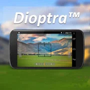
Dioptra™ Lite - a free camera tool 1.0.10
Dioptra™ Lite - a camera position and angle measurementtoolfornavigation, surveying, positioning, and measurement - -withover35,000 users! Stay tuned for an enhanced Dioptra app in2020withmore features, better sharing integration, andsupportingmorephones and devices! Instructions: Press the on-screencamerabuttonto save an image. View saved images in your device'sgalleryapp.[⊹] Dioptra™ Lite provides the following informationlikeatheodolite optical instrument - • yaw indicator (compass)•pitchindicator (tilt degrees) • roll indicator (tilt degrees)alongwith- • GPS position • azimuth and bearing to photo subjectTheancientgreek "dioptra" was a classical astronomicalandsurveyinginstrument, dating from the 3rd century BCE. Thedioptrawas asighting tube or, alternatively, a rod with a sight atbothends,attached to a stand. If fitted with protractors, it couldbeusedto measure angles. [⊹]
Dioptra Thrace Pro 1.16
Dioptra Thrace Pro is the tool you arelookingfor positioning, angle/slope measurment, navigationandsurveying.You can attacth text on your image, or save them as records.Dioptra Thrace Pro is a smart tool that combinestheodilete,dioptra, charts, excel files and virtual ruler.FEATURES-Measure angles using camera.-Capture images, record them adding your personal notes, and getMSExcel file from DiopThrace folder inside your device.-Visualize your measurements using bar or line charts oftheapplication.- Zoom in/out using pinch gesture.- Different reticle and font color styles- Selectible IMAGE RESOLUTIONS varying from 4096x2160pxto640x480px- Approximate measurement of distance to an object by settingit'swidth or height- Add live notes to image on previewInstructions- To capture image press capture button or press scren about3seconds- Swipe right to open navigation menu- Use pinch gesture to zoom in/outFeel free to contact us via [email protected] if youhavenew ideas we missed out, or suggestions to make this app or anyofour app better.Thanks for using our app.
Topography - Earthworks 1.9.0
Complete topographic leveling tool forbothfield work in road construction.Road-building tool: complete set of tools for leveling inroute,comprising:- Manager mile markers: from a txt file format, which previouslyweadded a list of mile markers, we can get the height offlushkilometer we need, even if present in a section withverticalagreement . And besides, at the time of calculating thelevel, willalso calculate the left and right camber (in the senseof lowerkilometer to kilometer higher), which correspond to thekilometercalculated. Obviously, these data are stored, and we usethem inreframing tab order to work with them.- Drag and closing levels: using leveled to reach the work area.Inthe case of drag, to reach the area, calculate our comparisonplaneand send it to the stakeout tab. To close, we will have allthenecessary functions to start the journey back, and get toourstarting point, calculating the closure of leveling.- Staking: starting from our grade level, camber, andcomparisonplane obtained in the tabs above, we can calculatequickly andeasily the elevation of any point we need in our roadlayout. Itcant be changed at any time, and update the datawhennecessary.Leveling routes registration and precise leveling- Normal Leveling: leveled reading log middle, andintermediatepoints function to register (name and its correspondingpointelevation) that are of interest to our work.- Precise leveling: read the three threads, and comparison ofthecentral wire read, with the central wire calculated bytheprogram.- All the level and intermediate points collected will be storedina txt file, to work with him later in cabinet.Points leveling tool: ideal for civil works. From a knownheight,we can get a comparison plane, and calculate levelingstaking anypoint we need, without having to calculators, oraccessories of anykind.
Topography APP 1.0.11
The Topography APP is an excellent application for georeferencingorland surveying, design of electrical networks, avenues,streets,subdivisions and studies in general.Export your surveys to DXF (Autocad), KML (Google Earth), CSV(MSExcel) without the slightest difficulty and the possibilityoftransmission by email of their withdrawals directly from thefieldto the office.In the Professional version you can mark up to 5000 pointsforsurveys.
Topografía básica 1.0
En CÁLCULO DE SUPERFICIES se puede obtenerlasuperficie de un tríángulo por el método de Heron y tambiénlasuperficie de un polígono de hasta 12 vértices mediante elmétodode coordenadas.En CÁLCULO DE COORDENADAS podemos pasar de coordenadas polaresarectangulares y viceversa. También de coordenadas geográficas aUTMy viceversa.En CÁLCULOS DE ESCALA obtendremos la distancia real o sobreelplano a partir de una distancia inicial. También se calculalatolerancia.En CÁLCULOS GPS SMARTPHONE se calcula la superficie deunpolígono de hasta 12 vértices por el método decoordenadasutilizando los datos obtenidos por el GPS deldispositivo móvil.También se calcula la distancia entres 2 puntos apartir de losdatos del GPS. En ambos métodos cuando aparecen lascoordenadas delGPS se debe accionar el botón de Salvar para quequeden fijadas lascoordenadas del punto una vez se considere que yaes un puntodefinitivo. Si se pierde el dato de cualquier vértice sepuedevolver a cargar el dato salvado la última vez mediante elbotónCarga. Es importante tener en cuenta que para la superficieodistancia calculada por este método la precisión obtenidadependede la precisión del GPS del dispositivo móvil, por tantolasuperficie final obtenida siempre diferirá de lasuperficiereal.In calculating areayoucan get the surface of a triangle by the method of Heron andalsothe surface of a polygon with 12 vertices using the methodofcoordinates.In coordinate calculation we can move from polar coordinatestorectangular coordinates and vice versa. Also geographiccoordinatesto UTM and vice versa.In scaling calculations we will get the actual or flat fromaninitial distance away. Tolerance is also calculated.GPS calculations SMARTPHONE the surface of a polygon with12vertices is calculated by the method of coordinates using thedataobtained by the GPS of the mobile device. 2 points enterthedistance is also calculated from the GPS data. In both methodswhenGPS coordinates appear to be driving the Save button toremainingfixed point coordinates when it is considered that it is afinalpoint. If the data of any vertex is lost can reload the lastdatasaved by Load button. It is important to note that for thesurfaceor distance calculated by this method the accuracy obtaineddependson the accuracy of GPS mobile, so the final surface obtainedalwaysdiffer from the actual area.
Bosch Site Measurement Camera 1.3
Site Measuring Camera- Input of measured values (e.g. measures of length, angleetc.)directly into a picture- Marking of specifics (wiring, connections, ventilation etc.)andaddition of side notes (voice recording, text, video)- Creation of new projects and folders- Send via e-mailThis app is provided free of charge by Bosch Professional,theleading manufacturer of power tools for trade and industry.Bosch Professional provides many other free digital toolsforyour smartphone. We summarized these in the "Bosch toolbox",theapp with many useful functions for craftsmen andotherprofessionals, including apps like a translator formeasurementunits.Naturally all Bosch Professional apps come in the usualhighBosch quality.Real Bosch! Real professional! Blue power tools: For tradeandindustry.
Smart Tools Laser Level 1.033
Smart Tools Laser Level is a tool tomeasureangle, slope or inclination using gyroscope, accelometerandcamera. It let's you to save your measurements to database andtakeexcel records whenever you need hard copy of yourmeasurements.Best laser level tool on the market.This version does not require user permissions, no locationandaddress updates and ruler is not available.If you want those features search Laser Level Capture fromThracianSoftware.FEATURES•3 diiferent measurement modes•Measure angles using gyroscope(if available), accelerometerandcamera.•Capture images with measurement, azimuth, bearing, pitch androllinfo•Visualize your measurement progress using bar or linecharts.•Fast and accurate and fast calibration option onmeasumentsscreen.•Freeze screen to have more precise measurements.•Use back and front(if available) camera to measure•Turn flash on if lighting is not sufficient where youmeasureFeel free to contact us via [email protected] if youhavenew ideas we missed out, or suggestions to make this app or anyofour app better.Thanks for using our app.This version contains ads, if you want to support us you can getthepro version.
Measure Angle 1.0.34
Our Measure Angleapplicationfunctionssimilarly to the theodolite surveyinginstrument that hasbeen usedfor generations while taking advantageof the tools onthesmartphone or tablet (GPS, maps,inclinometer,camera,magnetometer, etc.). In addition, thelongitude,latitude,altitude, azimuth, address (if available), dateand time,andhorizontal and vertical angles are overlayed ontothecameraviewfinder in real time and recorded when a photographistaken (ifdesired). The information is also recorded on amapincludingbearings, distances, and heights of objectsmeasured.Although thetool is primarily used by geologists,archaeologists,engineers,surveyors, architects and otherprofessionals, the devicecan beextremely handy for hikers andbikers, golfers trying todeterminedistances to holes, hunters, andtravelers in boats andcars.The height of a object can be determine by estimatingthedistanceto the object (or by determining the distance totheobject on a mapby simply touching the map) and pointingtheviewfinder at the bottomof the target and then the top ofthetarget.The distance to an object can be determine in severalways:byestimating the height of the object, by triangulationfromtwopoints, or by pointing to the object on a map.The power of our application is that the information cannotonlybe shared with various social sites such as Facebook,e-mailedtoothers, but also synchronized to a website we allow youtocreate soothers can see your work. Through the website, thedatacan beviewed in real time by friends, family and/orcolleagues.Thesynchronization also serves as a way to back up yourdatashouldyour phone or tablet malfunction in the field. If you donothaveweb access, the application will collect the data and storeituntila web connection is established. Once the data hasbeenuploaded,you can edit the data, create reports and/or maps,anddownload thedata or reports to spreadsheets and otherdocuments.Once yoursurveying or measuring is completed, youcanautomatically create apowerpoint or video of your work. Try it,itis free. You can alsoaccess the data via our websiteatwww.majorforms.com.


