Top 45 Apps Similar to Hunting Camera Manager


Dioptra™ Lite - a free camera tool 1.0.10
Dioptra™ Lite - a camera position and angle measurementtoolfornavigation, surveying, positioning, and measurement - -withover35,000 users! Stay tuned for an enhanced Dioptra app in2020withmore features, better sharing integration, andsupportingmorephones and devices! Instructions: Press the on-screencamerabuttonto save an image. View saved images in your device'sgalleryapp.[⊹] Dioptra™ Lite provides the following informationlikeatheodolite optical instrument - • yaw indicator (compass)•pitchindicator (tilt degrees) • roll indicator (tilt degrees)alongwith- • GPS position • azimuth and bearing to photo subjectTheancientgreek "dioptra" was a classical astronomicalandsurveyinginstrument, dating from the 3rd century BCE. Thedioptrawas asighting tube or, alternatively, a rod with a sight atbothends,attached to a stand. If fitted with protractors, it couldbeusedto measure angles. [⊹]


Speed Camera Radar (PRO) 3.2.5
★★★ This application does not contains any advertisements!★★★Thisapplication is used to detect hazards on the road, suchasspeedcameras (mobile ambush, static speed cameras, redlightcameras),speed bumps, bad roads and etc. This applicationusesdatabase ofhazards previously detected by other users.GETTINGSTARTED 1. Ifyou just installed the app you will need to goto menu"Updatedatabased" to download and install the latestdatabase ofspeedcamera for your region (country). 2. To run thehazarddetectionmode, press the "Start" button. at the bottom rightof thescreen.3. The application notifies only the dangers that arealongyourroute. 4. You can call main setting, swiping from the leftedgeofthe screen to the right. 5. You can call dangers filterthatyouwant to discover swiping from the right edge of the screentotheleft. 6. To add a new POI, tap + button close to the SPEEDatthebottom of the screen. 7. Sign in to edit and removecurrentPOI==========================================================Beforeyoubuy, you can first try the free version. Each user candevelopadatabase of hazards for his country. Please note,thattheapplication does not scan radiation police radar in realtimeforthe application is used only database hazards identifiedearlierbyusers. Any user can add new hazard to shared database.Alsousercan influence on rating of hazard (when user get dangeralerthecan define whether danger exists or not in fact).Theapplicationplays the sound and shows hazard on the map anddistanceto thishazard. If you are connected to the internet youwill beable tomonitor the traffic jams. There is a feature updatethedatabase ofthe hazards. The application may run in thebackground(even whenthe screen is off), just enable option "Usespeech whenhazarddetected". ★★★ Features ★★★ ★ Map or Radar viewmode (noneedInternet to render data) ★ Night mode adjustment onscreen ★3Dtilt on map support (3D buildings) ★ Map auto zoom androtationmapalong the way ★ Dashboard with current speed ★ 140000activehazards POIs around the world (check your country inFREEversionof this APP at first) ★ Daily database updates! ★Supportvoicealerts ★ Support of working in background or withotherNavigationAPPs ★ You can add their own POI toshareddatabase=================================================================Becarefulon the road and good luck!


Wear Camera
Easy control your phone camera from yourwatch!Be tricky spy, observe your pets, see back view from yourbicycleand more live scenarios with Wear Camera!Usage examples- Excellent selfie using high quality back camera;- Attach your phone to quadrocopter and create beautiful photousingyour device only!!!- Remote photo and video shooting. No need to ask a passerbytophotograph you;- Make interesting Timelapse sessions;- Radio babysitter;- Study hard to reach places;- Status of food when cooking;- Covert tracking;- The ability to see what is happening behind when you go onabike.Features- 3 recording mods: Photo, Video, Timelapse- connection by Bluetooth and Wi-Fi*- Show camera preview with quick response and good quality*- Set Preview resolution quality- Take photo and record video, even if your phone's screen is offorlocked- Switch between front and back camera- Set photo and video resolution for back and front camera- Quick change camera mode, flash mode- Set self-timer for photo and video recording- Set self-timer for Timelapse session- Zoom using seek bar- On/off shutter sound- Automatic rotation- No camera (preview) window on your phone. Nothing changesofbehavior on your phone.- Show results photo and video on device.- Show result photo on your watch.- All photo and video are saving to the "Picture" folder onyourdevice. (Look "Picture->WearCamera" folder)- Timelapse photos separate by folders for each session.- Voice command to start: “START WEAR CAMERA”*speed of data transfer depends on speed your Wi-Fi connection.(Incase If you don't use Bluetooth connection)*some phones are not compatible with preview in videorecordingmode.App review from Appliv:http://app-liv.com/android/en/26246152 ways to start the app1) Tap to Start- Just tap on your wear's face.- Scroll to the bottom and you can find the 'START' on thelistview.- Tap 'START' and scroll vertically a bit, you'll find'WearCamera'2) Voice commandsay 'START WEAR CAMERA' and wake up.Photo and video folders- All photo and video are saving to the "Picture" folderonyour device.You can open it using File Explorer ondevice.Look "Picture->WearCamera" folder- Also you can see it using "Folder" button (top left icon)onyour watch. In opened screen choose "watch" or"device"icon. Result video files can be opened on deviceonly (notwatch). Device and Android Wear must be paired before youuseit.To Sony's Xperia users"Turn off" the STAMINA mode,when you want to take picturewithscreen-off mode.(How to set:Setting>Power management>STAMINA mode)If you have a question, please feel free to contact [email protected]: You need to have an Android Wear Watch to be abletouse this app.Huawei Watch, LG Watch, Samsung Gear, Motorola Moto 360 etc.Also you canwriteto [email protected] if: - you have suggestions or comments- you want translate the application into your language;- you have any troubles using the app;- you found bug.Please write your e-mail with full description.


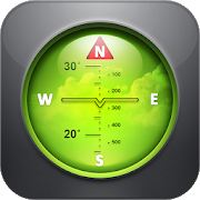
Compass Pro - with camera view 2.0
A very accurate compass withmanyfunctions:Spirit level, magnetic field, geo data (location).With the camera function you can 'look through' your device,focuson a point and get the exact cardinal point.No ads!Features:* Choose individual layout colors* Portrait and landscape mode (optimized for tablets)* Location (GPS or network)* Spirit level: acoustic and visiual feedback, decimalplaces,calibration, x and y values can be swapped* The rotation in horizontal position can be measured withthecompass* Strength of the magnetic field is displayed* App can be moved to sd-card* ...ONLY IN PRO VERSION:* No ads!* Set visual and acoustic indicator with a tolerance* Location can be displayed in decimal format* ...INFO:- You can't take pictures with this compass. If you want totakepictures as well, get the 'Level Camera' app in thePlayStore.- The precision of the compass depends on your sensor. Magnetsandelectric fields have a magnetic field and thus have an influenceonthe compass.PERMISSIONS:'Location': only used to display your location.'Camera': camera view can be set as background.


Measure Ground Control - Fly Drones & Manage Data 1.10.4
Measure Ground Control is an “all in one” drone deployment anddatamanagement software solution for UAV pilots, small businessesandlarge enterprises. Create a mission, plan a flight, checkairspace,and process your image data in a variety of formats, suchashigh-quality orthomosaics, 3D maps and 3D mesh, thermalimagery,digital surface models (DSM), and many more. Manage yourpilots anddrone fleet, create and reuse flight plans, store andmaintain flysites, build flight schedules, run safety checklistsand log flightdata, as well as create customized data reports. Withthe abilityto navigate seamlessly between the web and mobileapplications,Measure Ground Control features LAANC airspaceauthorization withbuilt-in Airmap technology, so you can fly anyairspace safely andFAA compliant. Process and create data productswith our advancedphotogrammetry and image processing featuring anintegrated Pix4Dtoolkit, or inspect and annotate image data usingour customScopito integration, all within the convenience of asinglesoftware application. Measure Ground Control offers multipleflightmodes including Panorama, Spotlight, POI, Profile, Trace,andTripod. Additional features can be activated for Enterpriseusers.Built for universal DJI compatibility. Device CompatibilityNot allAndroid compatible devices listed. Samsung (S20, S10, S9+,S9, S8+,S8, S7, S7 Edge, S6, S6 Edge, Note 20, Note 10, Note 9,Note 8)Huawei (P20 Pro, P20, P10 Plus, P10, Mate 10 Pro, Mate 10,Mate 9Pro, Mate 9, Mate 8, Honor 10, Honor 9) Vivo (X20, X9) Oppo(FindX, R15, R11) Xiaomi (Mi Mix 2S, Mi Mix 2, Mi 8, Mi 6, RedmiNote 5)Google Pixel 2XL, OnePlus (6, OnePlus 5T) Highlights Manualflightmode with live streaming Grid flight mode with terrainfollowCustom waypoint flight plans Mission creation and managementDronefleet & pilot management Image data processing &customreports Custom flight safety checklists LAANC digitalauthorizationrequest Flight logs & realtime flight info DJICompatibilityMavic (all) • Mavic 2 (all) including Smart Controller• Mavic Air1 • Phantom 3 (all) • Phantom 4 (all) • Exception beingthe P4PRTK- limited functionality • Inspire 1, 1 Pro and Inspire 2•Matrice 100/200/210 (all versions) • Matrice 600 & 600 Pro•Mavic Mini • Spark Plan a Mission Schedule and managemissioncalendar Assign pilots and equipment and send notificationsCreatea flight plan with a KML file, grid or waypoint plan Syncflightplans to the mobile flight app Check airspace and weather Fly&Collect Data Request LAANC authorization Retrieve and applyDJI GeoUnlock Fly with GPS-aided manual control, automated gridandwaypoint patterns Use active track modes including spotlight,POI,trace, orbit and profile Automatically upload flight logsandscreen captures Process & Analyze* Process imageryintohigh-quality data products powered by Pix4D Increaseimageprocessing accuracy with RTK drone data, or use GCPs infoCreateorthomosaics, digital surface models, and contour mapsMeasurelinear distance and area or add a 2D image layer to yourmapAnalyze data with our integrated Scopito annotation tool ReportandStore Data* Store unlimited flight logs, imagery, video,anduploaded files Track activity and compliance with built-inreportsExport and share data products (orthos, DSM, contours) asGeoTIFFor GeoJSON files Add inspection results and review missionandportfolio-level summaries Upload completed data products toeachmission Manage Operations* Access automatically uploadedflightlogs, including flight playback and screen capturesCheckautomatically flagged incidents for activity outside of safetybestpractices Add users, setup user profiles, control userpermissionswith pre-defined roles Manage equipment with automaticusagetracking Track program activity with dashboards and exportablePDFand CSV reports *Features only accessible via the MeasureGroundControl web application.


