Top 21 Apps Similar to Topography deposit
Topografía básica 1.0
En CÁLCULO DE SUPERFICIES se puede obtenerlasuperficie de un tríángulo por el método de Heron y tambiénlasuperficie de un polígono de hasta 12 vértices mediante elmétodode coordenadas.En CÁLCULO DE COORDENADAS podemos pasar de coordenadas polaresarectangulares y viceversa. También de coordenadas geográficas aUTMy viceversa.En CÁLCULOS DE ESCALA obtendremos la distancia real o sobreelplano a partir de una distancia inicial. También se calculalatolerancia.En CÁLCULOS GPS SMARTPHONE se calcula la superficie deunpolígono de hasta 12 vértices por el método decoordenadasutilizando los datos obtenidos por el GPS deldispositivo móvil.También se calcula la distancia entres 2 puntos apartir de losdatos del GPS. En ambos métodos cuando aparecen lascoordenadas delGPS se debe accionar el botón de Salvar para quequeden fijadas lascoordenadas del punto una vez se considere que yaes un puntodefinitivo. Si se pierde el dato de cualquier vértice sepuedevolver a cargar el dato salvado la última vez mediante elbotónCarga. Es importante tener en cuenta que para la superficieodistancia calculada por este método la precisión obtenidadependede la precisión del GPS del dispositivo móvil, por tantolasuperficie final obtenida siempre diferirá de lasuperficiereal.In calculating areayoucan get the surface of a triangle by the method of Heron andalsothe surface of a polygon with 12 vertices using the methodofcoordinates.In coordinate calculation we can move from polar coordinatestorectangular coordinates and vice versa. Also geographiccoordinatesto UTM and vice versa.In scaling calculations we will get the actual or flat fromaninitial distance away. Tolerance is also calculated.GPS calculations SMARTPHONE the surface of a polygon with12vertices is calculated by the method of coordinates using thedataobtained by the GPS of the mobile device. 2 points enterthedistance is also calculated from the GPS data. In both methodswhenGPS coordinates appear to be driving the Save button toremainingfixed point coordinates when it is considered that it is afinalpoint. If the data of any vertex is lost can reload the lastdatasaved by Load button. It is important to note that for thesurfaceor distance calculated by this method the accuracy obtaineddependson the accuracy of GPS mobile, so the final surface obtainedalwaysdiffer from the actual area.
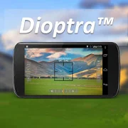
Dioptra™ Lite - a free camera tool 1.0.10
Dioptra™ Lite - a camera position and angle measurementtoolfornavigation, surveying, positioning, and measurement - -withover35,000 users! Stay tuned for an enhanced Dioptra app in2020withmore features, better sharing integration, andsupportingmorephones and devices! Instructions: Press the on-screencamerabuttonto save an image. View saved images in your device'sgalleryapp.[⊹] Dioptra™ Lite provides the following informationlikeatheodolite optical instrument - • yaw indicator (compass)•pitchindicator (tilt degrees) • roll indicator (tilt degrees)alongwith- • GPS position • azimuth and bearing to photo subjectTheancientgreek "dioptra" was a classical astronomicalandsurveyinginstrument, dating from the 3rd century BCE. Thedioptrawas asighting tube or, alternatively, a rod with a sight atbothends,attached to a stand. If fitted with protractors, it couldbeusedto measure angles. [⊹]
Topography - Earthworks 1.9.0
Complete topographic leveling tool forbothfield work in road construction.Road-building tool: complete set of tools for leveling inroute,comprising:- Manager mile markers: from a txt file format, which previouslyweadded a list of mile markers, we can get the height offlushkilometer we need, even if present in a section withverticalagreement . And besides, at the time of calculating thelevel, willalso calculate the left and right camber (in the senseof lowerkilometer to kilometer higher), which correspond to thekilometercalculated. Obviously, these data are stored, and we usethem inreframing tab order to work with them.- Drag and closing levels: using leveled to reach the work area.Inthe case of drag, to reach the area, calculate our comparisonplaneand send it to the stakeout tab. To close, we will have allthenecessary functions to start the journey back, and get toourstarting point, calculating the closure of leveling.- Staking: starting from our grade level, camber, andcomparisonplane obtained in the tabs above, we can calculatequickly andeasily the elevation of any point we need in our roadlayout. Itcant be changed at any time, and update the datawhennecessary.Leveling routes registration and precise leveling- Normal Leveling: leveled reading log middle, andintermediatepoints function to register (name and its correspondingpointelevation) that are of interest to our work.- Precise leveling: read the three threads, and comparison ofthecentral wire read, with the central wire calculated bytheprogram.- All the level and intermediate points collected will be storedina txt file, to work with him later in cabinet.Points leveling tool: ideal for civil works. From a knownheight,we can get a comparison plane, and calculate levelingstaking anypoint we need, without having to calculators, oraccessories of anykind.
DroidTopography v
=========USAGE:=========Start the App, wait for GPS signal and an accettablesatellitaraccuracy.- Tap Record button to start calibration, 5 points will becenteredto fit the best accuracy boundary- A point will be added to the survery- First point will be treat as the origin 0,0,0- All next points will mean the total cartesian distance fromthisexpressed in East, North, Elevation- With a minimum of 3 points a triangulation is performedanddisplayed directly in the integrated CAD.- When a triangulation occurred is shown surface area, volumeandperimeter- A single point can be changed by a form or directly on thegooglemap- The entire survey can be viewed on google map- All survey will be place into a fully readable folderconnectingto the USB cable- Some automations can be set to let the mobile to acquiredatapoints by a scheduled timer.- To export to DXF file open 'Manage Survey List' and press theDXFbutton after survey selectionScheduling acquisition points:is it possible to set a timer to automatically record the pointsatregular intervals. Convenient to measure embankments,bridges,wells, or linear long distances.Open "Global Settings"Sets a value <> 0 in the field "Record every x seconds"Hit the "back" button of the device, the settings areautomaticallysavedThis will activate the timer recording.Reset it to 0 to disable the timer=========INFO APP========Droid Topography is a simple way to collect measured pointusingGPSA combined free Windows Desktop tool named MapMe will help youtomanage the acquired data points from mobile just connecting ittoUSB device to compute topographic triangulation,contouring,kriging, voronoi, volumes, surface area and muchmore.GPS coordinates are acquired in LAT/LON WGS-84 format.Each point will be shown as cartesian x,y,z (E,N,Elev) andUTM,partial and total distances.The Unit measurement for the moment in only in meters.Next versions of the app will be concerning to introducemoreunitsLanguages supported:- English- Italiano- Espanol- Francais=============SETTINGS:==============eMail: registration address (only used forverificationauthenticity, are never sent messages)Basic fee: hypothetical difference between sea level andgeoidRecord every x seconds: Scheduling acquisition in secondsAccuracy points: minimum value of satellite Accuracy isacceptablebecause a pointHooking minimum SAT: the point is acquirable if there are at leastxsatellitesDist Point Double: Tolerance (in MT) for which a point isnotconsidered double and addedSpeed tolerance: To detect the stationing or not thedevice(increases accuracy)More Specifications:- Elevations are referred to the ellipsoid radius.- To calibrate a consistent elevation set the base elevationonsetting pane, this value will be subctrated to that aquiredfromGPS. Depending on the geographic area it should be aknownvalue.- Survey FileNames are composed by DTS.droid- User can choose the minimal distance to be considerduplicatepoints. In this case the point is skippedThis app is intended to be released as OpenSource projectSee GPL License for the terms of usage and distributionAll CopyLeft are reserved to the authorFabio Guerrazzi 2014eMail: [email protected]://vbgraphic.altervista.org/warehouseAbout The AuthorFabio Guerrazzi is not a company name or anypatentedproprietary.I am a single developer who loves coding math and graphic.This app and desktop tool are free
Geodesist
The handy application for performingbasicgeodetic calculations.It provides coordinates in 6 systems:- WGS-84- PZ-90 (RU)- PZ-90.02 (RU)- PZ-90.11 (RU)- SK-42 (RU)- SK-95 (RU)- GSK-2011 (RU)In each of these systems the coordinates can be represented in3projections:- Geodetic (latitude, longitude, altitude)- Gauss-Kruger (6-degrees zones)- Geocentric (X, Y, Z)It allows you to perform the following tasks:- Direct and Inverse Geodetic Problem. Geodetic coordinatesaresolved on the reference ellipsoid. Gauss-Kruger coordinatesaresolved on the plane with or without the height.Geocentriccoordinates are solved in space.- Conversion of Gauss-Kruger coordinates into other zones.- Calculation of the azimuth and elevation of the Sun at anygiventime at any observation point (your own location canbeused).It allows you to receive:- Your own location data (coordinates, accuracy, source andtime,direction and speed)- Information about navigation satellites (PRN, azimuth,elevation,signal/noise ratio, etc.)It allows you to save the coordinates of points (marks) forlateruse in calculations. The coordinates of points can bespecified inany of systems and projections (after saving the point,itscoordinates are automatically available in all other systemsandprojections). Also the coordinates of your own location canbeused.It allows you to export marks from the application to externalfileand import marks from external file into the application. Therearetwo formats available for export/import: GPX and innerGeodesist'sone. In GPX the marks are exported/imported as"waypoints" ("wpt"tag).Exported marks are stored in the file with specified name inthefolder named "Geodesist" at the internal storage of thedevice.These files are available for other applications, such asfilemanager (i.e. they can be copied, deleted, sent viaBluetooth,etc.).Marks can be imported into the application from files located inthesame "Geodesist" folder.It allows you to visualize your data (marks, etc.) on the mapbasedon the "Google Map" service (the latest version of the GooglePlayservices must be installed on the device).It allows you to add new marks directly on the map.The application has an original customizable interface andprovidesthe variety of formats for input and display coordinates,angles,and other variables.The application has a built-in hints. To learn more about workingina particular tab open the tab which you are interested in andcallthe "Menu"(green button on the toolbar) -> "Hint".
Niezbędnik Geodety 1.0
Niezbędnik Geodety jest aplikacjąprzeznaczonądla geodetów, studentów oraz wszystkich innych osób,które mająstyczność z geodezją. Ułatwia on wykonywanie obliczeńpoprzezwykorzystanie zaimplementowanych algorytmów izaprezentowanie ich wprzystępny sposób. Dodatkowym ułatwieniem jestprzygotowany systemobiektów oraz punktów niwelujący potrzebękażdorazowego wpisywaniawspółrzędnych i skracający go do zwykłegoimportu.Dostępne obliczenia:- Azymut i odległość,- Domiar prostokątny,- Kąt,- Pole powierzchni,- Przecięcie prostych,- Wcięcie liniowe,- Wcięcie kątowe w przód,- Wcięcie kątowe wsteczSurveyor Toolbox isanapplication designed for surveyors, students and all otherpeoplewho come into contact with geodesy. It facilitates thecalculationsby using the implemented algorithms and present them inanaccessible way. Another convenience is prepared system objectsandpoints of eliminating the need for re-entering coordinatesandreduce it to a simple import.Available calculations:- Azimuth and distance,- Offset rectangular,- Angle,- The surface area,- The intersection of simple,- Cut-linear,- Cut-angled forward,- Cut-back angle


