Top 9 Apps Similar to SkyDive


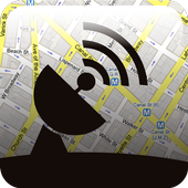
Satellite Director NG 2.3.26
Before buying this app: have you tried thefreeversion ?If you cannot install the free version your phone does not haveacompass, which is required for the director or pointing functioninthis app. Check "Satellite Locator" which uses GPS locationstofind a satellite.This app is simular to the free Satellite Directorbuthasadditional features, some may require the use of internet:- enter street and city to get your location coordinates- your location coordinates via network and/or GPS- find the exact location with the help Google Maps- see in satellite view above your location where to pointthedish- create your own satellite sat-lists with only those satellitesinit that you want using the build-in satellite list- reduce and sort the satellite list without restartingtheapp- on-line help pages- 'simple' mode without balancing the phone- export/import the satellite lists to SD card (backup)- overrule the build-in satellite list with your own list- vibrate- up to 6 satellites simultaniously displayed- display for your location and all satellites the valuesfor:azimuth, elevation and skew- the current location via the network- update the satellite list from a website (sats.csv,Enigmasatellites.xml, SatelliteCalculation) or a local file.- instead of finding a satellite find an antenna by gps locationoraddress.Warning: metal covers/cases or covers/cases withmetal/magneticclosure will influence/disrupt the compass of yourphone or tablet.Do not use these covers !!Finding a TV satellite, in azimuth, can be pretty difficult.Beforeyou can find it with a compass you have to do somecalculations using GPS location, magnetic variation, compassazimuthand satellite azimuth.Satellite Director replaces all of that.Just enable the GPS in your phone or enter your GPS location orusethe map to find your location,select the desired TV satellite and point your phone to the skytotarget (find) the TV satellite.Balance your phone. You have found the satellite when the whiteballis in the white circleand the cyan ball is in the cyan circle. Align the offset arm,inazimuth, of the satellite dish to the cyan arrow onthe phones display and the satellite dish is aligned in azimuthwiththe satellite.Selectable audio tone, camera preview, continuous mode (nopause),color pickers or a user defined satellite position may makeiteasier for you to find the desired TV satellite.There are 2 satellite lists: an extended list with 400+satellitesand a compact list with 220+ satellites or use your ownlist(mailed to the phone or downloaded, see Youtube how easy it istouse.).New phones with Android 4: remember that the "Settings" screenhasoptions to correct the compass readings, if needed.


True Bearing 0.7.1
True Bearing is a simple appthatdisplaysorientation and distance from your current locationtosomepoint-of-interest (a runway, a dive spot, a geocache,the9thgreen, etc) using Google maps and your mobile device'sGPS&internal compass. A point-of-interest (POI) can beselectedusingthe map, entered using latitude and longitude, setfromyourcurrent location, or recalled from memory.Possible uses include: aviation, diving, golf,hunting,andgeocaching. Set a POI from your current location whenyou parkanduse True Bearing to find you car later.FEATURES• Tracks your current location and the current trueheadingofyour android device• Select a point-of-interest (POI) using Google maps,byenteringlatitude and longitude explicitly, or fromyourcurrentlocation• Allows one to save a recall POIs• Displays in street mode or satellite view mode• Displays distance in: feet, yards, meters, kilometers,miles,ornautical milesRECENT CHANGESFor v0.7.1• Several bugs were fixed• General stability enhancements were implementedFor v0.7.0• The ability to save and recall POIs• Various auto-fit modes to help position and scale the map.• A new GUI that enables one to easily:- Set the POI from your current location- Bring up the lat/log POI dialog- Center and Fit the current bearing on the screen- Save and recall POIs• Various other small change


4G WiFi Maps & Speed Test. Find Signal & Data Now. 7.8.1-1
OpenSignal app is a powerful and freenetworksignal & wifi tool.Run a speed test to check connection quality to your ISP orcellnetwork, monitor data usage, compare coverage, viewconnectionhistory e.g. how much 4G you get. OpenSignal does itall.With free wifi maps & cell tower maps, you can see where togoto improve your wireless experience. Use coverage maps tocomparenetworks & data speed in your area.Download now to find high speed data and strong signal forcellcalls.Features✓ Cell tower direction - follow our signal compass tostrongersignal✓ Download, upload and latency tests - for 2G, 3G, LTEandwifi✓ Database of your speed test results so you can view test history-stored in app, so see results offline✓ Compare coverage and connection quality on a map✓ History of your mobile connection - see stats on yourconnectionto 4G and 3G and your data usage✓ Find fast wifi with our interactive wifi map✓ Free and no adsEasy, Fast Speed Test• Test download speed, upload speed and ping performance on yourISPor mobile network• High speed test - runs fast using a network of CDNs toshowrealistic measurements• Units in mbps and ms• History of results saved to a database - speed test history onamap• Speedometer style interface• Save to sd card as a CSV• Works for mobile and cable broadband (ADSL)Signal dashboard• Shows direction of your connected cell tower - walking towardsit,or out of the way of obstructions, can improvecellularconnection• Ping test for quick speed check• Signal strength in dB• Become a network master: get notifications when you have nodataor can't make phone callsCell and Wifi Maps• Where we have data, see the cell towers on *your* network-including, Verizon wireless, T Mobile, Sprint, AT&T,USCellular + more• Wifi hotspots map and list - find free wifi nearby• Unique network tools: signal compass, signal strength indBm• Uses Google Maps• By using the app you help crowdsource data - automaticallyaddingnetworks and wifisView history and stats• View data usage on wifi and cellular• How long have you had access to 4G (LTE), 3G or 2G, or spentinsignal notspots? See your stats for network availability• Save to SD Card as a CSV - see your history of LTE,3Gmeasurements and moreCompare networks with our coverage map• Interactive maps covering mobile networks worldwide• Compare performance on Verizon wireless, T Mobile,Sprint,AT&T, US Cellular and many more• Coverage checker for if you're moving home or going abroad, seeifyou can make calls or get fast data• View average speeds for download, upload and latency andnetworkstrength• 100% independent, our data is based on real measurements fromappusersCrowdsourcingSince launching in 2010, OpenSignal has built the largestglobaldatabase on mobile performance.With hundreds of billions of readings of mobile networksignalstrength and speed tests, OpenSignal shows the performancewhereyou live. Download the app to automatically contribute dataonspeed and 2G, 3G and LTE signal, or you can choose to turn offdatacollection settings.Want to check app performance - know if you can get fast videoonYoutube, or if WhatsApp will send messages - check our sisterappMeteor which is powered by OpenSignal technology.PermissionsLOCATION so we can show you nearby wifi and antennasPHONE SETTINGS allows network reset on some Android OSsSMS required to count the number of SMS sent to track yourusage,SMS are never read (use a packet sniffer to check!)Advanced NotesOn CDMA networks such as Verizon and Sprint you will seefewertowers than on GSM networks such as T Mobile andAT&T.Supported languages:English, Spanish, Italian, German, Portuguese (Brazil&Portugal), Indonesian, ThaiHelp test and develop features! Join the OpenSignalbetahttp://opnsg.nl/beta-community to help us improve theapp.We're developing other advanced network tools - we'd love tohearfrom you
GPS satellite navigation 2.0
GPS satellite navigation is The World’sMostInstalled online turn-by-turn GPS navigation applicationforAndroid phone powered by google maps.GPS Navigation and maps are installed on the online so there isneedfor an Internet connection when navigating. Map andapplicationupdates are FREE All lifetime. Our application canroute you aroundaccidents, help with multi-stop directions andeven has alternaterouting capabilities, robust bookmarkingoptions, and handy sharingfeatures. Map quest is here to help getyou where you need to go,wherever life takes you. Is your go-toapp for live maps , GPS , andlive traffic updates. Whether you’rerunning a quick errand acrosstown or taking a road trip across thecountry, map quest has thetrusted directions and traffic info youneed for stress-freenavigationThis application is completely secure and thorough in theresearch.You are able to be assured about reaching your locationspromptlywith this particular application for effective satnavtechniques