Top 48 Apps Similar to Leica Zeno Connect
Kronodesign® 3.3.2
A handy mobile tool to mix and match different decors,colorsandtextures that helps you to choose the bestcombinationofKronospan’s materials any time, anywhere. It is theperfectguideto visualize your ideas, apply your favorite designsintodifferentliving areas in the moodboard section and recreatetheinteriorstyle you like. With the Kronodesign app we bring panelstolife,and life to panels. Features: - Offline catalogue ofthedecorsfrom the Global Collection. Enlarged full-screen view.-Intuitivenavigation and detailed filters by collection, typeofproduct,texture and application, providing you with fastsearchresultsanywhere and at any time; - Predefined range ofmoodboardstovisualize your interior design ideas; -Additionalinformationabout the core materials for each decor; -Recommendeddecorscombinations; - Ability to save your favoritedecors anddownloadyour moodboard in a high-resolution; - Ability tosaveyourcreations in a project and edit them again later or sendthembyemail; - Optimized for all Android 4.2 devices and above;
Particle Board Furniture PRO 1.13
Do you want to :- Make your furniture without professional knowledge?- Select size in inches or mm?- Quickly create a detailed plan on how to build furniture?- Find out how much material you need and estimate theapproximatecost?- Have all the necessary information on your phone or tablet?Yes? Then this app will help you!In the PRO version you can :- Edit the settings, which includes: the thickness of thechipboard,the wall depth, the facades clearance, and the socleheight;-Keep all of the pieces of furniture, with the ability to editanddelete.The application is designed for home and professionals.Several types of furniture are included:- A box with one and two-doors;- A box with a socket and one or two-doors;- A standard table;- A computer table.Select a furniture, using the paging function.Then enter the external dimensions of the product and quantityofshelves.Review the calculation of the products and materials.Results can be downloaded to a csv (spreadsheet) file or senttoemail, for example, to a sawyer company.Your payment will be used for improvement of the application.Thankyou!
OLYMPUS Image Track 2.2.0
Paired with a compatible Olympus camera,theOlympus Image Track (OI.Track) smartphone app makes photographyonjourneys even more enjoyable. With this app, you can updatethecamera's GPS assist data, and display the trails taken orverticaldistance traveled along with your images.1. Display images and track data on your smartphoneDuring your journey, send your camera's track data by Wi-Fi toyoursmartphone and you will be able to check the progress that youhavemade on your journey thus far. Track data will bedisplayedtogether with images for easy identification.* Display of movies and altitude/depth data is only possiblewhenusing compatible cameras. Compatible cameras:StylusTG-Tracker2. Organize track data and images on your smartphoneManage your images and track data imported to your smartphoneassingle Activities. Relive the excitement of the moment andthefeeling of accomplishment by viewing the track data togetherwithyour images.* Display of movies and altitude/depth data is only possiblewhenusing compatible cameras. Compatible cameras:StylusTG-Tracker* On Android devices, 4K videos will be resized and saved as FullHDvideos.3. Make Your Videos Fun to WatchCombine Track Data with recorded footage for exciting videos youcanshare with your friends.* Maximum image quality of videos edited on a device is Full HD30fps.4. Update GPS Assist DataUse your smartphone to download the latest GPS assist dataandtransfer it t your camera by WI-Fi, to drastically shortenlocationacquisition time, whenever and wherever you are.5. Easy SetupAll you need to do is scan the QR code displayed on the screen ofacompatible camera with OI.Track to easily set up Wi-Ficonnectionsettings.* This app is not guaranteed to work on all Android devices.* Compatible Cameras : Stylus TG-4, TG-3, TG-870,TG-860,TG-Tracker* Wi-Fi is a registered trademark of the Wi-Fi Alliance.
Topography APP 1.0.11
The Topography APP is an excellent application for georeferencingorland surveying, design of electrical networks, avenues,streets,subdivisions and studies in general.Export your surveys to DXF (Autocad), KML (Google Earth), CSV(MSExcel) without the slightest difficulty and the possibilityoftransmission by email of their withdrawals directly from thefieldto the office.In the Professional version you can mark up to 5000 pointsforsurveys.
QField for QGIS - EXPERIMENTAL 1.9.3
QField focuses on efficiently getting GISfieldwork done.The mobile GIS app from OPENGIS.ch combines a minimal designwithsophisticated technology to get data from the field to theofficein a comfortable and easy way.QField unleashes the full power of the QGIS styling engine tobringyour customized maps to the field, collect attributes forfeatureswith configured edit widgets like value lists, checkboxes,freetext or pictures taken with the device camera.QField is an open source project, the documentation, muchmoreinformation, the source code and possibilities to to supporttheproject can be found at qfield.org (preferred) or by buyingtheQField for QGIS Karma editionapp(http://qfield.opengis.ch/karma).QField is built from ground up to be touch oriented and easy touseoutside.It is based on a few paradigms● GPS centric● QGIS desktop compatible● Fully working when offline● Synchronization capabilities● Project preparation on desktop● Few and large buttons● Mode based work (Display, Digitizing,Measuring,Inspection,...)QField is built using Qt5, QtQuick 2 (both are supportedandsuggested by Qt) and OpenGL so it is future proof and itspearheadsQGIS towards Qt5.OPENGIS.ch is happy to help you with the implementation ofmissingfeatures. Contact us at http://www.opengis.ch/contact/For bug reports please file an issueathttps://github.com/opengisch/QField/issues
Nuwa 2.2.7.0
Nuwa is a survey & data collection App developed byTersusGNSSInc. With Nuwa you can connect Tersus David GNSSreceiverviaBluetooth or USB that turns any Android devices intoRTKbase,rover or GIS data collector. This App providesvariousbuilt-insurvey tools. Key Features: 1) AssistswithBluetooth/USBconnection 2) Configure base/rover setup 3)Visualizedinterfacefor receiver operations 4) Data management(import/export)
Survey Master 2.7.1.200927
With Suvery Master you can survey though Topo survey/Autosurvey,Static and PPK modes; edit and stake points/lines. Also thisAppprovides a convenient way to import/export surveying datafiles,supporting data formats: TXT, CSV and AutoCAD DXF. Try it nowforFREE! Note: Please keep Bluetooth on your phone opened, sothatSurvey Master and T300 receiver can connect successfully. HOWITWORKS 1) Create a new survey project 2) Manage datum systems3)Connect with T300 GNSS receivers via Bluetooth 4) GNSSsurveys(Field data collection) 5) Data files output
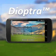
Dioptra™ Lite - a free camera tool 1.0.10
Dioptra™ Lite - a camera position and angle measurementtoolfornavigation, surveying, positioning, and measurement - -withover35,000 users! Stay tuned for an enhanced Dioptra app in2020withmore features, better sharing integration, andsupportingmorephones and devices! Instructions: Press the on-screencamerabuttonto save an image. View saved images in your device'sgalleryapp.[⊹] Dioptra™ Lite provides the following informationlikeatheodolite optical instrument - • yaw indicator (compass)•pitchindicator (tilt degrees) • roll indicator (tilt degrees)alongwith- • GPS position • azimuth and bearing to photo subjectTheancientgreek "dioptra" was a classical astronomicalandsurveyinginstrument, dating from the 3rd century BCE. Thedioptrawas asighting tube or, alternatively, a rod with a sight atbothends,attached to a stand. If fitted with protractors, it couldbeusedto measure angles. [⊹]
CartoDruid - GIS offline tool 0.60.16
CartoDruid is a GIS application developed by InstitutoTecnológicoAgrario de Castilla y León (ITACyL) thought as a tool tosupportthe fieldwork aiming to solve the problem of disconnectededitingof georeferenced information. In many field areas, mobilecoverageis insufficient to work in a reliable way. CartoDruidprovides asolution to this problem allowing the visualization onraster andvectorial layers stored on the device and allowing thecreation ofnew geometries (entities), drawing them directly on thescreen orusing embeded or external GPS. CartoDruid doesn't requierepreviousGIS (Geographic Information Systems) knowledge and it'seasy toconfigure and use. This allows any person to use it tomanagefieldwork information and then export generated data to usethem inexternal applications. What can CartoDruid do?: - VisualizeonlineGoogle Maps. - Use vectorial cartography loaded on aSpatiaLitedatabase. - USe rasterimaginery loaded on a RasterLitedatabase. -Consume online WMS services. - Create new layers on thedevice. -Configure filtering on vectorial layers to determinevisiblegeometries based on their attributes. - Configuresymbologies andlabels based on SQL expressions (easily). -Configure searches onlayers using SQL queries. - Configureidentification forms based onSQL queries. - Edit the attributes ofa geometry. - Manually drawgeometries: points, lines and polygons.- Draw and edit geometriesbased on GPS data. - Edit geometriesusing several useful tools:split using polyline, circular split,merge geometries, multipartexplosion. Graphically move existingvertices of geometries. -Create new geometries intersecting layers.- Automatically savegeorreferenced data: creating and update datesand others. -Associate pictures to entities. - SIGPAC search basedon existingdownloaded data. - Length and area measurement tools,defining themeasurement units. - Guided and line based navigationto help theuser reach her destination. - Manage bookmarks. - Importvectorialdata using CSV files. - Import SpatiaLite databases. -Exportseveral formats: SQLite, KML and CSV. - TOC (Table ofContents)management: sorting, symbologies, hierarchical sorting(folders). -Works with SHP (ESRI ShapeFile) as an exprimentalfeature. -Controlling the operations that can be performed on alayer viaconfiguration (overlaps. move vertices. deleteentities,identification and edition, ...) Go visitwww.cartodruid.es to seethe complete list, download examples andlearn how to start!
MobileSTAR 21.2.0.69
The latest release of MobileSTAR (formerly DeliveryConnect)ispowered by BluJay Solutions' logisticsapplicationframework.MobileSTAR helps to create smarter deliverycompanies byallowingthem to track and manage goods throughout theentirecollection anddelivery process, ensuring first time, on time,everytimedeliveries. The framework underpinning MobileSTARallowscustomersto take immediate advantage ofpre-configuredMobileSTARapplications built from BluJay Solutions'knowledge andexpertiseof the T&L market. These applicationsincludereal-time trackand trace, proof of delivery (POD),scanning,despatching, on theroad, routing and schedulingcapabilities, andactive two-waycommunication between the consigneeand deliverydriver. Inaddition to making it easy for customers tohit theground runningwith the deployment of pre-configuredapplications,BluJaySolutions understands that one size does notalways fit all.Theframework allows BluJay Solutions customers toquicklymakefunctionality changes to existing BluJay applicationstomatchtheir individual business processes. The frameworkhasbeendeveloped so that screens, process flows and logic arealldrivenby configuration and can be deployed at runtime.Anotherimportantease-of-use capability allows users to quicklyandseamlesslyswitch between applications. In order todownloadconfigurationsplease contact BluJay Solutions. Contact ustoday tofind howMobileSTAR can transform your operations.Disclaimer:MobileSTARtracks location while in the foreground andbackground.This is sostakeholders always know where their shipmentsare duringthe firstand last mile.
Structural 12.4.0
Structural brings together your people data to create amoreagile,connected, and productive enterprise. Rich profilesalloweveryonein your organization to access the full breadthavailabletalent bysurfacing skills, experience, contactdetails,reportingstructures, and more. Structural’s built-incommunicationandsegmentation tools allow you to send the rightmessages totheright audiences and collect feedback in real time.Plus,smartnotifications and on-demand resources keep you up todatewithinternal milestones, birthdays, policies, and company news.
LandStar 7 7.3.5.1.20210526
Developed by CHC Technology Co., Ltd(www.chcnav.com), LandStar7isthe newest field-proven software solution for Android.Designedforhigh precision surveying and mapping tasks for youreverydaywork.If you are new to LandStar 7, you will be impressed byitsseamlesswork mode management, easy-to-use andeasy-to-learngraphical userinterface with simple operation.Extensive dataimport/exportformats and multiple types ofmeasurement and stakeoutmethodsensure instant productivity. TopFeatures: 1.One-buttonSwitchingDual Styles Simple Style, forentry-level surveyors, withbasicfunctions in one screen. ClassicStyle, for professionalsurveyors,with all functions showing indifferent tables based onthefrequently used work flow. 2.VariousBase Map Displays OSM,BING,Google, WMS online maps. DXF, SHP, TIF,SIT, KML, KMZ offlinemaps3.Extensive Import and Export Data FormatsImport from DXF,SHP,KML, KMZ, CSV, TXT and CGO formats. Export toDXF, SHP, KML,KMZ,RAW, HTML, CSV, TXT formats. Customized importand exportcontentsin CSV or TXT formats. 4.Various Types ofMeasurementSupportsstatic, RTK and stop & go measurement. 7methods ofpointmeasurement, including topographic point, controlpoint,quickpoint, continuous point, offset point, EBubblecompensatedpointand corner point. 5.Various PeripheralsSupportedPipelinedetector, VIVAX-METROTECH vLocPro2. Laserrangefinder,LeicaDisto,SNDWay and Bosch. Echo sounder,sonarmite,NMEA DPT andDBT.6.Convenient Work Mode ManagementPresetting common work modesofbase and rover, switching work modesby one button. Convenienttowork in stop&go based on real-timekinematic (RTK) modeandstatic mode can be set at the same time.7.Standard CGDcorrectionfile CHCNAV own CGD file for grid/geoidcorrection. Datumgrid,plane grid and height geoid files areintegrated in one CGDfile,and each CGD file name is correspondingto coordinatesystem.Multiple grid formats are available, GGF,BIN,GRT, GRD,GSF,GRI,BYN,ASC. 8.User-friendly Stakeout InterfaceTwo modesforstakeout, map mode shows the current position andtargetposition,compass mode shows the target direction. Users cansetNorth, Sunor point as a reference direction. 9.Multiple TypesofStakeoutPoint and line stakeout by snapping feature point onDXFbase mapor survey point. Surface stakeout with 3D DXF, XML,HCTformats.10.Correction Repeater Function Easily repeatingcorrectiondatafrom RTK network or radio mode to other rovers viaradio.RTCMTransformation Message Using RTCMtransformationmessages(1021-1027) for datum transformation,projection, automatedgridposition and geoid adjustments. 11.CHCNAVCloud Service Allowsforuploading and downloading projects,coordinate systems, workmodesand code lists. 12.Quick Data ShareUse Gmail, WhatsApp,GoogleDrive, Skype to share your data Shareyour projects,coordinatesystems, points, work modes, codes, reportsandresults.13.Powerful Road Functions Create road elements infield,perfectlymatch your design data. Support center line,crosssection,profile, slope, structure, culvert and stakes.Differentviews areavailable for stakes, slope, structure and datacheck.14.FieldHardware Support Supports CHC i90 with firmwarev2.0.11,i80/i70/M6receiver with the firmware v1.6.55, i50 receiverwith thefirmwarev1.0.38, X91+/X900+ receiver with the firmwarev8.39 andabove, aswell as internal GPS of Android smartphone andhandheldcontroller.15.Data Collection Hardware LandStar 7 used withCHCHCE320 is themost compatible way, it can also be used withCHCHCE300, LT600,LT700, LT700H or other Android devices of v4.2andabove.16.Language support LandStar7 is available inBulgarian,Croatian,English, Finnish, French, German, Greek,Hungarian,Iranian,Japanese, Kazakh, Korean, Persian, Polish,Portuguese,Russian,Simplified Chinese, Spanish, Slovak,Thailand,TraditionalChinese,Turkish,Mongolian and Vietnamese.


