Top 45 Apps Similar to Meter Toolbox
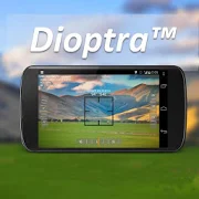
Dioptra™ Lite - a free camera tool 1.0.10
Dioptra™ Lite - a camera position and angle measurementtoolfornavigation, surveying, positioning, and measurement - -withover35,000 users! Stay tuned for an enhanced Dioptra app in2020withmore features, better sharing integration, andsupportingmorephones and devices! Instructions: Press the on-screencamerabuttonto save an image. View saved images in your device'sgalleryapp.[⊹] Dioptra™ Lite provides the following informationlikeatheodolite optical instrument - • yaw indicator (compass)•pitchindicator (tilt degrees) • roll indicator (tilt degrees)alongwith- • GPS position • azimuth and bearing to photo subjectTheancientgreek "dioptra" was a classical astronomicalandsurveyinginstrument, dating from the 3rd century BCE. Thedioptrawas asighting tube or, alternatively, a rod with a sight atbothends,attached to a stand. If fitted with protractors, it couldbeusedto measure angles. [⊹]
AndMeasure (Area & Distance) 2.0.7
The AndMeasure tool allows you tomeasuredistances and calculate area between points on a map.The tool has virtually unlimited applications. Use itPROFESSIONALLYfor measuring distances and areas in landscaping,lawn care, waterline measuring, paving and fencing. Use it infarming, agricultureand forestry to measure your fields andforests. Realtor's can useit for showing clients distances tocertain landmarks.For RECREATIONAL use, it can be used in measuring off-roadroutes,plotting running courses, water trips, range estimation attheshooting/driving range. Use it in Golf for gettingreal-timedistance to the green.★★★ Featured on AgWeb.com powered by Farm Journal ★★★"This app could be an easy way for farmers to measure newfields."March 2012Features:● Use it as a ruler on a map to calculate the distancebetweenmultiple points● Calculate areas in acres, sq miles, sq feet, m2, km2,Hectare,Ares● Measure the distance to your location from multiple pointsinreal-time using the "continuous mode" feature● Switch between Satellite, Hybrid, Terrain and normalmapmode● Find your current location via GPS or Network● Share measurement and screenshot via email and Google Drive● Add markers to the map either via tap or by dragging from the"addbutton" to get super accuracy● Move markers around to get precise measurementKeywords: map, maps, area, distance, length, ruler, gps, golf,areacalculator, range finder, map measure, area measure,distancemeasure, field area measure, surface measurement, realestate,realtor, GPS measure, solar, landscape, areacalculation,planimeter, efarmer, perimeter, landscaping, garden,fencing,acreage, terrain, geographical, property, geo,agricultural,calculator, forest, farm, field measure, location,roof area,solar, solar panel roof area, outdoor, snow removal,farmlogs, landcalculatorLanguages: English (write an email if you want to help withothertranslations)Get it at:https://play.google.com/store/apps/details?id=com.megelc.andmeasureFacebook:http://www.facebook.com/andmeasurePrivacy Policy:AndMeasure does not store any personal information at all.HoweverGoogle Analytics is used in the app to better understand howtheapp is used and performs.The Google Privacy Policy can be found here:http://www.google.com/intl/en/policies/privacy/
Altimeter Offline Pro 1.3
Altimeter not need phone signal orinternetconnection to work with high elevation accuracy. Accuracyimprovedgeoid compensation. Ideal for hiking, treking and climbs inmediumand high mountain, where the telephone is often lacking and3ghedge.Improved Altimeter Offline Version. Improvements: more precisely, to write data to yourroutes(maximum height, initial height, climbed, cumulative height,date...), record your historical record of maximum height andadjuststhe refresh rate of the sensor to save battery.Geographical coordinates displayed(longitude and latitude).This application saves your highest elevation automatically.Only need a phone/tablet with GPS sensor.Know your altitude always.Elevation showed in meters and feet. High accuracy inelevationdata.
Compass Pro - with camera view 2.0
A very accurate compass withmanyfunctions:Spirit level, magnetic field, geo data (location).With the camera function you can 'look through' your device,focuson a point and get the exact cardinal point.No ads!Features:* Choose individual layout colors* Portrait and landscape mode (optimized for tablets)* Location (GPS or network)* Spirit level: acoustic and visiual feedback, decimalplaces,calibration, x and y values can be swapped* The rotation in horizontal position can be measured withthecompass* Strength of the magnetic field is displayed* App can be moved to sd-card* ...ONLY IN PRO VERSION:* No ads!* Set visual and acoustic indicator with a tolerance* Location can be displayed in decimal format* ...INFO:- You can't take pictures with this compass. If you want totakepictures as well, get the 'Level Camera' app in thePlayStore.- The precision of the compass depends on your sensor. Magnetsandelectric fields have a magnetic field and thus have an influenceonthe compass.PERMISSIONS:'Location': only used to display your location.'Camera': camera view can be set as background.


