Top 20 Games Similar to Altimeter - Altitude, GPS, Compass

Altimeter Offline Pro 1.3
Altimeter not need phone signal orinternetconnection to work with high elevation accuracy. Accuracyimprovedgeoid compensation. Ideal for hiking, treking and climbs inmediumand high mountain, where the telephone is often lacking and3ghedge.Improved Altimeter Offline Version. Improvements: more precisely, to write data to yourroutes(maximum height, initial height, climbed, cumulative height,date...), record your historical record of maximum height andadjuststhe refresh rate of the sensor to save battery.Geographical coordinates displayed(longitude and latitude).This application saves your highest elevation automatically.Only need a phone/tablet with GPS sensor.Know your altitude always.Elevation showed in meters and feet. High accuracy inelevationdata.


Altimeter Ler Live Gps Geotracker 2.6
Modern Altimeter GPS+ app is for folks who care for hikingandbikingin mountainous terrain. GPS is getting very accurateinterms ofdistance indication. The choice between unit systemisperhaps animportant thing, just for your convenience the appisbeing equippedwith both of them (Imperial andMetric).Surprisingly strongbarometer measures the weight of theairpressure above a given pointand determines elevation oftwopoints. This app has a creativeand user-friendlystyledesign, simple and comprehensivefunctionalities. Featuresincluded- Imperial and Metric unitsettings. - GPS accuracyindicator. -GPS distance accuracyindicator. - Density of air ,indicator.Search any place and dropsearch pin with place info.Built inlibrary Map integration - GOOGLEmaps - Satellite mapsmode. -Hybrid maps mode. - Standard maps mode.- Terrain maps mode.-Tracking location changes trajectory. Compass- Compass withcamera- Take a pictures with coordinates - Showsdevicereal-timeorientation to magnetic fields. - Ability toswitchbetween trueand magnetic North. - Location coordinates(longitude,latitude). -Course Track information - Time elapsed. -Distance. -Averagespeed. - Max speed. - Altitude. Tracking - Speedtracking inmph orkm/h based on MPH or KM/H mode. - Distancetracking in milesorkilometers based on MPH or KM/H mode. - Timetracking. -Longitude,latitude coordinates. - Save locations drop apinWeather --Temperature information. -- Wind --Visibility--Sunrise,Sunset -- High/Low Temperature. --Abilitytoswitch between Celsius and Fahrenheit.


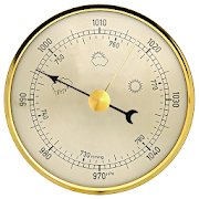
Altimeter & Altitude Widget 4.57
DS Altimeter is an elevation meter,elevationlogger, and altitude mapper. In addition to showing andoptionallytracking your altitude, the app allows you to search thealtitudefor other locations as well.You can select from the best sources of elevationdata,including:1. Location based altitude from NASA's Shuttle RadarTopographyMission2. Satellite based altitude (GPS altitude) corrected toheightabove mean sea level (AMSL)3. Get actual land survey altitude values for your locationfromthe United States Geologic SurveyDevices equipped with a barometer sensor can also obtainpressurealtitude which is converted to true altitude. For the mostprecisereadings, calibrate the pressure altitude by entering areferencevalue or by selecting one from the app's dynamic list ofnearestairfields.USGS (United States Geologic Survey) altitude results arealsoavailable for customers in the contiguous United States, CanadaandMexico.DS Altimeter also works offline: barometric altitude andGPSaltitude corrected to elevation above sea level do not requireaninternet connection.NEW IN DS ALTIMETER: Record altitude profiles and elevationtracksfor your favorite journeys to the highlands, the lowlandsandeverything in-between!Upgrade the application to pro and gain access to even morefeaturesincluding the Altimeter Widget and variousbarometricaltimeter calibration methods.Going skiing? Record your ski run with DS Altimeter, then viewyourski trail with its elevation points on the included maps.Mininumand maximum altitude points for your run will beclearlyshown.Altitude mapping, altitude search and bathymetry (lake andseadepths) are also included with DS Altimeter. Tap anywhere on amapto get the altitude or water depth at that location.* The perfect altimeter for skiing, hiking, mountain climbingandother outdoor sports, boating, marine navigation and anytimeyouare curious about your elevation!


TOP tours: Bolzano & environs 1.9.13
Whether in spring, summer, autumn or winter ...a holiday inBolzanoand environs is good for body and soul and offers a broadvarietyof hiking trails and destinations. Hiking and biking loverswillenjoy the comfortable temperatures in this culturallandscape,which is full of history. Top 7 destinations: – GeoparcBletterbachand Monte Corno Nature Parc: The ‘Grand Canyon’ of SouthTyrol wasformed about 15,000 years ago. It is nearly 8 km long and400metres deep and is part of the Dolomites UNESCO World Heritage.–Lago di Caldaro/Kalterer See and Laghi diMonticolo/MontigglerSeen: During the summer, the popular bathinglakes of the UpperEtsch region are a great destination if you wantto escape theheat. – South Tyrolean Wine Road: On more than 40kilometres, theSouth Tyrolean Wine Road invites you to a tour ofdiscovery throughthis blessed part of the world ... and its wines.– Saltenmountain: The sunny high plateau above Bolzano with itsphenomenalpanoramic views and Europe’s largest larch meadows is anidealstarting point for hiking trips, cycling or horse riding. –ValSarentino Alps: 100 summits and peaks crown the ValSarentino.Hikers, mountain bikers, friends of winter sports and skitours, aswell as snow-shoe hikers can find a fascinating variety ofholidayoffers in this valley. – Renon/Ritten: All year round, theRittenmountain is accessible for hikers and during the winter,awell-marked hiking trail has turned into the firstaward-winningwinter premium hiking path in Italy. – Bolzano,capital ofSüdtirol/Alto Adige: There are three cable railwaysstarting in theMediterranean wine town of Bolzano and reaching upinto the highermountain regions (Colle/Kohlern, Renon/Ritten,SanGenesio/Jenesien). A first step into the Bolzano andenvironsregion is definitely worth taking. In any season!Attention: whenusing the app abroad you may incur in high roamingcoasts. Yourbattery may run short when using the app in thebackground with anactivated GPS!


Compass Pro - with camera view 2.0
A very accurate compass withmanyfunctions:Spirit level, magnetic field, geo data (location).With the camera function you can 'look through' your device,focuson a point and get the exact cardinal point.No ads!Features:* Choose individual layout colors* Portrait and landscape mode (optimized for tablets)* Location (GPS or network)* Spirit level: acoustic and visiual feedback, decimalplaces,calibration, x and y values can be swapped* The rotation in horizontal position can be measured withthecompass* Strength of the magnetic field is displayed* App can be moved to sd-card* ...ONLY IN PRO VERSION:* No ads!* Set visual and acoustic indicator with a tolerance* Location can be displayed in decimal format* ...INFO:- You can't take pictures with this compass. If you want totakepictures as well, get the 'Level Camera' app in thePlayStore.- The precision of the compass depends on your sensor. Magnetsandelectric fields have a magnetic field and thus have an influenceonthe compass.PERMISSIONS:'Location': only used to display your location.'Camera': camera view can be set as background.