Top 32 Apps Similar to GPS Status Test & Route Finder

Maps Tracker and GPS Navigator 1.0
The nicest GPS test, status and diagnoseapp!Ifyour gps navigation works horrible use this app to gpstest,diagnoseand fix your problem. GPS Route Finder is a easyandGraphical baseduser interface which acts as it says. Easilydeleteyour completephone location history just by clicking on theclearhistory Tab.Best Mobile Locator App for your Android device.Viewyour completelocator points on map with date wise.Shareyourcurrent location withone click. Easy way to share yourcurrentaddress with position.GPSRoute Finder is your personalapplicationthrough which you caneasily track all the locations youhavevisited. Its a simple appthat helps you to track yourownlocations on date wise. Just pinstart point and end point andgetwalking route and drivingroute.
Mobile Number Location GPS 1.2
Do you want to be constantly updated bycurrentlocation of you loved ones? Are you worried by your lostphone anddidn’t remember where you left it? Mobile Number Trackerallows youto search and locate mobile number and fixedline/landline phonenumber in the world including 246 countries.Mobile Caller NumberLocator Shows the Caller Location informationlike Area and operatoron your mobile phone screen during Incomingand Outgoing calls. Thisapplication Mobile Number Location Trackerwill show Caller Locationand his Operator name and caller locationplace means state. CallerName and Location: You can easy see whois calling and identifyunknown incoming calls with caller name andlocation information.When you have this Mobile Number Trackerapplication in your device,you can easily get the caller details.Never get dodged by your fakefriends, that are continuouslykeeping you updated with fake causesof not meeting you or greetingyou, so that is the right time foryou to install Mobile NumberLocation GPS and keep your statusupdated for this. The device tobe located must have GPS PhoneLocator installed in it. In order totrack your phone, you need asecond phone device to find it. inshort its super powerful mobileand friend location finderapplicationthrough this application you can find your mobile location alsoyoucansearch friends mobile by using mobile location.


GPS Testing Tools 1.0
GPS Testing Tools allow to send theGPSreceiverdata via WiFi to PC, and send NMEA data to Email• RECEIVERGet GPS receiver Latitude, Longitude, Altitude, Speed, timetofirstfix, SNR-s and PRN-s.• LOGIn this tab is shown GPS receiver state• TESTTest GPS receiver, by entering the generatedcoordinatesinappropriate fields and push the “Count Difference”button.In all general tabs there are available “SHOW NMEADATA”button,which shows the current NMEA strings.NOTE: To record the NMEA strings need to turnon“Record”switcher• Share the GPS receiver data by WIFI1. Download the GPS testing tools Server Application on Pcandrunit2. On Device, Click on remote button in the top, and input PCName/IP.(Download GPS testingtoolsServer:https://yadi.sk/d/S0b82ym-uCZbM)

BackCountry Navigator TOPO GPS
Download topo maps for an offlineoutdoornavigator! Use your phone or tablet as an offroad topomappinghandheld GPS with the bestselling outdoor navigation appforAndroid! Explore beyond cell coverage for hiking andotherrecreation.Download topo maps for the US and many other countries inadvance,so you won't need cell coverage for navigation. Use storagememoryfor maps.New: Android Wear support to see navigation at a glanceonwristUse GPS waypoints from GPX or KML files, or enter yourowncoordinates using longitude/latitude, UTM, MGRS, or gridreference.Using GOTO makes a waypoint a locus for navigation.This uses many publicly available map sources as freedownloads.Some additional content available as an in apppurchase:-Accuterra Topo Map Source for $19.99/year. This can bepurchasedand used with or in instead of the free sources.- Boundary maps for 12 western states from the Bureau ofLandManagement(BLM) Overlay for topo maps valued by hunters.-GMU boundaries in some states-Lake Contours in several states.-Content from US TrailMaps including:-ATV, Whitewater, and Equestrian Trail MapsSee the menu under More-> "Purchasing AddOns". They can beshownon top of topo maps.You may try the DEMO version to make sure you like the maps inyourcountry.About topo (topographic) maps: Topo maps show terrain throughcolorand contours, and are useful for navigation offroad. Topo mapsandGPS can be used for hiking, hunting, kayaking, snowshoeing,&backpacker trails.You can create your own maps with Mobile Atlas Creator, or specifyacustom tile server. Built in sources include:OpenStreetMaps from MapQuestOpenCycleMaps showing terrain worldwideUS Topo Maps from Caltopo and the USGSUSTopo: Aerial Photography with markup.Canada Topo Maps from ToporamaMarine maps: NOAA RNC Nautical Charts (coastal)USGS Color Aerial photographyTopographic Maps of Spain and ItalyTopo maps of New ZealandJapan GSI maps.Many of the above sources are generally free to use.Use offline topo maps and GPS on hiking trails without cellservice.The GPS in your Android phone can get its position fromGPSsatellites, and you don’t have to rely on your data plan togetmaps. Have more fun and safe GPS navigation inthebackcountry.Use as a geocaching navigator by getting a pocket queryasGPX.Besides geocaching, use GPS for recording tracks and GPSwaypointson your trip, all the while tracking your GPS quest ontopographicmaps. It may replace your Garmin handheld GPS.Here are some of the outdoor GPS activities BackCountryNavigatorhas been used for:As a hiking GPS both on hiking trails and off trail.Camping trips to find that perfect camping site or the way backtocamp with GPS.Hunting trips for hunting wild game in rugged areas.Doing recon for a hunt or as your hunting GPSFishing: make it your fishing GPS.Search and Rescue (SAR).Trekking the Pacific Crest trail or other long term hiking.Kayak and canoe treks on inland lakes and streams or marine,coastalwaters.Backpacker trips: using topo maps of wilderness areas andnationalforests for navigation on trails with the GPS in yourrucksack orbackpack.Find your own ways to have fun in the outdoors. Be a maverickbyventuring beyond cell service boundaries with your GPS. Becomeapro at navigation with GPS for the outdoors.BackCountry Navigator has been on WM devices and preloaded ontheTrimble Nomad outdoor rugged device. This Android version ismoreflexible, featured, and fun. Create a memory with maps.For a one time fee, this a great addition to the outdoor gearyoubought at Cabelas, REI, or another outdoor store. Many havefoundthe Android GPS in a phone or tablet to substitute for aGarmin GPSor Magellan GPS, such as the Garmin GPS units Montana,Etrex, orOregon. Android can be your handheld GPS.


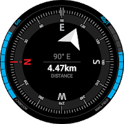
GPS Testing Tools 1.5.3
GPS Testing Tools is an application for exploring navigationdata.The main features are: 1. Very fast GPS fix. Delivers AllGPSreceiver data provided by Android framework 2. Satellites radarandPRN & SNR viewer 4. NMEA sentence editor, with ability tosave,share, mark, filter NMEA data in real time and etc. 5.HandyCompass 6. Converter LLA to ECEF and ECEF to LLA. 7. Fullcontrolon phone GPS receiver from settings .
GPS Route Finder 2017 1.0
Gps Route finder find your desireplacesi.e.ATM, Bank, Hospital, House, City through mapsandnavigation.Gps route finder 2017 enable you to search and browselocationsofdifferent countries, cities all over the world. GPSroutefinder2017 have the facility of finding shortest route,yourcurrentlocation, path between your location and yourdesiredlocation.This App have three kind of maps to clearly showyourdestinationand understand the route that is suitable for youduringjourney/traveling.Easily delete your complete phone location history justbyclickingon the clear history Tab. Best Mobile Locator App foryourAndroiddevice. Best android mobile location finder.GPS Route finder 2017 is the ultimate GPS Tracking app.GPS Route Finder takes advantage of GPS & Network togetyourposition on Earth, and obtains map information nearyourlocationusing Google Map and GPS locator and also providethelocation ofyour friend.GPS route finder is best app to find nearestlocationlikeRestaurants, ATMS, Hotels, Bank, Schools, UniversityPostoffice,Cafe and Police station nearby, Mosques PoliceStations,andairport.GPS Route Finder takes advantage of GPS & Network togetyourposition on Earth, and obtains map information nearyourlocationusing Google Map and GPS locator and also providethelocation ofyour friend.GPS Route Finder helps you not to waste your time in longroute.Youhave to enter your start location and endlocation(destination) andyou will get walking and driving route.GPS RouteFinder is a timesaving app most effective andefficient.GPS Route Finder will make your life easy GPS RouteFinderprovidesyou accuracy in finding destination. GPS Route Finderhelpsin easydriving routes. GPS location finder is best app fordriversto findlocation of their clients. GPS Route Finder-Exacthave threekindof maps which clarify your destination in asystematic way inorderto make you journey more comfortable, it is abest locationfinder,place finder and location tracker with GSMmapper.NOTE: For finding location of any place you must havetheinternetand also location services is “ON” on location.GPS ROUTE FINDER FEATURES:Find route between two points.-GPS Route Finder have three maps like Normal, SatelliteandTerrainmapsIt can find address of any location on maps.-GPS Route Finder helps you to easily find the routeofyourdestination.-In GPS Route Finder: You can also share your locationwithonesingle click.-GPS Route Finder is a time saving app mosteffectiveandefficient.-GPS Route Finder shows you the distance between startingpointandending destination in KM,Miles.-GPS Route Finder finds Near By important placeslikeRestaurants,ATM, School etc.-GPS Route Finder finds the walking route toyourdesiredplace.-Driving route can also be easily found with GPS RouteFinder.-You can also keep the history of most visited places.-Find your Current Location.-Beneficial GPS Route Finder application for Android.Simple and easy to use.Gorgeous and user-friendly interface.Note: It's a free app supported by Ads.


BackCountry Nav Topo Maps GPS
Use your Android as an offroad topo mappingGPSwith the bestselling outdoor navigation app for Android! TrythisDEMO to see if it is right for you, then upgrade to thepaidversion.Use offline topo maps and GPS on hike trails without cellservice!The GPS in your Android phone can get its position fromsatellites,and you don’t have to rely on your data plan to getmaps. Have morefun and safe GPS adventures in thebackcountry.Preload FREE offline topo maps, aerial photos, and road maps onyourstorage memory, so they are ready when you need them.Add custom GPS waypoints in longitude and latitude, UTM or MGRSgridreference. Import GPS waypoints from GPX files. Choose iconsforwaypoints much like in MapSource. (This app uses the WGS84datum,NAD27 is available in settings).Use GPS for hunting a waypoint or geocache, for recording tracksandGPS waypoints on your trip, all the while tracking your questontopographic maps.About topo (topographic) maps: Topo maps show terrain throughcolorand contours, and are useful for navigation offroad. Topo mapsandGPS can be used for hiking, hunting, kayaking, snowshoeing,&backpacker trails.The app has many built in map sources and allows you to createyourown maps with Mobile Atlas Creator. Built in sourcesinclude:OpenStreetMaps and NASA landsat data worldwide.OpenCyle Maps are topo maps that show terrain worldwide.USGS Color Aerial photography.Topographic Maps of Spain and Italy.Outdoor maps of Germany and AustriaTopo maps of New ZealandHere are some of the outdoor GPS activities BackCountryNavigatorhas been used for:Hiking both on hiking trails and off trail.Camping, to find the perfect camping site or the way backtocamp.Hunting trips for hunting wild game in rugged areas, includingreconfor the hunt.Bait fishing or fly fishing with a buddy.Search and Rescue (SAR) with GPS.Kayak and canoe trips on inland lakes and streams or marine,coastalwaters.Backpacker trips: using topo maps of wilderness areas andnationalforests to navigate on trails with the GPS.Snow adventures including snowmobiling, skiing (alpine orcrosscountry) and snowshoeing. Create a memory. Map it out.This a great addition to the outdoor gear you bought atCabelas,REI, or another outdoor store. Your android phone couldsubstitutefor a Garmin or Magellan outdoor handheld GPS! Youstorage hasmemory for maps.Find your own ways to have fun in the outdoors. Be a maverickbyventuring into new territory beyond cell service boundaries.Becomea pro at navigation with GPS.BackCountry Navigator has been previously available on WMdevicesand preloaded on the Trimble Nomad outdoor rugged device.ThisAndroid version is more flexible, featured, and fun.

GPS Navigation & Map Tracker 0.2
GPS map finder and route finder is a freeappwhich provide you a best alternative and demo of defaultmapdirection system of you mobile.Gps navigation and tracker location is an gps map which trackyourride and provide you the map where you are, gps map is andirectionlocator app which has own location system of trackingyourway.GPS navigation and maps sygic position map route finder whichupdateevery latitude of earth and give you the right path bydistrict todistrict also,gps tracker is one of the best trafficcontrol appwhich receive the directions from radar and update yourmap when youstuck at anywhere.Gps navigation and direction tracker is an car gps which informsyouthat where did I park the car,Also an phone gps that has unlimited traffic tracker systemwhichprovide you the best tracking app.GPS location finder & tracker also locate your directionsandgive you the right track or way,with gps navigator anddirectionfinder provide the the info of different street routes andalsothis wise dil lane saint system remove issues and provideyourplaces according to your route.GPS navigator location and tracker is an accurate and mostadvancedapplication which find your routes and navigate your mapthroughtraffic control systems,gps navigation locator is a timetrackingbest tool which give you the fastest and easy way pointfrom eastto west and north to south worldwide,gps direction finderclearyour routes & reduce your miles and time through radarbasesystem.Gps direction tracker in an tracker studio which copy themapdirection & paste it into to your middle map directionreceivesystem.

GPS Route Finder 2017 1.0
GPS Route Finder 2017 is used toeasilytrackall the locations you want to visit.gps tracker is asimpleappthat helps you to track your own loaction.Through gpsnavigationorgps mobile tracker you can find easy and fast routeforyourdestination.In this navigation system you can selectstartingandending point and get walking or driving route.gpsnavigationsystem is very simple gps app to use.GPS RouteFinderhelp to saveyour time through truck gps find a short pathtoyourdestination.GPS Route Finder,gps tracking system isveryusefullapp not to waste time onlong route.GPS Navigation & Track Route is a bestrouteMapper& a marina guide in which you have know aboutyourlocation andalsoa Direction tracker which contain the option of RoutefinderandGlobal map tracker.gps navigation system haveHuman tracker and ATMs, Hospitals, Mosques, compassresorts,Banks,gas filling stations, Hotels, gps fleettracking,fleet tracking system,gps fleet tracking,truckgpsnavigation,gpsmobile track,navegador gps camion,vehiclegpstracking,gpsnavigation system,gps transito,mapper,route plannerfinder gps,route mapper india,routemapperusa,routemapper pakistan,route mapper UAE,route mapperCanda,routeplannerindia,station locator,ride tracker,gpsroutefinder,usefull,car tracker,satellitefinder,routenplaner,dubaimaps,gpsapp,gpsvehicle tracking,,fleettracking system.Police Stations, Fire Stationsfinder,caserne,ridetracking,shortestroute planner route finder,deutschland gps,karta gps,deutschlandkarte,.In fact it’s a gpx geo tracker which tracks effectivelyinallaltitudes.GPS navigation & tracker is an live map android app whereyoucaneasilyfind your places and also you have access onlocationbasednavigation system through satellite system.GPS Route Finder 2017 FEATURES:Find route between two points.-GPS Route Finder have three maps like Normal, SatelliteandTerrainmapsIt can find address of any location on maps.-GPS Route Finder helps you to easily find the routeofyourdestination.-In GPS Route Finder: You can also share your locationwithonesingle click.-GPS Route Finder is a time saving app mosteffectiveandefficient.-GPS Route Finder shows you the distance between startingpointandending destination in KM,Miles.-GPS Route Finder finds Near By important placeslikeRestaurants,ATM, School etc.-GPS Route Finder finds the walking route toyourdesiredplace.-Driving route can also be easily found with GPS RouteFinder.-You can also keep the history of most visited places.-Find your Current Location.-Beneficial GPS Route Finder application for Android.Simple and easy to use GPS Route Finder 2017.Gorgeous and user-friendly interface.Through GPS direction tracking app you can trackanyonelocationbecause thisapp is a map navigation app and also a GPSmobiletrackingapplication ,This map contain world wide different countries Map like,RussianMapTracker ,America/USA Map Tracker, Japan Map Tracker ,China MapTracker,CanadaMap Tracker,Dubai map tracker ,Saudi Arabia map tracker ,IndiaMapTracker,Germany map Tracker,France map tracker, Czech Republic map tracker ,Hungarymaptracker,Italy map trackermoreover .

Radares Saltillo 3.1.2
Prueba ahora la aplicación Radares Saltillo que sirve paraladetección de los radares de velocidad que se encuentran ubicadosenla ciudad de Saltillo, Coahuila. Radares Saltillo es elcomplementoperfecto para ser tu copiloto mientras conduces.Conectado aInternet usted podrá obtener su ubicación GPS mas rápidoy precisa,el mapa le mostrara la ubicación de todos los radaresinstaladoscerca de su ubicación exacta. La aplicación cuenta con 22radaresubicados en toda la ciudad los cuales le ayudaran acontrolar suvelocidad. ¿Cómo trabajar con la aplicación? 1.-Instale GooglePlay Service para poder mostrar los mapas. 2.-Encienda laubicación en su celular. 3.- Para el funcionamiento ensegundoplano necesitarás seleccionar la opción navegar, esperartulocalización y después de ésto, salir. 4.- Debe de tener encuentaque para mostrar la zona en la que se encuentra en el maparequiereinternet. 5.- El celular mandara una alerta de audio paranodescuidar tu conducción cuando te encuentres a 300 metros omenosdel radar. Cuando esté en riesgo de ser multado la alarmasonara yel área donde se encuentra se pondrá en color rojo con 300metrosde distancia para disminuir la velocidad. Gracias a losaportes delos usuarios la base de datos de radares esta en mejoracontinua,puedes aportar tus comentarios enviándonos un [email protected] , en breve incluiremos el nuevo radar,solorequerirá actualizar la aplicación. Link del tutorial enYouTubehttps://youtu.be/VN7x1jigQ10


![Geographica [Offline GPS APP] 2.0.30](https://cdn.apk-cloud.com/detail/image/jp.keiziweb.geographica-w130.png)


GPS Route Finder 1.0
GPS Route Finder is used to easily trackallthelocations you want to visit.gps tracker is a simple appthathelpsyou to track your own loaction.Through gps navigation orgpsmobiletracker you can find easy and fast route foryourdestination.In thisnavigation system you can select startingandending point and getwalking or driving route. gpsnavigationsystem is very simple gpsapp to use.GPS Route Finderhelp to saveyour time through truck gpsfind a short path toyourdestination.GPS Route Finder,gps trackingsystem is veryusefullapp not to waste time onlong route. GPS Route Finder is also used as gps system forcar.gpsfinder find shortest path through satellite navigation.Itisthebest gps system for your gps navigation device.when youleavingforyour destination you feel free if you have mobile gpstrackeror GPSRoute Finder app in your phone.select your gpsposition tostartyour journy and then select your ending point.Thisapp isusefullfor car gps,gps for cars,gps bluetooth,carnavigationsystem,bestcar gps and car gps system.This app havefollowingFeatures:Accuracy of gps system .you can also use this app as car gps system vehicle gpstrackinggpsvehicle tracking system and gps car tracker.best gpsnavigationusedto find easy and fast route for yourdestination.garmin gpssystemseasily track the locations you arevisited. it have alsogps gsmtracker,gps auto tracker,best gpsnavigation system andauto gpssystems that are helpfull for user.GPSRoute Finder alsoknow asgarmin bluetooth gps,golf gps. it is usedin all trackingdevices.GPS Route Finder garmin gps bluetooth shareyourcurrentlocation.find address of any area in map.This app have livegpstrackingsystem.Find gps lowrance and driving route. it havegarmincarnavigation ,garmin latest gps,car gps reviews,garmingpsauto,gpstruck tracking,garmin gps 76,gps gsm,garmin nuvigpsnavigator,gpscell phone,gps for laptop,gpsequipment,vehicletracker gps,mobilephone gps tracking,Through GPSRoute Finder youcan find walkingroute. you can easily delete yourcomplete phonelocation .best GPSRoute Finder app for androidcompletely free todownload.


GPS MAP Route Finder 1.0
This App is made in order to help yougettheneeded information using your android GPS and Map.Find Your exact location and easy route andpreferednearbyplaces.So the app has these 3 main functions:* GPS Location:Find your exact GPS location. the app helps you get yourlocationandshare it with friend via SMS or social media.Just enable device GPS and get your location and display itonmapand with one touch the location is shared.* GPS Route Finder:Some times it is very hard to know the easy and short waybetweentwoplaces. Now with this app you can do it by just enablingtheGPS andInternet. Choose the first place and touch thedestinationplace andthen the route between this two places will bedrawn. youcan easilyfind the shortest driving route and walkingroute andthe app willshow you not only the route but also thedistancebetwwen the twoplaces and the duration you need to getfrom sourceplace todestination place.*GPS Nearby Places:the app will also find your prefred nearbyplaces:restaurants,cafes, bus stations, zoo, train stations,shoping mallsand manyplaces you like in order to spend time and foryour goodplans.Just enable device gps and the app will display yournearbyplacesaround you.Hop you will find what you are looking for in this app.

