Top 16 Apps Similar to Flamp


Yandex.Navigator 14.2.0
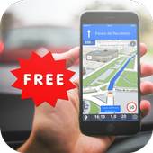
Yandex.Navigator helps drivers plot theoptimalroute to their destination. The app takes traffic jams,accidents,road works, and other road events into account whenplotting yourroute. Yandex.Navigator will present you with up tothree variantsof your journey, starting with the fastest. If yourselected journeytakes you over toll roads, the app will warn youabout this inadvance.Yandex. Navigator uses voice prompts to guide you along yourway,and displays your route on your device’s screen. Additionally,youcan always see how many minutes and kilometers you havetogo.You can use your voice to interact with Yandex.Navigator so thatyoudon't have to take your hands off the wheel. Just say "Hey,Yandex"and the app will start listening for your commands. Forexample,"Hey, Yandex, let's go to 1 Lesnaya Street" or "Hey,Yandex, take meto Domodedovo Airport". You can also let Navigatorknow about roadevents you encounter (such as "Hey, Yandex, thereis an accident inthe right lane") or search for locations on themap (by simplysaying "Hey, Yandex, Red Square").Save time by choosing recent destinations from your history.Lookthrough your recent destinations and favorites from any ofyourdevices—they are saved in the cloud and available when andwhereyou need them.Yandex.Navigator will guide you to your destinations inRussia,Belarus, Kazakhstan, Ukraine, and Turkey.The app suggests enabling the Yandex search widget forthenotification panel.

Navitel Navigator GPS & Maps v11.11.917
Navitel Navigator is a precise offlineGPSnavigation with free geosocial services and detailed maps of64countries. Try popular navigation for 7 day free!______________________________* 20M DOWNLOADS WORLDWIDE ** TOP 5 NAVIGATION IN 12 COUNTRIES!*ADVANTAGES• Offline navigation. No Internet connection required for the useofthe program and maps: No additional expenses on roamingordependency on mobile connection.• Access to maps at any time: Maps are downloaded to theinternalmemory of a device or an SD-card.• Map subscription: Map purchase for a limited period (1 year)withprices starting at 10.99$.SPECIAL FEATURES• 3 alternative routes with display of time and distance for eachofthem.• Navitel.Traffic. Information on all traffic jams in thecoveredarea, available in real time.• Navitel.Friends/Cloud. Messaging with friends, trackingtheirlocation and routing towards them. Program settings andwaypointsare stored in the NAVITEL cloud storage. Log intoNavitel.Friends/Cloud service using your social networkprofile(Facebook, Twitter, VKontakte)• Navitel.Weather. Weather forecast information for the nextthreedays anywhere in the world.• Dynamic POI. Fuel prices, movie showtimes and otherusefulinformation.• Navitel.Events. Road accidents, road works, speed cams andotherevents marked on the map by users.• Navitel.SMS. Message exchange with friends whilenavigating.• SpeedCam warnings. Information on radars, video recordingcamerasand speed bumps.• 3D Mapping. Three-dimensional maps with texture and numberoffloors support.• 3D Road interchanges. Displaying multilevel road interchangesin3D mode.• Line Assist. Route calculations taking multilane trafficintoaccount and visual prompts while following the route.• Multilanguage support. Support of the interface and voicepromptsin multiple languages.• Turn-by-turn voice guidance. Voice guidance while moving alongtheroute, warnings on battery charge and connection tothesatellites.• Dashboard. More than 100 different gauges: time, speed,weatherand other parameters.• Fast route calculation. Instant calculation and routing ofanylength and complexity.• Unlimited number of waypoints for routing. Easy routingwithunlimited number of waypoints.• Customizable user interface. Ability to adapt theprograminterface and map display mode for your own needs.• Multitouch support. Quick access to map scaling androtationfunctions via the multitouch input.• Purchase through the program menu.• GPS / GLONASS.OFFLINE NAVIGATION MAPS FOR PURCHASEAlbania, Andorra, Armenia, Austria, Azerbaijan, Cilumbia,Belarus,Belgium, Bosnia and Herzegovina, Brazil, Bulgaria, Croatia,Cyprus,Czech Republic, Denmark, Estonia, Finland, France,Georgia,Germany, Gibraltar, Greece, Hungary, Iran, Iceland, Isle ofMan,Italy, Kazakhstan, Kyrgyzstan, Latvia, Liechtenstein,Lithuania,Luxembourg, Macedonia, Maldives, Malta, Mexico, Moldova,Monaco,Montenegro, Netherlands, Norway, Peru, Poland,Portugal,Philippines, Romania, Russia, San Marino, Serbia,Slovakia,Slovenia, Spain, Sweden, Switzerland, Tajikistan, Turkey,Ukraine,United Kingdom, Uzbekistan, Vatican.If you have any questions contact us: [email protected]. We willbehappy to help you.CONNECT WITH USFacebook: http://www.facebook.com/NavitelWorldTwitter: https://twitter.com/NavitelNInstagram: http://instagram.com/navitel_en


MAPS.ME – Map with Navigation and Directions v14.2.71484-googleRelease
Free, fast, detailed and entirely offlinemapswith turn-by-turn navigation – trusted by over 90milliontravelers worldwide.OFFLINE MAPSSave mobile data, no internet is required.FREE FOREVERAll maps inside and all features are free. Always were andalwayswill be.NAVIGATIONUse driving, walking and cycle navigation anywhere intheworld.INCREDIBLY DETAILEDDirections to points of interest (POI), hiking trails andplacesmissing from other maps.UP-TO-DATEMaps are updated by millions of OpenStreetMap contributorsdaily.OSM is an open-source alternative to Google Maps, MapquestandWaze.FAST AND RELIABLEOffline search, GPS navigation along with optimized mapstoeffectively save memory space.BOOKMARKSSave locations you love and share them with your friends.AVAILABLE WORLDWIDEEssential for home and travel. Paris, France? Check.Amsterdam,Netherlands? Check. Barcelona, Spain? Check. New York,Chicago,Florida, Las Vegas, Nevada, Seattle, San Francisco,California,USA? Check! Rome, Italy? Check. London, UK? Check.TRAFFIC DATANew online city traffic maps. Check out updates on traffic infoandfastest driving routes in 36 countries!AND MORE!– Search through different categories e.g. restaurants,cafes,tourist attractions, hotels, ATMs and public transport(metro,bus…)– Make hotel bookings via Booking.com directly from the app– Share your location via text message or social media– When cycling or walking, the app shows whether the way isuphillor downhillContinued use of GPS running in the background candramaticallydecrease battery life.If you have any questions, visit our HelpCenter:support.maps.me.If you are unable to find the answer to your question, contactusat: [email protected] us on FB: http://www.facebook.com/mapswithme |Twitter:@MAPS_ME

GPS Navigation 20.0
Navigating from one place to the other has become easy with thehelpof GPS devices that gets its information directly fromsatellites.This interesting Android application GPS Navigationhelp users toget access to links that connect to websites thatprovide them withlive maps of locations they intend to navigateto. Users candownload softwares that can provide them with thecorrect directionsalong with accurate landmarks as they receivelive information fromsatellites. One can use this applicationwhile driving and it willautomatically direct to the desiredlocation.


Fisherman Navigator
Convenient saving and searching for your geopoints,recordingtracks,offline maps (fishing, historical, topographic,your own)it's not afull list of the main functionality of the app.Theapplication hasbeen created for the most convenient andeasiestnavigation in thefishing conditions. Later, thisapplication wasalso liked bytreasure hunters, mushroom pickers,tourists,hunters, etc. Thecreator of the application is afishermanhimself, and initially, theapplication has been createdforpersonal usage, because of lack ofusability in previouslytestedapps. We decided to share our app withthe improved userexperienceand hope you will like it. Features: -Any kinds ofOffline Mapsfor every taste: fishing (with depths),historical(Schubert,Mende, Red Army), topographic (General Staff,Open StreetMaps) andothers - Use your maps offline ( ozf, ozf2,mbtilesformats) -Convenient work with layers (you can place severallayersabove themap and set them different transparency) - Showthecoordinates,and their accuracy - Save geopoints when shakingthephone. Setgeopoints different colors, shapes and sizes. -Records asoundcomment to the geopoint after saving, which you canlisten inthedescription of the geopoint. - Take a photo to thegeopointthatwill be shown in the description of the geopoint. -Sendgeopointsvia SMS, mail or any other way - Geopoint search modebyvoiceprompts. - Records a movement track - Shows a map andyourlocationon it - Shows saved geopoints and tracks on the map -Showstheaccuracy of the geopoints, in the circle in which it islocated-Allows you to name and give detailed descriptions ofgeopointsandtracks - Convenient geopoints search by clicking on it- Abilitytoexport and import geopoints and tracks in gpx format -Syncpointswith the cloud, backup Now added support for Wear OSsmartwatches.You can save point and control track recordingbyinteractions withyour watches! In the future upgrades weareplaning additionalfeatures: - easy and convenient navigation tothegeopoint -offline maps - ability to view track on the map Ourwebsite withFAQ and other usefulinformation-https://sites.google.com/view/susaninnavigator/faqSubscribe toourInstagram to stay in touch and get the latestupdates, you canalsotalk to us inEnglishhere:https://www.instagram.com/fishermannavigator We arealwaysopen toyour ideas and suggestions! What other tutorials areneeded?whatfeatures would you like to receive in the next versionsoftheapplication? what comments you have to existing functions -donothesitate, write in reviews or by mail. Enjoy and don'thesitatetoask us anything. Good luck!

Voice GPS Navigation Advice 3.0.0
Navigating from one place to the otherhasbecome easy with the help of GPS devices that gets itsinformationdirectly from satellites. This interesting Androidapplication GPSNavigation help users to get access to links thatconnect towebsites that provide them with live maps of locationsthey intendto navigate to.GPS Navigation Satellite systems have become so widespread thattheyare almost taken for granted. However, the fact that they aresouseful is leading to an expansion of available systems.This application will show your location and with applicationsuchas GPS NavigationGPS Navigation for car may be able to answer:- the roads or paths available,- traffic congestion and alternative routes,- roads or paths that might be taken to get tothedestination,- if some roads are busy (now or historically) the best routetotake,- The location of food, banks, hotels, fuel, airports orotherplaces of interests,- the shortest route between the two locations,- the different options to drive on highway or back roads.GPS Navigation app can work with data connection or with GPSalone.Navigator has in a way improved the lifestyles of people bymakingtravelling easy especially to unknown places. This androidappcontains content that provide users with information onGPSnavigation and its uses. App developers are exerting efforttoprovide users with an amazing array of features. Open StreetMapsupport, turn by turn voice guidance, high quality map, 3Dviews,precision positioning, and integrated social media are justsome ofthe amazing features.This app advise you to find the roads or paths availablefrominterest GPS directions apps and voice directions have becomesowidespread.This is the best voice GPS Navigation Advice. We do not provideanyvoice GPS navigation service or route finder serviceinanyway.

GPS Without Internet 1.0.0
"GPS No Internet" is a GPS with you'll never be lost. NoneedInternet. There are more full browsers but with "GPS NoInternet"does not need Internet. You'll always know where to go.Are you abroad? Do not have Internet?Quiet! With "GPSNoInternet" you'll never miss.How to use?- Insert the points that you want to go before you leave yourhotel.(Required Internet)- Choose where you want to go and "GPS No Internet" tells youwhereyou should walk (Without Internet).Do you have internet? Use Google Maps.Do not have Internet? Use "GPS No Internet"


Offline Maps & Navigation
Here we created another great navigationappbased on offline maps.You can enjoy unlimited navigation features, lifetime freemapupdates with no hidden costs. Our real-time traffic helps youtoavoid traffic jams. Features: - Free offline GPS navigation- Offline maps- Lifetime free map updates- Speed limit warnings- 3D buildings - Large POI database- Pedestrian, car, or even bee-line navigation- Night mode based on local sunset time Advanced:- Real-time traffic- Multi-language voice navigation- Speed camera warnings- Lane guidance- Track recording- Navigate to photo- Travelbook- Support Free version includes 90 days Advanced features with voiceguidednavigation. After 90 days use offline maps and trip planningforfree or upgrade to unlimited voice guided premiumnavigation.