Top 20 Apps Similar to World Map - Atlas Plus


World Map 2.9.2
I present to you an application that includes an interactive mapofthe world. Each country has the data: surface area andpopulation.For 120 additional flag is. The application is ideal forlearningand fun. All countries are grouped by continent. They arepresentedin a list with search engine. On the map, you can selectthe colorsin the two data any number of countries in order tocompareselected groups of countries. Convenient and easy to useandnavigate user interface. Argentina, Bolivia, Brazil,Chile,Colombia, Ecuador, Paraguay, Peru, Uruguay, Venezuela,Canada,Costa Rica, Cuba, Dominican Republic, El Salvador,Guatemala,Haiti, Honduras, Jamaica, Mexico, Nicaragua, Panama, theUnitedStates, Algeria, Benin, Burkina Faso, Chad, DemocraticRepublic ofthe Congo, Egypt, Ghana, Guinea, Mali, Morocco, Niger,Nigeria,Senegal, Sudan, Tunisia, Ivory Coast, Angola, Cameroon,Ethiopia,Kenya, Madagascar, Malawi, Mozambique, South Africa,Rwanda,Tanzania, Uganda, Zambia, Zimbabwe, Austria, Belgium,Denmark,Finland, France, the Netherlands, Iceland, Ireland, Italy,Germany,Norway, Portugal, Spain, Switzerland, Sweden, UnitedKingdom,Albania, Belarus, Bosnia and Herzegovina, Bulgaria,Croatia, CzechRepublic, Estonia, Greece, Hungary, Latvia,Lithuania, Moldova,Poland, Romania, Russia, Serbia, Slovakia,Slovenia, Ukraine,Afghanistan, Armenia, Azerbaijan, India, Iran,Iraq, Israel,Kazakhstan, Pakistan, Saudi Arabia, Syria, Tajikistan,Turkey,United Arab Emirates, Uzbekistan, Bangladesh, Burma,Cambodia,China, Indonesia, Japan, Laos, Malaysia, Mongolia, Nepal,NorthKorea, the Philippines, South Korea, Sri Lanka, Thailand,Vietnam,Yemen, Australia, New Zealand, Papua New Guinea, Fiji ThePRO adsare disabled. Be happy! Required qualifications:INTERNET,ACCESS_NETWORK_STATE - to display ads in the free versionandsupport my work (you can remove the ads in the "RemoveAds")CHECK_LICENSE - control of the pay-version license

World atlas & map MxGeo Pro 6.8.10
World atlas, world map and educational appforgeography. Contains 240 countries and territories of the worldwithcomprehensive economic and geopolitical data. Political mapswithregional units (provinces), capitals and majorcitiesincluded.Designed for smartphones and tablets.• Maps, flags and comprehensive data for 240 countriesandterritories of the world• Interactive political world, continent and country maps• Shaded relief layer for world and continent maps• Geography quiz challenge for playful learning• Country comparison, favorites and distance calculator• Configurable world clock with time zone display• World-explorer: the smallest, largest, wealthiest, andmostpopulated countries of the world• Selectable color themes for map display• All data and maps included, no online connection required• No advertising or In App Purchases• No permissions requiredExplore the world through political continent and countryofflinemaps. Whether Europe, Africa, Asia, Oceania, South andNorthAmerica: maps of all continents and countries are included.Learnwhere each country in the world is located. View itspositionhighlighted on a digital globe. Create your favorite colortheme orchoose from different color schemes for map display.Do you know the flag of Mauritius? Yes? Perfect. Do you also knowinwhich country the Mount Everest is located? “World atlas &worldmap MxGeo Pro” Quiz helps you acquire a geographic literacyin aplayful manner.Choose from six geo guessing games:• Test your knowledge about the capitals in the world• Recognize the proper country flag based on the outline map• Do you know the top-level domains of the world's countries?• Guess the highlighted country on the virtual globe• Do you know the ISO countries codes of the world?• Do you know the mountains of the world?Each quiz offers seven regional variants: World, Europe,Africa,Asia, Oceania, South or North America.Geo learning app and educational game which is fun foreveryonewhether children, adults, seniors or teachers. Get readyfor yournext stay abroad while enjoying this great world almanacincludingtime zones and statistical data, such as populationgrowth,unemployment rate, average age, gross domestic product (GDP)bysector and other key figures. Or prepare for your nextgeographylesson with this genius digital world map. If nottraveling ourworld atlas lets you explore the world just onlyvirtually.Enjoy the comprehensive atlas of the World including Europe,Asia,North America, Africa, Oceania and South America with allcountriesand regional units, capitals and flags.


World Atlas - Country, Capital 2.3
World Atlas is a great source of information to know aboutcountriesin the world. World Atlas contains information aboutalmost 250+country like capital, the country flag, currency,border, etc. Youcan learn •Country flag, •Currency, •InternationalTelephone code,•Location in the map, •Languages spoken, •Economy,•Borders,•Continent. Visit our website www.confodeal.com foramazing offers,deals and coupons from all e-commerce websites.

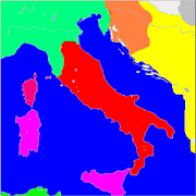
World Map - Lite 15
Designed for Kids to explore earth(Worldmap)(Countries, Continents and Oceans)-Select country feature listed in bottom of the screen-Automatic zoom in and Zoom out-Country indicators, vertical scroll, text to voice feature-Filter countries option on top of the screen to filter byHighincome, Upper middle income and Lower middle income, Lowincomecountries and Quiz-Continents / Oceans** Samsung users: To hear selected country (Google TTS )1) Go to settings2) Select Language and Input3) Select "Text-To-Speech"4) Select "Google Text To Speech"**To avoid ads purchase Ad free version (World Map - Full)**All Data Extracted from world bank sources,feel free tocontactour official channel [email protected] in case ofanydiscrepancies with data.


World In The Round 1.3
The World in the Round brings our planettolifein superb detail. Gorgeous illustrations unlockreal-lifevideos.Launch "World in the Round" and scan the pictures. Touchtheredpulsating buttons that appear on the screen of yourtabletorsmartphone. Sit back and enjoy the video clips (withorwithoutbackground music).Includes free sample of "The World_In_The_Round" book.A "World_Atlas" out of the box.

India Map Atlas - 250+ maps 2.0.2
India Map Atlas provides variety ofmapscategorized in India, its states and cities which arespecificallydesigned and added keeping in mind for the need ofexams ( likeupsc and state pcs) and travel & tourism. As anadditionaladvantage it also provide features like notes addition,pagebookmarking and map informations (making it more specific toyourpurpose).More maps and features are coming soon!Please provide your valuable feedback to make it more better.

World Map 1.1.2
World Map is entirely offline maps.World Map AtlasNo internet connection is required.Great for educationYou can learnThe information of countries in the world such as:Flag,capital,population,callingcode,isocode,currencyunit,bigcity,density,gpp,timezone,domaininternet...If you have feedback,please contact to us viaemail:[email protected] you.

Diercke Weltatlas digital 2.1.52
Der Diercke Weltatlas auf Android-Tablets:DerKlassiker unter den Schulatlanten jetzt digital „auf allenEbenen“.Die kostenlose App beinhaltet vier Karten aus demDierckeWeltatlas Ausgabe 2015 zur freien und dauerhaften Nutzung.PerLizenzerwerb auf der Webseite www.diercke.de/digitaloderIn-App-Kauf kann der komplette Atlas-Inhalt alsJahreslizenzfreigeschaltet werden.Die Demo-Karten können über das Zahnrad-Symbol und einenKlickauf "Demo aktivieren" und anschließend einem Klick aufdasKartensymbol und dann auf "Gratiskarten" in einerÜbersichtgelistet werden.Alle Karten sind in Ebenen zerlegbar, so dass jeder Benutzersichseine eigene Karte zusammenstellen kann. Hiermit wird derDierckeWeltatlas interaktiv. Die Legende der Karten passt sichautomatischden gewählten Ebenen an – so wird auch hier nurangezeigt, wastatsächlich in der Karte zu sehen ist.Für physische Karten (Beispielkarte „Deutschland –physischeÜbersicht") gibt es ein Quizspiel, in dem Orte und andereEinträgeauf der Karte an die richtige Stelle in der Kartezugeordnet werdenmüssen.Mit der einfach zu bedienenden Messfunktion könnenEntfernungenin den Karten im Handumdrehen bestimmt werden.Die Suchfunktion ermöglicht den schnellen Zugriff aufjeden(Teil-)Begriff aus dem gesamten Diercke-Weltatlas.Um alle Karten zu verwenden, wird einmalig eineOnline-Verbindungzum Download benötigt. Bitte beachten Sie, dassdie Größe diesesbenötigten Downloads von den ausgewählten Kartenabhängig ist. Wirempfehlen, dafür eine WLAN-Verbindung zuverwenden.Zur Aktivierung der Lizenz (auch der kostenlosen Version)wirdeinmalig eine Internetverbindung benötigt.Bitte prüfen Sie vor dem Lizenzkauf, ob Ihr Tablet kompatibelzurApp ist. Wenn Sie die Installation der App nicht angebotenbekommen,ist Ihr Tablet leider nicht kompatibel.The Diercke world atlasonAndroid tablets: The classic among school atlases now digital"atall levels".The free app contains four maps from the DierckeWeltatlasEdition 2015 free and permanent use. By purchasing alicense on thewebsite www.diercke.de/digital or in-app purchase ofthe completeAtlas content can be unlocked as annual license.The demo cards can then be listed by clicking on the map iconand"Free cards" in an overview "Enable Demo" on the gear icon andthenclicking on and.All cards are disassembled into levels, so that each user canputtogether his own map. Herewith the Diercke World Atlasisinteractive. The legend of the map adjusts automatically totheselected levels - so is only shown what is actually seen inthemap.For physical maps (eg map "Germany - physical Overview") thereisa quiz game in which places and other items on the card mustbeassigned to the correct location on the map.With the easy to use measuring function distances canbedetermined in the map in no time.The search function allows quick access to any (partial)termfrom the entire Diercke World Atlas.To use all the cards, an online connection is neededoncedownloaded. Please note that this required download sizeisdependent on the selected map. We recommend it to use awirelessconnection.To activate the license (also the free version) is uniquerequiresan Internet connection.Please check before the license purchase, if your tabletiscompatible with the app. If you do not get offered to installtheapp, your tablet is not compatible.

Ancient Indian History Maps 2.0
'Ancient Indian History Maps' is aneducationaland informative atlas app for history enthusiasts. Youcan explorehistory of ancient India (6th century BC to 12thcentury AD) throughmaps on this free app. This app contains 34high definition and highquality maps, graphic designed fromvarious authentic sourcesavailable. This app is optimized forsmaller phones also.Maps in this app covers the maximum extent of area inIndiansubcontinent (South Asia) at some time controlled by thepower(s)named:01. Haryanka Empire02. Sishunaga Dynasty03. Nanda Dynasty04. Mauryan Empire05. Shunga Dynasty06. Indo-Greek Kingdom07. Northern Sakas08. Satavahana Empire09. Indo-Parthians10. Maha-Meghavahanas11. Kushan Dynasty12. Western Sakas13. Vakatakas Dynasty14. Guptan Empire15. Southern Hunas16. Early Pallavas17. Maukhari Dynasty18. Chach Dynasty19. Later Guptas20. Pandyas Dynasty21. Shashanka Dynasty22. Early Kalachuris23. Chalukyas Of Vatapi24. Pushyabhuti Dynasty25. Great Pallavas26. Varman Dynasty27. Karkota Dynasty28. Pala Dynasty29. Rashtharakuta Dynasty30. Gurjara-Parthiharas31. Hindu Shahi Dynasty32. Chandellas33. Later Kalachuris34. (Rivers of Indian Subcontinent)Features of application:* Low size boom package* Free treat for learning geeks and history enthusiasts* High quality graphics with 'zoom in - zoom out' feature* Clutter free contour maps with important details only forahassle-free experience of learning* Most possible authenticity of content as based onauthenticsources - Archaeological Survey of India (ASI), Imperialgazetteerof India Atlas, Swartzberg's - A Historical Atlas of SouthAsiaetc.In this app you will learn all these things:* Maximum extend and geographical expansion of various rulersandtheir reign* History time-line of dynasties ruled overIndiansubcontinent* Time duration of power(s) ruled during ancient India* Rivers of Indian subcontinent and rivers asnaturalboundaries* Conflicted areas between contemporary powers* Areas acquired by various foreign power(s) andterritoriescaptured by them* Capital(s) and major cities of various kingdoms inancientIndiaThis app is specially for:* Secondary, senior secondary, high school, juniorcollege,college and university students.* Teachers and professors who lack graphical resources inclassroomto teach Indian or South Asian History.* Aspirants preparing for various competitive exams like UPSC -IASand CDS, SSC, State PCS - RPSC (RAS), UPPCS, BPCS etc.Thank You, Keep Encouraging Us!!NOTE:* Maps are drawn not to scale* This application doesn't requires an active Internetconnection.Feel free to use offline without expending a penny.