

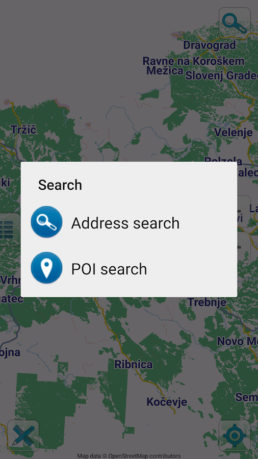


Description
App Information Map of Slovenia offline
- App NameMap of Slovenia offline
- Package Nameorg.mapapps.mapyourtown.slovenia
- UpdatedApr 22, 2023
- File SizeUndefined
- Requires AndroidAndroid 4.4
- Version2.1
- DeveloperMap Apps
- Installs-
- PriceFree
- Category
- Developer
- Google Play Link
Map Apps Show More...


Map of Croatia offline 2.3 APK
Map of Croatia offline works without connecting to the Internet. Noneed to pay for internet in roaming. Benefits Map of Croatiaoffline: - Ease of Use - Highly detailed maps are adapted to workwith mobile devices - Smooth operation with Croatia map - Supportfor screen and tablet devices with high resolution screens -Determine your location using GPS - Location sharing. Send a pin ofany place on the map via e-mail or sms. Share your current location- Free map of Croatia updates & Free POI database updates -Offline search - Offline POI search - Measure tool - Details of thecurrent GPS location Mapping data based on OpenStreetMap ©(http://www.openstreetmap.org) under license Creative CommonsAttribution / Share Alike License


Similar Apps Show More...

Map of Croatia offline 2.3 APK
Map of Croatia offline works without connecting to the Internet. Noneed to pay for internet in roaming. Benefits Map of Croatiaoffline: - Ease of Use - Highly detailed maps are adapted to workwith mobile devices - Smooth operation with Croatia map - Supportfor screen and tablet devices with high resolution screens -Determine your location using GPS - Location sharing. Send a pin ofany place on the map via e-mail or sms. Share your current location- Free map of Croatia updates & Free POI database updates -Offline search - Offline POI search - Measure tool - Details of thecurrent GPS location Mapping data based on OpenStreetMap ©(http://www.openstreetmap.org) under license Creative CommonsAttribution / Share Alike License


 1.0.30")
IGN maps (E-walk plugin) 1.0.30 APK
E-WALK PLUGIN This app in an E-walk plugin (a plugin is an appthatadds features to another app). You need E-walk to use thisplugin:https://play.google.com/store/apps/details?id=com.at.ewalk.free.The plugin adds to E-walk the ability to use the French IGNmaps,and IGNrando'. WARNING: these features mostly cover Franceonly.IGN MAPS The IGN maps are highly detailed and cover thetotality offrench territory. Some maps are only available atcertain zoomlevels. They are the same as the ones used on theGéoportailwebsite (http://www.geoportail.gouv.fr). The IGN mapsplugin addsto E-walk 8 base maps : • ortho images: a highresolution satelliteimagery (zoom levels 2 - 19) • scan: a scan ofpaper IGN maps (zoomlevels 2 - 18) • scan express (classic): a scanof paper IGN mapsoften updated but with less details (zoom levels 6- 18) • scanexpress (standard): a scan of paper IGN maps oftenupdated but withless details, with another style (zoom levels 6 -18) • ICAO maps:International Civil Aviation Organisation maps(zoom levels 6 - 11)• administratives limits: administrativeslimits map (zoom levels 6- 10) • elevation map: digital terrainmodel (zoom levels 6 - 14) •army staff map (1820-1866): historicalmap from 18th century (zoomlevels 6 - 15) And 8 overlay maps: •cadastral parcels (black): mapof numerical cadastral information(zoom levels 2 - 20) • cadastralparcels (white): map of numericalcadastral information (zoomlevels 2 - 20) • cadastral parcels(orange): map of numericalcadastral information (zoom levels 2 -20) • administrative limits:map of administrative limits (zoomlevels 6 - 18) • buildings: mapof constructions (zoom levels 12 -18) • geographical names: mapshowing names of cities, towns, etc...(zoom levels 12 - 18) •Histolitt coastline: map showing the limitbetween land and marinearea (zoom levels 6 - 18) • hydrography: mapof lakes, reservoirs,rivers, creeks, etc... (zoom levels 6 - 18)LICENCES The pluginallows to see the maps through two licences:Discovery licence(free), and Adventure licence (5.99$USD / month or14.99$USD /year). The Discovery licence is limited by a monthlyquota sharedbetween all the users. Once the quota is exceeded, themaps can'tbe displayed until the next month. With the Adventurelicence, youcan also download the maps beforehand on your device,in order touse them without any internet access. IGNrando’IGNrando'(https://ignrando.fr) is a website provided by the IGN,allowingyou to visualize treks and points of interest among thetens ofthousands available. You can also add and share yours. Thosetreksand points of interest are mostly available in France only.WithE-walk, you can synchronize the treks and points of interestthatyou like on your device. Thereby, they will be availableanywhere,and you'll no longer need an internet access to see them.


Slovenia Trails Hiking&Biking 2.4 APK
Slovenia Trails is a new application for Slovenian hiking andbiking trails. Application was developed in cooperation withcompany Monolit d.o.o. and association Hiking&biking GIZ. It isa great tool for everyone who like to discover new places and enjoySlovenian beauties. The guide includes over 300 hiking and bikingtrails and data about special destinations for hikers and bikersthat are members of Slovenian Hiking and Biking association. Theguide covers the entire Slovenian territory. Trails includedetailed information as trail length, duration, description of thetrail, picture of the trail blaze, elevation data with elevationprofile and interesting locations by the trail. Every trail ischecked for availability for families and how many percentage ofthe trail goes through the forest, main roads and side roads. Somefeatures of the app: - Display of routes on a detailed topographicmap (Monolit maps, used in different GPS navigation devices), -enabled search through specialised hikers and bikers friendlydestinations, - off line maps for easier and friendlier use of theapplication in the nature.

Rother Touren Guides 28.07.2022 APK
Hol Dir die beliebten Rother Wanderführer als interaktiveGuides.Jeder Guide enthält rund 50 geprüfte Touren vonausgewiesenenGebietskennern. Du hast schon ein Buch von uns? Dannkannst dukostenlos die GPS-Daten in die App importieren, aber nichtdenentsprechenden Guide gratis freischalten.Anleitung:gps.rother.de/faq-auf-deutsch Bereits über 180 Guides zudenschönsten Wanderregionen weltweit sind verfügbar – auch fürdenJakobsweg und Fernwanderwege sowie für den Winter(Skitouren,Rodeln, Schneeschuhtouren). GPS-NAVIGATION Beim Wandernsiehst Dujederzeit deinen Standort und den Verlauf der Tour.WANDERKARTENTopografische Karten in vielen Zoomstufen OFFLINENUTZUNG LadeGuides oder einzelne Touren inkl. Karten herunter undgeh ohneInternetverbindung wandern. HIGHLIGHTS ENTDECKEN Fotosundzusätzliche Informationen zu bedeutenden PunktenWEGBESCHREIBUNGENZuverlässige Tourenbeschreibungen und alle Infoszu Anforderungen,Einkehr etc. In einer Slideshow mit Fotos der Toursiehst Du, wasDich erwartet. HÖHENPROFIL UND TACHO DetaillierteHöhenprofilezeigen Dir Auf- und Abstiege, der TachoGeschwindigkeit, Entfernungund Zeit. GEBIETS-INFOS Jeder Guideenthält wichtige Infos undWissenswertes zur Region. EINFACHETOURENWAHL Sortiere Wanderungennach Entfernung, Dauer,Schwierigkeit oder von A-Z und schau Dirdie Lage auf derÜbersichtskarte an. GRATIS TESTEN Bis zu 5 Tourenpro Guide kannstDu kostenlos und unbegrenzt testen. Den gesamtenGuide schaltest Duper In-App-Kauf frei. ÜBER DEN BERGVERLAG ROTHERDer BergverlagRother ist einer der ältesten und mit über 600lieferbaren Büchernder bedeutendste alpine Verlag Europas. Er istweit über die Grenzender Alpen hinaus für seine unumstritteneKompetenz im BereichWanderführer und Outdoor-Guides bekannt. DieAutoren sindausgewiesene Gebietskenner, die für eine überlegteTourenauswahl undhöchste inhaltliche Qualität stehen. DieseQualität undVerlässlichkeit stehen allen Outdoor-Freunden auch alsTouren Appzur Verfügung.


